Doire nan Dearcag

Wood, Forest in Inverness-shire

Scotland

Doire nan Dearcag

Binnein Mor Binnein Mor viewed from Sgor Eilde Beag to the south-east.
Binnein Mor Credit: Scott Cormie

Doire nan Dearcag, located in Inverness-shire, Scotland, is a picturesque woodland area known for its breathtaking beauty and rich biodiversity. Covering a vast expanse of land, it is a haven for nature enthusiasts and a popular tourist destination.

The woodland, whose name translates to "Wood of the Oaks" in Scottish Gaelic, is characterized by its dense forest of oak trees that have stood for centuries. These majestic trees provide a stunning backdrop with their vibrant green foliage, especially during the spring and summer months.

The diversity of flora and fauna found in Doire nan Dearcag is truly remarkable. The forest floor is carpeted with a variety of wildflowers, creating a vibrant and colorful display. The area is also home to a range of animal species, including red deer, foxes, badgers, and a variety of bird species. Birdwatchers can spot rare and endangered birds, such as the Scottish crossbill and the crested tit, among others.

The woodland offers several walking trails and paths, allowing visitors to immerse themselves in nature and explore its hidden treasures. These trails provide a chance to observe the native wildlife up close and enjoy the tranquil surroundings. Additionally, there are designated picnic areas where visitors can relax and enjoy a meal amidst the serene atmosphere.

Doire nan Dearcag is not only a haven for nature lovers but also serves as an important conservation area. Efforts are made to preserve its natural beauty and protect the diverse ecosystem that it harbors. The woodland offers a unique opportunity to experience the beauty of the Scottish countryside and appreciate the wonders of nature in all its glory.

If you have any feedback on the listing, please let us know in the comments section below.

Doire nan Dearcag Images

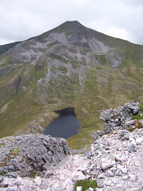
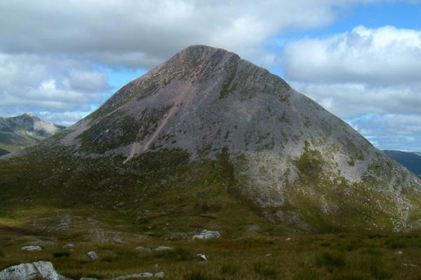
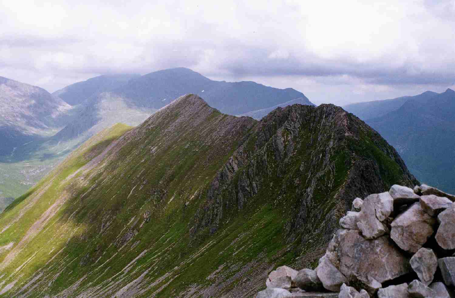
Images are sourced within 2km of 56.766056/-4.9384616 or Grid Reference NN2067. Thanks to Geograph Open Source API. All images are credited.

Binnein Mor Binnein Mor viewed from Sgor Eilde Beag to the south-east.
Binnein Mor
Binnein Mor viewed from Sgor Eilde Beag to the south-east.
Summit ridge of Binnein Mór Looking along the rocky crest at the summit of Binnein Mór, with Ben Nevis at extreme left.
Summit ridge of Binnein Mór
Looking along the rocky crest at the summit of Binnein Mór, with Ben Nevis at extreme left.
Pale scree on steep slope of Coire an Easain Coire an Easain is a large hollow in the Mamore mountains enclosed by Na Gruagaichean, Sgòr Eilde Beag and Binnein Mòr. The image was recorded from Na Gruagaichean.
 Binnein Mòr is the obvious flat-topped mountain; further mountains of the Grey Corrie group are in the distance.
Pale scree on steep slope of Coire an Easain
Coire an Easain is a large hollow in the Mamore mountains enclosed by Na Gruagaichean, Sgòr Eilde Beag and Binnein Mòr. The image was recorded from Na Gruagaichean. Binnein Mòr is the obvious flat-topped mountain; further mountains of the Grey Corrie group are in the distance.
Ridge connecting Binnein Mòr with its south top The ridge runs north from Binnein Mòr's south top and Binnein Mòr itself which is the obvious peak along the ridge.
Ridge connecting Binnein Mòr with its south top
The ridge runs north from Binnein Mòr's south top and Binnein Mòr itself which is the obvious peak along the ridge.
Sròn a' Choire-Gharbh Sròn a' Choire-Gharbh is the prominent ridge descending north-east from Binnein Mòr; as with much of the ground in the area, it's well covered with pale scree.
Beyond the ridge is an elongated lochan, unnamed on OS maps. The mountain towering above that lochan is Binnein Beag.
The Grey Corries group lies further in the distance.
Sròn a' Choire-Gharbh
Sròn a' Choire-Gharbh is the prominent ridge descending north-east from Binnein Mòr; as with much of the ground in the area, it's well covered with pale scree. Beyond the ridge is an elongated lochan, unnamed on OS maps. The mountain towering above that lochan is Binnein Beag. The Grey Corries group lies further in the distance.
Blocks of rock on north ridge of Binnein Mòr The rock ridge immediately north from the summit of Binnein Mòr is short, narrow and has many individual blocks of rock. The view is up the rising ridge to the summit where an individual climber can be seen.
Blocks of rock on north ridge of Binnein Mòr
The rock ridge immediately north from the summit of Binnein Mòr is short, narrow and has many individual blocks of rock. The view is up the rising ridge to the summit where an individual climber can be seen.
Water of Nevis flowing down a small gully
Summit ridge of Binnein Mor Ben Nevis in the distance
Summit ridge of Binnein Mor
Ben Nevis in the distance
Binnein Mor towards Sgor Eilde Beag
Path towards Glen Nevis
Small lochan near Binnein Beag
Summit cairns on Binnein Beag
Binnein Beag from the ascent of Sgurr Eilde Mor Ben Nevis is visible in the back left of the photo.
Binnein Beag from the ascent of Sgurr Eilde Mor
Ben Nevis is visible in the back left of the photo.
Binnein Beag Good Friday walking in from south, still snow about.
Name: Binnein Beag
Hill number: 320
Height: 943m / 3094ft
Area: 04A: Fort William to Loch Treig and Loch Leven
Class: Ma,M,Mur
Grid ref: NN221677 (est)
Drop: 197m
Col: 746m  NN217673
Binnein Beag
Good Friday walking in from south, still snow about. Name: Binnein Beag Hill number: 320 Height: 943m / 3094ft Area: 04A: Fort William to Loch Treig and Loch Leven Class: Ma,M,Mur Grid ref: NN221677 (est) Drop: 197m Col: 746m NN217673
Binnein Mor Good Friday, dry, mild, cloudy with summit ridge under snow.
Name: Binnein Mor
Hill number: 287
Height: 1130m / 3707ft
Area: 04A: Fort William to Loch Treig and Loch Leven
Class: Ma,M,Mur
Grid ref: NN212663 (est)
Drop: 759m
Col: 371m  NN239693
Binnein Mor
Good Friday, dry, mild, cloudy with summit ridge under snow. Name: Binnein Mor Hill number: 287 Height: 1130m / 3707ft Area: 04A: Fort William to Loch Treig and Loch Leven Class: Ma,M,Mur Grid ref: NN212663 (est) Drop: 759m Col: 371m NN239693
Moorland with Ben Nevis in background
Binnein Beag from the northeast rib of Binnein Mòr
The summit of Binnein Beag looking to Binnein Mor
Show me another place!

Doire nan Dearcag is located at Grid Ref: NN2067 (Lat: 56.766056, Lng: -4.9384616)

Unitary Authority: Highland

Police Authority: Highlands and Islands

What 3 Words

///screening.elevate.imagined. Near Fort William, Highland

Nearby Locations

Doire nan Dearcag

Related Wikis

Ramsay Round

The Ramsay Round, also known as the Charlie Ramsay Round, is a long distance hill running challenge near Fort William, Scotland. The route is a circuit...

Binnein Mòr

Binnein Mòr is the highest peak in the Mamores, the range of mountains between Glen Nevis and Loch Leven in the Highlands of Scotland, located about five...

Binnein Beag

Binnein Beag is a Scottish mountain situated at the eastern end of the Mamores range seven kilometres north north-east of Kinlochleven. It is a relatively...

An Gearanach

An Gearanach is a Scottish mountain situated in the Mamore Forest, five and a half kilometres north of Kinlochleven in the Lochaber region of the Highland...

Have you been to Doire nan Dearcag?

Leave your review of Doire nan Dearcag below (or comments, questions and feedback).