Bankfield Plantation

Wood, Forest in Wigtownshire

Scotland

Bankfield Plantation

New Square at Glenluce On the corner of Church Street and Main Street.
New Square at Glenluce Credit: Billy McCrorie

Bankfield Plantation is a picturesque woodland area located in Wigtownshire, a historic county in southwest Scotland. This beautiful plantation covers an extensive area of lush greenery, comprising mainly of diverse tree species, making it a significant forested region in the locality.

The plantation boasts a varied ecosystem, with an array of flora and fauna thriving within its boundaries. The dominant tree species found here includes oak, birch, beech, and pine, among others. These trees provide a rich habitat for numerous wildlife species, including birds, squirrels, and deer, which can often be spotted roaming freely among the trees.

Bankfield Plantation is a popular destination for nature enthusiasts and outdoor adventurers alike. The woodland offers several walking and hiking trails, allowing visitors to explore its natural beauty at their own pace. The trails wind through the forest, offering stunning views of the surroundings and providing ample opportunities for birdwatching and wildlife spotting.

In addition to its natural allure, Bankfield Plantation also serves as an important conservation area, with efforts made to protect and preserve its unique ecosystem. The woodland is managed by local authorities and conservation organizations to ensure the sustainability of its diverse flora and fauna.

Overall, Bankfield Plantation is a captivating woodland area in Wigtownshire, offering visitors a chance to immerse themselves in the tranquility of nature, witness a wide range of wildlife, and appreciate the importance of forest conservation.

If you have any feedback on the listing, please let us know in the comments section below.

Bankfield Plantation Images

Images are sourced within 2km of 54.875651/-4.812822 or Grid Reference NX1957. Thanks to Geograph Open Source API. All images are credited.

New Square at Glenluce On the corner of Church Street and Main Street.
New Square at Glenluce
On the corner of Church Street and Main Street.
Church Street, Glenluce Viewed from Main Street.
Church Street, Glenluce
Viewed from Main Street.
Main Street, Glenluce Viewed from the junction with Bankfield Road.
Main Street, Glenluce
Viewed from the junction with Bankfield Road.
Main Street, Glenluce From the junction with Bankfield Road.
Main Street, Glenluce
From the junction with Bankfield Road.
Bankfield Road, Glenluce Viewed from the Main Street.
Bankfield Road, Glenluce
Viewed from the Main Street.
New Square, Glenluce The bottom tier viewed from Main Street.
New Square, Glenluce
The bottom tier viewed from Main Street.
Shelter at the New Square Glenluce Located on the corner of Church Street and the Main Street.
Shelter at the New Square Glenluce
Located on the corner of Church Street and the Main Street.
New Square, Glenluce Up at the second tier.
New Square, Glenluce
Up at the second tier.
New Square, Glenluce Up at the top tier.
New Square, Glenluce
Up at the top tier.
New Square, Glenluce At the top tier looking down towards the Main Street.
New Square, Glenluce
At the top tier looking down towards the Main Street.
Shelter at the New Square, Glenluce Looking down from the top tier towards Main Street.
Shelter at the New Square, Glenluce
Looking down from the top tier towards Main Street.
New Square, Glenluce Steps up to the top tier.
New Square, Glenluce
Steps up to the top tier.
Bridge over Lady Burn, Glenluce On Bankfield Road.
Bridge over Lady Burn, Glenluce
On Bankfield Road.
Bankfield Road, Glenluce Leading to Main Street.
Bankfield Road, Glenluce
Leading to Main Street.
Lady Burn, Glenluce Viewed from the road bridge on Bankfield Road.
Lady Burn, Glenluce
Viewed from the road bridge on Bankfield Road.
Lady Burn, Glenluce Viewed from the road bridge on Bankfield Road.
Lady Burn, Glenluce
Viewed from the road bridge on Bankfield Road.
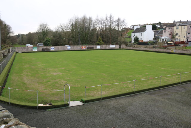
Bowling Green, Glenluce Viewed from School Road.
Bowling Green, Glenluce
Viewed from School Road.
Glenluce Bowling Club Viewed from School Road.
Glenluce Bowling Club
Viewed from School Road.
Show me another place!

Bankfield Plantation is located at Grid Ref: NX1957 (Lat: 54.875651, Lng: -4.812822)

Unitary Authority: Dumfries and Galloway

Police Authority: Dumfries and Galloway

What 3 Words

///darting.bills.lakeside. Near Stranraer, Dumfries & Galloway

Related Wikis

Old Luce

Old Luce is a civil parish in Dumfries and Galloway, Scotland. It lies in the Machars peninsula, in the traditional county of Wigtownshire. The parish...

Glenluce

Glenluce (Scottish Gaelic: Clachan Ghlinn Lus) is a small village in the parish of Old Luce in Wigtownshire, Scotland.It contains a village shop,a caravan...

Glenluce railway station

Glenluce station was a station open in 1862 on the former Port Road that was constructed on the Portpatrick and Wigtownshire Joint Railway. It served the...

Castle of Park

The Castle of Park is a 16th-century L-plan tower house near Glenluce, in the historic county of Wigtownshire in Dumfries and Galloway, Scotland. It...

Nearby Amenities

Located within 500m of 54.875651,-4.812822
Glenluce
Alt Name Gd: Gleann Lus
Name En: Glenluce
Name Gd: Clachan Ghlinn Lus
Place: village
Wikidata: Q1017187
Wikipedia: en:Glenluce
Lat/Long: 54.8785041/-4.8110991
Bus Stop
Town Hall
Bench: no
Bin: yes
Lit: yes
Naptan AtcoCode: 680000091333
Naptan Bearing: W
Naptan CommonName: Town Hall
Naptan Indicator: o/s Hall
Naptan Landmark: Town Hall
Naptan NaptanCode: 34234986
Naptan Notes: none
Naptan Street: Main Street
Naptan Verified: no
Shelter: no
Source: naptan_import
Tactile Paving: no
Lat/Long: 54.8786085/-4.8107379
Bus Stop
Town Hall
Bench: no
Bin: no
Lit: yes
Naptan AtcoCode: 680000091444
Naptan Bearing: E
Naptan CommonName: Town Hall
Naptan Indicator: opp Hall
Naptan Landmark: Town Hall
Naptan NaptanCode: 34234985
Naptan Notes: none
Naptan Street: Main Street
Naptan Verified: no
Shelter: no
Source: naptan_import
Tactile Paving: no
Lat/Long: 54.878677/-4.810883
Bus Stop
Lady Burn
Local Ref: A75
Naptan AtcoCode: 680000873333
Naptan Bearing: SW
Naptan BusStopType: CUS
Naptan CommonName: Lady Burn
Naptan Indicator: A75
Naptan Landmark: Main Street
Naptan NaptanCode: 34234984
Naptan Notes: none
Naptan Street: A75
Naptan Verified: no
Source: naptan_import
Lat/Long: 54.8752497/-4.814464
Bus Stop
Lady Burn
Naptan AtcoCode: 680000873444
Naptan Bearing: NE
Naptan BusStopType: CUS
Naptan CommonName: Lady Burn
Naptan Indicator: at A75
Naptan Landmark: Main Street
Naptan NaptanCode: 34234983
Naptan Notes: none
Naptan Street: A75
Naptan Verified: no
Source: naptan_import
Lat/Long: 54.8753599/-4.8147523
Post Box
Collection Times: Mo-Fr 09:00; Sa 07:00
Operator: Royal Mail
Operator Wikidata: Q638098
Post Box Mounting: pier
Post Box Type: lamp
Ref: DG8 30
Royal Cypher: scottish_crown
Lat/Long: 54.8781785/-4.811738
Toilets
Fee: no
Lat/Long: 54.8785246/-4.810808
KeyStore
Addr City: Glenluce
Addr Housename: KeyStore
Addr Housenumber: 31
Addr Postcode: DG8 0PW
Addr Street: Main Street
Atm: yes
Branch: Glenluce
Contact Facebook: https://www.facebook.com/glenlucekeystore
Opening Hours: Mo-Sa 06:00-20:00; Su 08:00-18:00
Phone: +44 1581 300481
Prepaid Top Up Energy: yes
Shop: convenience
Website: https://www.keystore.co.uk
Wheelchair: yes
Lat/Long: 54.8788444/-4.8109211
Atm
Drive Through: no
Lat/Long: 54.8788674/-4.810966
Generator Method: photovoltaic
Generator Output Electricity: yes
Generator Source: solar
Generator Type: solar_photovoltaic_panel
Power: generator
Lat/Long: 54.8764726/-4.8117474
Generator Method: photovoltaic
Generator Output Electricity: yes
Generator Source: solar
Generator Type: solar_photovoltaic_panel
Power: generator
Lat/Long: 54.8788024/-4.8103065
Post Office
Glenluce Post Office
Addr City: Glenluce
Addr Country: GB
Addr Housename: Public Hall
Addr Postcode: DG8 0PR
Addr Street: Main Street
Addr Village: Glenluce
Brand: Post Office
Brand Wikidata: Q1783168
Check Date: 2022-05-27
Check Date Opening Hours: 2022‑05‑27
Contact Website: https://www.postoffice.co.uk/
Opening Hours: Tu 11:30-12:30
Ref Pol Id: 144788
Lat/Long: 54.8785208/-4.8106187
Defibrillator
Access: yes
Defibrillator Location: Glenluce. 51 Main Street. Physique 51. External south facing wall.
Emergency: defibrillator
Indoor: no
Source: survey
Lat/Long: 54.8792212/-4.8100466
Power: pole
Lat/Long: 54.8756595/-4.8200807
Power: pole
Lat/Long: 54.8750868/-4.8201652
Power: pole
Lat/Long: 54.8760728/-4.8200548
Power: pole
Lat/Long: 54.8764456/-4.8200196
Power: pole
Lat/Long: 54.8769143/-4.8199868
Power: pole
Lat/Long: 54.8762826/-4.8050794
Power: pole
Lat/Long: 54.8768468/-4.8053118
Power: pole
Lat/Long: 54.8772371/-4.8064551
Power: pole
Lat/Long: 54.8773185/-4.807478
Power: pole
Lat/Long: 54.8774036/-4.8084797
Power: pole
Lat/Long: 54.8775337/-4.8099506
Power: pole
Lat/Long: 54.8776881/-4.810686
Turning Circle
Lat/Long: 54.8768388/-4.8121146
Bench
Backrest: yes
Lat/Long: 54.8785183/-4.8113745
Glenluce Community Shop
Addr City: Glenluce
Addr Street: Main Street
Check Date: 2023-07-24
Contact Facebook: https://www.facebook.com/GlenluceHall
Opening Hours: Tu 10:00-13:00; Th 13:00-16:00; Sa 11:00-14:00
Payment Cash: yes
Phone: +44 7557 307053
Second Hand: only
Shop: charity
Lat/Long: 54.8784978/-4.8108277
Glenluce Village Square
Board Type: notice
Information: board
Tourism: information
Lat/Long: 54.8785013/-4.8112901
Glenluce Roman Camp
Heritage Operator: Historic Environment Scotland
Heritage Website: https://portal.historicenvironment.scot/designation/SM7443
Historic: archaeological_site
Ref GB Hs: SM7443
Ref Canmore: 79047
Wikidata: Q56668176
Lat/Long: 54.8716311/-4.8101127
The data included in this document is from www.openstreetmap.org. The data is made available under ODbL.

Have you been to Bankfield Plantation?

Leave your review of Bankfield Plantation below (or comments, questions and feedback).