Back of the Wall Plantation

Wood, Forest in Wigtownshire

Scotland

Back of the Wall Plantation

New Square at Glenluce On the corner of Church Street and Main Street.
New Square at Glenluce Credit: Billy McCrorie

Back of the Wall Plantation is a picturesque wood located in Wigtownshire, a historic county in southwestern Scotland. Covering an area of approximately 100 acres, this plantation is nestled in the beautiful countryside near the village of Newton Stewart.

The wood is predominantly composed of native Scottish species, including oak, ash, birch, and beech trees. These trees create a dense and vibrant forest that provides a haven for a variety of wildlife, such as deer, squirrels, and a wide array of bird species. The tranquility and natural beauty of the wood make it a popular destination for nature enthusiasts and walkers.

Back of the Wall Plantation offers several well-maintained trails that wind through the wood, allowing visitors to explore the area and soak in the peaceful atmosphere. The paths are suitable for all levels of walkers, from leisurely strollers to more experienced hikers. Along the trails, visitors can discover hidden streams, charming clearings, and breathtaking viewpoints that offer panoramic vistas of the surrounding countryside.

The wood is managed by the local forestry commission, ensuring the preservation of its natural habitat and the conservation of its biodiversity. Back of the Wall Plantation is also open to the public year-round, providing a tranquil escape for those seeking to immerse themselves in nature or simply enjoy a leisurely stroll in a serene setting.

Overall, Back of the Wall Plantation in Wigtownshire is a delightful woodland retreat that offers a captivating glimpse into Scotland's natural beauty, providing a sanctuary for both flora and fauna alike.

If you have any feedback on the listing, please let us know in the comments section below.

Back of the Wall Plantation Images

Images are sourced within 2km of 54.886389/-4.8285102 or Grid Reference NX1858. Thanks to Geograph Open Source API. All images are credited.

New Square at Glenluce On the corner of Church Street and Main Street.
New Square at Glenluce
On the corner of Church Street and Main Street.
Church Street, Glenluce Viewed from Main Street.
Church Street, Glenluce
Viewed from Main Street.
Main Street, Glenluce Viewed from the junction with Bankfield Road.
Main Street, Glenluce
Viewed from the junction with Bankfield Road.
Main Street, Glenluce From the junction with Bankfield Road.
Main Street, Glenluce
From the junction with Bankfield Road.
Bankfield Road, Glenluce Viewed from the Main Street.
Bankfield Road, Glenluce
Viewed from the Main Street.
New Square, Glenluce The bottom tier viewed from Main Street.
New Square, Glenluce
The bottom tier viewed from Main Street.
Shelter at the New Square Glenluce Located on the corner of Church Street and the Main Street.
Shelter at the New Square Glenluce
Located on the corner of Church Street and the Main Street.
New Square, Glenluce Up at the second tier.
New Square, Glenluce
Up at the second tier.
New Square, Glenluce Up at the top tier.
New Square, Glenluce
Up at the top tier.
New Square, Glenluce At the top tier looking down towards the Main Street.
New Square, Glenluce
At the top tier looking down towards the Main Street.
Shelter at the New Square, Glenluce Looking down from the top tier towards Main Street.
Shelter at the New Square, Glenluce
Looking down from the top tier towards Main Street.
New Square, Glenluce Steps up to the top tier.
New Square, Glenluce
Steps up to the top tier.
Bridge over Lady Burn, Glenluce On Bankfield Road.
Bridge over Lady Burn, Glenluce
On Bankfield Road.
Bankfield Road, Glenluce Leading to Main Street.
Bankfield Road, Glenluce
Leading to Main Street.
Lady Burn, Glenluce Viewed from the road bridge on Bankfield Road.
Lady Burn, Glenluce
Viewed from the road bridge on Bankfield Road.
Lady Burn, Glenluce Viewed from the road bridge on Bankfield Road.
Lady Burn, Glenluce
Viewed from the road bridge on Bankfield Road.
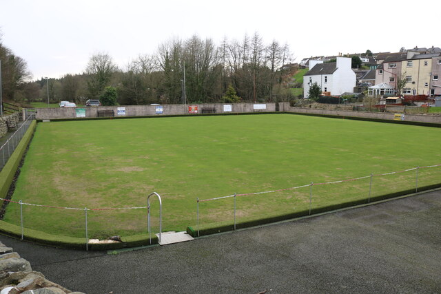
Bowling Green, Glenluce Viewed from School Road.
Bowling Green, Glenluce
Viewed from School Road.
Glenluce Bowling Club Viewed from School Road.
Glenluce Bowling Club
Viewed from School Road.
Show me another place!

Back of the Wall Plantation is located at Grid Ref: NX1858 (Lat: 54.886389, Lng: -4.8285102)

Unitary Authority: Dumfries and Galloway

Police Authority: Dumfries and Galloway

What 3 Words

///amaze.slope.knots. Near Stranraer, Dumfries & Galloway

Related Wikis

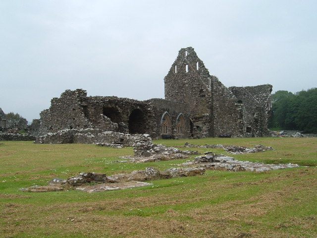
Glenluce Abbey

Glenluce Abbey, near to Glenluce, Scotland, was a Cistercian monastery called also Abbey of Luce or Vallis Lucis and founded around 1190 by Rolland or...

Castle of Park

The Castle of Park is a 16th-century L-plan tower house near Glenluce, in the historic county of Wigtownshire in Dumfries and Galloway, Scotland. It...

Glenluce railway station

Glenluce station was a station open in 1862 on the former Port Road that was constructed on the Portpatrick and Wigtownshire Joint Railway. It served the...

Old Luce

Old Luce is a civil parish in Dumfries and Galloway, Scotland. It lies in the Machars peninsula, in the traditional county of Wigtownshire. The parish...

Nearby Amenities

Located within 500m of 54.886389,-4.8285102
Power: pole
Lat/Long: 54.8826586/-4.8305028
Power: pole
Lat/Long: 54.8824611/-4.829108
Power: pole
Lat/Long: 54.8830104/-4.8330938
Power: pole
Lat/Long: 54.8828343/-4.8318691
Place: farm
Lat/Long: 54.8868783/-4.8314407
Power: pole
Lat/Long: 54.8823402/-4.8297681
Power: pole
Lat/Long: 54.8829398/-4.8301625
Power: pole
Lat/Long: 54.8837407/-4.8307071
Power: pole
Lat/Long: 54.8845685/-4.8312706
Power: pole
Lat/Long: 54.8854003/-4.8318317
Power: pole
Lat/Long: 54.8861916/-4.8323763
Power: pole
Lat/Long: 54.8869127/-4.8330571
Power: pole
Lat/Long: 54.8876986/-4.8328529
Power: pole
Lat/Long: 54.8884791/-4.83309
Power: pole
Lat/Long: 54.8891799/-4.8333036
Power: pole
Lat/Long: 54.8861984/-4.8322472
Power: pole
Lat/Long: 54.8858473/-4.8316955
Power: pole
Lat/Long: 54.8855002/-4.8311297
Power: pole
Lat/Long: 54.8851424/-4.8305733
Power: pole
Lat/Long: 54.8848115/-4.8300451
Power: pole
Lat/Long: 54.8844213/-4.8294535
Power: pole
Lat/Long: 54.8899792/-4.8323481
The data included in this document is from www.openstreetmap.org. The data is made available under ODbL.

Have you been to Back of the Wall Plantation?

Leave your review of Back of the Wall Plantation below (or comments, questions and feedback).