Coille na Lapaich

Wood, Forest in Inverness-shire

Scotland

Coille na Lapaich

Cairn above the southern arm of Loch Monar I can't find a name for the burn flowing down into the loch. Perhaps it is Allt Seasgach?
Speaking purely personally, I don't think I would have enjoyed a camp just left of the cairn in these conditions. Or any other conditions, come to that.
Cairn above the southern arm of Loch Monar Credit: David Purchase

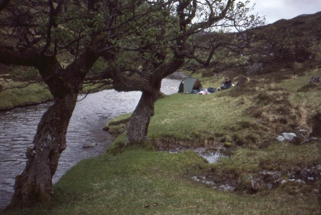
Coille na Lapaich, located in Inverness-shire, Scotland, is a stunning wood or forest that captivates visitors with its natural beauty and tranquil surroundings. With its name translating to "Wood of the Lark," it offers a diverse range of flora and fauna, making it a popular destination for nature enthusiasts, hikers, and photographers.

Spread across a vast area, Coille na Lapaich features a mixture of native and introduced tree species, including Scots pine, birch, oak, and various conifers. The forest's dense canopy provides a sheltered habitat for an array of wildlife, such as red squirrels, roe deer, and a variety of bird species. Birdwatchers will delight in the chance to spot golden eagles, ospreys, and crossbills.

Numerous walking trails wind through Coille na Lapaich, catering to different levels of difficulty and distance. These paths offer visitors the opportunity to explore the forest's wonders at their own pace. Whether strolling along the gentle paths or embarking on a more challenging hike, visitors can immerse themselves in the forest's peaceful ambiance, relishing the sights, scents, and sounds of nature.

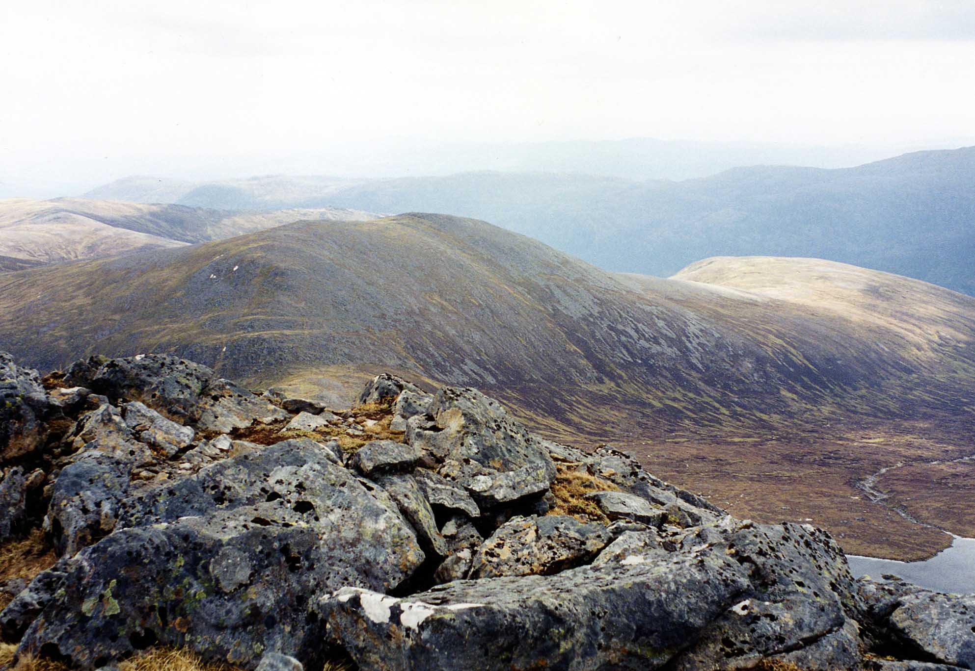
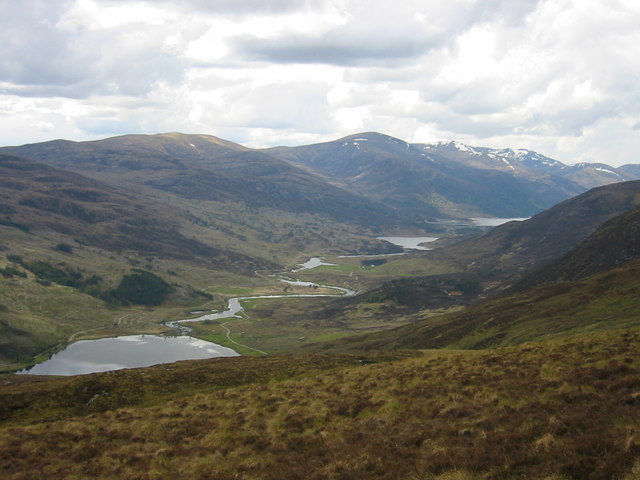
Coille na Lapaich also boasts breathtaking viewpoints, including elevated spots that offer panoramic vistas of the surrounding landscape. These viewpoints provide an idyllic setting for capturing stunning photographs or simply taking in the awe-inspiring beauty of the forest.

As a protected area, Coille na Lapaich is carefully managed to preserve its ecological integrity and ensure its long-term sustainability. Visitors are encouraged to respect the forest's fragile ecosystem by following designated trails, refraining from littering, and avoiding damage to vegetation.

In summary, Coille na Lapaich in Inverness-shire is a captivating wood or forest that invites visitors to immerse themselves in its natural splendor. With its diverse flora and fauna, picturesque trails, and breathtaking viewpoints, it offers a truly enchanting

If you have any feedback on the listing, please let us know in the comments section below.

Coille na Lapaich Images

Images are sourced within 2km of 57.391519/-5.027161 or Grid Reference NH1837. Thanks to Geograph Open Source API. All images are credited.

Cairn above the southern arm of Loch Monar I can't find a name for the burn flowing down into the loch. Perhaps it is Allt Seasgach?
Speaking purely personally, I don't think I would have enjoyed a camp just left of the cairn in these conditions. Or any other conditions, come to that.
Cairn above the southern arm of Loch Monar
I can't find a name for the burn flowing down into the loch. Perhaps it is Allt Seasgach? Speaking purely personally, I don't think I would have enjoyed a camp just left of the cairn in these conditions. Or any other conditions, come to that.
Uisge Misgeach Power Station Uisge Misgeach hydro-electric power station
Uisge Misgeach Power Station
Uisge Misgeach hydro-electric power station
Pipe Line to Uisge Misgeach Power Station Pipe line from the headpond on Carn na Sàile Lèithe to Uisge Misgeach Power Station
Pipe Line to Uisge Misgeach Power Station
Pipe line from the headpond on Carn na Sàile Lèithe to Uisge Misgeach Power Station
Beside the Uisge Misgeach Downstream of the power station.
Beside the Uisge Misgeach
Downstream of the power station.
Misgeach Power Station A large pipe crossing Gleann Innis an Loichel, with a small hydro-electric power station.
Misgeach Power Station
A large pipe crossing Gleann Innis an Loichel, with a small hydro-electric power station.
Upper part of the glen of Uisge Misgeach
Pumping station in Gleann Innis an Loichel
Pipeline as part of the Glen Strathfarrar hydro scheme at Gleann Innis an Loichel
Coltsfoot (Tussilago farfara), Gleann Innis an Loichel On disturbed ground, even here 200m above sea level.
Coltsfoot (Tussilago farfara), Gleann Innis an Loichel
On disturbed ground, even here 200m above sea level.
Uisge Misgeach, Gleann Innis an Loichel
A less than perfect seal, pumping station at Gleann Innis an Loichel
Small burn flowing into Loch Monar
Slopes of Sgùrr na Lapaich Steep grassy slopes on the north side of the hill.
Slopes of Sgùrr na Lapaich
Steep grassy slopes on the north side of the hill.
Allt Garbh-choire Draining a wet corrie to the northeast of Sgùrr na Lapaich
Allt Garbh-choire
Draining a wet corrie to the northeast of Sgùrr na Lapaich
Old tree stump, Garbh-choire A reminder that the forest below is shrinking outwith the fenced enclosures. Old trees die while the newer generations never get past the seedling stage due to the deer.  Stags could be heard at the time.
Old tree stump, Garbh-choire
A reminder that the forest below is shrinking outwith the fenced enclosures. Old trees die while the newer generations never get past the seedling stage due to the deer. Stags could be heard at the time.
Giubhas nan Saighead Scots pine woodland in Gleann Innis an Loichel. It is now regenerating in enclosures but not here. I was following a very muddy deer path down out of the Garbh-choire.
Giubhas nan Saighead
Scots pine woodland in Gleann Innis an Loichel. It is now regenerating in enclosures but not here. I was following a very muddy deer path down out of the Garbh-choire.
Pipe Line to Uisge Misgeach Power Station It takes water from burns on the south side of the glen to a small power station.
Pipe Line to Uisge Misgeach Power Station
It takes water from burns on the south side of the glen to a small power station.
Cloud on Beinn Dubh an Iaruinn View across Gleann Innis an Loichel as low cloud dissipates.
Cloud on Beinn Dubh an Iaruinn
View across Gleann Innis an Loichel as low cloud dissipates.
Show me another place!

Coille na Lapaich is located at Grid Ref: NH1837 (Lat: 57.391519, Lng: -5.027161)

Unitary Authority: Highland

Police Authority: Highlands and Islands

What 3 Words

///wing.dictation.react. Near Cannich, Highland

Related Wikis

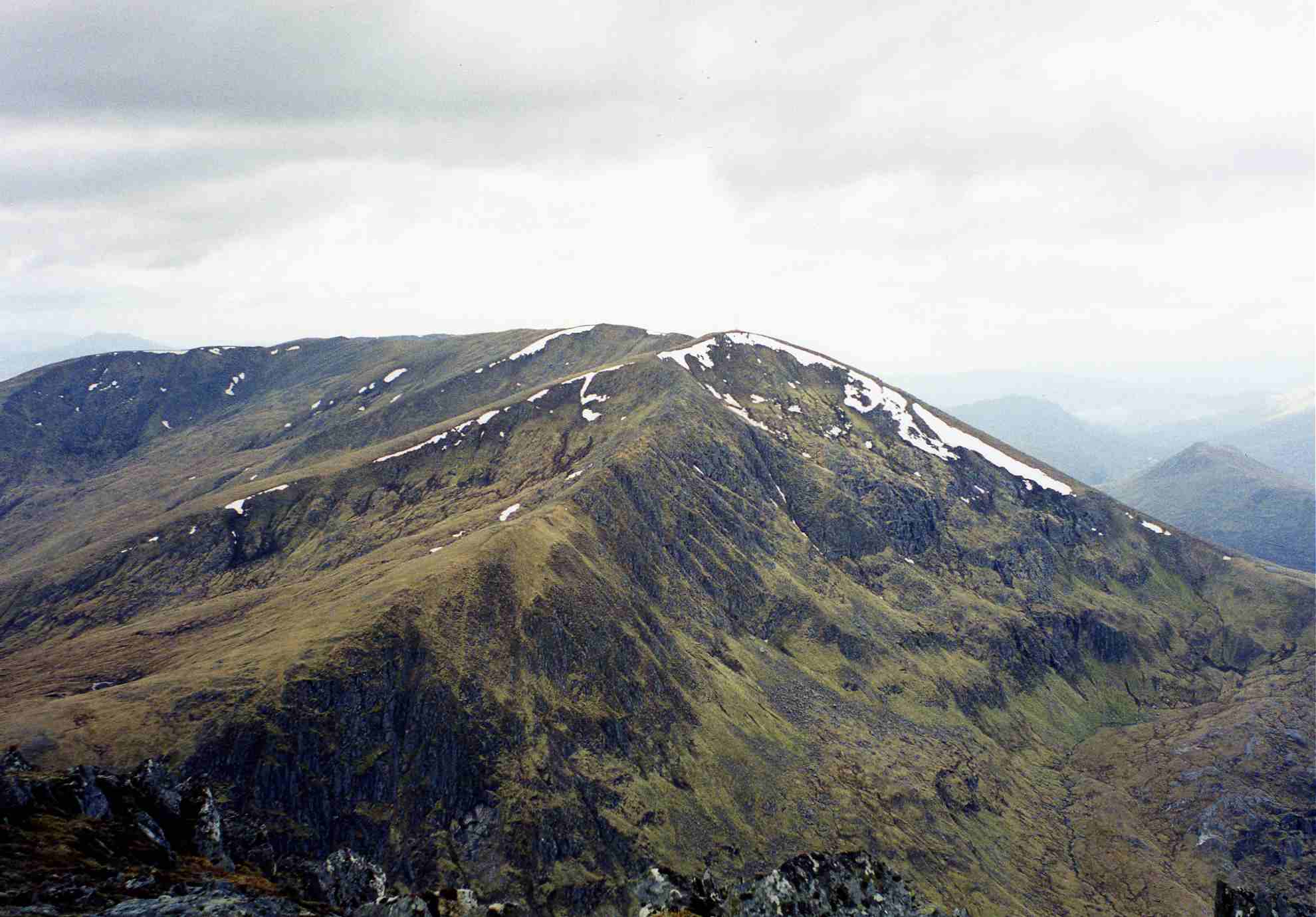
Càrn nan Gobhar (Mullardoch)

Càrn nan Gobhar is a mountain rising to 993 metres (3,258 ft) in the Northwest Highlands of Scotland. It stands on the northern side of Loch Mullardoch...
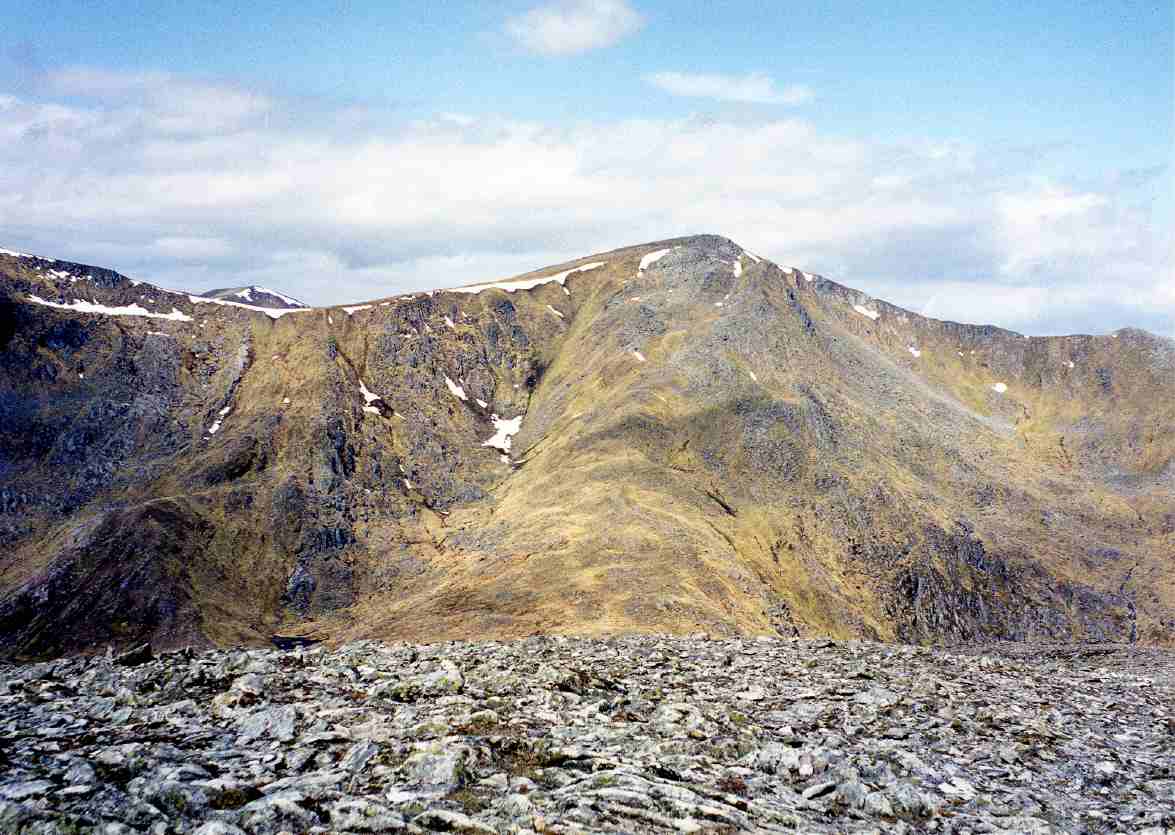
Sgùrr na Lapaich

Sgurr na Lapaich is a mountain in the Northwest Highlands of Scotland, situated north of Loch Mullardoch in the high ground that separates Glen Cannich...

Loch Monar

Loch Monar is a freshwater loch situated at the head of Glen Strathfarrar, in the West Highlands of Scotland. Since the 1960s, it has been dammed as part...

An Riabhachan

An Riabhachan is a Scottish mountain in the Skye and Lochalsh district of the Highland council area. It is situated 35 kilometres east of Kyle of Lochalsh...

Loch Mullardoch

Loch Mullardoch is a major reservoir in Glen Cannich in the Northwest Highlands of Scotland. It was created by the damming in 1951 of the River Cannich...

Glen Cannich

Glen Cannich (Scottish Gaelic: Gleann Chanaich) is a long glen in the Northwest Highlands of Scotland and through which runs the River Cannich. Emerging...

An Socach (Glen Cannich)

An Socach is a mountain at the head of Glen Cannich, in the Highlands of Scotland. It is situated between Loch Mullardoch in Glen Cannich, and Loch Monar...

Toll Creagach

Toll Creagach (1,054 m) is a mountain in the Northwest Highlands of Scotland. It lies between Glen Affric in the south and Loch Mullardoch in Inverness...

Have you been to Coille na Lapaich?

Leave your review of Coille na Lapaich below (or comments, questions and feedback).