Backhill Strips

Wood, Forest in Ayrshire

Scotland

Backhill Strips

Winter at Reuchal An early-March view. Most of the overnight snow had melted in the spring sunshine.
Winter at Reuchal Credit: Mary and Angus Hogg

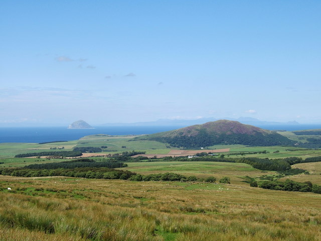
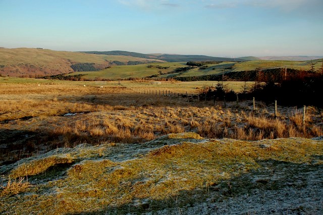
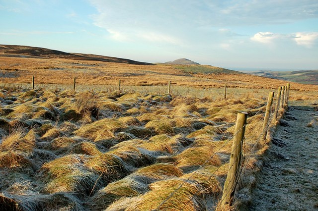
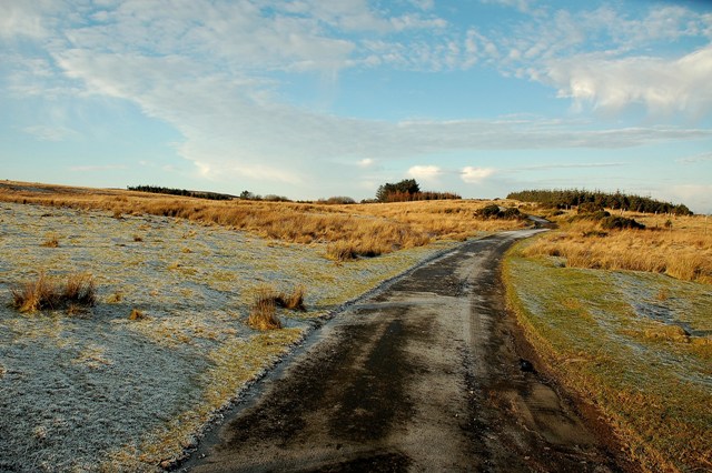
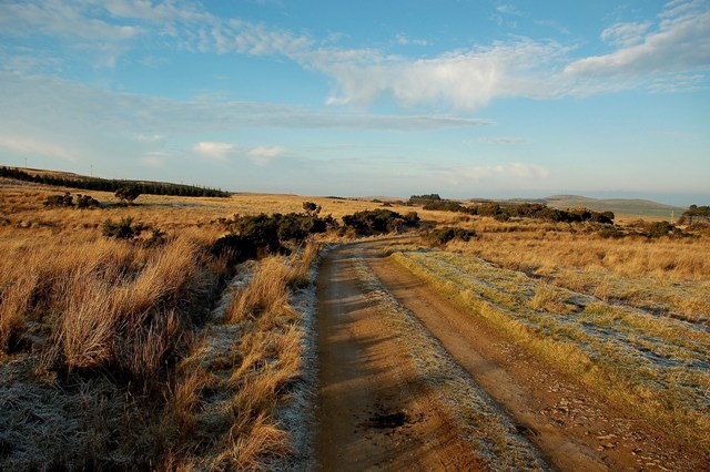
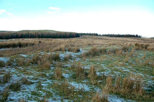
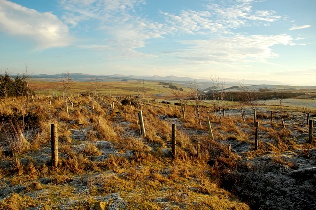
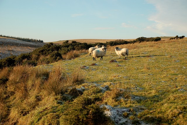
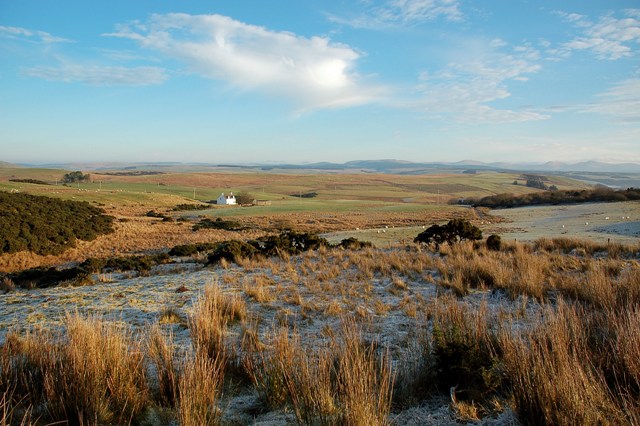
Backhill Strips is a woodland area located in Ayrshire, Scotland. It covers an approximate area of 200 acres and is known for its dense forest and diverse range of tree species. The woodland is situated in a rural setting with rolling hills and offers a peaceful and tranquil environment for visitors.

The forest is predominantly composed of native tree species such as oak, birch, and beech, which provide a rich habitat for various wildlife including birds, mammals, and insects. The diverse vegetation in Backhill Strips supports a thriving ecosystem, making it a popular spot for nature enthusiasts and birdwatchers.

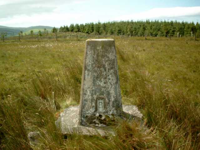
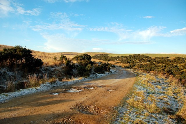
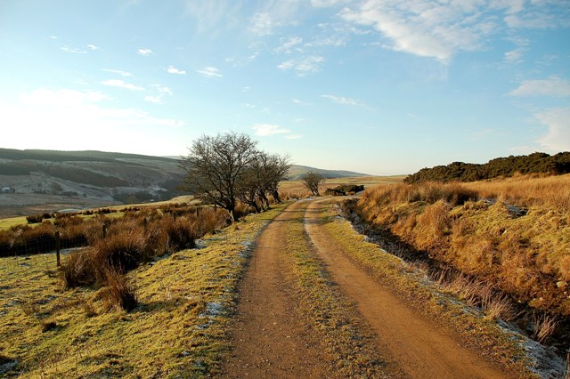
The woodland is crisscrossed by several well-maintained walking trails, allowing visitors to explore the area at their leisure. These trails provide stunning views of the surrounding countryside, and during the spring and summer months, the forest floor becomes a vibrant carpet of wildflowers.

Backhill Strips is also home to a small stream that meanders through the woodland, adding to the natural beauty of the area. The stream serves as a water source for the wildlife and provides an opportunity for visitors to enjoy the soothing sound of running water.

The woodland is open to the public year-round and offers ample parking facilities. It is a popular destination for recreational activities such as hiking, picnicking, and photography. Additionally, the forest management team regularly organizes educational events and guided tours to promote awareness and appreciation of the natural environment.

In conclusion, Backhill Strips in Ayrshire is a picturesque woodland area that offers a diverse range of flora and fauna, making it a haven for nature lovers and outdoor enthusiasts alike.

If you have any feedback on the listing, please let us know in the comments section below.

Backhill Strips Images

Images are sourced within 2km of 55.113916/-4.8825145 or Grid Reference NX1683. Thanks to Geograph Open Source API. All images are credited.

Winter at Reuchal An early-March view. Most of the overnight snow had melted in the spring sunshine.
Winter at Reuchal
An early-March view. Most of the overnight snow had melted in the spring sunshine.
Track to Reuchal The light covering of snow was still lying in the shady places.
Track to Reuchal
The light covering of snow was still lying in the shady places.
Reuchal view The distant Galloway Hills were covered with a white blanket but only a sprinkling of snow had fallen around the farm.
Reuchal view
The distant Galloway Hills were covered with a white blanket but only a sprinkling of snow had fallen around the farm.
Knockdhu (230 metres) near to Ballantrae and Colmonell, South Ayrshire. The hill Knockdhu taken from the footpath from Penwhirn Reservoir to Ballantrae near to Benawhirter, Smyrton. The photo has good views of the Irish Sea and clearly shows Ailsa Craig with the island of Arran in the background.
Knockdhu (230 metres) near to Ballantrae and Colmonell, South Ayrshire.
The hill Knockdhu taken from the footpath from Penwhirn Reservoir to Ballantrae near to Benawhirter, Smyrton. The photo has good views of the Irish Sea and clearly shows Ailsa Craig with the island of Arran in the background.
Wheeb Hill Trig Pillar, S8087 The pillar was completed on 7th August 1954 costing £19.2s.6d.
Wheeb Hill Trig Pillar, S8087
The pillar was completed on 7th August 1954 costing £19.2s.6d.
Knockdolian View Looking out towards the Firth of Clyde on a fine, frosty December morning.
Knockdolian View
Looking out towards the Firth of Clyde on a fine, frosty December morning.
Towards Dalreoch Burn Upland farming country, viewed on a frosty December morning.  The small valley of Dalreoch Burn, in the same square, is visible in the background of this shot.
Towards Dalreoch Burn
Upland farming country, viewed on a frosty December morning. The small valley of Dalreoch Burn, in the same square, is visible in the background of this shot.
Hill Grazing Land A winter view of hill grazing on the lower slopes of Ford Hill.
Hill Grazing Land
A winter view of hill grazing on the lower slopes of Ford Hill.
Winter Scene Looking towards the Firth of Clyde from the lower slopes of Ford Hill.  The top of Knockdolian is visible in the distance.
Winter Scene
Looking towards the Firth of Clyde from the lower slopes of Ford Hill. The top of Knockdolian is visible in the distance.
Farm Road This roads connects four upland farms with the Stinchar valley at Colmonell.
Farm Road
This roads connects four upland farms with the Stinchar valley at Colmonell.
On The Farm Track Looking back towards the Firth of Clyde on a fine December morning.
On The Farm Track
Looking back towards the Firth of Clyde on a fine December morning.
Ford Hill View The low-angle winter sun had left the night's frost lying the shady spots.
Ford Hill View
The low-angle winter sun had left the night's frost lying the shady spots.
Towards The Burn Of Lig Looking down the valley of the Burn of Lig from the high farm track.
Towards The Burn Of Lig
Looking down the valley of the Burn of Lig from the high farm track.
Hill Sheep Black-faced sheep on hill grazing in early December.  The valley of the Burn of Lig is visible on the left.
Hill Sheep
Black-faced sheep on hill grazing in early December. The valley of the Burn of Lig is visible on the left.
A Winter View Looking down the valley of the Burn of Lig on a frosty December morning.  Reuchal farm is shown on the left.
A Winter View
Looking down the valley of the Burn of Lig on a frosty December morning. Reuchal farm is shown on the left.
Farm Track This track links some isolated farms with the Stinchar Valley at Colmonell.
Farm Track
This track links some isolated farms with the Stinchar Valley at Colmonell.
Into Glen Tig On the farm track above the upper part of Glen Tig.
Into Glen Tig
On the farm track above the upper part of Glen Tig.
Above Glen Tig Perched high above Glen Tig, "the Wheeb" lies at the end of the track.
Above Glen Tig
Perched high above Glen Tig, "the Wheeb" lies at the end of the track.
Show me another place!

Backhill Strips is located at Grid Ref: NX1683 (Lat: 55.113916, Lng: -4.8825145)

Unitary Authority: South Ayrshire

Police Authority: Ayrshire

What 3 Words

///help.legroom.entertainer. Near Girvan, South Ayrshire

Nearby Locations

Backhill Strips

Related Wikis

Colmonell

Colmonell (Scottish Gaelic: Cill Cholmain Eala) (meaning the church of St. Colman of Lainn Eala - in Lynally, County Offaly, Ireland) is a small village...

Heronsford

Heronsford is a village located in South Ayrshire, South-West Scotland. == About == Heronsford is a hamlet located near Ballantrae that sits along the...

Pinwherry railway station

Pinwherry railway station served the village of Pinwherry, South Ayrshire, Scotland from 1887 to 1965 on the Girvan and Portpatrick Junction Railway....

Pinwherry

Pinwherry is a hamlet in the civil parish of Colmonell, in the council area of South Ayrshire, Scotland. It is 8 miles south of Girvan. In 1961 it had...

Dumbarton Collegiate Church

The Collegiate Church of St Mary, Dumbarton, Scotland, was founded in about 1453 by Isabella, Countess of Lennox and Duchess of Albany. During the medieval...

Barrhill railway station

Barrhill railway station is a railway station serving the village of Barrhill, South Ayrshire, Scotland. The station is managed by ScotRail and is on the...

Arecleoch Wind Farm

Arecleoch Wind Farm is a 60 turbine wind farm in South Ayrshire, Scotland with a total capacity of 120 megawatts (MW), enough to power over 67,000 homes...

Lendalfoot

Lendalfoot is a small village located on Carleton Bay, parish of Colmonell in the old district of Carrick, now South Ayrshire, about six miles (ten kilometres...

Nearby Amenities

Located within 500m of 55.113916,-4.8825145
Power: pole
Lat/Long: 55.1179163/-4.8818113
Power: pole
Lat/Long: 55.1173286/-4.8827543
Power: pole
Lat/Long: 55.1168928/-4.8834339
Power: pole
Lat/Long: 55.1160361/-4.8848191
Power: pole
Lat/Long: 55.1156501/-4.8854352
Power: pole
Lat/Long: 55.1149682/-4.8865429
Power: pole
Lat/Long: 55.1143696/-4.8874883
Power: pole
Lat/Long: 55.1136931/-4.8885912
Power: pole
Lat/Long: 55.1130663/-4.8895719
The data included in this document is from www.openstreetmap.org. The data is made available under ODbL.

Have you been to Backhill Strips?

Leave your review of Backhill Strips below (or comments, questions and feedback).