Doire na h-Achlaise
Wood, Forest in Inverness-shire
Scotland
Doire na h-Achlaise

Doire na h-Achlaise, located in Inverness-shire, Scotland, is a picturesque wood or forest region that captivates visitors with its natural beauty. Spread across an area of approximately 10 square kilometers, this enchanting woodland is nestled amidst the stunning Scottish Highlands. The name "Doire na h-Achlaise" translates to "oakwood of the field" in Scottish Gaelic, reflecting the prevalence of oak trees within the area.
The forest boasts a diverse range of flora and fauna, with a rich array of plant species thriving in its fertile soil. Towering oak trees dominate the landscape, their branches creating a dense canopy that filters sunlight and creates a peaceful atmosphere. Other tree species such as birch, rowan, and pine can also be found, contributing to the forest's biodiversity.
Doire na h-Achlaise is not only visually appealing but also serves as a haven for wildlife. Visitors may encounter various species, including red deer, foxes, squirrels, and a variety of birds. The forest's serene ambiance and abundant food sources make it an ideal habitat for these creatures.
For those seeking outdoor activities, Doire na h-Achlaise offers a range of recreational opportunities. Hiking trails wind through the woodland, allowing visitors to immerse themselves in nature and enjoy the breathtaking scenery. Birdwatchers will also find delight in observing the diverse birdlife that inhabits the forest.
Overall, Doire na h-Achlaise is a true gem within Inverness-shire, inviting nature enthusiasts to explore its tranquil woodlands, admire its majestic trees, and revel in the wonders of Scotland's natural landscape.
If you have any feedback on the listing, please let us know in the comments section below.
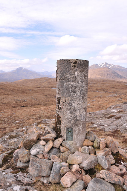
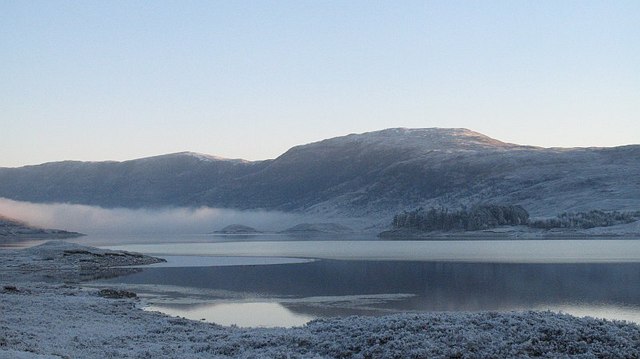
Doire na h-Achlaise Images
Images are sourced within 2km of 57.088701/-5.0769641 or Grid Reference NH1303. Thanks to Geograph Open Source API. All images are credited.


Doire na h-Achlaise is located at Grid Ref: NH1303 (Lat: 57.088701, Lng: -5.0769641)
Unitary Authority: Highland
Police Authority: Highlands and Islands
What 3 Words
///superhero.polka.slate. Near Gairlochy, Highland
Nearby Locations
Related Wikis

Loch Loyne
Loch Loyne is a loch in the Northwest Highlands of Scotland. Loch Loyne lies between Glen Garry and Glen Cluanie. The A87 road runs beside the eastern...

Tomdoun
Tomdoun (Scottish Gaelic: An Tom Donn) is a settlement on the north side of the River Garry, near the western end of Loch Garry, in Glen Garry in the Highlands...
Beinn Loinne
Beinn Loinne (also known as Druim nan Cnamh) (789 m) is a mountain in the Northwest Highlands of Scotland. It rises above the southern shore of Loch Cluanie...

Loch Cluanie
Loch Cluanie (Scottish Gaelic: Loch Cluanaidh) is a loch in the Northwest Highlands of Scotland at the south-east end of Glen Shiel. It is a reservoir...

Spidean Mialach
Spidean Mialach (996 m) is a mountain in the Northwest Highlands, Scotland, situated on the northern shore of Loch Quoich in Inverness-shire. One of a...

Aonach air Chrith
Aonach air Chrith (1,020 m) is a mountain in the Northwest Highlands, Scotland. It is located on the southern side of Glen Shiel in Kintail. The mountain...

Gleouraich
Gleouraich (Scottish Gaelic: Gleadhraich) is a Scottish mountain located to the north of Loch Quoich in the north western highlands. It has a height of...

Loch Garry
Loch Garry (Scottish Gaelic: Loch Garraidh) is a freshwater loch 25 km north of Fort William, Lochaber, Scotland. Loch Garry is 11 km long and 50 m deep...
Have you been to Doire na h-Achlaise?
Leave your review of Doire na h-Achlaise below (or comments, questions and feedback).