Bad an Og

Wood, Forest in Sutherland

Scotland

Bad an Og

Loch Ruighean an Aitinn - 1983 Loch Ruighean an Aitinn, seen from the B869 (single track road) near Drumbeg.
Loch Ruighean an Aitinn - 1983 Credit: Helmut Zozmann

Bad an Og is a forested area located in Sutherland, Scotland. It is situated in the northern part of the country, approximately 10 miles northwest of the village of Lairg. The name "Bad an Og" translates to "place of the young" in Scottish Gaelic, reflecting the area's natural beauty and abundance of wildlife.

Covering an area of approximately 5 square miles, Bad an Og is primarily characterized by its dense woodland and ancient Caledonian pine trees. These trees, some of which are estimated to be hundreds of years old, create a unique and enchanting atmosphere within the forest. The area is also home to a variety of other tree species, including oak, birch, and rowan, which contribute to the rich biodiversity of the region.

The forest is a haven for numerous wildlife species, making it a popular destination for nature enthusiasts and wildlife photographers. Red squirrels, pine martens, and roe deer are commonly spotted within the forest, while golden eagles and ospreys can occasionally be seen soaring through the skies above. The diverse range of bird species in Bad an Og includes crossbills, crested tits, and wood warblers.

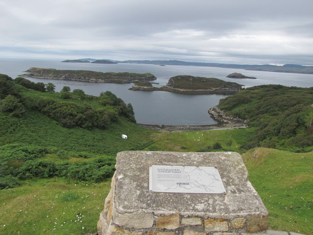
Visitors to Bad an Og can explore the forest through a network of walking trails, which provide access to the most picturesque areas of the woodland. These trails offer opportunities to observe the wildlife and immerse oneself in the tranquility of the natural surroundings. Additionally, the forest is equipped with visitor facilities, such as parking areas and picnic spots, ensuring a comfortable experience for those who wish to spend a day exploring the beauty of Bad an Og.

If you have any feedback on the listing, please let us know in the comments section below.

Bad an Og Images

Images are sourced within 2km of 58.229563/-5.2107678 or Grid Reference NC1131. Thanks to Geograph Open Source API. All images are credited.

Loch Ruighean an Aitinn - 1983 Loch Ruighean an Aitinn, seen from the B869 (single track road) near Drumbeg.
Loch Ruighean an Aitinn - 1983
Loch Ruighean an Aitinn, seen from the B869 (single track road) near Drumbeg.
Water Lilies - 1983 Water lilies on Loch Ruighean an Aitinn, seen from the B869 (single track road) near Drumbeg.
Water Lilies - 1983
Water lilies on Loch Ruighean an Aitinn, seen from the B869 (single track road) near Drumbeg.
Water Lilies - 1983 Water lilies on Loch Ruighean an Aitinn, seen from the B869 (single track road) near Drumbeg.
Water Lilies - 1983
Water lilies on Loch Ruighean an Aitinn, seen from the B869 (single track road) near Drumbeg.
Loch Ruighean an Aitinn - 1983 Water lilies on Loch Ruighean an Aitinn, seen from the B869 (single track road) near Drumbeg.
Loch Ruighean an Aitinn - 1983
Water lilies on Loch Ruighean an Aitinn, seen from the B869 (single track road) near Drumbeg.
Moorland valley near Drumbeg View to the northwest towards Loch Bad na Labhairt
Moorland valley near Drumbeg
View to the northwest towards Loch Bad na Labhairt
Cloud formation over Sail Gorm Taken near Ambraigh, Drumbeg
Cloud formation over Sail Gorm
Taken near Ambraigh, Drumbeg
Drumbeg viewpoint Drumbeg viewpoint has magnificent views out over Eddrachillis Bay to the famous bird sanctuary of Handa Island and the mountains towards Cape Wrath.
Drumbeg viewpoint
Drumbeg viewpoint has magnificent views out over Eddrachillis Bay to the famous bird sanctuary of Handa Island and the mountains towards Cape Wrath.
Assynt Free Church Functional at best as is the case with many of the Free Church's establishments.
Assynt Free Church
Functional at best as is the case with many of the Free Church's establishments.
Some of Drumbeg's Facilities A telephone box and a grit bin.
Some of Drumbeg's Facilities
A telephone box and a grit bin.
Tea Garden at Drumbeg A nice place to sit and have tea. And cake.
Tea Garden at Drumbeg
A nice place to sit and have tea. And cake.
Drumbeg stores What ever you need can be purchased in the store and Post Office, a great little shop.
Drumbeg stores
What ever you need can be purchased in the store and Post Office, a great little shop.
Drumbeg village Part of the village from the store shop.
Drumbeg village
Part of the village from the store shop.
Part of Loch Drumbeg This small corner of Loch Drumbeg is just in square.
Part of Loch Drumbeg
This small corner of Loch Drumbeg is just in square.
Loch Drumbeg Loch Drumbeg from the road
Loch Drumbeg
Loch Drumbeg from the road
Port Drumbeg The view from the view point
Port Drumbeg
The view from the view point
Redwing at Drumbeg A numerous thrush in the area at this time, mostly moving north.
Redwing at Drumbeg
A numerous thrush in the area at this time, mostly moving north.
Show me another place!

Bad an Og is located at Grid Ref: NC1131 (Lat: 58.229563, Lng: -5.2107678)

Unitary Authority: Highland

Police Authority: Highlands and Islands

What 3 Words

///custard.workshops.cheerily. Near Clachtoll, Highland

Related Wikis

Drumbeg, Sutherland

Drumbeg (Scottish Gaelic: An Druim Beag) is a remote crofting village on the north west coast of Scotland in Assynt, Sutherland, Scottish Highlands and...

Nedd

Nedd (Scottish Gaelic: An Nead) is a small village, which lies on the western head of Loch Nedd in Lairg, western Sutherland, Scottish Highlands and is...

Culkein Drumbeg

Culkein Drumbeg (Scottish Gaelic: Cùl-cinn an Droma Bhig) is a remote village on the north west coast of Scotland. It is located 0.93 miles (1.50 km) north...

MV Bermuda

MV Bermuda was a passenger motor ship that Furness, Withy's Furness Bermuda Line operated between New York and Bermuda from 1928 until 1931. She was damaged...

Nearby Amenities

Located within 500m of 58.229563,-5.2107678
The data included in this document is from www.openstreetmap.org. The data is made available under ODbL.

Have you been to Bad an Og?

Leave your review of Bad an Og below (or comments, questions and feedback).