Camelon

Settlement in Stirlingshire

Scotland

Camelon

Falkirk Wheel - upper level sealing arrangement Swinging the boat lift is the easy bit, it is the sealing devices at each level and at each end of the two boat chambers that get complicated. A view from a descending boat.
Falkirk Wheel - upper level sealing arrangement Credit: Robin Webster

Camelon is a small town located in the Stirlingshire region of Scotland. Situated in the Falkirk council area, it lies approximately 2 miles east of Falkirk and about 24 miles northwest of the bustling city of Edinburgh. With a population of around 5,000 people, Camelon has a rich history dating back to Roman times.

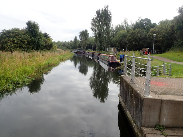
The town's name is derived from the Gaelic word "camshron," meaning "crooked nose," which aptly describes the shape of the land on which Camelon is built. Historically, Camelon was an important Roman settlement known as Camelonium and served as a key military base along the Antonine Wall, which was built by the Romans in the 2nd century AD.

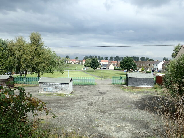
Today, Camelon is a residential area that offers a peaceful and tranquil atmosphere. The town boasts a range of amenities including local shops, restaurants, and pubs, providing residents with easy access to daily necessities. Additionally, Camelon is served by several schools, making it an attractive place for families.

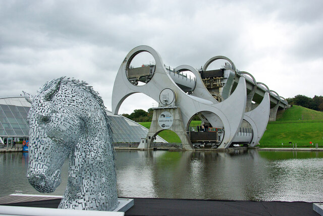
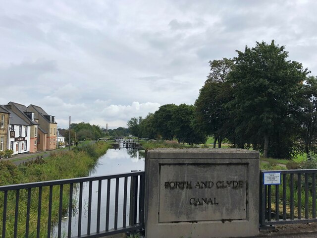
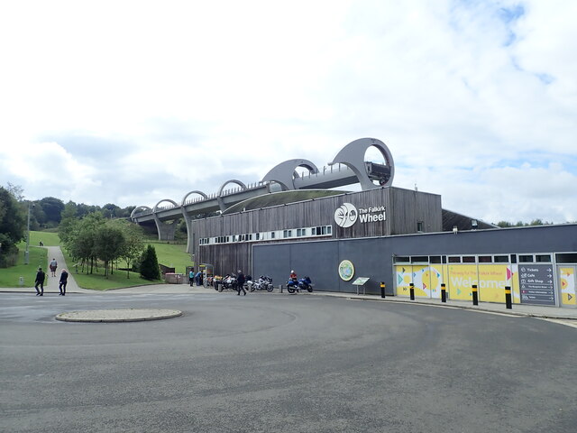
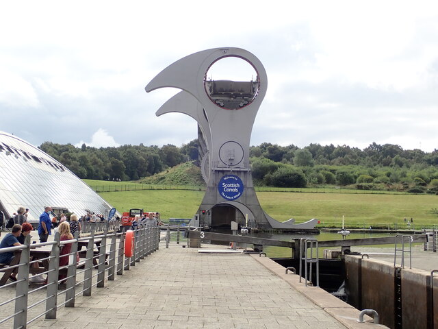
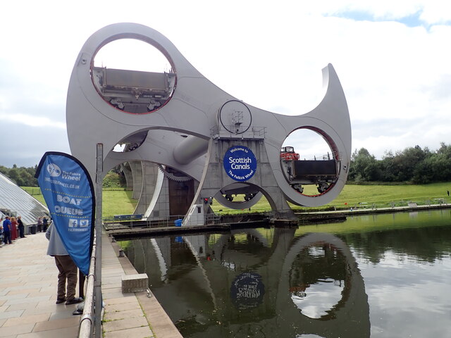
One notable feature of Camelon is the iconic Falkirk Wheel, a rotating boat lift that connects the Forth and Clyde Canal with the Union Canal. This engineering marvel attracts tourists from far and wide, offering boat trips and a visitor center that provides insight into the history and operation of the wheel.

Overall, Camelon is a picturesque town with a fascinating past and a close-knit community. Its convenient location, rich history, and modern amenities make it an appealing place to live or visit.

If you have any feedback on the listing, please let us know in the comments section below.
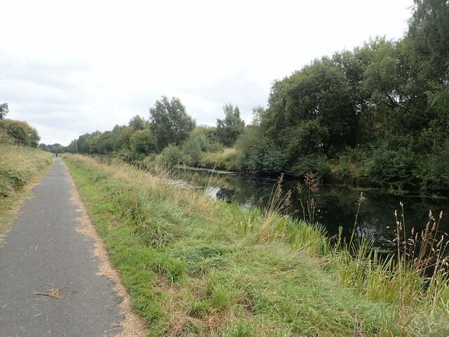
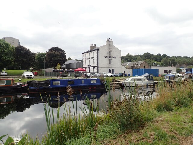
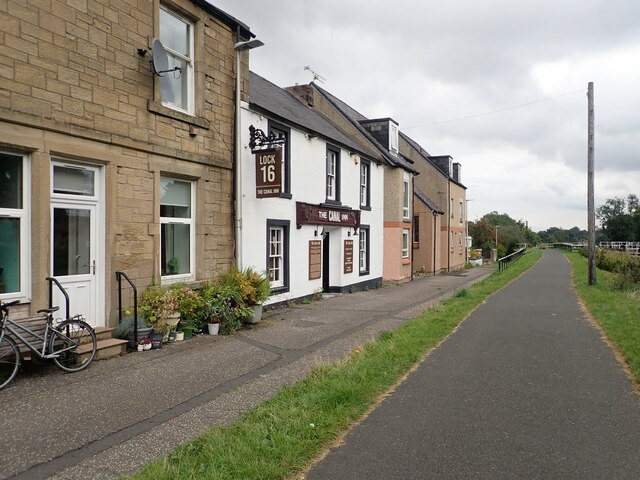
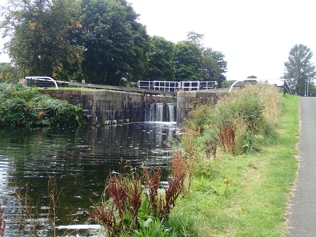
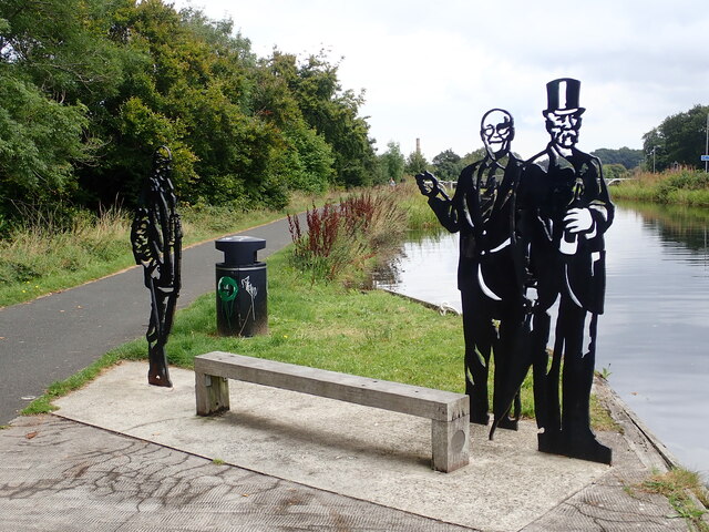
Camelon Images

Images are sourced within 2km of 56.003418/-3.813128 or Grid Reference NS8780. Thanks to Geograph Open Source API. All images are credited.

Falkirk Wheel - upper level sealing arrangement Swinging the boat lift is the easy bit, it is the sealing devices at each level and at each end of the two boat chambers that get complicated. A view from a descending boat.
Falkirk Wheel - upper level sealing arrangement
Swinging the boat lift is the easy bit, it is the sealing devices at each level and at each end of the two boat chambers that get complicated. A view from a descending boat.
Falkirk Wheel and a Kelpie model, 2007 Despite what Wikipedia says, the miniature (1/10) Kelpies existed in 2007, and were not made in 2008. They were on display here before the large size ones were made or even had the finance secured, from what I remember of the display board.
Falkirk Wheel and a Kelpie model, 2007
Despite what Wikipedia says, the miniature (1/10) Kelpies existed in 2007, and were not made in 2008. They were on display here before the large size ones were made or even had the finance secured, from what I remember of the display board.
Unrecorded old worn Bench Mark between Carronvale Road and Dorrator Bridge (old Swing Bridge) An old worn Ordnance Survey Cut Mark (Bench Mark) on a concrete post situated in the East hedge line on the footpath between the end of Carronvale Road and Dorrator Bridge (locally known as swing bridge). No records found on old OS maps of this Bench Mark.
Unrecorded old worn Bench Mark between Carronvale Road and Dorrator Bridge (old Swing Bridge)
An old worn Ordnance Survey Cut Mark (Bench Mark) on a concrete post situated in the East hedge line on the footpath between the end of Carronvale Road and Dorrator Bridge (locally known as swing bridge). No records found on old OS maps of this Bench Mark.
The 3 Larbert bridges viewed from River Carron in winter The Larbert viaduct, old Larbert Bridge, and newer Larbert road bridge viewed from River Carron towards the viaduct in winter.
The 3 Larbert bridges viewed from River Carron in winter
The Larbert viaduct, old Larbert Bridge, and newer Larbert road bridge viewed from River Carron towards the viaduct in winter.
Alexander Dennis factory at Stirling Major bus builder who design, engineer, build and support the widest range of market leading buses and coaches using low, ultra-low and zero emission technologies.
Alexander Dennis factory at Stirling
Major bus builder who design, engineer, build and support the widest range of market leading buses and coaches using low, ultra-low and zero emission technologies.
Forth and Clyde Canal at Lock 16 The Forth and Clyde Canal links Bowling on the Firth of Clyde with Grangemouth on the Firth of Forth. It allowed goods to be transported between the east and west coasts, and to be exported from Glasgow to Europe or from Edinburgh to America, without taking the hazardous route round the north of Scotland or the longer route via the English Channel. 

It is 56 kilometres (35 miles) long and has 39 locks, and the highest point is 47 metres (155 feet) above sea level. Originally there were 33 drawbridges, ten large aqueducts and 33 smaller ones.

It was designed by the engineer John Smeaton and opened in 1790, after over 20 years of planning and construction. 

With time seagoing vessels became too large to pass through the locks, and competition from the railways in the 19th century led to it being more or less disused, and it was closed in 1963.

However it was reopened as a Millennium project in 2001, and linked to the Union Canal by the Falkirk Wheel.
Forth and Clyde Canal at Lock 16
The Forth and Clyde Canal links Bowling on the Firth of Clyde with Grangemouth on the Firth of Forth. It allowed goods to be transported between the east and west coasts, and to be exported from Glasgow to Europe or from Edinburgh to America, without taking the hazardous route round the north of Scotland or the longer route via the English Channel. It is 56 kilometres (35 miles) long and has 39 locks, and the highest point is 47 metres (155 feet) above sea level. Originally there were 33 drawbridges, ten large aqueducts and 33 smaller ones. It was designed by the engineer John Smeaton and opened in 1790, after over 20 years of planning and construction. With time seagoing vessels became too large to pass through the locks, and competition from the railways in the 19th century led to it being more or less disused, and it was closed in 1963. However it was reopened as a Millennium project in 2001, and linked to the Union Canal by the Falkirk Wheel.
The Falkirk Wheel Visitor Centre for the Falkirk Wheel, and behind it the Union Canal culminating in a boat lift
The Falkirk Wheel
Visitor Centre for the Falkirk Wheel, and behind it the Union Canal culminating in a boat lift
Rotating bridge at the basin at the foot of the Falkirk Wheel Opened in 2002 by the Queen, the Falkirk Wheel is a testament to the popularity of canal cruising in the modern era. It connects the Forth and Clyde Canal with the Union Canal, replacing a flight of locks which fell into disuse in the 1930s and had been built on. The wheel raises or lowers boats 24m (79ft) and takes five-and-a-half minutes to complete a rotation. It is now a major visitor attraction.
Rotating bridge at the basin at the foot of the Falkirk Wheel
Opened in 2002 by the Queen, the Falkirk Wheel is a testament to the popularity of canal cruising in the modern era. It connects the Forth and Clyde Canal with the Union Canal, replacing a flight of locks which fell into disuse in the 1930s and had been built on. The wheel raises or lowers boats 24m (79ft) and takes five-and-a-half minutes to complete a rotation. It is now a major visitor attraction.
Narrow boats at the landing stage  On the Forth and Clyde Canal near the Falkirk Wheel
Narrow boats at the landing stage
On the Forth and Clyde Canal near the Falkirk Wheel
Falkirk Wheel Waiting for the wheel to rotate, one gondola is at the top and the other in the tunnel at the bottom
Falkirk Wheel
Waiting for the wheel to rotate, one gondola is at the top and the other in the tunnel at the bottom
Half-way round on the Falkirk Wheel Opened in 2002 by the Queen, the Falkirk Wheel is a testament to the popularity of canal cruising in the modern era. It connects the Forth and Clyde Canal with the Union Canal, replacing a flight of locks which fell into disuse in the 1930s and had been built on. The wheel raises or lowers boats 24m (79ft) and takes five-and-a-half minutes to complete a rotation. It is now a major visitor attraction.
Half-way round on the Falkirk Wheel
Opened in 2002 by the Queen, the Falkirk Wheel is a testament to the popularity of canal cruising in the modern era. It connects the Forth and Clyde Canal with the Union Canal, replacing a flight of locks which fell into disuse in the 1930s and had been built on. The wheel raises or lowers boats 24m (79ft) and takes five-and-a-half minutes to complete a rotation. It is now a major visitor attraction.
Towpath beside the Forth and Clyde Canal 4.1 miles to go to reach the Kelpies from the Falkirk Wheel
Towpath beside the Forth and Clyde Canal
4.1 miles to go to reach the Kelpies from the Falkirk Wheel
Playing fields at Carmuirs
Towpath along the Forth and Clyde Canal The Forth and Clyde Canal links Bowling on the Firth of Clyde with Grangemouth on the Firth of Forth. It allowed goods to be transported between the east and west coasts, and to be exported from Glasgow to Europe or from Edinburgh to America, without taking the hazardous route round the north of Scotland or the longer route via the English Channel. 

It is 56 kilometres (35 miles) long and has 39 locks, and the highest point is 47 metres (155 feet) above sea level. Originally there were 33 drawbridges, ten large aqueducts and 33 smaller ones.

It was designed by the engineer John Smeaton and opened in 1790, after over 20 years of planning and construction. 

With time seagoing vessels became too large to pass through the locks, and competition from the railways in the 19th century led to it being more or less disused, and it was closed in 1963.

However it was reopened as a Millennium project in 2001, and linked to the Union Canal by the Falkirk Wheel.
Towpath along the Forth and Clyde Canal
The Forth and Clyde Canal links Bowling on the Firth of Clyde with Grangemouth on the Firth of Forth. It allowed goods to be transported between the east and west coasts, and to be exported from Glasgow to Europe or from Edinburgh to America, without taking the hazardous route round the north of Scotland or the longer route via the English Channel. It is 56 kilometres (35 miles) long and has 39 locks, and the highest point is 47 metres (155 feet) above sea level. Originally there were 33 drawbridges, ten large aqueducts and 33 smaller ones. It was designed by the engineer John Smeaton and opened in 1790, after over 20 years of planning and construction. With time seagoing vessels became too large to pass through the locks, and competition from the railways in the 19th century led to it being more or less disused, and it was closed in 1963. However it was reopened as a Millennium project in 2001, and linked to the Union Canal by the Falkirk Wheel.
Union Inn near Lock 16  The Union Canal from Edinburgh joined the Forth and Clyde here in 1822. The Union Inn was built beside the basin to cater for boat passengers travelling between Glasgow and Edinburgh.
Union Inn near Lock 16
The Union Canal from Edinburgh joined the Forth and Clyde here in 1822. The Union Inn was built beside the basin to cater for boat passengers travelling between Glasgow and Edinburgh.
Canal Inn Beside the towpath along the Forth and Clyde Canal
Canal Inn
Beside the towpath along the Forth and Clyde Canal
Lock 15 on the Forth and Clyde Canal The Forth and Clyde Canal links Bowling on the Firth of Clyde with Grangemouth on the Firth of Forth. It allowed goods to be transported between the east and west coasts, and to be exported from Glasgow to Europe or from Edinburgh to America, without taking the hazardous route round the north of Scotland or the longer route via the English Channel. 

It is 56 kilometres (35 miles) long and has 39 locks, and the highest point is 47 metres (155 feet) above sea level. Originally there were 33 drawbridges, ten large aqueducts and 33 smaller ones.

It was designed by the engineer John Smeaton and opened in 1790, after over 20 years of planning and construction. 

With time seagoing vessels became too large to pass through the locks, and competition from the railways in the 19th century led to it being more or less disused, and it was closed in 1963.

However it was reopened as a Millennium project in 2001, and linked to the Union Canal by the Falkirk Wheel.
Lock 15 on the Forth and Clyde Canal
The Forth and Clyde Canal links Bowling on the Firth of Clyde with Grangemouth on the Firth of Forth. It allowed goods to be transported between the east and west coasts, and to be exported from Glasgow to Europe or from Edinburgh to America, without taking the hazardous route round the north of Scotland or the longer route via the English Channel. It is 56 kilometres (35 miles) long and has 39 locks, and the highest point is 47 metres (155 feet) above sea level. Originally there were 33 drawbridges, ten large aqueducts and 33 smaller ones. It was designed by the engineer John Smeaton and opened in 1790, after over 20 years of planning and construction. With time seagoing vessels became too large to pass through the locks, and competition from the railways in the 19th century led to it being more or less disused, and it was closed in 1963. However it was reopened as a Millennium project in 2001, and linked to the Union Canal by the Falkirk Wheel.
Local Heroes Cut-out sculptures of three renowned local men - Dr Harold Lyon on the left, who established a centre for palliative care for Central Scotland; Reginald Adams (centre) a swimming trainer over 50 years who coached Scottish champions, and Robert Barr (right) who produced the famous Scottish soft drink "Iron Brew" in 1875
Local Heroes
Cut-out sculptures of three renowned local men - Dr Harold Lyon on the left, who established a centre for palliative care for Central Scotland; Reginald Adams (centre) a swimming trainer over 50 years who coached Scottish champions, and Robert Barr (right) who produced the famous Scottish soft drink "Iron Brew" in 1875
Show me another place!

Camelon is located at Grid Ref: NS8780 (Lat: 56.003418, Lng: -3.813128)

Unitary Authority: Falkirk

Police Authority: Forth Valley

What 3 Words

///pythons.mainly.slim. Near Falkirk

Nearby Locations

Camelon

Related Wikis

Camelon

Camelon (; Scots: Caimlan, Scottish Gaelic: Camalan) is a large settlement within the Falkirk council area, Scotland. The village is in the Forth Valley...

Camelon railway station

Camelon railway station is a railway station serving the suburb of Camelon in Falkirk, Scotland. It is located on the Edinburgh-Dunblane and Cumbernauld...

Camelon Juniors F.C.

Camelon Juniors Football Club are a Scottish football club based in Camelon, in the Falkirk district. The team plays in the East of Scotland League First...
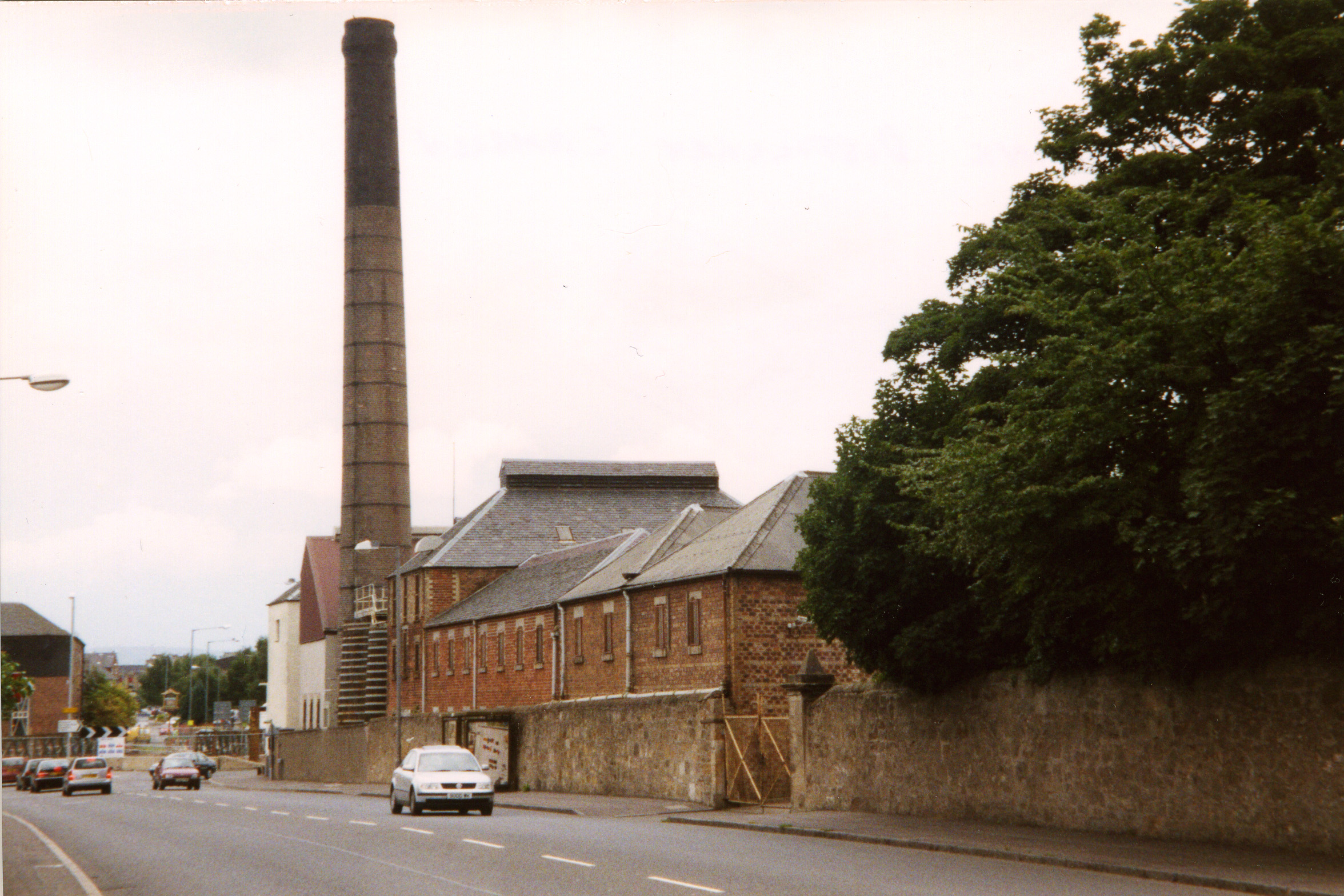
Rosebank distillery

Rosebank distillery is situated in Camelon on the banks of the Forth and Clyde canal between Edinburgh and Glasgow. Its name originated after the roses...

Nearby Amenities

Located within 500m of 56.003418,-3.813128
Mini Roundabout
Lat/Long: 56.0006339/-3.8105509
Mini Roundabout
Direction: clockwise
Lat/Long: 55.999589/-3.8148711
Traffic Signals
Lat/Long: 56.0047423/-3.8197483
Camelon
Name Gd: Camlann
Name Sco: Caimlan
Place: suburb
Population: 4508
Source: NPE
Wikidata: Q1028477
Wikipedia: en:Camelon
Lat/Long: 56.0038296/-3.8154094
Mini Roundabout
Direction: clockwise
Lat/Long: 56.0002245/-3.8154201
Lock 13
Waterway: lock_gate
Lat/Long: 56.0011893/-3.8069437
Lock 14
Waterway: lock_gate
Lat/Long: 56.000989/-3.8084849
Lock 14
Waterway: lock_gate
Lat/Long: 56.0009737/-3.8089183
Lock 15
Waterway: lock_gate
Lat/Long: 56.0008357/-3.8108377
Lock 16
Waterway: lock_gate
Lat/Long: 56.0004334/-3.8131771
Lock 16
Waterway: lock_gate
Lat/Long: 56.0003704/-3.8136079
Lock 10
Waterway: lock_gate
Lat/Long: 56.0000579/-3.8153996
Mini Roundabout
Direction: clockwise
Lat/Long: 56.000566/-3.8163188
Camelon
Public Transport: stop_position
Railway: stop
Train: yes
Lat/Long: 56.006182/-3.8176581
Dentist
Lux Dental
Lat/Long: 56.0028437/-3.8131714
Turning Circle
Lat/Long: 56.0028348/-3.8191236
Lock 15
Waterway: lock_gate
Lat/Long: 56.0008846/-3.8104579
Lock 13
Waterway: lock_gate
Lat/Long: 56.0012912/-3.8066406
Lock 10
Waterway: lock_gate
Lat/Long: 55.999967/-3.8158701
Crossing
Crossing Island: no
Crossing Markings: no
Crossing Signals: no
Lat/Long: 56.0059802/-3.8171559
Turning Circle
Lat/Long: 56.0059627/-3.81698
Restaurant
Copper Top
Addr City: Falkirk
Addr Housenumber: 2
Addr Postcode: FK1 4BN
Addr Street: Dorrator Road
Fhrs Id: 1135568
Website: https://www.thecoppertop.co.uk
Wheelchair: yes
Lat/Long: 56.0029904/-3.8086261
Shop: convenience
Lat/Long: 56.0029484/-3.8089534
Barrier: entrance
Foot: yes
Lat/Long: 56.0037521/-3.8151237
Barrier: entrance
Foot: yes
Lat/Long: 56.0037174/-3.8150625
Barrier: entrance
Foot: yes
Lat/Long: 56.0037442/-3.8152128
Bar
Lat/Long: 56.0039233/-3.8157397
Bicycle Parking
Bicycle Parking: stands
Capacity: 8
Check Date: 2024-01-02
Covered: no
Lat/Long: 56.0060742/-3.8174693
Barrier: lift_gate
Motorcycle: yes
Lat/Long: 56.0032903/-3.8150873
Access: no
Entrance: emergency
Foot: yes
Lat/Long: 56.0048842/-3.817805
Mini Roundabout
Lat/Long: 56.0055335/-3.8191942
Crossing
Crossing: traffic_signals
Crossing Ref: puffin
Lat/Long: 56.0037403/-3.814478
Crossing
Crossing: traffic_signals
Crossing Ref: puffin
Lat/Long: 56.0038647/-3.8145452
Crossing
Crossing: marked
Crossing Island: no
Tactile Paving: yes
Lat/Long: 56.0006794/-3.8101893
Barrier: entrance
Lat/Long: 56.0015706/-3.8077906
Crossing
Crossing: unmarked
Crossing Island: no
Kerb: lowered
Tactile Paving: yes
Lat/Long: 55.9998028/-3.8100726
Crossing
Crossing: unmarked
Crossing Island: yes
Kerb: lowered
Tactile Paving: yes
Lat/Long: 56.0004435/-3.8104497
Waste Basket
Source: survey
Lat/Long: 56.0063587/-3.8120641
Entrance: main
Lat/Long: 56.0037691/-3.8102322
Camelon
Public Transport: stop_position
Train: yes
Lat/Long: 56.0062824/-3.8189852
Barrier: swing_gate
Bicycle: yes
Foot: yes
Lat/Long: 56.0000378/-3.8163322
Bus Stop
Naptan AtcoCode: 66901320014
Naptan NaptanCode: 32524849
Shelter: no
Lat/Long: 55.9998283/-3.8139973
Bus Stop
Bench: yes
Bin: yes
Bus: yes
Naptan AtcoCode: 66901610022
Naptan NaptanCode: 32525646
Public Transport: platform
Shelter: yes
Tactile Paving: no
Lat/Long: 56.0045728/-3.8177995
Bus Stop
Bench: no
Bin: no
Bus: yes
Public Transport: platform
Shelter: no
Tactile Paving: no
Lat/Long: 56.0043373/-3.8172872
Bus Stop
Lat/Long: 56.0049372/-3.8159219
Bus Stop
Lat/Long: 56.0047914/-3.8157266
Bus Stop
Naptan AtcoCode: 66901600025
Naptan NaptanCode: 32525763
Shelter: yes
Lat/Long: 56.0038274/-3.8141275
Bus Stop
Sherriff Court
Bench: yes
Bus: yes
Departures Board: timetable
Naptan AtcoCode: 66901600012
Naptan NaptanCode: 32525686
Public Transport: platform
Shelter: yes
Lat/Long: 56.0038572/-3.8151717
Bus Stop
Sherriff Court
Bench: yes
Bus: yes
Departures Board: timetable
Naptan AtcoCode: 66901600024
Naptan NaptanCode: 32525736
Public Transport: platform
Shelter: yes
Lat/Long: 56.0038114/-3.8149899
Bus Stop
The Hedges
Bus: yes
Departures Board: timetable
Public Transport: platform
Shelter: yes
Lat/Long: 56.002965/-3.8116518
Bus Stop
The Hedges
Bus: yes
Departures Board: timetable
Naptan AtcoCode: 66901630004
Naptan NaptanCode: 32523634
Public Transport: platform
Shelter: yes
Lat/Long: 56.0028822/-3.8100921
Bus Stop
Dorrator Road
Bus: yes
Public Transport: platform
Lat/Long: 56.0025226/-3.8092244
Bench
Backrest: no
Lat/Long: 56.000688/-3.8122314
Bench
Backrest: no
Lat/Long: 56.0006691/-3.8123467
Bench
Backrest: no
Lat/Long: 56.0006596/-3.8123931
Bench
Backrest: no
Lat/Long: 56.0006473/-3.812476
Waste Basket
Lat/Long: 56.0006995/-3.812191
Bench
Backrest: no
Lat/Long: 56.0006813/-3.812283
The Falkirk Connection
Board Type: history
Check Date: 2023-01-11
Information: board
Operator: Scottish Canals
Tourism: information
Lat/Long: 56.0006813/-3.8123119
Fast Food
New Union Chippie
Addr City: Falkirk
Addr Housenumber: 86
Addr Place: Camelon
Addr Postcode: FK1 4PF
Addr Street: Union Road
Cuisine: ice_cream;fish_and_chips
Drive Through: no
Fhrs Id: 730941
Source: survey
Source Addr: fhrs opendata
Takeaway: yes
Lat/Long: 56.0003568/-3.8151091
Community Centre
Camelon Education Centre
Addr City: Camelon
Addr Housename: Camelon Education Centre
Addr Postcode: FK1 4HA
Addr Street: Abercrombie Street
Description: test
Digital Access: computer
Email: CLearning@falkirk.gov.uk
Internet Access: wlan
Opening Hours: Mo-Fr 09:30-16:30
Phone: +44 1324 501696
Website: https://www.falkirk.gov.uk/places/community-centres/camelon-local-learning-centre.aspx
Wheelchair: yes
Lat/Long: 56.0044824/-3.8122051
Noexit: yes
Lat/Long: 56.003675/-3.8185327
Camelon
Naptan AtcoCode: 9100CAMELON
Network: National Rail
Network Website: https://www.nationalrail.co.uk/stations/cmo/
Network Wikidata: Q26334
Operator: ScotRail
Operator Website: https://www.scotrail.co.uk/plan-your-journey/stations-and-facilities/cmo
Operator Wikidata: Q18356161
Railway: station
Ref Crs: CMO
Wheelchair: yes
Wikidata: Q2364853
Wikipedia: en:Camelon railway station
Lat/Long: 56.0062328/-3.8183922
Crossing
Button Operated: yes
Crossing: traffic_signals
Crossing Island: no
Kerb: lowered
Tactile Paving: yes
Traffic Signals Sound: yes
Traffic Signals Vibration: yes
Lat/Long: 56.0046113/-3.818684
Dentist
Camelon Dental Lab
Healthcare: dentist
Lat/Long: 56.0045119/-3.8192911
Fast Food
Pepe's
Addr Housenumber: 4a
Addr Postcode: FK1 4HJ
Addr Street: Glasgow Road
Brand: Pepe's
Brand Wikidata: Q120645662
Check Date: 2024-03-20
Cuisine: chicken
Drive Through: no
Opening Hours: Mo-Su 11:00-23:00
Outdoor Seating: no
Source: local knowledge
Takeaway: yes
Website: https://www.pepes.co.uk/pepes-piri-piri-stores/falkirk
Lat/Long: 56.004165/-3.8167809
Addr City: Camelon
Addr Housenumber: 316-318
Addr Postcode: FK1 4EG
Addr Street: Main Street
Check Date: 2020-08-21
Disused Amenity: pharmacy
Old Name: Lloyds Pharmacy
Lat/Long: 56.0033169/-3.8132633
Crossing
Crossing: traffic_signals
Crossing Ref: puffin
Lat/Long: 56.0032383/-3.8125547
Crossing
Crossing: traffic_signals
Crossing Ref: puffin
Lat/Long: 56.0033679/-3.812664
usave
Shop: convenience
Lat/Long: 56.003496/-3.8139537
Fast Food
Greggs
Brand: Greggs
Brand Wikidata: Q3403981
Brand Wikipedia: en:Greggs
Contact Website: https://www.greggs.co.uk/shop-finder?shop-code=2350
Cuisine: sandwich;bakery
Takeaway: yes
Lat/Long: 56.0034517/-3.8138023
Shop: newsagent
Lat/Long: 56.0032275/-3.8129184
Pharmacy
Dispensing: yes
Healthcare: pharmacy
Lat/Long: 56.0032396/-3.8129935
William Hill
Brand: William Hill
Brand Wikidata: Q4053147
Brand Wikipedia: en:William Hill (bookmaker)
Shop: bookmaker
Lat/Long: 56.0032085/-3.8128189
Betfred
Brand: Betfred
Brand Wikidata: Q4897425
Brand Wikipedia: en:Betfred
Shop: bookmaker
Lat/Long: 56.0031372/-3.8124602
Fast Food
Subway
Brand: Subway
Brand Wikidata: Q244457
Brand Wikipedia: en:Subway (restaurant)
Contact Website: https://restaurants.subway.com/united-kingdom/sc/camelon/254-main-street
Cuisine: sandwich
Takeaway: yes
Lat/Long: 56.0030605/-3.8121273
Spar
Brand: Spar
Brand Wikidata: Q610492
Brand Wikipedia: en:Spar (retailer)
Shop: supermarket
Website: https://www.spar.co.uk/store-locator/lan10927-spar-camelon/
Lat/Long: 56.00308/-3.8122386
Post Office
Camelon Post Office
Addr Country: GB
Addr Postcode: FK1 4DY
Brand: Post Office
Brand Wikidata: Q1783168
Contact Website: https://www.postoffice.co.uk/branch-finder/2108682/camelon
Ref Pol Id: 125237
Lat/Long: 56.003074/-3.8123017
Shop: hairdresser
Lat/Long: 56.003152/-3.8125377
Fast Food
Camelon Wok
Lat/Long: 56.002921/-3.8116432
Bus Stop
Bus: yes
Public Transport: platform
Lat/Long: 56.002612/-3.8070969
Crossing
Crossing: marked
Crossing Island: yes
Kerb: lowered
Tactile Paving: yes
Lat/Long: 55.9993207/-3.8153968
Traffic Calming: cushion
Lat/Long: 56.0066455/-3.8174593
Give Way
Direction: forward
Lat/Long: 56.0068469/-3.816672
Crossing
Crossing: uncontrolled
Crossing Island: yes
Kerb: lowered
Tactile Paving: yes
Lat/Long: 56.0067658/-3.8165072
Charging Station
Operator: ChargePlace Scotland
Operator Wikidata: Q105359316
Lat/Long: 56.0050305/-3.8169605
Crossing
Crossing: traffic_signals
Crossing Island: no
Lat/Long: 56.0048521/-3.8197046
Crossing
Crossing: traffic_signals
Crossing Island: yes
Lat/Long: 56.0047793/-3.820022
Mr Motivapor
Check Date: 2023-05-13
Shop: e-cigarette
Lat/Long: 56.0029569/-3.8089143
Door: sliding
Entrance: main
Wheelchair: yes
Lat/Long: 56.0051761/-3.8179406
Entrance: main
Lat/Long: 56.0027624/-3.8176253
Shop: convenience
Lat/Long: 56.0037192/-3.8192493
Scissor Creations
Addr Housenumber: 93
Addr Street: Hamilton Street
Shop: hairdresser
Lat/Long: 56.0037788/-3.8195855
Post Box
Collection Times: Mo-Fr 09:00; Sa 07:00
Operator: Royal Mail
Operator Wikidata: Q638098
Post Box Type: pillar
Lat/Long: 56.00362/-3.8194754
Entrance: main
Lat/Long: 56.0051832/-3.8204826
Entrance: exit
Lat/Long: 56.0051865/-3.8205241
Bicycle Parking
Access: customers
Bicycle Parking: stands
Capacity: 10
Covered: yes
Lat/Long: 56.0052472/-3.8203252
Bench: yes
Covered: no
Leisure: picnic_table
Lat/Long: 56.0050955/-3.8122447
Bench
Backrest: yes
Material: metal
Seats: 4
Lat/Long: 56.0062714/-3.8180754
Barrier: lift_gate
Locked: yes
Lat/Long: 56.0054393/-3.8175259
Waste Basket
Waste: trash
Lat/Long: 56.0062499/-3.8178965
USave
Brand: USave
Brand Wikidata: Q121435010
Shop: convenience
Lat/Long: 56.0008595/-3.8189678
Give Way
Direction: backward
Lat/Long: 55.9999207/-3.8152222
Give Way
Direction: forward
Lat/Long: 56.0032839/-3.8175132
Give Way
Direction: backward
Lat/Long: 56.0025803/-3.8208703
Give Way
Direction: forward
Lat/Long: 56.0037953/-3.8209302
Railway: signal
Railway Signal Direction: forward
Railway Signal Main: GB-NR:main
Railway Signal Main Form: light
Ref: ECL270
Lat/Long: 56.0062347/-3.809459
The data included in this document is from www.openstreetmap.org. The data is made available under ODbL.

Have you been to Camelon?

Leave your review of Camelon below (or comments, questions and feedback).