Balker Belt
Wood, Forest in Wigtownshire
Scotland
Balker Belt

The Balkers Belt, located in Wigtownshire, is a renowned wood and forest area in Scotland. Spanning approximately 200 hectares, it is a site of great natural beauty and ecological significance. The forest is predominantly composed of native tree species, including oak, birch, and beech, creating a diverse and enchanting landscape.
Balker Belt boasts a rich biodiversity, providing a habitat for numerous species of flora and fauna. The woodland floor is carpeted with vibrant wildflowers during the spring and summer months, attracting various pollinators. The forest also supports a thriving population of different bird species, such as woodpeckers, owls, and warblers, making it a paradise for birdwatchers.
The forest ecosystem plays a crucial role in maintaining the environmental balance of the region. It acts as a carbon sink, absorbing greenhouse gases and helping mitigate the impacts of climate change. Furthermore, the woodland provides a natural filtration system, improving water quality in the surrounding rivers and streams.
For outdoor enthusiasts, Balker Belt offers a range of recreational activities. Well-maintained walking trails and cycling routes wind through the forest, providing opportunities for visitors to immerse themselves in the tranquility of nature. The area is also popular for camping and picnicking, allowing families and friends to enjoy the great outdoors.
Balker Belt, with its breathtaking scenery and ecological significance, is not only a cherished natural gem in Wigtownshire but also a testament to Scotland's commitment to preserving its natural heritage.
If you have any feedback on the listing, please let us know in the comments section below.
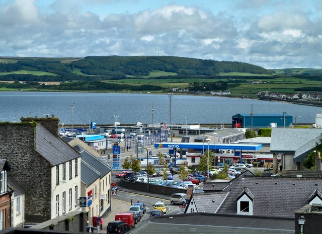
Balker Belt Images
Images are sourced within 2km of 54.933633/-4.9553283 or Grid Reference NX1063. Thanks to Geograph Open Source API. All images are credited.


Balker Belt is located at Grid Ref: NX1063 (Lat: 54.933633, Lng: -4.9553283)
Unitary Authority: Dumfries and Galloway
Police Authority: Dumfries and Galloway
What 3 Words
///hobby.dame.majoring. Near Cairnryan, Dumfries & Galloway
Nearby Locations
Related Wikis
Inch, Dumfries and Galloway
Inch is a civil parish in Dumfries and Galloway, southwest Scotland. It lies on the shore of Loch Ryan, in the traditional county of Wigtownshire.The...

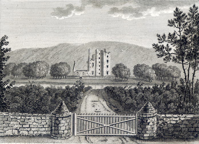
Castle Kennedy (castle)
Castle Kennedy is a ruined 17th-century tower house, about 3 miles (4.8 km) east of Stranraer, Dumfries and Galloway, Scotland, around 0.5 miles (0.80...

Aird, Dumfries and Galloway
Aird (Gaelic:An Àird) is a village in Dumfries and Galloway, in the southwest of Scotland. It is 2.5 miles (4.0 km) east of Stranraer and 1 mile (1.6 km...
Castle Kennedy
Castle Kennedy is a small village 3 miles (4.8 km) east of Stranraer in Dumfries and Galloway, south-west Scotland. It is on the A75 road, and is within...
RAF Castle Kennedy
Royal Air Force Castle Kennedy, or more simply RAF Castle Kennedy, is a former Royal Air Force satellite station located in Castle Kennedy, Dumfries and...

Castle Kennedy railway station
Castle Kennedy railway station served the village of Castle Kennedy, Dumfries and Galloway, Scotland from 1861 to 1965 on the Portpatrick and Wigtownshire...

Stair Park
Stair Park is a public park and football stadium in the town of Stranraer, Scotland and is the home of Stranraer F.C. It is owned by Dumfries and Galloway...

Soulseat Abbey
Saulseat or Soulseat Abbey was a Premonstratensian monastic community located in Wigtownshire, Galloway, in the Gaelic-speaking south-west of Scotland...
Have you been to Balker Belt?
Leave your review of Balker Belt below (or comments, questions and feedback).