Auchencrosh Wood

Wood, Forest in Ayrshire

Scotland

Auchencrosh Wood

Stubble field The harvest is done, and there are distant sounds of baling the straw. Just visible are some of the great flock of birds gleaning the remains of the crop.
Stubble field Credit: Jonathan Wilkins

Auchencrosh Wood is a beautiful forest located in Ayrshire, Scotland. Covering an area of approximately 300 hectares, it offers a diverse range of flora and fauna, making it a popular destination for nature enthusiasts and hikers.

The woodland is predominantly composed of native tree species, including oak, birch, and rowan. These trees provide a habitat for a variety of wildlife, such as red squirrels, roe deer, and a plethora of bird species, including woodpeckers and owls. The forest floor is adorned with a rich carpet of mosses, ferns, and wildflowers, adding to its natural charm.

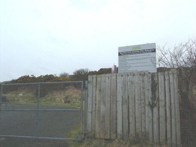
Several walking trails wind through the wood, offering visitors the opportunity to explore its beauty at their own pace. The paths are well-maintained and clearly marked, making it accessible to individuals of all fitness levels. Along the way, there are information boards that provide insights into the history and ecology of the area, enhancing the overall experience.

Auchencrosh Wood is also known for its archaeological significance. There are remnants of ancient settlements and burial sites that date back thousands of years, reflecting the long-standing human connection to the land. Archaeologists have uncovered artifacts and evidence of early human activity, shedding light on the area's past.

Overall, Auchencrosh Wood is a captivating destination that offers a tranquil escape from the hustle and bustle of everyday life. Its natural beauty, diverse wildlife, and historical significance make it a must-visit for anyone seeking to connect with nature and immerse themselves in Scotland's rich heritage.

If you have any feedback on the listing, please let us know in the comments section below.

Auchencrosh Wood Images

Images are sourced within 2km of 55.073673/-4.9822591 or Grid Reference NX0979. Thanks to Geograph Open Source API. All images are credited.

Stubble field The harvest is done, and there are distant sounds of baling the straw. Just visible are some of the great flock of birds gleaning the remains of the crop.
Stubble field
The harvest is done, and there are distant sounds of baling the straw. Just visible are some of the great flock of birds gleaning the remains of the crop.
Farming landscape A view over stubble to Meadow Park and Craigalbert farms.
Farming landscape
A view over stubble to Meadow Park and Craigalbert farms.
Turning the straw Turning barley straw and rowing-up for baling.
Turning the straw
Turning barley straw and rowing-up for baling.
Glenapp Castle Ballantrae Winter view of castle once home of the Inchcape family and now an award winning hotel owned by the Mc Millan family
Glenapp Castle Ballantrae
Winter view of castle once home of the Inchcape family and now an award winning hotel owned by the Mc Millan family
The mail must get through view of Glenapp Castle drive
The mail must get through
view of Glenapp Castle drive
Big Park Farm and sheep The sheep have found a sheltered spot from the harsh easterly wind.
Big Park Farm and sheep
The sheep have found a sheltered spot from the harsh easterly wind.
Former Ballantrae Coup For many years locals used the quarry as a dump until the Council became more involved now it is closed and a tiny skip is placed in the village about every 3 weeks.
Former Ballantrae Coup
For many years locals used the quarry as a dump until the Council became more involved now it is closed and a tiny skip is placed in the village about every 3 weeks.
What a waste! Gates at former village coup. Nearest one is now at Lendalfoot. The landfill site there takes several lorry loads from Northern Ireland each day.
What a waste!
Gates at former village coup. Nearest one is now at Lendalfoot. The landfill site there takes several lorry loads from Northern Ireland each day.
Reflections on Glenapp Pond Small pond, possibly a curling pond for the Castle. Sawmill Cottage roof in background. This ensures picture is right way up !
Reflections on Glenapp Pond
Small pond, possibly a curling pond for the Castle. Sawmill Cottage roof in background. This ensures picture is right way up !
Heronsford Trail Entrance to path through Glenapp woods to Heronsford.
Heronsford Trail
Entrance to path through Glenapp woods to Heronsford.
Glenapp Woods Start of Heronsford trail through the woods.
Glenapp Woods
Start of Heronsford trail through the woods.
Trail Sign Stinchar Valley Trail indicating path up through Glenapp wood.
Trail Sign
Stinchar Valley Trail indicating path up through Glenapp wood.
Foot Bridge Bridge over the Kilphin burn.
Foot Bridge
Bridge over the Kilphin burn.
Kilphin Burn Burn at start of path through woods on the Garleffin side.
Kilphin Burn
Burn at start of path through woods on the Garleffin side.
Glenapp Bridge Bridge up through the woods on the Heronsford trail.
Glenapp Bridge
Bridge up through the woods on the Heronsford trail.
Woodland Trail Muddy Heronsford path through woods.
Woodland Trail
Muddy Heronsford path through woods.
Heronsford Trail Bridge Metal framed bridge over the Smyrton burn in Glenapp wood.
Heronsford Trail Bridge
Metal framed bridge over the Smyrton burn in Glenapp wood.
Heronsford Trail Footbridge Very narrow bridge over the Smyrton burn.
Heronsford Trail Footbridge
Very narrow bridge over the Smyrton burn.
Show me another place!

Auchencrosh Wood is located at Grid Ref: NX0979 (Lat: 55.073673, Lng: -4.9822591)

Unitary Authority: South Ayrshire

Police Authority: Ayrshire

What 3 Words

///observe.rectangular.postcard. Near Cairnryan, Dumfries & Galloway

Related Wikis

Glenapp Castle

Glenapp Castle, formerly the family seat of the Earl of Inchcape, is now a luxury hotel and restaurant located about 1+1⁄2 miles (2.5 kilometres) southeast...

River Stinchar

The River Stinchar ( STIN-shər) is a river in South Ayrshire, Scotland. It flows south west from the Galloway Forest Park to enter the Firth of Clyde at...

Ballantrae

Ballantrae is a community in Carrick, South Ayrshire, Scotland. The name probably comes from the Scottish Gaelic Baile na Tràgha, meaning the "town by...

Ballantrae Windmill

The Ballantrae Windmill, on Mill Hill was a late 17th or early 18th century vaulted tower windmill, the ruins of which are located above the old raised...

Heronsford

Heronsford is a village located in South Ayrshire, South-West Scotland. == About == Heronsford is a hamlet located near Ballantrae that sits along the...

The Lagafater Estate

Lagafater is a 7000-acre (2832.8 ha) former sporting estate near New Luce in Dumfries and Galloway, Scotland. Since 1910 it has been in the family of its...

Arecleoch Wind Farm

Arecleoch Wind Farm is a 60 turbine wind farm in South Ayrshire, Scotland with a total capacity of 120 megawatts (MW), enough to power over 67,000 homes...

Bennane Head

Bennane Head is a tapering piece of land formed of hard rock projecting into the Firth of Clyde, Scotland, at the northern end of Ballantrae Bay, 17 kilometres...

Nearby Amenities

Located within 500m of 55.073673,-4.9822591
Design: delta
Power: tower
Lat/Long: 55.0702611/-4.978583
Power: portal
Lat/Long: 55.0698063/-4.9793869
Operator: Mutual Energy
Operator Website: https://www.mutual-energy.com/
Operator Wikidata: Q112882722
Phases: 1
Power: transformer
Transformer: converter
Voltage: 275000
Wikidata: Q5636206
Wikipedia: en:Moyle Interconnector
Lat/Long: 55.0692677/-4.9812368
Operator: Mutual Energy
Operator Website: https://www.mutual-energy.com/
Operator Wikidata: Q112882722
Phases: 1
Power: transformer
Transformer: converter
Voltage: 275000
Wikidata: Q5636206
Wikipedia: en:Moyle Interconnector
Lat/Long: 55.0693256/-4.9813111
Power: portal
Lat/Long: 55.0694414/-4.9808467
Operator: Mutual Energy
Operator Website: https://www.mutual-energy.com/
Operator Wikidata: Q112882722
Phases: 1
Power: transformer
Transformer: converter
Voltage: 275000
Wikidata: Q5636206
Wikipedia: en:Moyle Interconnector
Lat/Long: 55.069592/-4.9816522
Operator: Mutual Energy
Operator Website: https://www.mutual-energy.com/
Operator Wikidata: Q112882722
Phases: 1
Power: transformer
Transformer: converter
Voltage: 275000
Wikidata: Q5636206
Wikipedia: en:Moyle Interconnector
Lat/Long: 55.0696605/-4.98174
Operator: Mutual Energy
Operator Website: https://www.mutual-energy.com/
Operator Wikidata: Q112882722
Phases: 1
Power: transformer
Transformer: converter
Voltage: 275000
Wikidata: Q5636206
Wikipedia: en:Moyle Interconnector
Lat/Long: 55.0697269/-4.981825
Power: portal
Lat/Long: 55.0698723/-4.9815185
Smyrton
Place: locality
Lat/Long: 55.0766803/-4.9819395
Power: pole
Lat/Long: 55.0692948/-4.9830321
Power: pole
Lat/Long: 55.0741234/-4.9748847
Power: pole
Lat/Long: 55.0735269/-4.9757078
Power: pole
Lat/Long: 55.0728632/-4.9766227
Power: pole
Lat/Long: 55.0721092/-4.9776433
Power: pole
Lat/Long: 55.0715706/-4.9783723
Power: pole
Lat/Long: 55.0710535/-4.9794235
Power: pole
Lat/Long: 55.0770355/-4.9782641
Power: pole
Lat/Long: 55.0767232/-4.9793012
Power: pole
Lat/Long: 55.0745731/-4.975776
Power: pole
Lat/Long: 55.0717308/-4.9764416
Power: switch
Lat/Long: 55.0695444/-4.9799994
Power: switch
Lat/Long: 55.070085/-4.9810211
Power: switch
Lat/Long: 55.0694409/-4.9802415
Power: switch
Lat/Long: 55.0696992/-4.9796373
Power: switch
Lat/Long: 55.0696505/-4.9805121
Power: switch
Lat/Long: 55.0697704/-4.980695
Power: switch
Lat/Long: 55.0699344/-4.980887
Power: switch
Lat/Long: 55.0702886/-4.9805467
Power: switch
Lat/Long: 55.0699706/-4.9801201
Power: switch
Lat/Long: 55.0701341/-4.9803321
The data included in this document is from www.openstreetmap.org. The data is made available under ODbL.

Have you been to Auchencrosh Wood?

Leave your review of Auchencrosh Wood below (or comments, questions and feedback).