Cambusbarron

Settlement in Stirlingshire

Scotland

Cambusbarron

M9, northbound The M9 runs 32 from Edinburgh to Dunblane.
M9, northbound Credit: N Chadwick

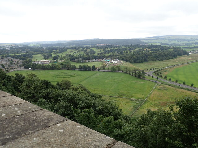
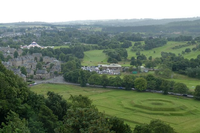
Cambusbarron is a charming village located in Stirlingshire, Scotland. Situated just three miles west of Stirling, it offers a peaceful and picturesque setting with stunning views of the surrounding countryside. The village is nestled at the foot of the Ochil Hills, providing residents and visitors with ample opportunities for outdoor activities and exploration.

One of the notable features of Cambusbarron is its rich history. Evidence of human settlement in the area dates back to prehistoric times, and the village itself has a long-standing history, with records dating as far back as the 12th century. The village was once a hub for mining and weaving industries, contributing to its growth and development over the years.

Today, Cambusbarron retains its small village charm and offers a range of amenities for its residents. These include a primary school, a community hall, a local pub, and a post office. There are also several recreational facilities, such as a park and a golf course, providing ample opportunities for leisure activities.

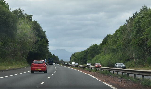
The village is well-connected to the surrounding areas, with frequent bus services and easy access to major road networks. This makes it an ideal location for those seeking a peaceful rural lifestyle while still being within reach of nearby towns and cities.

Overall, Cambusbarron is a quaint and historic village in Stirlingshire, offering a tranquil setting, stunning scenery, and a close-knit community.

If you have any feedback on the listing, please let us know in the comments section below.

Cambusbarron Images

Images are sourced within 2km of 56.109612/-3.968604 or Grid Reference NS7792. Thanks to Geograph Open Source API. All images are credited.

M9, northbound The M9 runs 32 from Edinburgh to Dunblane.
M9, northbound
The M9 runs 32 from Edinburgh to Dunblane.
M9, northbound The M9 runs 32 from Edinburgh to Dunblane.
M9, northbound
The M9 runs 32 from Edinburgh to Dunblane.
M9, northbound The M9 runs 32 from Edinburgh to Dunblane.
M9, northbound
The M9 runs 32 from Edinburgh to Dunblane.
M9, northbound The M9 runs 32 from Edinburgh to Dunblane.
M9, northbound
The M9 runs 32 from Edinburgh to Dunblane.
M9, northbound The M9 runs 32 from Edinburgh to Dunblane.
M9, northbound
The M9 runs 32 from Edinburgh to Dunblane.
M9, 1 mile from J10 The M9 runs 32 from Edinburgh to Dunblane.
M9, 1 mile from J10
The M9 runs 32 from Edinburgh to Dunblane.
M9, tourist information The M9 runs 32 from Edinburgh to Dunblane.
M9, tourist information
The M9 runs 32 from Edinburgh to Dunblane.
M9, northbound The M9 runs 32 from Edinburgh to Dunblane.
M9, northbound
The M9 runs 32 from Edinburgh to Dunblane.
Newhouse, Stirling
Newhouse, Stirling
The King's Knot The King’s Knot is on the grounds of the ancient King’s Park, Crown property from at least the 1100s, where Scotland’s royalty partook in jousting, hawking and hunting.
The King's Knot
The King’s Knot is on the grounds of the ancient King’s Park, Crown property from at least the 1100s, where Scotland’s royalty partook in jousting, hawking and hunting.
Church of the Holy Rood, St John Street The Church of the Holy Rude is the second oldest building in Stirling after the castle. Founded in 1129 during the reign of David I (1124 - 1153) as the parish church of Stirling. The infant King James VI was crowned here in 1567. For the history of the church, see <span class="nowrap"><a title="http://www.holyrude.org/styled-8/index.html" rel="nofollow ugc noopener" href="http://www.holyrude.org/styled-8/index.html">Link</a><img style="margin-left:2px;" alt="External link" title="External link - shift click to open in new window" src="https://s1.geograph.org.uk/img/external.png" width="10" height="10"/></span>
Church of the Holy Rood, St John Street
The Church of the Holy Rude is the second oldest building in Stirling after the castle. Founded in 1129 during the reign of David I (1124 - 1153) as the parish church of Stirling. The infant King James VI was crowned here in 1567. For the history of the church, see LinkExternal link
Cowane's Hospital The hospital was funded from a legacy from John Cowane, Dean of Guild and Member of Parliament for Stirling, as an almshouse for the support of twelve "decayed Gildbreithers" of the burgh. It is a rare survival of 17th century burgh architecture and one of the finest buildings of its kind in Scotland. Occupying a key site at the core of the old City of Stirling adjacent to the Church of the Holy Rude. A statue of the founder is in a niche above the entrance door.
Cowane's Hospital
The hospital was funded from a legacy from John Cowane, Dean of Guild and Member of Parliament for Stirling, as an almshouse for the support of twelve "decayed Gildbreithers" of the burgh. It is a rare survival of 17th century burgh architecture and one of the finest buildings of its kind in Scotland. Occupying a key site at the core of the old City of Stirling adjacent to the Church of the Holy Rude. A statue of the founder is in a niche above the entrance door.
St John Street, Stirling On the left is Stirling Boys' Club dated 1929 and further down the street on the right is the site of the Erskine Memorial
St John Street, Stirling
On the left is Stirling Boys' Club dated 1929 and further down the street on the right is the site of the Erskine Memorial
Stained glass windows, Church of the Holy Rude
Mar's Wark Former town house of the Earl of Mar, keeper of Stirling Castle. The now ruined Renaissance palace was built in 1567. The 6th Earl of Mar refitted the house for use as a barracks during the 1715 Jacobite Rising, which he led. The failed rising resulted in his exile and forfeiture of estates, including Mar’s Lodging. It was leased to the Town Council as a workhouse,
Mar's Wark
Former town house of the Earl of Mar, keeper of Stirling Castle. The now ruined Renaissance palace was built in 1567. The 6th Earl of Mar refitted the house for use as a barracks during the 1715 Jacobite Rising, which he led. The failed rising resulted in his exile and forfeiture of estates, including Mar’s Lodging. It was leased to the Town Council as a workhouse,
View from the bridge over the M9 At the foot of the hill in the distance is Cambusbarron, a disused mill building at centre and South Kersebonny Steading on the right.
View from the bridge over the M9
At the foot of the hill in the distance is Cambusbarron, a disused mill building at centre and South Kersebonny Steading on the right.
Stirling - Royal Gardens & King's Knot from the castle  Looking due south from an elevated lookout at the southern tip of the castle the houses on the left are on 'Royal Gardens' while the octagonal mound seen on the right is the 'King's Knot'
See <span class="nowrap"><a title="https://www.historicenvironment.scot/visit-a-place/places/kings-knot" rel="nofollow ugc noopener" href="https://www.historicenvironment.scot/visit-a-place/places/kings-knot">Link</a><img style="margin-left:2px;" alt="External link" title="External link - shift click to open in new window" src="https://s1.geograph.org.uk/img/external.png" width="10" height="10"/></span> for more information on this Royal Pleasure Ground.
Stirling - Royal Gardens & King's Knot from the castle
Looking due south from an elevated lookout at the southern tip of the castle the houses on the left are on 'Royal Gardens' while the octagonal mound seen on the right is the 'King's Knot' See LinkExternal link for more information on this Royal Pleasure Ground.
Stirling - Raploch and Dumbarton Roads from Castle Taken from the wall-walk on the western side of Stirling Castle looking over to where Dumbarton Road (coming in from the west) turns sharply and becomes Raploch Road which runs parallel with the base of the cliff on which the castle is perched.
Stirling - Raploch and Dumbarton Roads from Castle
Taken from the wall-walk on the western side of Stirling Castle looking over to where Dumbarton Road (coming in from the west) turns sharply and becomes Raploch Road which runs parallel with the base of the cliff on which the castle is perched.
Show me another place!

Cambusbarron is located at Grid Ref: NS7792 (Lat: 56.109612, Lng: -3.968604)

Unitary Authority: Stirling

Police Authority: Forth Valley

What 3 Words

///tell.zones.salad. Near Stirling

Nearby Locations

Cambusbarron

Related Wikis

Cambusbarron

Cambusbarron is a village in Stirling, Scotland. In the 2001 census, it had a population of 3,224. There is evidence of settlement at the site since the...

Birkhill House, Stirling

Birkhill House is a historic house situated between the city of Stirling and the village of Cambusbarron in central Scotland. == History == There is evidence...

Torbrex Village

Torbrex is a small village in Scotland. Geographically Torbrex is enclosed within Stirling by Cambusbarron to the west, St. Ninians to the south, Livlilands...

Gillies Hill

Gillies Hill is located west of Stirling and the M9, south of Cambusbarron, and north of the Bannock Burn in Central Scotland. Gillies Hill covers a 140...

Stirling High School

Stirling High School is a state high school for 11- to 18-year-olds run by Stirling Council in Stirling, Scotland. It is one of seven high schools in...

Stirling Smith Art Gallery and Museum

Stirling Smith Art Gallery and Museum, formerly The Smith Institute, is an art and local history museum in Stirling, Scotland. The museum was founded in...

Cowane's Hospital

Cowane's Hospital is a 17th-century almshouse in the Old Town of Stirling, Scotland. It was established in 1637 with a bequest of 40,000 merks from the...

Albert Halls, Stirling

The Albert Halls are a concert and conference venue on Dumbarton Road, in Stirling, Scotland. The building was designed by William Simpson in 1881 and...

Nearby Amenities

Located within 500m of 56.109612,-3.968604
Cambusbarron
Alt Name Gd: Camas a' Bharrain
Name Gd: Camas a' Bharain
Place: village
Population: 3224
Wikidata: Q5025686
Wikipedia: en:Cambusbarron
Lat/Long: 56.1092899/-3.9679557
Bus Stop
Bus: yes
Public Transport: platform
Lat/Long: 56.1087467/-3.9670014
Fair-Price
Shop: convenience
Lat/Long: 56.1091457/-3.9683197
Post Office
Cambusbarron Post Office
Addr Country: GB
Addr Postcode: FK7 9JT
Brand: Post Office
Brand Wikidata: Q1783168
Contact Website: https://www.postoffice.co.uk/branch-finder/1098683/cambusbarron
Ref Pol Id: 1575
Lat/Long: 56.1091115/-3.9673874
Bicycle Parking
Access: yes
Bicycle Parking: stands
Capacity: 8
Covered: no
Fee: no
Lat/Long: 56.1086359/-3.9656067
Post Box
Postal Code: FK7
Ref: FK7 137
Lat/Long: 56.1091403/-3.9687151
Post Box
Operator: Royal Mail
Postal Code: FK7
Ref: FK7 179D
Lat/Long: 56.1105551/-3.9676341
Post Box
Postal Code: FK7
Ref: FK7 178D
Lat/Long: 56.1078624/-3.9677742
Michael R. More
Shop: butcher
Lat/Long: 56.1090161/-3.9684824
Devine Hair Design
Female: yes
Male: yes
Shop: hairdresser
Lat/Long: 56.1090067/-3.9683853
G. Johns
Shop: newsagent
Lat/Long: 56.1089894/-3.9682675
Village Store
Shop: convenience
Lat/Long: 56.1091129/-3.967363
Pub
Foresters
Lat/Long: 56.1090378/-3.9688118
Barrier: bollard
Lat/Long: 56.1091366/-3.9686791
Bus Stop
Bus: yes
Naptan AtcoCode: 66004690071
Naptan NaptanCode: 78426239
Public Transport: platform
Lat/Long: 56.1083087/-3.9658052
Bus Stop
Bus: yes
Public Transport: platform
Lat/Long: 56.1095061/-3.969678
Bus Stop
Bus: yes
Naptan AtcoCode: 66004690067
Naptan NaptanCode: 78423783
Public Transport: platform
Lat/Long: 56.1078381/-3.9659255
Bus Stop
Bus: yes
Naptan AtcoCode: 66004690079
Naptan NaptanCode: 78423823
Public Transport: platform
Lat/Long: 56.1103941/-3.9631046
Bus Stop
Bus: yes
Naptan AtcoCode: 66004690076
Naptan NaptanCode: 78423829
Public Transport: platform
Lat/Long: 56.1107439/-3.9673232
Bus Stop
Bus: yes
Public Transport: platform
Lat/Long: 56.1108951/-3.9611876
Bus Stop
Bus: yes
Naptan AtcoCode: 66004690077
Naptan NaptanCode: 78423848
Public Transport: platform
Lat/Long: 56.1119133/-3.9646611
Bus Stop
Bus: yes
Naptan AtcoCode: 66004690068
Naptan NaptanCode: 78423784
Public Transport: platform
Lat/Long: 56.1078889/-3.9661209
Defibrillator
Access: yes
Check Date: 2024-04-13
Defibrillator Location: Available 24hr on the exterior of the building.
Description: Public access AED - iPad SP1
Emergency: defibrillator
Indoor: no
Operator: Cambusbarron Community Development Trust
Lat/Long: 56.1085861/-3.9656386
Generator Method: photovoltaic
Generator Output Electricity: yes
Generator Source: solar
Generator Type: solar_photovoltaic_panel
Location: roof
Power: generator
Lat/Long: 56.1114034/-3.9661476
Generator Method: photovoltaic
Generator Output Electricity: yes
Generator Source: solar
Generator Type: solar_photovoltaic_panel
Location: roof
Power: generator
Lat/Long: 56.1111058/-3.9667457
Generator Method: photovoltaic
Generator Output Electricity: yes
Generator Source: solar
Generator Type: solar_photovoltaic_panel
Location: roof
Power: generator
Lat/Long: 56.1109727/-3.9670408
Generator Method: photovoltaic
Generator Output Electricity: yes
Generator Source: solar
Generator Type: solar_photovoltaic_panel
Location: roof
Power: generator
Lat/Long: 56.1110385/-3.9668798
Generator Method: photovoltaic
Generator Output Electricity: yes
Generator Source: solar
Generator Type: solar_photovoltaic_panel
Location: roof
Power: generator
Lat/Long: 56.1106137/-3.9693233
Generator Method: photovoltaic
Generator Output Electricity: yes
Generator Source: solar
Generator Type: solar_photovoltaic_panel
Location: roof
Power: generator
Lat/Long: 56.1106078/-3.9692348
Generator Method: photovoltaic
Generator Output Electricity: yes
Generator Source: solar
Generator Type: solar_photovoltaic_panel
Location: roof
Power: generator
Lat/Long: 56.1105943/-3.9691329
Generator Method: photovoltaic
Generator Output Electricity: yes
Generator Source: solar
Generator Type: solar_photovoltaic_panel
Location: roof
Power: generator
Lat/Long: 56.1105838/-3.9690578
Generator Method: photovoltaic
Generator Output Electricity: yes
Generator Source: solar
Generator Type: solar_photovoltaic_panel
Location: roof
Power: generator
Lat/Long: 56.1107095/-3.968752
Generator Method: photovoltaic
Generator Output Electricity: yes
Generator Source: solar
Generator Type: solar_photovoltaic_panel
Location: roof
Power: generator
Lat/Long: 56.110696/-3.9686662
Generator Method: photovoltaic
Generator Output Electricity: yes
Generator Source: solar
Generator Type: solar_photovoltaic_panel
Location: roof
Power: generator
Lat/Long: 56.1104597/-3.968744
Generator Method: photovoltaic
Generator Output Electricity: yes
Generator Source: solar
Generator Type: solar_photovoltaic_panel
Location: roof
Power: generator
Lat/Long: 56.1104268/-3.9688271
Generator Method: photovoltaic
Generator Output Electricity: yes
Generator Source: solar
Generator Type: solar_photovoltaic_panel
Location: roof
Power: generator
Lat/Long: 56.1102967/-3.9691141
Generator Method: photovoltaic
Generator Output Electricity: yes
Generator Source: solar
Generator Type: solar_photovoltaic_panel
Location: roof
Power: generator
Lat/Long: 56.1102937/-3.9690471
Generator Method: photovoltaic
Generator Output Electricity: yes
Generator Source: solar
Generator Type: solar_photovoltaic_panel
Location: roof
Power: generator
Lat/Long: 56.1099497/-3.9688754
Generator Method: photovoltaic
Generator Output Electricity: yes
Generator Source: solar
Generator Type: solar_photovoltaic_panel
Location: roof
Power: generator
Lat/Long: 56.1099602/-3.9689505
Generator Method: photovoltaic
Generator Output Electricity: yes
Generator Source: solar
Generator Type: solar_photovoltaic_panel
Location: roof
Power: generator
Lat/Long: 56.1098899/-3.9689666
Generator Method: photovoltaic
Generator Output Electricity: yes
Generator Source: solar
Generator Type: solar_photovoltaic_panel
Location: roof
Power: generator
Lat/Long: 56.1098884/-3.9688915
Addr City: Cambusbarron
Addr Housenumber: 16
Addr Postcode: FK7 9RF
Addr Street: Paterson Way
Lat/Long: 56.1123062/-3.9699367
Addr City: Cambusbarron
Addr Housenumber: 15
Addr Postcode: FK7 9RF
Addr Street: Paterson Way
Lat/Long: 56.1122784/-3.9699898
Addr City: Cambusbarron
Addr Housenumber: 17
Addr Postcode: FK7 9RF
Addr Street: Paterson Way
Lat/Long: 56.1123337/-3.9698795
Power: pole
Lat/Long: 56.1126923/-3.9736848
Power: pole
Lat/Long: 56.1121045/-3.9741157
Power: pole
Lat/Long: 56.1114736/-3.9745759
Power: pole
Lat/Long: 56.1108018/-3.9750926
Power: pole
Lat/Long: 56.1102862/-3.9752913
Power: pole
Lat/Long: 56.1098255/-3.9754754
Generator Method: photovoltaic
Generator Output Electricity: yes
Generator Source: solar
Generator Type: solar_photovoltaic_panel
Power: generator
Lat/Long: 56.1087221/-3.9685448
Generator Method: photovoltaic
Generator Output Electricity: yes
Generator Source: solar
Generator Type: solar_photovoltaic_panel
Power: generator
Lat/Long: 56.1087267/-3.968494
Generator Method: photovoltaic
Generator Output Electricity: yes
Generator Source: solar
Generator Type: solar_photovoltaic_panel
Power: generator
Lat/Long: 56.1085096/-3.9685621
Generator Method: photovoltaic
Generator Output Electricity: yes
Generator Source: solar
Generator Type: solar_photovoltaic_panel
Power: generator
Lat/Long: 56.1084988/-3.9684889
Generator Method: photovoltaic
Generator Output Electricity: yes
Generator Source: solar
Generator Type: solar_photovoltaic_panel
Power: generator
Lat/Long: 56.1083817/-3.9690999
Crossing
Crossing: zebra
Crossing Island: no
Lat/Long: 56.1084891/-3.9662435
Generator Method: photovoltaic
Generator Output Electricity: yes
Generator Source: solar
Generator Type: solar_photovoltaic_panel
Power: generator
Lat/Long: 56.1088558/-3.9741237
Noexit: yes
Lat/Long: 56.1095103/-3.9667359
Noexit: yes
Lat/Long: 56.1095362/-3.9669965
Bench
Backrest: yes
Lat/Long: 56.1083419/-3.9640568
Waste Basket
Lat/Long: 56.1086438/-3.9643457
Playground: basketswing
Lat/Long: 56.1084756/-3.9644114
Playground: climbingframe
Lat/Long: 56.108225/-3.9644404
Playground: swing
Lat/Long: 56.1083605/-3.9642325
Waste Basket
Lat/Long: 56.1088526/-3.9649264
Playground: structure
Lat/Long: 56.108244/-3.9639486
Bench
Backrest: yes
Lat/Long: 56.1086824/-3.9639064
Bench
Backrest: yes
Lat/Long: 56.1087512/-3.9646807
Playground: structure
Lat/Long: 56.1085213/-3.9638049
Bench
Backrest: yes
Lat/Long: 56.1086384/-3.9636829
Bench
Backrest: yes
Lat/Long: 56.1086463/-3.9644277
Bench
Backrest: yes
Lat/Long: 56.1086517/-3.9639717
Playground: seesaw
Lat/Long: 56.1085936/-3.9641125
Playground: roundabout
Lat/Long: 56.1084586/-3.9641625
Playground: trampoline
Lat/Long: 56.1086159/-3.9638605
Bench
Backrest: yes
Lat/Long: 56.1088352/-3.9649811
Playground: structure
Lat/Long: 56.1084175/-3.9640051
Waste Basket
Lat/Long: 56.1082494/-3.9652444
The data included in this document is from www.openstreetmap.org. The data is made available under ODbL.

Have you been to Cambusbarron?

Leave your review of Cambusbarron below (or comments, questions and feedback).