Blair Plantation

Wood, Forest in Wigtownshire

Scotland

Blair Plantation

Barn at East Galdenoch On the B7077 Portpatrick to Glenluce road
Barn at East Galdenoch Credit: Oliver Dixon

Blair Plantation, located in Wigtownshire, is a sprawling woodland area that covers a vast expanse of approximately 200 acres. Situated in the southwest of Scotland, this picturesque plantation is a haven for nature enthusiasts and those seeking tranquility amidst the beauty of nature.

The plantation is primarily composed of dense forests, boasting a diverse range of tree species including oak, beech, and pine. These towering trees provide shelter to a wide array of wildlife, making Blair Plantation a hotspot for birdwatchers and animal lovers. Visitors can spot various species of birds, such as woodpeckers, owls, and thrushes, as well as mammals like deer, rabbits, and squirrels.

The woodland is crisscrossed with well-maintained walking trails, allowing visitors to explore the plantation at their own pace. These trails wind through the forest, offering breathtaking views of the surrounding countryside and the nearby coastline. The plantation also features picnic areas and benches for visitors to relax and immerse themselves in the tranquil ambiance.

Blair Plantation is not only a natural haven but also a historical site. The area has a rich cultural heritage, dating back centuries. Ruins of an ancient castle can be found within the plantation, serving as a reminder of the area's intriguing past.

Overall, Blair Plantation in Wigtownshire is a captivating destination that combines natural beauty, wildlife, and historical significance. It offers a unique opportunity for visitors to connect with nature, explore the woodland trails, and experience the rich heritage of the area.

If you have any feedback on the listing, please let us know in the comments section below.

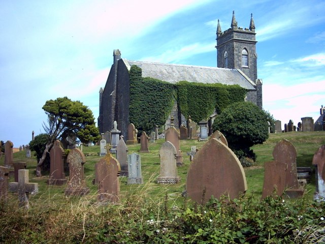
Blair Plantation Images

Images are sourced within 2km of 54.85259/-4.9830373 or Grid Reference NX0854. Thanks to Geograph Open Source API. All images are credited.

Barn at East Galdenoch On the B7077 Portpatrick to Glenluce road
Barn at East Galdenoch
On the B7077 Portpatrick to Glenluce road
Cottage near East Galdenoch Situated on the lowlands between the head of Loch Ryan and the head of Luce Bay.
Cottage near East Galdenoch
Situated on the lowlands between the head of Loch Ryan and the head of Luce Bay.
High Mye Fields, West Freugh View across muddy cattle fields of High Mye farm on a March evening. Taken from north side of the access road into MOD West Freugh Airfield and just outside the perimeter fence; an area which is forbidden to photograph.
High Mye Fields, West Freugh
View across muddy cattle fields of High Mye farm on a March evening. Taken from north side of the access road into MOD West Freugh Airfield and just outside the perimeter fence; an area which is forbidden to photograph.
East Galdenoch View along the B7077 taken from the entrance to the farm.
East Galdenoch
View along the B7077 taken from the entrance to the farm.
Fields of Corn at Low Mye Late harvest corn on both sides of this road.
Fields of Corn at Low Mye
Late harvest corn on both sides of this road.
Bungalow at West Galdenoch On the B7077 Portpatrick to Glenluce road
Bungalow at West Galdenoch
On the B7077 Portpatrick to Glenluce road
Tractor crossing the bridge over the Piltanton Burn
Bullocks to you! Near Stoneykirk. Craigencrosh Farm on the low hill to the right in the distance.
Bullocks to you!
Near Stoneykirk. Craigencrosh Farm on the low hill to the right in the distance.
Bullocks and oilseed rape At High Mye, near Stoneykirk. The alien yellow of the oil seed rape is an unattractive intrusion into the green landscape of the Rhins of Galloway. Craigencrosh Farm on the hill in the distance to the right.
Bullocks and oilseed rape
At High Mye, near Stoneykirk. The alien yellow of the oil seed rape is an unattractive intrusion into the green landscape of the Rhins of Galloway. Craigencrosh Farm on the hill in the distance to the right.
Potato bedforming at Mosscroft Potatoes are an important crop in the Rhins of Galloway. This shot shows the modern technique of Bedforming. Rather than traditional single rows, the potatoes come up in groups of two, three or even four rows in each of these beds.
The harvester machine will lift all of them together in the Autumn. (information supplied by 4wd)
Potato bedforming at Mosscroft
Potatoes are an important crop in the Rhins of Galloway. This shot shows the modern technique of Bedforming. Rather than traditional single rows, the potatoes come up in groups of two, three or even four rows in each of these beds. The harvester machine will lift all of them together in the Autumn. (information supplied by 4wd)
Barnultoch, near Lochans
Stoneykirk Stoneykirk Parish Church, now closed, was rebuilt in 1827 at a cost of £2000.  In the distance can be seen the 'golf balls' of the MOD/Qinetiq satellite ground station at West Freugh.
Stoneykirk
Stoneykirk Parish Church, now closed, was rebuilt in 1827 at a cost of £2000. In the distance can be seen the 'golf balls' of the MOD/Qinetiq satellite ground station at West Freugh.
Stoneykirk Parish Church
Grey Hill, Stoneykirk. The field of barley has just been harvested.  The round objects in the distance are on the Qinetiq/MOD satellite ground station.  Other buildings on the former airfield are to the left of them.
Grey Hill, Stoneykirk.
The field of barley has just been harvested. The round objects in the distance are on the Qinetiq/MOD satellite ground station. Other buildings on the former airfield are to the left of them.
Cottage near Barnultoch
The road to Culgrange
Building site near High Mye
High Mye
High Mye
Show me another place!

Blair Plantation is located at Grid Ref: NX0854 (Lat: 54.85259, Lng: -4.9830373)

Unitary Authority: Dumfries and Galloway

Police Authority: Dumfries and Galloway

What 3 Words

///escalated.vines.daisy. Near Stranraer, Dumfries & Galloway

Nearby Locations

Blair Plantation

Related Wikis

Garthland Castle

Garthland Castle was a castle that was located near Garthland Mains, Dumfries and Galloway, Scotland.The castle was possibly built in 1211, as a datestone...

Stoneykirk

Stoneykirk (Scottish Gaelic: Eaglais Steafain) is an area and a village in the heart of the Rhins of Galloway, Wigtownshire, in the administrative council...

RAF West Freugh

RAF West Freugh is a former Royal Air Force station located in Wigtownshire, 5 miles (8 km) south east of Stranraer, Dumfries and Galloway, Scotland. It...

Lochans, Dumfries and Galloway

Lochans is a small village around 2.5 miles (4.0 km) south of Stranraer, in Dumfries and Galloway in south-west Scotland. In 1971 it had a population of...

Nearby Amenities

Located within 500m of 54.85259,-4.9830373
Power: pole
Lat/Long: 54.8534986/-4.9756452
Power: pole
Lat/Long: 54.852847/-4.9754924
Power: pole
Lat/Long: 54.8497818/-4.9881237
Power: pole
Lat/Long: 54.8501345/-4.9871165
Power: pole
Lat/Long: 54.8503494/-4.9853441
Power: pole
Lat/Long: 54.8504319/-4.9846891
Power: pole
Lat/Long: 54.8505251/-4.9840341
Power: pole
Lat/Long: 54.8508225/-4.9899971
Power: pole
Lat/Long: 54.8515753/-4.9904478
Power: pole
Lat/Long: 54.8522997/-4.9905675
Power: pole
Lat/Long: 54.8530322/-4.9907037
The data included in this document is from www.openstreetmap.org. The data is made available under ODbL.

Have you been to Blair Plantation?

Leave your review of Blair Plantation below (or comments, questions and feedback).