Coille a' Chàirn

Wood, Forest in Cromartyshire

Scotland

Coille a' Chàirn

Outfall from Loch Bad na h-Achlaise Where Loch Bad na h-Achlaise flows into Loch Bad'Ghaill. For some reason sheep and deer don't get down here which makes for tough ankle grabbing walking through tall heather, grass and bracken, no paths to follow. You can cross the outfall in low water but it is very very slippery. Salmon will run through to here.
Outfall from Loch Bad na h-Achlaise Credit: Michael Dorr

Coille a' Chàirn, located in Cromartyshire, is a charming and picturesque woodland area in the Scottish Highlands. The name Coille a' Chàirn translates to "Wood of the Cairn" in English, reflecting the rich history and natural beauty of the region.

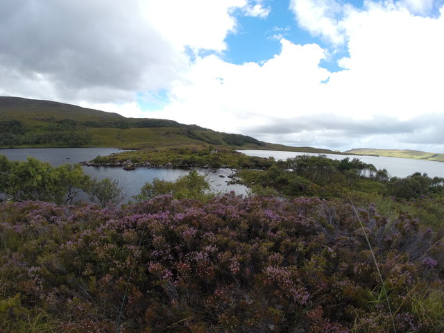
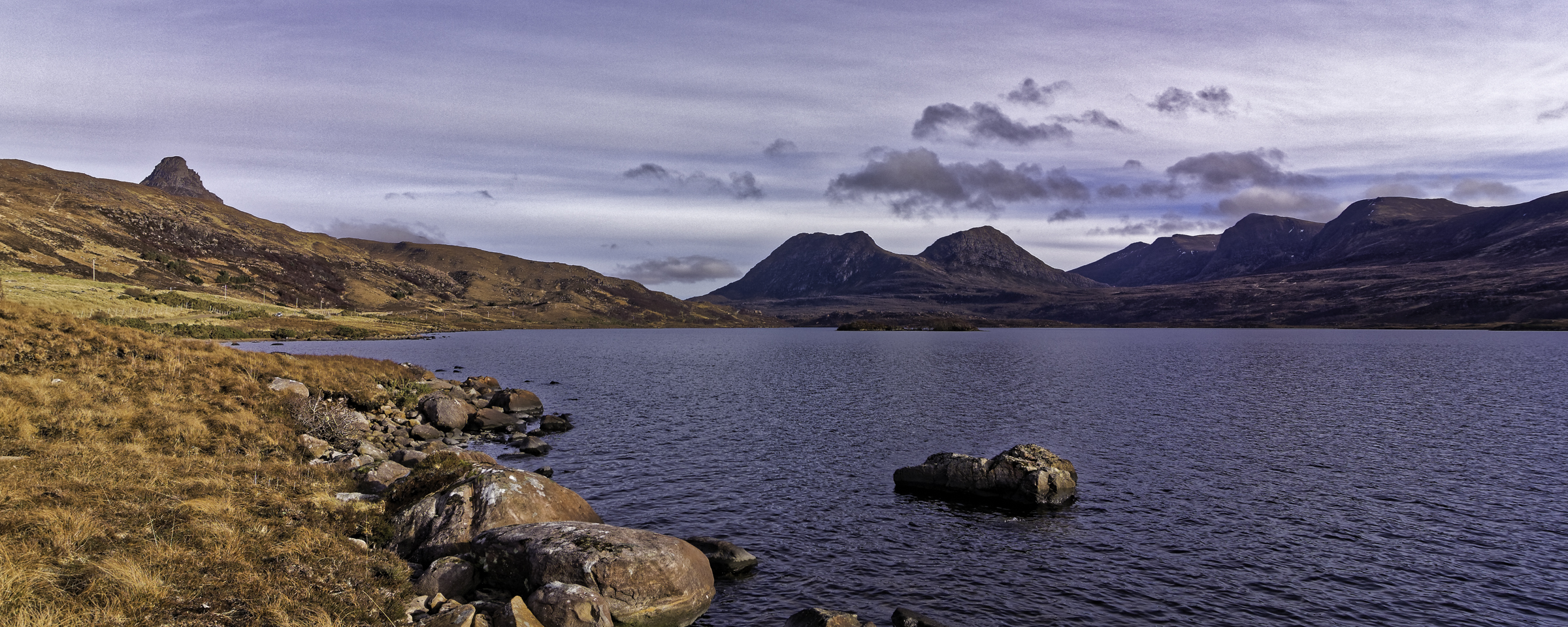
Stretching over an expansive area of approximately 100 hectares, Coille a' Chàirn is home to a diverse range of flora and fauna. The woodland is predominantly populated by native Scottish tree species, including oak, birch, and pine, which create a stunning tapestry of colors throughout the seasons.

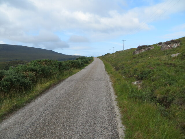
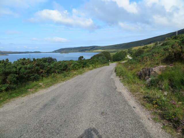
The forest is intersected by a network of well-maintained trails, allowing visitors to explore its wonders on foot or by bicycle. These paths wind through moss-covered glens, alongside babbling brooks, and up gentle inclines, offering breathtaking views of the surrounding countryside.

Coille a' Chàirn is not only a sanctuary for wildlife but also a place of historical significance. In the heart of the forest lies an ancient cairn, a prehistoric burial mound, which has been carefully preserved and protected. This archaeological site provides a glimpse into the lives and rituals of bygone civilizations, adding an air of mystery and intrigue to the woodland.

Visitors to Coille a' Chàirn can also enjoy a range of outdoor activities, such as birdwatching, nature photography, and picnicking. The serene atmosphere and tranquil surroundings make it an ideal destination for those seeking solace and a connection with nature.

Overall, Coille a' Chàirn in Cromartyshire is a captivating woodland retreat that offers a harmonious blend of natural beauty, wildlife, and historical significance. Whether exploring its trails or simply enjoying the serenity, visitors are sure to be enchanted by this hidden gem in the Scottish Highlands.

If you have any feedback on the listing, please let us know in the comments section below.

Coille a' Chàirn Images

Images are sourced within 2km of 58.04465/-5.247833 or Grid Reference NC0810. Thanks to Geograph Open Source API. All images are credited.

Outfall from Loch Bad na h-Achlaise Where Loch Bad na h-Achlaise flows into Loch Bad'Ghaill. For some reason sheep and deer don't get down here which makes for tough ankle grabbing walking through tall heather, grass and bracken, no paths to follow. You can cross the outfall in low water but it is very very slippery. Salmon will run through to here.
Outfall from Loch Bad na h-Achlaise
Where Loch Bad na h-Achlaise flows into Loch Bad'Ghaill. For some reason sheep and deer don't get down here which makes for tough ankle grabbing walking through tall heather, grass and bracken, no paths to follow. You can cross the outfall in low water but it is very very slippery. Salmon will run through to here.
Loch Bad a' Ghaill
Loch Bad a' Ghaill
Allt Bad a' Bhuin Bhig As it enters Loch Bad a' Ghaill
Allt Bad a' Bhuin Bhig
As it enters Loch Bad a' Ghaill
Loch Bad a' Ghaill Cul Beag, Sgorr Tuath and Sgor Deas in the background. Boat is on decent sized sand spit deposited by Allt Bad a' Bhuin Bhig as it enters the loch.
Loch Bad a' Ghaill
Cul Beag, Sgorr Tuath and Sgor Deas in the background. Boat is on decent sized sand spit deposited by Allt Bad a' Bhuin Bhig as it enters the loch.
A section of minor road between Loch Lurgainn and Loch Bad a' Ghaill Looking westward.
A section of minor road between Loch Lurgainn and Loch Bad a' Ghaill
Looking westward.
Minor road beside Loch Bad a' Ghaill Looking north-westward.
Minor road beside Loch Bad a' Ghaill
Looking north-westward.
Loch Bad a' Ghaill, Wester Ross View from the east end of the loch, facing west.
Loch Bad a' Ghaill, Wester Ross
View from the east end of the loch, facing west.
Eastern end of Loch Badaghaill, Cul Beag in background
Outfall from Loch Bad na h-Achlaise into Loch Badaghaill Sgurr an Fhidhleir and Ben More Coigach in the background
Outfall from Loch Bad na h-Achlaise into Loch Badaghaill
Sgurr an Fhidhleir and Ben More Coigach in the background
Minor road towards Achiltibuie
Moorland by Loch Lurgainn A fair bit of rough ground between the road and lochs.
Moorland by Loch Lurgainn
A fair bit of rough ground between the road and lochs.
Loch Lurgainn and hills View over the loch towards Ben More and Beinn an Eòin (left).
Loch Lurgainn and hills
View over the loch towards Ben More and Beinn an Eòin (left).
Achiltibuie road View eastwards towards Cùl Beag
Achiltibuie road
View eastwards towards Cùl Beag
Achiltibuie road Above Loch Bad a' Ghaill
Achiltibuie road
Above Loch Bad a' Ghaill
Loch Bad a'Ghaill One of the big Coigach lochs
Loch Bad a'Ghaill
One of the big Coigach lochs
Loch Bad a Ghaill
Loch Bad a Ghaill
A lonesome birch on a Loch Bad a' Ghaill promontory
Show me another place!

Coille a' Chàirn is located at Grid Ref: NC0810 (Lat: 58.04465, Lng: -5.247833)

Unitary Authority: Highland

Police Authority: Highlands and Islands

What 3 Words

///graphics.continues.corner. Near Ullapool, Highland

Nearby Locations

Coille a' Chàirn

Related Wikis

Loch Bad a' Ghaill

Loch Bad a' Ghaill is a small remote and deep freshwater loch that is located 10 miles north of Ullapool and immediately north west of Loch Lurgainn. It...
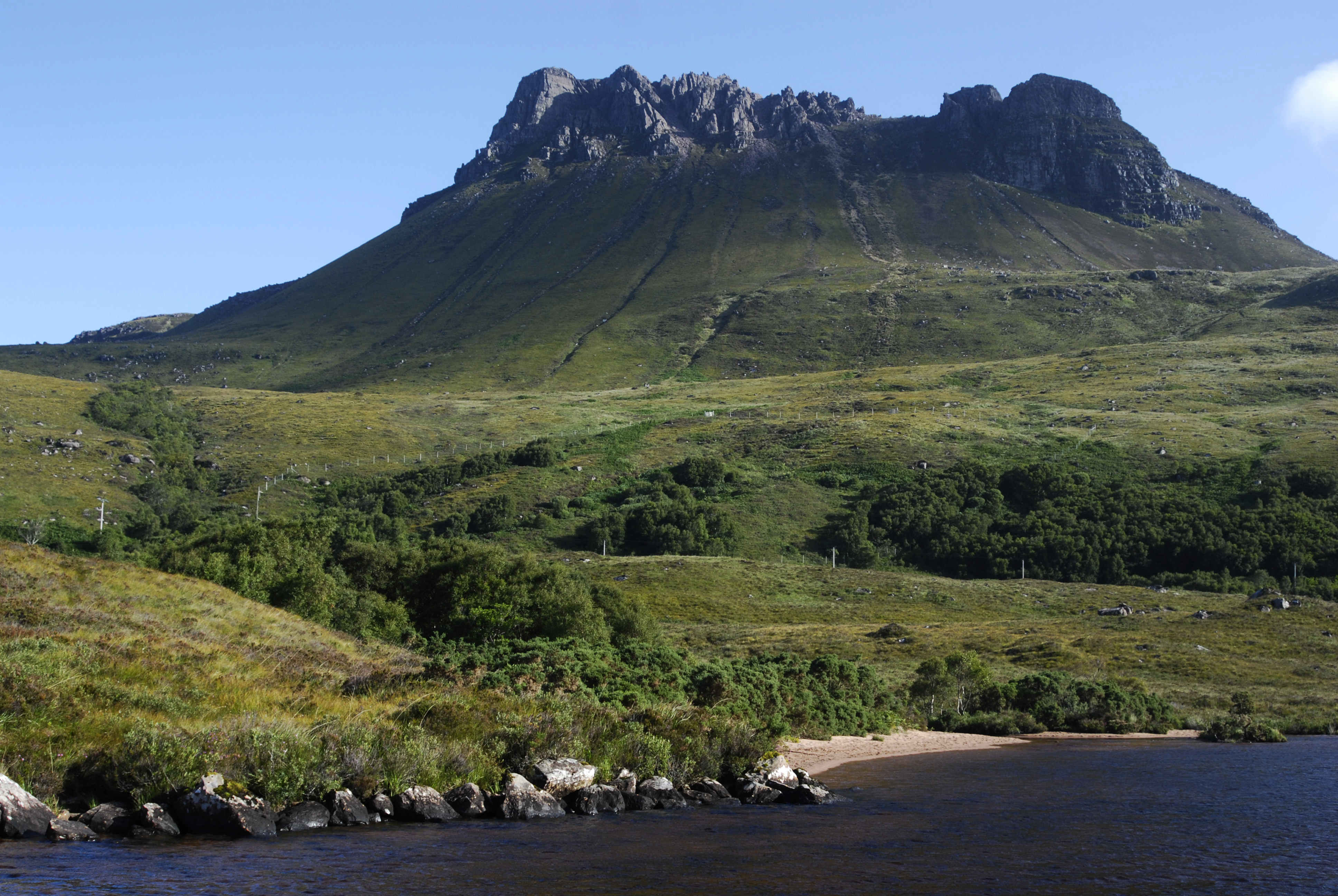
Stac Pollaidh

Stac Pollaidh (Scottish Gaelic pronunciation: [ˈs̪t̪ʰaʰkˈpʰɔɫ̪ai]) is a mountain in the Northwest Highlands of Scotland. The peak displays a rocky crest...

Inverpolly

Inverpolly is the name given to a large area of northern Wester Ross in the Northwest Highlands of Scotland, north of Ullapool. The area contains several...
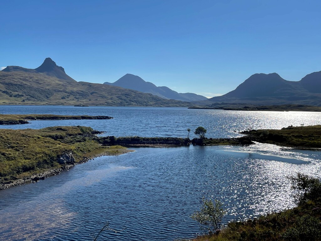
Loch Osgaig

Loch Osgaig (Loch Owskeich) is a small remote and deep freshwater loch, orientated on north-west to south-east axis, that is located 1 miles south of Enard...

Nearby Amenities

Located within 500m of 58.04465,-5.247833
Power: pole
Lat/Long: 58.0451079/-5.2551436
Power: pole
Lat/Long: 58.0448477/-5.2539437
Power: pole
Lat/Long: 58.0445963/-5.2528313
Power: pole
Lat/Long: 58.0442942/-5.2520188
Power: pole
Lat/Long: 58.0439635/-5.2511522
Power: pole
Lat/Long: 58.0436349/-5.2502856
Power: pole
Lat/Long: 58.0433085/-5.2494607
Power: pole
Lat/Long: 58.04298/-5.2485858
Power: pole
Lat/Long: 58.0425279/-5.2479192
Power: pole
Lat/Long: 58.0420979/-5.2472942
Power: pole
Lat/Long: 58.0416546/-5.2466484
Power: pole
Lat/Long: 58.0412114/-5.2459943
Power: pole
Lat/Long: 58.0407527/-5.2453777
Power: pole
Lat/Long: 58.0404087/-5.2450153
The data included in this document is from www.openstreetmap.org. The data is made available under ODbL.

Have you been to Coille a' Chàirn?

Leave your review of Coille a' Chàirn below (or comments, questions and feedback).