Church Walk Wood

Wood, Forest in Wigtownshire

Scotland

Church Walk Wood

Portpatrick From the coast path to the north west, the start of the Southern Upland Way to Cockburnspath on the east coast.
Portpatrick Credit: Andy Stephenson

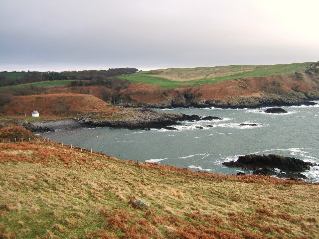
Church Walk Wood is a picturesque woodland located in Wigtownshire, Scotland. Covering an area of approximately 10 acres, this enchanting forest is renowned for its natural beauty and tranquil atmosphere, making it a popular destination for nature lovers and outdoor enthusiasts.

The wood is characterized by a diverse range of trees, including oak, beech, and birch, which create a stunning canopy overhead. The floor of the woodland is covered in a thick carpet of moss and ferns, adding to the magical ambiance of the place.

Church Walk Wood is crisscrossed by a network of well-maintained footpaths, making it easily accessible for visitors of all ages and abilities. These paths lead visitors through the heart of the woodland, allowing them to fully immerse themselves in the natural splendor and discover hidden treasures along the way.

One of the highlights of Church Walk Wood is the presence of a charming old church ruin, which adds a touch of history and intrigue to the surroundings. The ruins, covered in ivy and surrounded by ancient gravestones, provide a fascinating glimpse into the past and serve as a reminder of the area's rich heritage.

The wood is home to a variety of wildlife, including squirrels, deer, and a wide array of bird species. Birdwatchers will delight in the opportunity to spot woodpeckers, owls, and other feathered inhabitants.

Whether strolling along the paths, picnicking under the shade of the trees, or simply taking in the serenity of the surroundings, Church Walk Wood offers a truly idyllic escape from the hustle and bustle of everyday life.

If you have any feedback on the listing, please let us know in the comments section below.

Church Walk Wood Images

Images are sourced within 2km of 54.849505/-5.1077412 or Grid Reference NX0054. Thanks to Geograph Open Source API. All images are credited.
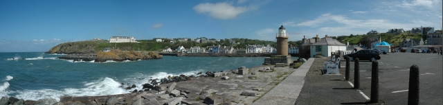
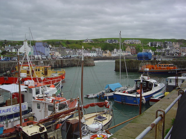
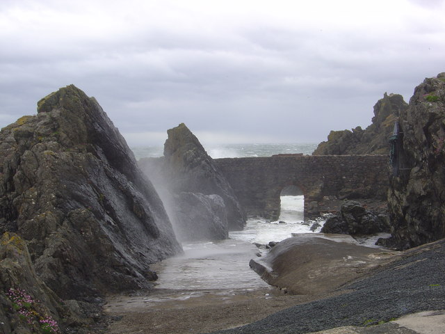
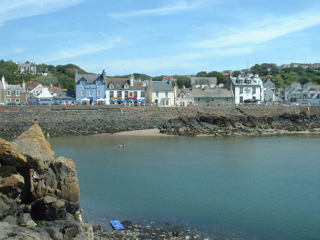
Portpatrick From the coast path to the north west, the start of the Southern Upland Way to Cockburnspath on the east coast.
Portpatrick
From the coast path to the north west, the start of the Southern Upland Way to Cockburnspath on the east coast.
Dunskey Glen, near Portpatrick
A tribute to the Lifeboatmen of Portpatrick This is in memory of the Lifeboatmen of Portpatrick who, in January 1953, risked their lives to save the passengers and crew of the BR/S Princess Victoria during The Great Storm.
A tribute to the Lifeboatmen of Portpatrick
This is in memory of the Lifeboatmen of Portpatrick who, in January 1953, risked their lives to save the passengers and crew of the BR/S Princess Victoria during The Great Storm.
Car park at south end of Portpatrick Harbour Car park at south end of Portpatrick Harbour.
Car park at south end of Portpatrick Harbour
Car park at south end of Portpatrick Harbour.
Portpatrick This is a panoramic view on Portpatrick. Four pictures were used for this view and were stitched together using Panavue.
Portpatrick
This is a panoramic view on Portpatrick. Four pictures were used for this view and were stitched together using Panavue.
Port Kale and Port Mora Bays from Catebraid near Portpatrick Port Kale (foreground) and Port Mora (known locally as Sandeel Bay) Bays near Portpatrick. This location covers three ordnance survey squares but I have chosen the furthest away for the location.
Port Kale and Port Mora Bays from Catebraid near Portpatrick
Port Kale (foreground) and Port Mora (known locally as Sandeel Bay) Bays near Portpatrick. This location covers three ordnance survey squares but I have chosen the furthest away for the location.
A waterfall over caves at the end of Sandeel Bay (Port Mora Bay) near Portpatrick.
Port Patrick Hotel Taken from the old Harbour in Portpatrick up towards the hotel
Port Patrick Hotel
Taken from the old Harbour in Portpatrick up towards the hotel
Portpatrick Harbour My yacht 'Makushla' is the large yacht moored against the wall with the smaller one rafted against it.
Portpatrick Harbour
My yacht 'Makushla' is the large yacht moored against the wall with the smaller one rafted against it.
Portpatrick Waterfront Hotel
Portpatrick Harbour
Portpatrick Harbour
View from Portpatrick
Port Mora
Port Mora
The Portpatrick Hotel The hotel in the picture dominates the village of Portpatrick, and is The Portpatrick Hotel. It is late Victorian and is now owned by the Wallace Arnold Shearings Group.
The Portpatrick Hotel
The hotel in the picture dominates the village of Portpatrick, and is The Portpatrick Hotel. It is late Victorian and is now owned by the Wallace Arnold Shearings Group.
Portpatrick waterfront
The south side of Portpatrick Harbour
The Inner Harbour breakwater The breakwater connects the mainland [visible right] with a natural rock islet in the harbour, creating a totally sheltered 'arm' of the harbour.
The Inner Harbour breakwater
The breakwater connects the mainland [visible right] with a natural rock islet in the harbour, creating a totally sheltered 'arm' of the harbour.
Portpatrick waterfront, looking north And there's that hotel again, overlooking everything.....
Portpatrick waterfront, looking north
And there's that hotel again, overlooking everything.....
Show me another place!

Church Walk Wood is located at Grid Ref: NX0054 (Lat: 54.849505, Lng: -5.1077412)

Unitary Authority: Dumfries and Galloway

Police Authority: Dumfries and Galloway

What 3 Words

///cleanest.ends.exonerate. Near Stranraer, Dumfries & Galloway

Related Wikis

Portpatrick railway station

Portpatrick railway station was a railway station serving the village of Portpatrick, Dumfries & Galloway, Scotland. Opened in 1862 the station served...
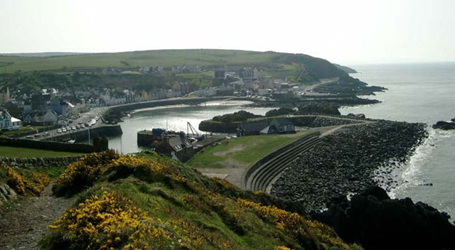
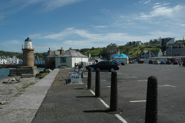
Portpatrick

Portpatrick is a village and civil parish in the historical county of Wigtownshire, Dumfries and Galloway, Scotland. It is located on the west coast of...

Dunskey

Dunskey Estate (also known as Portree Estate) is north of Portpatrick on the west coast of Scotland. The B-listed mansion dates from the start of the twentieth...

Dunskey Castle

Dunskey Castle is a ruined, 12th-century tower house or castle, located 0.5 miles (0.80 km) south of the village of Portpatrick, Rhinns, Wigtownshire,...

MV Craigantlet

MV Craigantlet was a German-owned, Cyprus-registered container ship operated on time-charter by Cawoods Containers Ltd of Belfast. She ran aground on 26...

Killantringan Lighthouse

Killantringan Lighthouse is a lighthouse located near Portpatrick in Dumfries and Galloway, south-west Scotland. The light came into operation in 1900...

Colfin railway station

Colfin railway station, located in Wigtownshire, Scotland, between Portpatrick and Stranraer, was a station on the Portpatrick and Wigtownshire Joint Railway...

Rhins of Galloway

The Rhins of Galloway, otherwise known as the Rhins of Wigtownshire (or as The Rhins, also spelled The Rhinns; Scottish Gaelic: Na Rannaibh), is a hammer...

Nearby Amenities

Located within 500m of 54.849505,-5.1077412
Bus Stop
Caravan Park
Naptan AtcoCode: 680000277501
Naptan Bearing: NE
Naptan CommonName: Caravan Park
Naptan Indicator: opp road end
Naptan Landmark: Merrick
Naptan NaptanCode: 34234869
Naptan Notes: none
Naptan Street: A77
Naptan Verified: no
Source: naptan_import
Lat/Long: 54.8466148/-5.1108948
Bus Stop
Caravan Park
Naptan AtcoCode: 680000277502
Naptan Bearing: SW
Naptan CommonName: Caravan Park
Naptan Indicator: road end
Naptan Landmark: Merrick
Naptan NaptanCode: 34234868
Naptan Notes: none
Naptan Street: A77
Naptan Verified: no
Source: naptan_import
Lat/Long: 54.8465548/-5.1107811
Bus Stop
War Memorial
Naptan AtcoCode: 680000277503
Naptan Bearing: NE
Naptan CommonName: War Memorial
Naptan Indicator: at memorial
Naptan Landmark: Heugh Road
Naptan NaptanCode: 34234865
Naptan Notes: none
Naptan Street: A77
Naptan Verified: no
Shelter: yes
Source: naptan_import
Lat/Long: 54.8484994/-5.1092791
Bus Stop
War Memorial
Naptan AtcoCode: 680000277504
Naptan Bearing: SW
Naptan CommonName: War Memorial
Naptan Indicator: opp memorial
Naptan Landmark: Heugh Road
Naptan NaptanCode: 34234867
Naptan Notes: none
Naptan Street: A77
Naptan Verified: no
Source: naptan_import
Lat/Long: 54.8484129/-5.1091478
Dunskey Farm
Naptan AtcoCode: 680000850111
Naptan Bearing: N
Naptan BusStopType: CUS
Naptan CommonName: Dunskey Farm
Naptan Indicator: road end
Naptan Landmark: Dunskey
Naptan NaptanCode: 34234824
Naptan Notes: none
Naptan Street: A764
Naptan Verified: no
Source: naptan_import
Lat/Long: 54.8516042/-5.1074144
Dunskey Farm
Naptan AtcoCode: 680000850222
Naptan Bearing: S
Naptan BusStopType: CUS
Naptan CommonName: Dunskey Farm
Naptan Indicator: opp road end
Naptan Landmark: Dunskey
Naptan NaptanCode: 34234825
Naptan Notes: none
Naptan Street: A764
Naptan Verified: no
Source: naptan_import
Lat/Long: 54.8516245/-5.1073225
Generator Method: wind_turbine
Generator Source: wind
Power: generator
Lat/Long: 54.8532867/-5.1046083
Generator Method: wind_turbine
Generator Source: wind
Power: generator
Lat/Long: 54.8533083/-5.1038573
Horse Park Hill
Natural: peak
Lat/Long: 54.852017/-5.110774
Portpatrick
Abandoned Railway: station
End Date: 1950-02-06
Railway: site
Source: http://www.railbrit.co.uk/Portpatrick_Railway
Start Date: 1862-08-28
Wikidata: Q29587186
Wikipedia: en:Portpatrick railway station
Lat/Long: 54.8459586/-5.1110098
Golf: pin
Lat/Long: 54.8483995/-5.11527
Golf: pin
Lat/Long: 54.8492831/-5.1120241
Golf: pin
Lat/Long: 54.8503464/-5.1135289
Golf: pin
Lat/Long: 54.8491918/-5.1136341
Golf: pin
Lat/Long: 54.8495658/-5.1153768
Golf: pin
Lat/Long: 54.8487893/-5.1136088
Golf: pin
Lat/Long: 54.8479022/-5.1147934
Power: pole
Lat/Long: 54.8451578/-5.1060726
Power: pole
Lat/Long: 54.8456877/-5.1051758
Power: pole
Lat/Long: 54.8462094/-5.1043002
Power: pole
Lat/Long: 54.8467555/-5.1033893
Power: pole
Lat/Long: 54.8475554/-5.1036133
Power: pole
Lat/Long: 54.8483464/-5.1038494
Power: pole
Lat/Long: 54.8483829/-5.1028963
Power: pole
Lat/Long: 54.848441/-5.1014032
Power: pole
Lat/Long: 54.8473164/-5.1042884
Power: pole
Lat/Long: 54.8469217/-5.1054834
Power: pole
Lat/Long: 54.8465892/-5.1065281
Power: pole
Lat/Long: 54.8463243/-5.1073333
Power: pole
Lat/Long: 54.8460945/-5.1080305
Historic: memorial
Memorial: war_memorial
Lat/Long: 54.8482503/-5.1095764
Dunskey Home Farm
Place: farm
Lat/Long: 54.8538852/-5.108311
Dinvin
Place: farm
Lat/Long: 54.8505502/-5.1035886
Man Made: tower
Tower Type: communication
Lat/Long: 54.8459083/-5.1042824
The data included in this document is from www.openstreetmap.org. The data is made available under ODbL.

Have you been to Church Walk Wood?

Leave your review of Church Walk Wood below (or comments, questions and feedback).