Achnaba Forest
Wood, Forest in Argyllshire
Scotland
Achnaba Forest

Achnaba Forest is a picturesque woodland located in Argyllshire, Scotland. Situated near Lochgilphead, the forest covers an area of approximately 1,500 acres, making it a significant natural reserve in the region. The forest is characterized by its diverse range of tree species, including oak, birch, rowan, and pine, creating a rich and vibrant habitat for various flora and fauna.
The forest boasts an extensive network of walking trails, providing visitors with the opportunity to explore its natural beauty. These trails cater to all levels of fitness and are well-maintained, making them accessible to all. Additionally, there are maps and information boards throughout the forest, offering guidance to visitors and helping them navigate the trails.
Wildlife enthusiasts will find Achnaba Forest particularly captivating, as it is home to an array of animal species. Red squirrels, roe deer, and otters can often be spotted within the woodland, while birdwatchers can enjoy sightings of species such as woodpeckers, owls, and various songbirds. The forest also supports a diverse range of plant life, with bluebells, wild garlic, and ferns adding splashes of color to the landscape.
Achnaba Forest is not only a haven for nature lovers but also serves as an important conservation site. The forest is managed sustainably, with efforts aimed at preserving its ecological balance and protecting its biodiversity. This commitment to conservation ensures that future generations can continue to enjoy the beauty and tranquility of Achnaba Forest.
If you have any feedback on the listing, please let us know in the comments section below.
Achnaba Forest Images
Images are sourced within 2km of 56.032876/-5.3878825 or Grid Reference NR8987. Thanks to Geograph Open Source API. All images are credited.


Achnaba Forest is located at Grid Ref: NR8987 (Lat: 56.032876, Lng: -5.3878825)
Unitary Authority: Argyll and Bute
Police Authority: Argyll and West Dunbartonshire
What 3 Words
///technical.manly.pokers. Near Lochgilphead, Argyll & Bute
Nearby Locations
Related Wikis
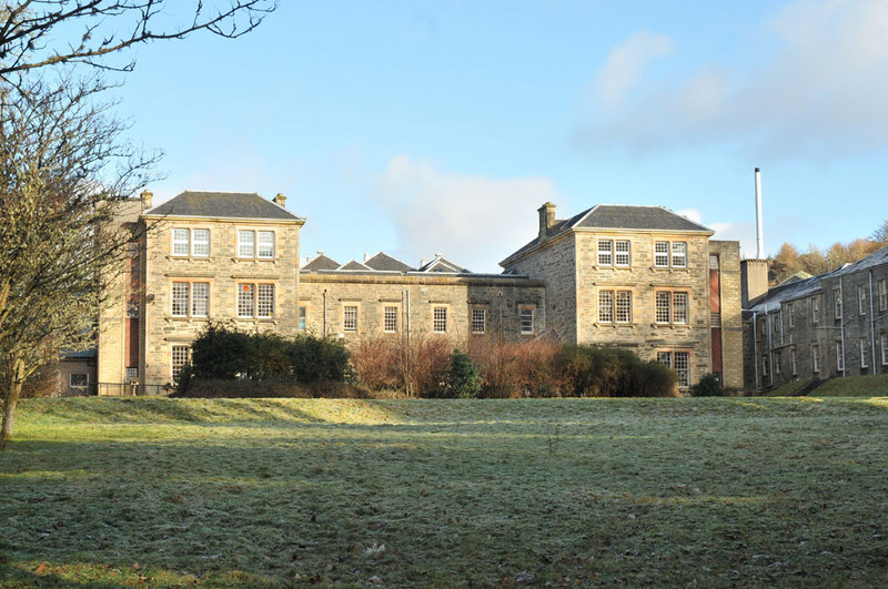
Argyll and Bute Hospital
Argyll and Bute Hospital was a mental health facility in Lochgilphead, Scotland. The original building (sometimes referred to as the West House) is a Grade...
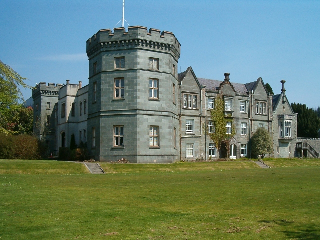
Kilmory Castle
Kilmory Castle, also known as Kilmory House, is a large 19th century house located just to the south of Lochgilphead, in old county Argyll, on the west...

Mid Argyll Community Hospital
Mid Argyll Community Hospital is a community hospital in Blarbuie Road, Lochgilphead, Scotland. It is managed by NHS Highland. == History == The facility...

Lochgilphead High School
Lochgilphead High School in Lochgilphead, Argyll is a secondary school servicing around 500-700 students. A new campus has been built in 2007 incorporating...
Have you been to Achnaba Forest?
Leave your review of Achnaba Forest below (or comments, questions and feedback).