Bardaravine Wood
Wood, Forest in Argyllshire
Scotland
Bardaravine Wood

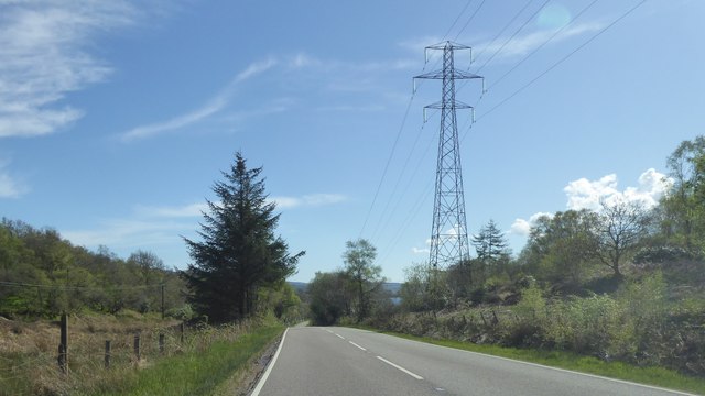
Bardaravine Wood is a captivating forest located in the picturesque region of Argyllshire, Scotland. Spanning over a vast area, this woodland offers a serene and enchanting atmosphere for nature enthusiasts and hikers alike.
The wood is rich in biodiversity, hosting a diverse range of plant and animal species, providing a haven for wildlife. The towering trees, predominantly oak and birch, create a dense canopy that filters sunlight and casts a magical shadow on the forest floor. Moss-covered rocks and fallen logs add to the woodland's ethereal charm.
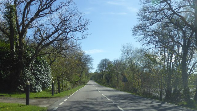
Trails wind their way through Bardaravine Wood, offering visitors the opportunity to explore its natural wonders. The paths are well-maintained, making it accessible for all skill levels. As you stroll through the forest, you may encounter native animals such as red squirrels, roe deer, and a vast array of bird species.
The wood also boasts a small river that meanders through its heart, providing a soothing soundtrack of running water. The river is home to a variety of fish species, attracting anglers from near and far.
Bardaravine Wood is a popular destination for nature photographers, who are drawn to its captivating beauty throughout the seasons. The vibrant hues of autumn leaves, the delicate blossoms of spring, and the lush green foliage of summer create a stunning backdrop for any camera lens.
Overall, Bardaravine Wood is a hidden gem in Argyllshire, offering visitors a chance to immerse themselves in the tranquility and natural beauty of Scotland's woodlands.
If you have any feedback on the listing, please let us know in the comments section below.
Bardaravine Wood Images
Images are sourced within 2km of 55.833644/-5.4470427 or Grid Reference NR8465. Thanks to Geograph Open Source API. All images are credited.


Bardaravine Wood is located at Grid Ref: NR8465 (Lat: 55.833644, Lng: -5.4470427)
Unitary Authority: Argyll and Bute
Police Authority: Argyll and West Dunbartonshire
What 3 Words
///cringe.whimpered.glitter. Near Tarbert, Argyll & Bute
Nearby Locations
Related Wikis
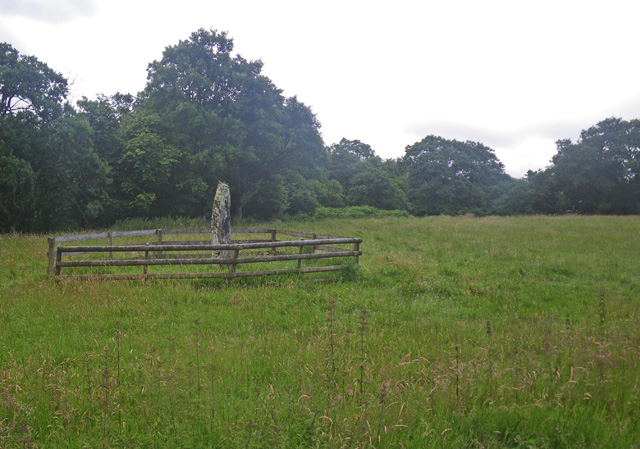
Avinagillan standing stone
The Avinagillan standing stone is a prehistoric menhir on the Kintyre Peninsula of Scotland. The stone is near the hamlet of Avinagillan. == See also... ==

Torinturk
Torinturk (Scottish Gaelic: Tòrr an Tuirc) is a village in Argyll and Bute, Scotland. Torinturk is 5 miles (8 km) from Tarbert. Torinturk comes from the...

Kennacraig
Kennacraig (Scottish Gaelic: Ceann na Creige) is a hamlet situated on West Loch Tarbert, a five miles (eight kilometres) southwest of Tarbert on the Kintyre...
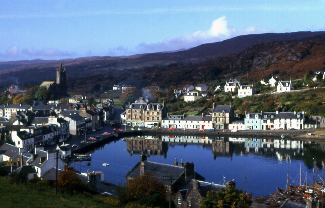
Tarbert, Kintyre
Tarbert (Scottish Gaelic: An Tairbeart, pronounced [ən̪ˠ ˈt̪ʰaɾʲapərˠʃt̪], or Tairbeart Loch Fìne to distinguish it from other places of the same name...

Eilean Ceann na Creige
Eilean Ceann na Creige is a small island near Kennacraig in West Loch Tarbert in Scotland. Ceann na Creige is Gaelic for head of the rock.Eilean Ceann...

Dùn a' Choin Duibh
Dùn a' Choin Duibh (Scottish Gaelic: Fort of the Black Dog) is a hillfort located near Torinturk, Argyll and Bute, Scotland. According to the local shanachies...

Tarbert Castle
Tarbert Castle is located on the southern shore of East Loch Tarbert, at Tarbert, Argyll, Scotland, at the north end of Kintyre. Tarbert Castle was a strategic...

Whitehouse, Argyll
Whitehouse (Scottish Gaelic: An Taigh Bàn, pronounced [ən̪ˠ t̪ʰɤj ˈpaːn]) is a hamlet on the Kintyre peninsula of Argyll and Bute, Scotland. It is located...
Nearby Amenities
Located within 500m of 55.833644,-5.4470427Have you been to Bardaravine Wood?
Leave your review of Bardaravine Wood below (or comments, questions and feedback).