Calton

Settlement in Staffordshire Staffordshire Moorlands

England

Calton

Warning signage - A52
Warning signage - A52 Credit: Dave Thompson

Calton is a small village located in the county of Staffordshire, England. Situated approximately 4 miles northeast of the town of Ashbourne, Calton is nestled within the picturesque Peak District National Park. The village is surrounded by rolling green hills and offers stunning views of the surrounding countryside.

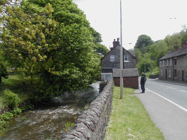
With a population of around 300 people, Calton is a tight-knit community known for its peaceful and idyllic setting. The village is characterized by its charming stone houses and traditional English cottages, which contribute to its quaint and welcoming atmosphere.

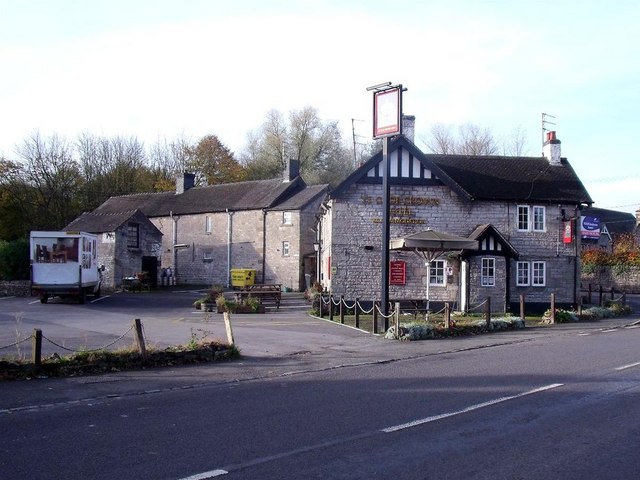
Calton is not heavily commercialized, and there are limited amenities within the village itself. However, the nearby town of Ashbourne provides residents with a wider range of services, including shops, schools, and healthcare facilities. The village is also well-connected transportation-wise, with good road links to nearby towns and cities.

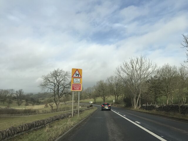
The surrounding area offers ample opportunities for outdoor activities and exploration. Calton is a popular destination for hikers, cyclists, and nature enthusiasts due to its proximity to the beautiful Peak District countryside. There are numerous walking trails and cycling routes in the vicinity, allowing visitors to immerse themselves in the area's natural beauty.

Overall, Calton offers a tranquil and picturesque escape from the hustle and bustle of larger towns and cities. With its stunning surroundings and close-knit community, the village provides a peaceful haven for those seeking a slower pace of life.

If you have any feedback on the listing, please let us know in the comments section below.

Calton Images

Images are sourced within 2km of 53.0485/-1.849301 or Grid Reference SK1050. Thanks to Geograph Open Source API. All images are credited.

Warning signage - A52
River Hamps valley View looking south-east from public footpath over the valley of the River Hamps.
River Hamps valley
View looking south-east from public footpath over the valley of the River Hamps.
Waterhouses, Staffordshire View from the main road (A52) about 600 yards to the east of the main part of the village. Pleasant-looking uniform row of cottages on the road to Waterfall at the far side of rough pasture.
Waterhouses, Staffordshire
View from the main road (A52) about 600 yards to the east of the main part of the village. Pleasant-looking uniform row of cottages on the road to Waterfall at the far side of rough pasture.
Waterhouses, Staffordshire The River Hamps flows east here through Waterhouses and alongside the A52 before it turns north towards the R Manifold.
Waterhouses, Staffordshire
The River Hamps flows east here through Waterhouses and alongside the A52 before it turns north towards the R Manifold.
Manifold Trail ... but running along the valley of the R Hamps at this point, just north of the A52. The River Hamps was remarkable for having a dry bed along much of this length despite other rivers in the area being fairly high at the time of the photo.
Manifold Trail
... but running along the valley of the R Hamps at this point, just north of the A52. The River Hamps was remarkable for having a dry bed along much of this length despite other rivers in the area being fairly high at the time of the photo.
Derelict farm building in Hamps Valley
Lee House Tea Rooms, Hamps Valley
Dry bed of River Hamps near Waterhouses
Silver Jubilee Pillar, Manifold Track, Waterhouses
Bridge over the River Hamps
Bridge over Earlsway This bridge used to carry the standard gauge line to Waterhouses Station, where it met the narrow-gauge Leek & Manifold Valley Light Railway.
Bridge over Earlsway
This bridge used to carry the standard gauge line to Waterhouses Station, where it met the narrow-gauge Leek & Manifold Valley Light Railway.
Station House Station House is next to the former Waterhouses Station.
Station House
Station House is next to the former Waterhouses Station.
Ye Olde Crown Hotel The Crown has been here since 1647.
Ye Olde Crown Hotel
The Crown has been here since 1647.
Waterhouses Methodist Church Part of the Cheadle Methodist Circuit, Waterhouses Methodist Church was originally built in 1823 and rebuilt again in 1905.
Waterhouses Methodist Church
Part of the Cheadle Methodist Circuit, Waterhouses Methodist Church was originally built in 1823 and rebuilt again in 1905.
Pick your path This gate by the Manifold Way gives access to three different paths.
Pick your path
This gate by the Manifold Way gives access to three different paths.
Footbridge access to Lee House Tea Rooms The main access is a little further north on the Manifold Way.
Footbridge access to Lee House Tea Rooms
The main access is a little further north on the Manifold Way.
Sewage works by the Manifold Way Run by Severn Trent Water.
Sewage works by the Manifold Way
Run by Severn Trent Water.
The start/finish of the Manifold Way
Show me another place!

Calton is located at Grid Ref: SK1050 (Lat: 53.0485, Lng: -1.849301)

Administrative County: Staffordshire

District: Staffordshire Moorlands

Police Authority: Staffordshire

What 3 Words

///headstone.vanish.tributes. Near Mayfield, Staffordshire

Nearby Locations

Calton

Related Wikis

Calton, Staffordshire

Calton is a village and a former parochial chapelry and civil parish, now in the parish of Waterhouses, in the Staffordshire Moorlands district of Staffordshire...

Leek and Manifold Valley Light Railway

The Leek and Manifold Valley Light Railway (L&MVLR) was a narrow gauge railway in Staffordshire, England that operated between 1904 and 1934. The line...

Brown End Quarry

Brown End Quarry is a nature reserve of the Staffordshire Wildlife Trust, near the village of Waterhouses in Staffordshire, England. It is designated a...

Waterhouses railway station (Staffordshire)

Waterhouses railway station was a railway station that served the village of Waterhouses, Staffordshire. It was opened jointly by the North Staffordshire...

Sparrowlee railway station

Sparrowlee was the name of a railway station on the Leek and Manifold Valley Light Railway, a 2 ft 6 in (762 mm) narrow gauge line which ran for 8 miles...

Waterhouses, Staffordshire

Waterhouses is a village in the south of the Staffordshire Peak District in England. It is around 8 miles from Leek and Ashbourne, being nearly the halfway...

Back o'th' Brook

Back o'th' Brook is a village in Staffordshire, England. The population for the 2011 census can be found under Waterhouses

Cauldon

Cauldon or Caldon is a village and former civil parish, 19 miles (31 km) north east of Stafford, now in the parish of Waterhouses, in the Staffordshire...

Nearby Amenities

Located within 500m of 53.0485,-1.849301
Bus Stop
St Mary's Church
Naptan AtcoCode: 3800C804000
Naptan Bearing: E
Naptan CommonName: St Mary's Church
Naptan Indicator: Adj
Naptan Landmark: St Mary's Church
Naptan Street: Back Lane
Naptan Verified: no
Source: naptan_import
Lat/Long: 53.0489425/-1.8471972
Bus Stop
St Mary's Church
Naptan AtcoCode: 3800C804001
Naptan Bearing: W
Naptan CommonName: St Mary's Church
Naptan Indicator: Opp
Naptan Landmark: St Mary's Church
Naptan Street: Back Lane
Naptan Verified: no
Source: naptan_import
Lat/Long: 53.0489049/-1.8475881
Barrier: stile
Material: stone
Source: survey;bing
Stile: squeezer
Lat/Long: 53.0491782/-1.8534173
Barrier: stile
Material: stone
Source: survey;bing
Stile: squeezer
Lat/Long: 53.0495235/-1.8512741
Barrier: stile
Material: stone
Source: survey;gps
Stile: squeezer
Lat/Long: 53.0526385/-1.8489869
Barrier: stile
Material: stone
Source: survey;gps
Stile: squeezer
Lat/Long: 53.0473913/-1.8464077
Barrier: stile
Material: stone
Source: survey;gps
Stile: squeezer
Lat/Long: 53.047411/-1.8470495
Barrier: stile
Material: wood
Source: survey;gps
Stile: stepover
Lat/Long: 53.0474323/-1.8486039
Barrier: stile
Material: wood
Source: survey;gps
Stile: stepover
Lat/Long: 53.0475111/-1.848635
Barrier: stile
Material: stone
Source: survey;gps
Stile: squeezer
Lat/Long: 53.0506273/-1.8482173
Barrier: stile
Material: wood
Source: survey;gps
Stile: stq
Lat/Long: 53.0512004/-1.8475295
Barrier: stile
Material: stone
Source: survey;gps
Stile: squeezer
Lat/Long: 53.0514163/-1.8472965
Barrier: stile
Material: wood
Source: survey;gps
Stile: stepover
Lat/Long: 53.044637/-1.8482081
Barrier: stile
Material: wood
Source: survey;gps
Stile: stepover
Lat/Long: 53.0451343/-1.8502125
Barrier: stile
Material: wood
Source: survey;gps
Stile: stepover
Lat/Long: 53.0442448/-1.8481351
Barrier: stile
Material: stone
Source: survey;gps
Stile: squeezer
Lat/Long: 53.0443886/-1.8506167
Barrier: entrance
Source: survey;gps
Lat/Long: 53.0446342/-1.848306
Barrier: stile
Material: wood
Source: survey;gps
Stile: stepover
Lat/Long: 53.0450113/-1.8482244
Barrier: stile
Material: stone
Source: survey;gps
Stile: squeezer
Lat/Long: 53.0455218/-1.8437036
Barrier: stile
Material: wood
Source: survey;gps
Stile: stepover
Lat/Long: 53.0463586/-1.8490421
Fixme: gate or stile?
Lat/Long: 53.0469572/-1.8444011
Barrier: stile
Material: stone
Source: survey;gps
Stile: squeezer
Lat/Long: 53.0488992/-1.8470227
Information: route_marker
Tourism: information
Lat/Long: 53.0505865/-1.8509444
Information: route_marker
Tourism: information
Lat/Long: 53.0507127/-1.8488703
Post Box
Operator: Royal Mail
Post Box Type: wall
Ref: ST10 376
Royal Cypher: VR
Royal Cypher Wikidata: Q33102356
Lat/Long: 53.0488277/-1.8471882
The data included in this document is from www.openstreetmap.org. The data is made available under ODbL.

Have you been to Calton?

Leave your review of Calton below (or comments, questions and feedback).