Calthorpe

Settlement in Oxfordshire Cherwell

England

Calthorpe

A4260 Oxford Road Towards Banbury town centre.
A4260 Oxford Road Credit: Robin Webster

Calthorpe is a small village located in Oxfordshire, England. Situated approximately 6 miles northeast of the city of Oxford, it falls within the Cherwell district. The village is surrounded by picturesque countryside, offering residents and visitors a tranquil setting.

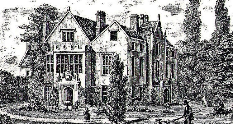
Calthorpe is known for its rich history, with evidence of human habitation in the area dating back to the Roman era. The village is home to several notable landmarks, including the Grade II listed Calthorpe Manor, a historic manor house that dates back to the 17th century. This architectural gem is a testament to the village's past and is often admired by visitors.

Although small in size, Calthorpe boasts a strong sense of community. The village has a close-knit population that takes pride in maintaining its rural charm. The village pub, The Red Lion, serves as a hub for socializing and is renowned for its warm atmosphere and traditional British cuisine.

Nature enthusiasts will appreciate the surrounding countryside, which offers numerous walking and cycling trails. The village is also in close proximity to the River Cherwell, providing opportunities for outdoor activities such as fishing and boating.

Despite its peaceful ambiance, Calthorpe benefits from its proximity to Oxford. This allows residents to easily access the city's amenities, including its world-renowned university, museums, and vibrant cultural scene. Overall, Calthorpe offers a delightful blend of rural tranquility and convenient access to nearby urban centers.

If you have any feedback on the listing, please let us know in the comments section below.
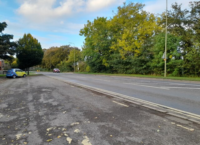
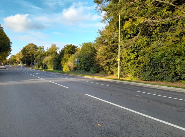
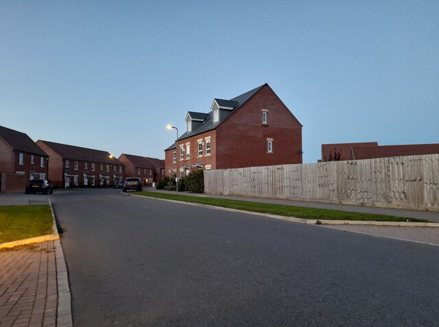
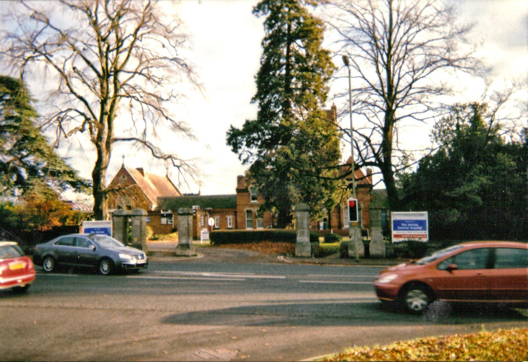
Calthorpe Images

Images are sourced within 2km of 52.053362/-1.3322912 or Grid Reference SP4539. Thanks to Geograph Open Source API. All images are credited.

A4260 Oxford Road Towards Banbury town centre.
A4260 Oxford Road
Towards Banbury town centre.
A4260 Oxford Road, Banbury Towards the town centre.
A4260 Oxford Road, Banbury
Towards the town centre.
A4260 Oxford Road, Banbury Approaching Oxford Road Junction, where most through traffic is directed right.
A4260 Oxford Road, Banbury
Approaching Oxford Road Junction, where most through traffic is directed right.
The Sutton End at the Banbury Plant Hire Community Stadium
The Puritans Radio Stand at the Banbury Plant Hire Community Stadium
Oxford Road at the junction of Upper Windsor Street
Oxford Road, Bodicote By the Esso garage, which doesn't have a toilet.
Oxford Road, Bodicote
By the Esso garage, which doesn't have a toilet.
By the Esso petrol station on Oxford Road, Bodicote
Oxford Road, Banbury
Bus stop on Oxford Road, Banbury
Oxford Road, Banbury My last visit <a title="https://www.geograph.org.uk/photo/6923307" href="https://www.geograph.org.uk/photo/6923307">Link</a>
Oxford Road, Banbury
My last visit Link
Longford Park Road, Bodicote
Field View, Bodicote It's behind the hedge (the field).
Field View, Bodicote
It's behind the hedge (the field).
Roundabout on Bankside, Banbury
Longford Park Road, Bodicote The building on the right is a school
Longford Park Road, Bodicote
The building on the right is a school
Songthrush Road from Longford Park Road
Terrace of houses on Longford Park Road, Bodicote Why so many new houses have to look like Victorian railway cottages is a mystery to me. Many are no bigger either.
Terrace of houses on Longford Park Road, Bodicote
Why so many new houses have to look like Victorian railway cottages is a mystery to me. Many are no bigger either.
Hightown Road, Banbury By the New Foscote Hospital
Hightown Road, Banbury
By the New Foscote Hospital
Show me another place!

Calthorpe is located at Grid Ref: SP4539 (Lat: 52.053362, Lng: -1.3322912)

Administrative County: Oxfordshire

District: Cherwell

Police Authority: Thames Valley

What 3 Words

///placed.shows.wheels. Near Banbury, Oxfordshire

Nearby Locations

Calthorpe Easington

Related Wikis

Nearby Amenities

Located within 500m of 52.053362,-1.3322912
Traffic Signals
Traffic Signals: signal
Traffic Signals Direction: both
Lat/Long: 52.0549152/-1.3389697
Traffic Signals
Traffic Signals: traffic_lights
Traffic Signals Direction: both
Lat/Long: 52.0525318/-1.3376386
Traffic Signals
Traffic Signals: signal
Traffic Signals Direction: both
Lat/Long: 52.052035/-1.3373266
Hospital
Horton Midwifery-led Unit
Addr City: Banbury
Addr Housename: Horton General Hospital
Addr Postcode: OX16 9AL
Addr Street: Oxford Road
Healthcare: hospital
Operator: NHS
Operator Wikidata: Q918396
Phone: +44 1295 229459
Website: https://www.ouh.nhs.uk/women/maternity/units/horton/default.aspx
Lat/Long: 52.053652/-1.3335016
Bus Stop
St Johns School
Bus: yes
Naptan AtcoCode: 340000192SCH
Naptan Bearing: N
Naptan CommonName: St Johns School
Naptan Indicator: Avocet Way
Naptan Landmark: School
Naptan NaptanCode: oxfajtgw
Naptan PlusbusZoneRef: BNBR
Naptan Street: Avocet Way
Naptan Verified: no
Public Transport: platform
Source: naptan_import
Lat/Long: 52.0500734/-1.3299465
Bus Stop
Horton Hospital
Bench: yes
Bin: no
Bus: yes
Departures Board: timetable
Lit: yes
Naptan AtcoCode: 340000878ENT
Naptan Bearing: S
Naptan CommonName: Horton Hospital
Naptan Indicator: Outside
Naptan Landmark: Horton Hospital
Naptan NaptanCode: oxfapgtm
Naptan PlusbusZoneRef: BNBR
Naptan Street: Oxford Road
Naptan Verified: no
Operator: Stagecoach
Public Transport: platform
Shelter: yes
Source: naptan_import
Tactile Paving: no
Lat/Long: 52.053145/-1.3379015
Bus Stop
Horton Hospital
Bench: yes
Bin: no
Bus: yes
Lit: yes
Naptan AtcoCode: 340000878OXF
Naptan Bearing: N
Naptan CommonName: Horton Hospital
Naptan Indicator: Opposite
Naptan Landmark: Horton Hospital
Naptan NaptanCode: oxfapgdj
Naptan PlusbusZoneRef: BNBR
Naptan Street: Oxford Road
Naptan Verified: no
Public Transport: platform
Shelter: yes
Source: naptan_import
Tactile Paving: no
Lat/Long: 52.0533305/-1.3383274
Bus Stop
Coppice Close
Bus: yes
Naptan AtcoCode: 340001396CNR
Naptan Bearing: NW
Naptan CommonName: Coppice Close
Naptan Indicator: Corner
Naptan Landmark: Coppice Close
Naptan NaptanCode: oxfagjgw
Naptan PlusbusZoneRef: BNBR
Naptan Street: Bankside
Naptan Verified: no
Public Transport: platform
Source: naptan_import
Lat/Long: 52.0531575/-1.3252481
Bus Stop
Coppice Close
Bus: yes
Naptan AtcoCode: 340001396OPP
Naptan Bearing: SE
Naptan CommonName: Coppice Close
Naptan Indicator: Opposite
Naptan Landmark: Coppice Close
Naptan NaptanCode: oxfgpjgt
Naptan Street: Bankside
Naptan Verified: no
Public Transport: platform
Source: naptan_import
Lat/Long: 52.0532195/-1.3250867
Bus Stop
Morrisons
Bench: yes
Bin: no
Bus: yes
Naptan AtcoCode: 340001399ENT
Naptan Bearing: NW
Naptan CommonName: Morrisons
Naptan Indicator: Entrance
Naptan Landmark: Morrisons
Naptan NaptanCode: oxfagjgd
Naptan PlusbusZoneRef: BNBR
Naptan Street: Swan Close Road
Naptan Verified: no
Public Transport: platform
Shelter: yes
Source: naptan_import
Lat/Long: 52.0576937/-1.3321402
Bus Stop
Morrisons
Bus: yes
Naptan AtcoCode: 340001399OPP
Naptan Bearing: SE
Naptan CommonName: Morrisons
Naptan Indicator: Opposite
Naptan Landmark: Morrisons
Naptan NaptanCode: oxfagjga
Naptan PlusbusZoneRef: BNBR
Naptan Street: Swan Close Road
Naptan Verified: no
Public Transport: platform
Source: naptan_import
Lat/Long: 52.0577536/-1.331859
Bus Stop
Newbold Close
Bus: yes
Naptan AtcoCode: 340001400NEW
Naptan Bearing: NW
Naptan CommonName: Newbold Close
Naptan Indicator: Corner
Naptan Landmark: Newbold Close
Naptan NaptanCode: oxfgpjgw
Naptan Street: Bankside
Naptan Verified: no
Public Transport: platform
Source: naptan_import
Lat/Long: 52.0554736/-1.3277655
Bus Stop
Newbold Close
Bus: yes
Naptan AtcoCode: 340001400OPP
Naptan Bearing: SE
Naptan CommonName: Newbold Close
Naptan Indicator: Opposite
Naptan Landmark: Newbold Close
Naptan NaptanCode: oxfagjdw
Naptan PlusbusZoneRef: BNBR
Naptan Street: Bankside
Naptan Verified: no
Public Transport: platform
Source: naptan_import
Lat/Long: 52.056053/-1.3284715
Bus Stop
Grange Road
Bench: yes
Bin: no
Bus: yes
Lit: yes
Naptan AtcoCode: 340001784CNR
Naptan Bearing: NW
Naptan CommonName: Grange Road
Naptan Indicator: Corner
Naptan Landmark: Grange Road
Naptan NaptanCode: oxfgdgdg
Naptan PlusbusZoneRef: BNBR
Naptan Street: Oxford Road
Naptan Verified: no
Public Transport: platform
Shelter: yes
Source: naptan_import
Tactile Paving: no
Lat/Long: 52.0498166/-1.3354044
Bus Stop
Grange Road
Bench: no
Bin: no
Bus: yes
Lit: yes
Naptan AtcoCode: 340001784OPP
Naptan Bearing: SE
Naptan CommonName: Grange Road
Naptan Indicator: Opposite
Naptan Landmark: Grange Road
Naptan NaptanCode: oxfgdgda
Naptan PlusbusZoneRef: BNBR
Naptan Street: Oxford Road
Naptan Verified: no
Public Transport: platform
Shelter: no
Source: naptan_import
Tactile Paving: no
Lat/Long: 52.0496512/-1.3347652
Bus Stop
Easington Road
Bus: yes
Naptan AtcoCode: 340003143CNR
Naptan Bearing: E
Naptan CommonName: Easington Road
Naptan Indicator: Corner
Naptan Landmark: Easington Road
Naptan NaptanCode: oxfatpdj
Naptan PlusbusZoneRef: BNBR
Naptan Street: Horton View
Naptan Verified: no
Public Transport: platform
Source: naptan_import
Lat/Long: 52.052193/-1.339088
Western Crescent
Naptan AtcoCode: 340003165CNR
Naptan Bearing: SW
Naptan BusStopType: CUS
Naptan CommonName: Western Crescent
Naptan Indicator: Corner
Naptan Landmark: Western Cresent
Naptan NaptanCode: oxfgagtg
Naptan PlusbusZoneRef: BNBR
Naptan Street: Hightown Road
Naptan Verified: no
Source: naptan_import
Lat/Long: 52.0553304/-1.3294595
Bus Stop
Western Crescent
Bus: yes
Departures Board: yes
Naptan AtcoCode: 340003165OPP
Naptan Bearing: NE
Naptan CommonName: Western Crescent
Naptan Indicator: Opposite
Naptan Landmark: Western Cresent
Naptan NaptanCode: oxfgajda
Naptan PlusbusZoneRef: BNBR
Naptan Street: Hightown Road
Naptan Verified: no
Operator: Stagecoach
Public Transport: platform
Shelter: no
Source: naptan_import
Lat/Long: 52.0553402/-1.3296052
Hightown Gardens for Hospital
Naptan AtcoCode: 340003166CNR
Naptan Bearing: W
Naptan BusStopType: CUS
Naptan CommonName: Hightown Gardens for Hospital
Naptan Indicator: Corner
Naptan Landmark: Horton Hospital
Naptan NaptanCode: oxfgagtd
Naptan PlusbusZoneRef: BNBR
Naptan Street: Hightown Road
Naptan Verified: no
Source: naptan_import
Lat/Long: 52.0529078/-1.3335063
Bus Stop
Hightown Gardens for Hospital
Bus: yes
Naptan AtcoCode: 340003166OPP
Naptan Bearing: NE
Naptan CommonName: Hightown Gardens for Hospital
Naptan Indicator: Opposite
Naptan Landmark: Horton Hospital
Naptan NaptanCode: oxfgajaw
Naptan PlusbusZoneRef: BNBR
Naptan Street: Hightown Road
Naptan Verified: no
Public Transport: platform
Source: naptan_import
Lat/Long: 52.0529836/-1.3335361
Calthorpe
Place: suburb
Lat/Long: 52.0568479/-1.3368904
Doctors
Hightown Surgery
Healthcare: doctor
Lat/Long: 52.0511413/-1.336335
Post Box
Brand: Royal Mail
Brand Wikidata: Q638098
Collection Times: Mo-Fr 16:45; Sa 08:00
Mapillary: 486682392538006
Operator: Royal Mail
Operator Wikidata: Q638098
Post Box Mounting: brick_wall
Post Box Type: wall
Ref: OX16 1030
Royal Cypher: EIIR
Royal Cypher Wikidata: Q33102113
Survey Date: 2021-07-31
Lat/Long: 52.0521237/-1.3371675
Post Box
Collection Times: Mo-Fr 09:00; Sa 07:00
Ref: OX16 557
Royal Cypher: EIIR
Royal Cypher Wikidata: Q33102113
Lat/Long: 52.0493149/-1.3336907
Clinic
The Foscote Private Hospital
Healthcare: clinic
Lat/Long: 52.0534969/-1.331074
Post Box
Collection Times: Mo-Fr 17:00; Sa 08:00
Post Box Mounting: brick_pillar
Post Box Type: wall
Ref: OX16 1134
Lat/Long: 52.0554449/-1.329594
Turning Circle
Source: Bing
Lat/Long: 52.0540822/-1.3286657
Turning Circle
Lat/Long: 52.0562288/-1.3356383
Mini Roundabout
Direction: clockwise
Source: Bing
Lat/Long: 52.0571059/-1.3316319
Source: Bing
Traffic Calming: bump
Lat/Long: 52.053587/-1.3257607
Crossing
Crossing: unmarked
Crossing Island: yes
Tactile Paving: yes
Lat/Long: 52.0504176/-1.3362202
Recycling
Recycling Cans: yes
Recycling Clothes: yes
Recycling Glass: no
Recycling Glass Bottles: yes
Recycling Shoes: yes
Recycling Type: container
Lat/Long: 52.0574747/-1.3325331
Recycling
Location: overground
Recycling Cans: yes
Recycling Clothes: yes
Recycling Glass Bottles: yes
Recycling Paper: yes
Recycling Plastic: no
Recycling Plastic Packaging: yes
Recycling Type: container
Lat/Long: 52.0504878/-1.3356825
Crossing
Crossing: marked
Lat/Long: 52.0501821/-1.3352025
Vending Machine
Vending: parking_tickets
Lat/Long: 52.053542/-1.3335113
Vending Machine
Vending: parking_tickets
Lat/Long: 52.0530704/-1.3342836
Turning Circle
Lat/Long: 52.0563034/-1.3354242
Entrance: yes
Lat/Long: 52.0537246/-1.3356428
Entrance: yes
Lat/Long: 52.05359/-1.3354467
Recycling
Recycling Clothes: yes
Recycling Shoes: yes
Recycling Type: container
Lat/Long: 52.0578103/-1.3319059
Atm
Cash In: no
Check Date: 2022-10-08
Operator: Note Machine
Lat/Long: 52.0572274/-1.332579
Atm
Cash In: no
Check Date: 2022-10-08
Operator: Note Machine
Lat/Long: 52.0572372/-1.3326099
Atm
Cash In: no
Check Date: 2022-10-08
Operator: Note Machine
Lat/Long: 52.0572469/-1.3326403
Atm
Cash In: no
Check Date: 2022-10-24
Operator: Sainsbury's Bank
Lat/Long: 52.0508025/-1.334329
Power: pole
Lat/Long: 52.0552363/-1.3260332
Library
Horton Library
Addr City: Banbury
Addr Housename: Terence Mortimer Postgraduate Centre, Horton General Hospital
Addr Postcode: OX16 9AL
Addr Street: Oxford Road
Operator: Bodleian Libraries
Operator Type: private_non_profit
Lat/Long: 52.0541943/-1.3376543
Terence Mortimer Postgraduate Education Centre
Addr City: Banbury
Addr Housename: Horton General Hospital
Addr Postcode: OX16 9AL
Addr Street: Oxford Road
Office: educational_institution
Operator: Oxford University Hospitals NHS Foundation Trust
Operator Type: public
Website: https://www.ouh.nhs.uk/education-centres/centres/terence-mortimer.aspx
Lat/Long: 52.0541177/-1.33763
Crossing
Crossing: unmarked
Lat/Long: 52.0510519/-1.3366368
Traffic Signals
Traffic Signals: signal
Traffic Signals Direction: backward
Lat/Long: 52.0506775/-1.336202
Traffic Signals
Traffic Signals: traffic_lights
Traffic Signals Direction: forward
Lat/Long: 52.0505992/-1.3365294
Traffic Signals
Traffic Signals: signal
Traffic Signals Direction: both
Lat/Long: 52.0507359/-1.3364999
Traffic Signals
Traffic Signals: traffic_lights
Traffic Signals Direction: both
Lat/Long: 52.0505164/-1.3363027
Vending Machine
Vending: parking_tickets
Lat/Long: 52.0537281/-1.3345096
Vending Machine
Vending: parking_tickets
Lat/Long: 52.0528053/-1.3346249
Entrance: yes
Lat/Long: 52.0539015/-1.3356625
Crossing
Crossing: marked
Lat/Long: 52.0533197/-1.3343021
Turning Circle
Lat/Long: 52.056548/-1.3362331
Access: destination
Barrier: swing_gate
Wheelchair: no
Lat/Long: 52.0573848/-1.3327048
Parcel Locker
Brand: Amazon Hub Locker
Brand Wikidata: Q16974764
Covered: yes
Indoor: yes
Opening Hours: 24/7
Operator: Amazon
Operator Wikidata: Q3884
Operator Wikipedia: en:Amazon (company)
Parcel Locker Type: cabinet
Parcel Mail In: returns_only
Parcel Pickup: yes
Ref: Tulip
Lat/Long: 52.057085/-1.3321313
The Bnabury Therapy Group
Addr City: Banbury
Addr Housenumber: 69
Addr Postcode: OX16 9AJ
Addr Street: Oxford Road
Healthcare: psychotherapist
Website: https://www.banburytherapycentre.com/
Lat/Long: 52.0551388/-1.3387042
Crossing
Lat/Long: 52.0493048/-1.333937
Man Made: mast
Tower Type: communication
Lat/Long: 52.0543562/-1.3370472
Man Made: surveillance
Surveillance Type: camera
Lat/Long: 52.0566377/-1.3308038
The data included in this document is from www.openstreetmap.org. The data is made available under ODbL.

Have you been to Calthorpe?

Leave your review of Calthorpe below (or comments, questions and feedback).