Alaistair's Wood

Wood, Forest in Argyllshire

Scotland

Alaistair's Wood

Entrance to the forest The entrance has been considerably enhanced since this photo was taken: <a href="https://www.geograph.org.uk/photo/175917">NM3951 : Entrance to Langamull forest</a>.
Entrance to the forest Credit: Rod Allday

Alaistair's Wood is a pristine forest located in Argyllshire, Scotland. Covering an expansive area of land, this woodland is a natural haven of breathtaking beauty and ecological significance. The wood is named after the renowned Scottish botanist, Alaistair MacArthur, who dedicated his life to the conservation of native Scottish forests.

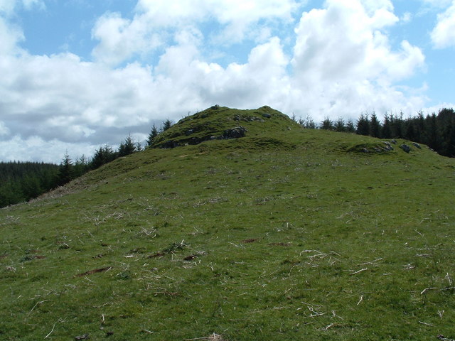
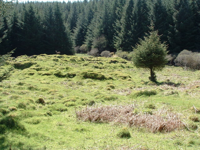
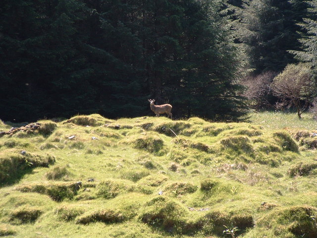
The wood is predominantly composed of ancient oak trees, standing tall and majestic, their branches intertwined to create a dense canopy that filters sunlight and creates a mesmerizing play of light and shadow on the forest floor. The ground is carpeted with a rich layer of mosses, lichens, and ferns, creating a lush and verdant undergrowth.

The biodiversity within Alaistair's Wood is remarkable, with a plethora of plant and animal species thriving in this natural habitat. The forest is home to various species of birds, including the elusive Scottish crossbill and the majestic golden eagle. Red deer, foxes, badgers, and pine martens roam freely, adding to the enchanting allure of the wood.

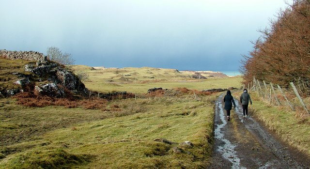
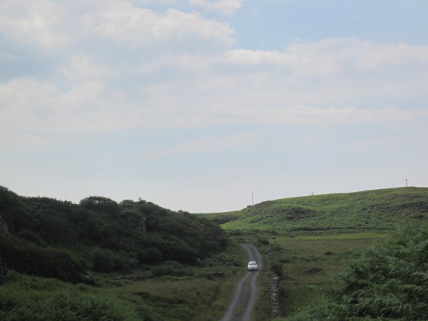
The wood is a popular destination for nature enthusiasts, hikers, and photographers, who come to immerse themselves in its tranquil ambiance. A network of well-maintained trails allows visitors to explore the wood at their own pace, offering breathtaking vistas and opportunities to spot wildlife. The wood also houses a visitor center, providing information about the forest's history, conservation efforts, and the species that call it home.

Alaistair's Wood stands as a testament to the importance of preserving Scotland's natural heritage. Its towering trees, vibrant wildlife, and pristine ecosystem make it a true gem in Argyllshire's crown, inviting all who visit to appreciate and protect the wonders of the natural world.

If you have any feedback on the listing, please let us know in the comments section below.

Alaistair's Wood Images

Images are sourced within 2km of 56.591594/-6.227917 or Grid Reference NM4052. Thanks to Geograph Open Source API. All images are credited.

Entrance to the forest The entrance has been considerably enhanced since this photo was taken: <a href="https://www.geograph.org.uk/photo/175917">NM3951 : Entrance to Langamull forest</a>.
Entrance to the forest
The entrance has been considerably enhanced since this photo was taken: NM3951 : Entrance to Langamull forest.
The track to Langamull The track that leads down to Langamull and the beach at Port Langamull
The track to Langamull
The track that leads down to Langamull and the beach at Port Langamull
Old Milestone by the B8073, east of Calgary Mull granite by the B8073, in parish of Kilfinichen and Kilvickeon (Mull District), edge of woods, opposite school/former school.

Inscription not known.

Surveyed

Milestone Society National ID: AB_MLTMCL11
Old Milestone by the B8073, east of Calgary
Mull granite by the B8073, in parish of Kilfinichen and Kilvickeon (Mull District), edge of woods, opposite school/former school. Inscription not known. Surveyed Milestone Society National ID: AB_MLTMCL11
Langamull Forest A new road has been built opposite the road to Langamull. This links Langamull with the other North West Mull Community Forest woodland.  Much of Langamull will be felled in 2011.
Langamull Forest
A new road has been built opposite the road to Langamull. This links Langamull with the other North West Mull Community Forest woodland. Much of Langamull will be felled in 2011.
Sign, Langamull Forest Northwest Mull Community Woodland
<span class="nowrap"><a title="http://www.nwmullwoodland.co.uk/maps.htm" rel="nofollow ugc noopener" href="http://www.nwmullwoodland.co.uk/maps.htm">Link</a><img style="margin-left:2px;" alt="External link" title="External link - shift click to open in new window" src="https://s1.geograph.org.uk/img/external.png" width="10" height="10"/></span>
Sign, Langamull Forest
Northwest Mull Community Woodland LinkExternal link
New road, Langamull Langamull Forest was bought off the Forestry Commission in 2006. It is now ready for harvesting and a new logging road has been built.
New road, Langamull
Langamull Forest was bought off the Forestry Commission in 2006. It is now ready for harvesting and a new logging road has been built.
Coast road approaching Calgary The narrow B8073 winds its way around the north-west corner of Mull. Cruach Slèibhe <a href="https://www.geograph.org.uk/gridref/NM3752">NM3752</a>, with its tabular form typical of the lava flow country of northern Mull, stands on the skyline.
Coast road approaching Calgary
The narrow B8073 winds its way around the north-west corner of Mull. Cruach Slèibhe NM3752, with its tabular form typical of the lava flow country of northern Mull, stands on the skyline.
Mornish Schoolhouse Like many of the small schools scattered around the Isle of Mull, this one closed in the 1970s. It is now a bed and breakfast.
Mornish Schoolhouse
Like many of the small schools scattered around the Isle of Mull, this one closed in the 1970s. It is now a bed and breakfast.
Road towards B&B
Road towards B&B
Langamull Forest Large area of clear felled woodland. There is felling in progress south of the Calgary - Dervaig road as well.
Langamull Forest
Large area of clear felled woodland. There is felling in progress south of the Calgary - Dervaig road as well.
Langamull Forest Large clear felled area.
Langamull Forest
Large clear felled area.
Langamull Forest Much of the woodland has been felled recently.
Langamull Forest
Much of the woodland has been felled recently.
Langamull Forest Much of the conifer plantation has been felled.
Langamull Forest
Much of the conifer plantation has been felled.
Langamull Forest Surviving larches amongst some big clear fell areas.
Langamull Forest
Surviving larches amongst some big clear fell areas.
Dun Mhadaidh Not much evidence of any sort of habitation but the hill itself.
Dun Mhadaidh
Not much evidence of any sort of habitation but the hill itself.
Kildavie Remains of settlement now surrounded by forestry. I'd wandered around for a bit then found a bit of higher ground to take the picture from, only then did I realise I wasn't alone.
Kildavie
Remains of settlement now surrounded by forestry. I'd wandered around for a bit then found a bit of higher ground to take the picture from, only then did I realise I wasn't alone.
My deer friend After a minute or so, long enough to get this shot, it turned and wandered off through the trees.
My deer friend
After a minute or so, long enough to get this shot, it turned and wandered off through the trees.
Entrance to Langamull forest The old 1940's map shows the road as the A848, it's now been downgraded to the B8073. The A road stops at Tobermory
Entrance to Langamull forest
The old 1940's map shows the road as the A848, it's now been downgraded to the B8073. The A road stops at Tobermory
Show me another place!

Alaistair's Wood is located at Grid Ref: NM4052 (Lat: 56.591594, Lng: -6.227917)

Unitary Authority: Argyll and Bute

Police Authority: Argyll and West Dunbartonshire

What 3 Words

///estimate.scribbled.respond. Near Dervaig, Argyll & Bute

Related Wikis

Dervaig

Dervaig (Scottish Gaelic: Dearbhaig) is a small village on the Isle of Mull off the west coast of Scotland. The village is within the parish of Kilninian...

Calgary, Mull

Calgary is a hamlet on the northwest coast of the Isle of Mull, in Argyll and Bute, Scotland, United Kingdom. The hamlet is within the parish of Kilninian...

Calgary Castle

Calgary Castle, also known as Calgary House, is a 19th-century castellated Gothic mansion at Calgary on the Isle of Mull, Scotland. The mansion faces Calgary...

Eas Fors

Eas Fors is a waterfall on the island of Mull in Scotland. It is situated on the Ardow Burn south of Dervaig. There is another Eas Fors on the Allt an...

Glengorm Castle

Glengorm Castle, also known as Castle Sorn, is a 19th-century country house on the Isle of Mull, Scotland. Located in Mishnish, 6 kilometres (4 mi) northwest...

RMS Aurania (1916)

RMS Aurania was an ocean liner owned by the Cunard Line. She was built in 1916 at Wallsend and measured 13,936 gross register tons. The Aurania was the...

Torloisk House

Torloisk House (sometimes referred to as Torluck House in 19th century references) on the Isle of Mull, Argyll in Scotland was the family seat held by...

Achleck

Achleck is a small settlement in the north-west of the Isle of Mull in Argyll and Bute, Scotland. == References ==

Related Videos

Experience The Isles of Staffa and Lunga in 60 Seconds

Our travel guide for spending a day on Scotland's famous Isle of Staffa to see Fingal's Cave and photographing Puffins close up ...

Nearby Amenities

Located within 500m of 56.591594,-6.227917
Post Box
Operator: Royal Mail
Operator Wikidata: Q638098
Ref: PA75 112
Royal Cypher: scottish_crown
Lat/Long: 56.5909044/-6.2255204
Charging Station
Chargeplace Scotland charge station
Operator: ChargePlace Scotland
Operator Wikidata: Q105359316
Lat/Long: 56.5910703/-6.2248804
Power: pole
Lat/Long: 56.5911181/-6.2255171
Power: pole
Lat/Long: 56.590325/-6.2267134
Power: pole
Lat/Long: 56.5898162/-6.2274872
Power: pole
Lat/Long: 56.5893214/-6.228265
Power: pole
Lat/Long: 56.5891723/-6.2293795
Power: pole
Lat/Long: 56.5882019/-6.2302834
Power: pole
Lat/Long: 56.5876045/-6.2308587
Generator Method: photovoltaic
Generator Output Electricity: yes
Generator Source: solar
Generator Type: solar_photovoltaic_panel
Power: generator
Lat/Long: 56.5926165/-6.2251631
Power: pole
Lat/Long: 56.5951931/-6.2325862
Power: pole
Lat/Long: 56.5946076/-6.2327594
Power: pole
Lat/Long: 56.5940267/-6.2329345
Power: pole
Lat/Long: 56.5934594/-6.2331179
Power: pole
Lat/Long: 56.5929068/-6.2332849
Power: pole
Lat/Long: 56.5922964/-6.2334662
Power: pole
Lat/Long: 56.5917029/-6.2336538
Power: pole
Lat/Long: 56.5911083/-6.2338331
Power: pole
Lat/Long: 56.5906351/-6.2329242
Power: pole
Lat/Long: 56.5901847/-6.2320587
Power: pole
Lat/Long: 56.5897478/-6.231224
Power: pole
Lat/Long: 56.5892349/-6.2303173
Power: pole
Lat/Long: 56.588904/-6.2296294
Power: pole
Lat/Long: 56.5920876/-6.2210105
Power: pole
Lat/Long: 56.5917619/-6.2224964
Power: pole
Lat/Long: 56.5914635/-6.2238875
Power: pole
Lat/Long: 56.5906306/-6.2227561
Power: pole
Lat/Long: 56.5909472/-6.2245717
Power: pole
Lat/Long: 56.5904479/-6.2217133
Power: pole
Lat/Long: 56.5900803/-6.2209961
The data included in this document is from www.openstreetmap.org. The data is made available under ODbL.

Have you been to Alaistair's Wood?

Leave your review of Alaistair's Wood below (or comments, questions and feedback).