Callow End

Settlement in Worcestershire Malvern Hills

England

Callow End

Grassy field on the Old Hills
Grassy field on the Old Hills Credit: Sarah Charlesworth

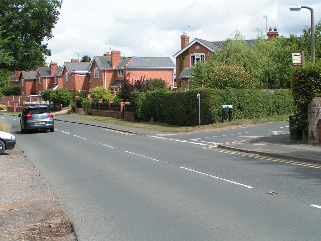
Callow End is a picturesque village located in the county of Worcestershire, England. Situated approximately five miles south of the city of Worcester, Callow End is nestled in the beautiful countryside of the Severn Valley. With a population of around 1,500 residents, the village offers a peaceful and close-knit community atmosphere.

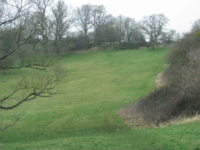
The village is renowned for its charming traditional English cottages, many of which date back several centuries. These quaint properties, along with well-manicured gardens and hedgerows, contribute to the village's idyllic and timeless ambiance. The natural beauty of Callow End is further enhanced by the nearby River Severn, which meanders through the landscape, providing scenic views and recreational opportunities.

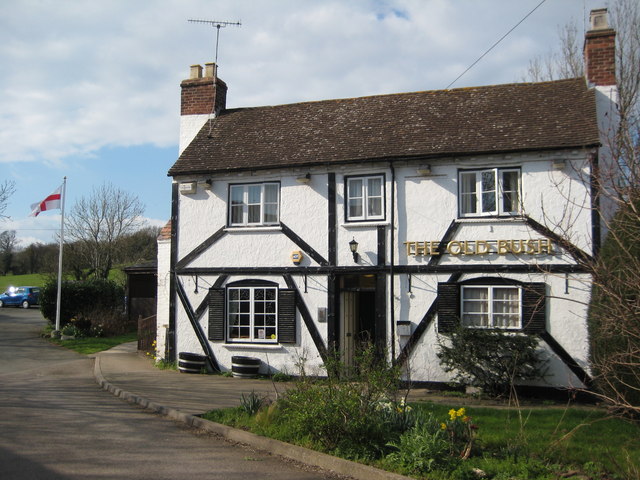
Callow End offers a range of amenities for its residents, including a primary school, a village hall, and a local pub. The village hall serves as a hub for community activities and hosts various events throughout the year, promoting a strong sense of unity among the villagers. Additionally, the local pub provides a cozy gathering place for residents and visitors alike, offering a warm welcome and traditional pub fare.

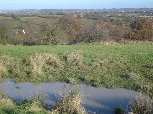
For those seeking outdoor activities, Callow End boasts an abundance of opportunities. The surrounding countryside offers ample opportunities for walking, cycling, and horse riding, with numerous trails and paths to explore. The nearby Malvern Hills, an Area of Outstanding Natural Beauty, also provide a stunning backdrop for outdoor enthusiasts.

In summary, Callow End is a quintessential English village that combines natural beauty, historic charm, and a strong community spirit. Its tranquil setting, coupled with its proximity to larger towns and cities, makes it an ideal place to reside for those seeking a peaceful yet accessible rural lifestyle.

If you have any feedback on the listing, please let us know in the comments section below.

Callow End Images

Images are sourced within 2km of 52.143502/-2.244008 or Grid Reference SO8349. Thanks to Geograph Open Source API. All images are credited.

Grassy field on the Old Hills
B4424 passing through Callow End
Kempsey church Kempsey church is dedicated to St Mary the Virgin, at the time of the picture work was taking place on the tower.
Kempsey church
Kempsey church is dedicated to St Mary the Virgin, at the time of the picture work was taking place on the tower.
Flood defence work, Kempsey Work has begun on creation of flood defences in Kempsey, here work is being carried out to the south of the church.
Flood defence work, Kempsey
Work has begun on creation of flood defences in Kempsey, here work is being carried out to the south of the church.
Ford in Kempsey Ford on Hatfield Brook in Kempsey.
Ford in Kempsey
Ford on Hatfield Brook in Kempsey.
Bridge over Hatfield Brook Bridge over Hatfield Brook beside a ford in Kempsey.
Bridge over Hatfield Brook
Bridge over Hatfield Brook beside a ford in Kempsey.
Kempsey Ford
Kempsey Ford
Kempsey Hatfield Brook Ford
The Old Bush, Callow End Public house set back from the B4424 as it passes through the village of Callow End.
The Old Bush, Callow End
Public house set back from the B4424 as it passes through the village of Callow End.
The Severn Way at Lower Ham
Up on stilts - caravans on the floodplain
Flood defences at Kempsey One month ago on the 25 November, Kempsey made national headlines when this newly built flood defence and in particular this pumping station failed.  The flood bank effectively became a dam trapping the water of the swollen Hatfield Brook and resulting in the unexpected flooding of a number of homes in the village.  A month on and another flood, but fortunately this time it is working.  The tower of Kempsey church is to the right.
Flood defences at Kempsey
One month ago on the 25 November, Kempsey made national headlines when this newly built flood defence and in particular this pumping station failed. The flood bank effectively became a dam trapping the water of the swollen Hatfield Brook and resulting in the unexpected flooding of a number of homes in the village. A month on and another flood, but fortunately this time it is working. The tower of Kempsey church is to the right.
The Severn and the Malverns
Meanders in the Severn
Walking on the Severn Way, Upper Ham, Kempsey
Kempsey - St Mary's Church
Narrow boat on River Severn approaching Kempsey from the south
Kempsey: Squire's Walk and water level gaugeboard On the right is a water level gaugeboard, which shows the depth of water at the ford across Hatfield Brook, which itself is just around the corner to the left. Some indication of the depth of water that was expected at the ford in historic times can be gleaned from the fact that the base of the gaugeboard is at 7 feet. Philip's <a href="https://www.geograph.org.uk/photo/2642421">SO8449 : Ford in Kempsey</a> taken round the corner shows the "lower half" of the gaugeboard. Hopefully, with the completion in September 2012 of Kempsey's flood protection embankment, that keeps floodwater from the River Severn out of the village, and pumps that take excess water from the brook into the river, there will be no more need for such a gauge. However the pumps failed to operate as planned in a flood event in November 2012, and some properties in the village were flooded again.
Kempsey: Squire's Walk and water level gaugeboard
On the right is a water level gaugeboard, which shows the depth of water at the ford across Hatfield Brook, which itself is just around the corner to the left. Some indication of the depth of water that was expected at the ford in historic times can be gleaned from the fact that the base of the gaugeboard is at 7 feet. Philip's SO8449 : Ford in Kempsey taken round the corner shows the "lower half" of the gaugeboard. Hopefully, with the completion in September 2012 of Kempsey's flood protection embankment, that keeps floodwater from the River Severn out of the village, and pumps that take excess water from the brook into the river, there will be no more need for such a gauge. However the pumps failed to operate as planned in a flood event in November 2012, and some properties in the village were flooded again.
Show me another place!

Callow End is located at Grid Ref: SO8349 (Lat: 52.143502, Lng: -2.244008)

Administrative County: Worcestershire

District: Malvern Hills

Police Authority: West Mercia

What 3 Words

///landlady.shade.pages. Near Kempsey, Worcestershire

Related Wikis

Callow End

Callow End is a constituent village of the civil parish of Powick in the Malvern Hills District of Worcestershire, England. It is located on the B4424...

Old Hills

The Old Hills are an area of common land in Worcestershire, England. They are located around two miles to the east of Great Malvern and about a mile west...

Powick Hospital

Powick Hospital, which opened in 1847 was a psychiatric facility located on 552 acres (223 ha) outside the village of Powick, near Malvern, Worcestershire...

Kempsey, Worcestershire

Kempsey is a village and civil parish in the Malvern Hills District in the county of Worcestershire, England. It is bounded by the River Severn on the...

Nearby Amenities

Located within 500m of 52.143502,-2.244008
Public Bookcase
Booth: K6
Disused Amenity: telephone
Man Made: telephone_box
Public Bookcase Type: phone_box
Lat/Long: 52.1433006/-2.2426774
Barrier: stile
Foot: yes
Lat/Long: 52.1461726/-2.246322
Pound Village Stores
Shop: convenience
Lat/Long: 52.1461367/-2.2403968
Pub
The Old Bush
Lat/Long: 52.142537/-2.2444984
Pub
The Blue Bell
Addr City: Worcester
Addr Housenumber: 35
Addr Postcode: WR2 4TY
Addr Street: Upton Road
Brand: Marston's
Brand Wikidata: Q6773982
Fhrs Id: 672634
Opening Hours: Mo-Su 12:00-23:00
Source Addr: FHRS Open Data
Website: https://www.bluebellinncallowend.co.uk/
Lat/Long: 52.1473755/-2.2403679
Callow End
Place: village
Wikidata: Q5022920
Wikipedia: en:Callow End
Lat/Long: 52.1435428/-2.242468
Bow Hill
Naptan AtcoCode: 2000G022352
Naptan Bearing: S
Naptan BusStopType: CUS
Naptan CommonName: Bow Hill
Naptan NaptanCode: wocgpdwt
Naptan ShortCommonName: Bow Hill
Naptan Street: Lower Ferry Lane
Naptan Verified: no
Source: naptan_import
Lat/Long: 52.1448168/-2.2395043
Bus Stop
Shop
Bus: yes
Naptan AtcoCode: 2000G059301
Naptan Bearing: SW
Naptan CommonName: Shop
Naptan Indicator: Opp
Naptan Landmark: Shop
Naptan NaptanCode: wocdmgaj
Naptan Street: Upton Road
Naptan Verified: no
Public Transport: platform
Source: naptan_import
Lat/Long: 52.1461274/-2.2405051
Bus Stop
Blue Bell
Bus: yes
Naptan AtcoCode: 2000G059302
Naptan Bearing: S
Naptan CommonName: Blue Bell
Naptan Indicator: opp
Naptan NaptanCode: wocdmgam
Naptan Street: Upton Road
Naptan Verified: no
Public Transport: platform
Source: naptan_import
Lat/Long: 52.1471982/-2.2400578
Bus Stop
Bus: yes
Naptan AtcoCode: 2000G059303
Naptan Bearing: N
Naptan CommonName: School
Naptan Indicator: Adj
Naptan NaptanCode: wocdmgap
Naptan Street: Upton Road
Naptan Verified: no
Public Transport: platform
Source: naptan_import
Lat/Long: 52.1431288/-2.2427978
Bus Stop
Upper Ferry Lane
Bus: yes
Naptan AtcoCode: 2000G500707
Naptan Bearing: NE
Naptan CommonName: Upper Ferry Lane
Naptan Indicator: Opp
Naptan NaptanCode: wocdjgwm
Naptan Street: Upton Road
Naptan Verified: no
Public Transport: platform
Source: naptan_import
Lat/Long: 52.1421468/-2.2437569
Bus Stop
School
Bus: yes
Naptan AtcoCode: 2000G500710
Naptan Bearing: N
Naptan CommonName: School
Naptan Indicator: opp
Naptan Landmark: Shelter
Naptan NaptanCode: wocdjgwp
Naptan Street: Upton Road
Naptan Verified: no
Public Transport: platform
Source: naptan_import
Lat/Long: 52.1439198/-2.2428898
Bus Stop
Upper Ferry Lane
Bus: yes
Naptan AtcoCode: 2000G508000
Naptan Bearing: SW
Naptan CommonName: Upper Ferry Lane
Naptan Indicator: Adj
Naptan NaptanCode: wocgjmpg
Naptan Street: Upton Road
Naptan Verified: no
Public Transport: platform
Source: naptan_import
Lat/Long: 52.1418952/-2.2436971
Post Box
Post Box Type: lamp
Ref: WR2 300
Lat/Long: 52.1424094/-2.2428284
Callow End War Memorial
Historic: memorial
Memorial: war_memorial
Lat/Long: 52.1426373/-2.2429505
Barrier: stile
Foot: yes
Lat/Long: 52.1460048/-2.248911
Barrier: kissing_gate
Foot: yes
Lat/Long: 52.1456628/-2.2423891
Barrier: stile
Foot: yes
Lat/Long: 52.1460091/-2.2449773
Barrier: kissing_gate
Foot: yes
Lat/Long: 52.1415213/-2.2381318
Barrier: kissing_gate
Foot: yes
Lat/Long: 52.1412339/-2.2408249
Barrier: kissing_gate
Foot: yes
Lat/Long: 52.1405747/-2.2413423
Post Box
Collection Times: Mo-Fr 17:30; Sa 10:30
Description: On The Pound (green) opposite shopping cluster
Post Box Type: pillar
Ref: WR2 45
Royal Cypher: GVIR
Royal Cypher Wikidata: Q33102169
Lat/Long: 52.1462135/-2.2403304
Barrier: stile
Foot: yes
Lat/Long: 52.1417985/-2.2503913
Barrier: stile
Foot: yes
Lat/Long: 52.1438722/-2.2507622
Barrier: stile
Foot: yes
Lat/Long: 52.1437518/-2.2506174
Stanbrook
Place: locality
Lat/Long: 52.1474029/-2.2444728
Post Office
Callow End Post Office
Addr City: Worcester
Addr Housename: The Pound Store
Addr Postcode: WR2 4TY
Addr Street: Upton Road
Addr Village: Callow End
Brand: Post Office
Brand Wikidata: Q1783168
Fixme: verify by survey
Opening Hours: Mo-Fr 09:00-17:30; Sa 09:00-12:30
Ref Pol Id: 97587
Source: pol_branch_list_2018-02
Website: https://www.postoffice.co.uk/branch-finder/2752220/callow-end
Lat/Long: 52.1461/-2.2406
Entrance: main
Lat/Long: 52.1473331/-2.2433392
Generator Method: photovoltaic
Generator Output Electricity: yes
Generator Source: solar
Generator Type: solar_photovoltaic_panel
Location: roof
Power: generator
Lat/Long: 52.1432386/-2.2400536
Generator Method: photovoltaic
Generator Output Electricity: yes
Generator Source: solar
Generator Type: solar_photovoltaic_panel
Location: roof
Power: generator
Lat/Long: 52.1430691/-2.2398283
Generator Method: photovoltaic
Generator Output Electricity: yes
Generator Source: solar
Generator Type: solar_photovoltaic_panel
Location: roof
Power: generator
Lat/Long: 52.141614/-2.2405645
Location Transition: yes
Power: pole
Lat/Long: 52.1441604/-2.2388694
Power: pole
Lat/Long: 52.1435711/-2.2376463
Power: pole
Lat/Long: 52.1453554/-2.2473612
Power: pole
Lat/Long: 52.1459167/-2.2484127
Power: pole
Transformer: distribution
Lat/Long: 52.1448608/-2.2465137
Power: pole
Lat/Long: 52.144274/-2.2455159
Power: pole
Transformer: distribution
Voltage Primary: 11000
Lat/Long: 52.1430576/-2.2437027
Power: pole
Lat/Long: 52.1437571/-2.2447354
Orchard Coppice
Power: pole
Transformer: distribution
Voltage Primary: 11000
Lat/Long: 52.1426016/-2.2468838
Power: pole
Lat/Long: 52.1431892/-2.2451323
Power: pole
Lat/Long: 52.1423679/-2.2456849
Upper Ferry Lane
Power: pole
Transformer: distribution
Voltage Primary: 11000
Lat/Long: 52.1403991/-2.2404438
Power: pole
Lat/Long: 52.1400304/-2.2400093
Rosemount
Power: pole
Transformer: distribution
Voltage Primary: 11000
Lat/Long: 52.1397439/-2.2452691
Power: pole
Lat/Long: 52.1404222/-2.2455803
Brickell Bakery
Power: pole
Transformer: distribution
Voltage Primary: 11000
Lat/Long: 52.1416131/-2.2462334
Power: pole
Lat/Long: 52.1414178/-2.2461262
Power: pole
Lat/Long: 52.1415111/-2.2449714
Bush Cottage
Power: pole
Transformer: distribution
Voltage Primary: 11000
Lat/Long: 52.1415399/-2.2442821
Generator Method: photovoltaic
Generator Output Electricity: yes
Generator Source: solar
Generator Type: solar_photovoltaic_panel
Location: roof
Power: generator
Lat/Long: 52.1424633/-2.2397625
Generator Method: photovoltaic
Generator Output Electricity: yes
Generator Source: solar
Generator Type: solar_photovoltaic_panel
Location: roof
Power: generator
Lat/Long: 52.1433588/-2.24208
Generator Method: photovoltaic
Generator Output Electricity: yes
Generator Source: solar
Generator Type: solar_photovoltaic_panel
Location: roof
Power: generator
Lat/Long: 52.1433999/-2.2419271
Generator Method: photovoltaic
Generator Output Electricity: yes
Generator Source: solar
Generator Type: solar_photovoltaic_panel
Location: roof
Power: generator
Lat/Long: 52.1434378/-2.2417983
Generator Method: photovoltaic
Generator Output Electricity: yes
Generator Source: solar
Generator Type: solar_photovoltaic_panel
Location: roof
Power: generator
Lat/Long: 52.1434789/-2.2416669
Generator Method: photovoltaic
Generator Output Electricity: yes
Generator Source: solar
Generator Type: solar_photovoltaic_panel
Location: roof
Power: generator
Lat/Long: 52.1435086/-2.2415435
Generator Method: photovoltaic
Generator Output Electricity: yes
Generator Source: solar
Generator Type: solar_photovoltaic_panel
Location: roof
Power: generator
Lat/Long: 52.1439119/-2.2402373
Generator Method: photovoltaic
Generator Output Electricity: yes
Generator Source: solar
Generator Type: solar_photovoltaic_panel
Location: roof
Power: generator
Lat/Long: 52.1463183/-2.241734
Generator Method: photovoltaic
Generator Output Electricity: yes
Generator Source: solar
Generator Type: solar_photovoltaic_panel
Location: roof
Power: generator
Lat/Long: 52.1462409/-2.2416937
Generator Method: photovoltaic
Generator Output Electricity: yes
Generator Source: solar
Generator Type: solar_photovoltaic_panel
Location: roof
Power: generator
Lat/Long: 52.1461734/-2.241624
Generator Method: photovoltaic
Generator Output Electricity: yes
Generator Source: solar
Generator Type: solar_photovoltaic_panel
Location: roof
Power: generator
Lat/Long: 52.1467495/-2.2407335
Generator Method: photovoltaic
Generator Output Electricity: yes
Generator Source: solar
Generator Type: solar_photovoltaic_panel
Location: roof
Power: generator
Lat/Long: 52.142116/-2.2412217
Power: pole
Lat/Long: 52.1411308/-2.2489893
Power: pole
Lat/Long: 52.1412802/-2.2475711
Power: transformer
Transformer: distribution
Voltage Primary: 11000
Lat/Long: 52.1425308/-2.2403208
The Burdens
Power: transformer
Transformer: distribution
Lat/Long: 52.145922/-2.2412056
Location Transition: yes
Power: pole
Lat/Long: 52.1444707/-2.2450639
The data included in this document is from www.openstreetmap.org. The data is made available under ODbL.

Have you been to Callow End?

Leave your review of Callow End below (or comments, questions and feedback).