Callow

Settlement in Derbyshire Derbyshire Dales

England

Callow

Path to Hopton There is a clear line of former mine workings, though the land is all now given over to sheep. In the background is Carsington Water.
Path to Hopton Credit: Bill Boaden

Callow is a small rural village located in the county of Derbyshire, England. Situated in the Derbyshire Dales district, it is nestled within the picturesque Peak District National Park, renowned for its stunning natural beauty and rolling hills. With a population of around 200 residents, Callow offers a peaceful and close-knit community experience.

The village itself is characterized by traditional stone-built houses and cottages, exuding a charming and timeless appeal. Surrounded by lush green fields and meadows, Callow provides a serene and idyllic setting for residents and visitors alike.

Although small in size, Callow boasts a number of amenities to cater to its residents' needs. These include a village hall, a primary school, and a local pub, offering a welcoming atmosphere and a place to socialize. Additionally, the nearby market town of Ashbourne provides further conveniences, including shops, supermarkets, and medical facilities.

For outdoor enthusiasts, Callow offers a wealth of opportunities to explore the natural wonders of the Peak District. The village acts as a gateway to numerous walking trails, cycling routes, and bridleways, allowing visitors to immerse themselves in the breathtaking landscapes and enjoy activities such as hiking, horseback riding, and birdwatching.

Callow's central location within the Peak District also provides easy access to popular attractions such as Chatsworth House, Haddon Hall, and the Tissington Trail, ensuring there is never a shortage of things to see and do in the surrounding area.

Overall, Callow is a delightful village that perfectly encapsulates the quintessential charm of rural Derbyshire, making it an ideal destination for those seeking a tranquil retreat in the heart of England's picturesque countryside.

If you have any feedback on the listing, please let us know in the comments section below.

Callow Images

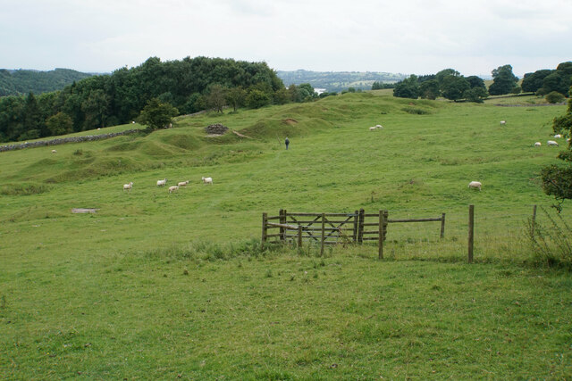
Images are sourced within 2km of 53.065425/-1.60538 or Grid Reference SK2652. Thanks to Geograph Open Source API. All images are credited.

Path to Hopton There is a clear line of former mine workings, though the land is all now given over to sheep. In the background is Carsington Water.
Path to Hopton
There is a clear line of former mine workings, though the land is all now given over to sheep. In the background is Carsington Water.
Hillside above Godfreyhole The land is used for grazing sheep but there are the remains of former mine workings.
Hillside above Godfreyhole
The land is used for grazing sheep but there are the remains of former mine workings.
Path through mine workings There are plenty of remains of spoil heaps but the land is now all grazed by sheep.
Path through mine workings
There are plenty of remains of spoil heaps but the land is now all grazed by sheep.
The northern end of Carsington Water This arm of the lake is fully grown over with rushes and other foliage. The visible water is not far away.
The northern end of Carsington Water
This arm of the lake is fully grown over with rushes and other foliage. The visible water is not far away.
Path towards Callow A steady uphill stretch. My walk instructions said head towards the holly tree. While you can't see the leaves, there is only one shape that could be a holly tree.
Path towards Callow
A steady uphill stretch. My walk instructions said head towards the holly tree. While you can't see the leaves, there is only one shape that could be a holly tree.
Sheep above Stainsborough Hall
Excavator on Rough Pitty Side The excavator is assisting work on shoring up a forestry path which had been liable to subsidence. It is seen through the trees from Stainsbro Lane with Wirksworth in the background.
Excavator on Rough Pitty Side
The excavator is assisting work on shoring up a forestry path which had been liable to subsidence. It is seen through the trees from Stainsbro Lane with Wirksworth in the background.
Stainsborough Hall As seen from Stainsborough Lane.
Stainsborough Hall
As seen from Stainsborough Lane.
Path to Stainsborough Lane The path from Wirksworth crosses fields with a few mining traces.
Path to Stainsborough Lane
The path from Wirksworth crosses fields with a few mining traces.
Path to Wirksworth The town is seen in the valley ahead.
Path to Wirksworth
The town is seen in the valley ahead.
Cattle above Wirksworth The ground is uneven and according to OS is the site of Yokecliffe Rake Mines. These lead mines would have been mined from the surface.
Cattle above Wirksworth
The ground is uneven and according to OS is the site of Yokecliffe Rake Mines. These lead mines would have been mined from the surface.
Greylag geese in a ridge and furrow field at Carsington Water
The road to Carsington from the west
The Rectory at Carsington
Rectory garden, Carsington Immaculate garden with a substantial statue
Rectory garden, Carsington
Immaculate garden with a substantial statue
Carsington village View across a field from Back Lane
Carsington village
View across a field from Back Lane
Sheepwash Cottage A pair of semi-detached cottages at the corner of Back Lane and Pringle Lane
Sheepwash Cottage
A pair of semi-detached cottages at the corner of Back Lane and Pringle Lane
Carsington Water path The circular route near Brown Ale Bay heading west. The route runs parallel with the B5035 at the northern end of the reservoir.
Carsington Water path
The circular route near Brown Ale Bay heading west. The route runs parallel with the B5035 at the northern end of the reservoir.
Show me another place!

Callow is located at Grid Ref: SK2652 (Lat: 53.065425, Lng: -1.60538)

Administrative County: Derbyshire

District: Derbyshire Dales

Police Authority: Derbyshire

What 3 Words

///stunning.occupations.units. Near Wirksworth, Derbyshire

Related Wikis

Callow, Derbyshire

Callow is a village and a civil parish in the Derbyshire Dales District, in the English county of Derbyshire. At the 2011 Census the population of the...

Kirk Ireton

Kirk Ireton is a village and civil parish in Derbyshire, England, 4 miles (6.4 km) southwest of Wirksworth on a hillside near Carsington Water, 700 feet...

Dream Cave

Dream Cave (sometimes called Dream Hole or Dream Mine) is a natural limestone cavern located near Wirksworth in Derbyshire, England. It was discovered...
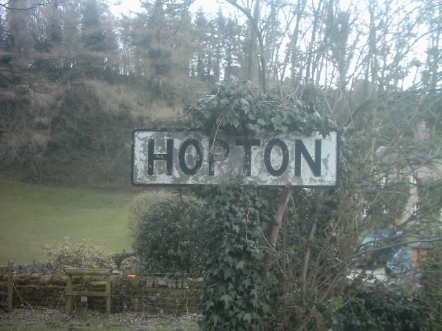
Hopton, Derbyshire

Hopton is a small village adjacent to the village of Carsington and two miles (3.2 km) from the market town of Wirksworth in the Peak District. Evidence...

Nearby Amenities

Located within 500m of 53.065425,-1.60538
Callow
Place: hamlet
Wikidata: Q2178025
Lat/Long: 53.0645637/-1.602324
Passing Place
Lat/Long: 53.0693686/-1.6035807
Barrier: stile
Ele: 232.0000000
Material: stone
Steps: 1
Stile: squeezer
Lat/Long: 53.0610257/-1.6039704
Barrier: stile
Ele: 226.0000000
Material: wood
Steps: 1
Stile: stepover
Lat/Long: 53.0619253/-1.6039632
Barrier: stile
Ele: 223.0000000
Material: stone
Stile: squeezer
Lat/Long: 53.0627578/-1.6042734
Barrier: stile
Ele: 241.0000000
Material: stone
Stile: squeezer
Lat/Long: 53.0650367/-1.6029802
Ele: 242.0000000
Lat/Long: 53.0651974/-1.602935
Barrier: stile
Ele: 256.0000000
Material: stone
Stile: squeezer
Lat/Long: 53.0666376/-1.6025674
Barrier: stile
Ele: 262.0000000
Material: stone
Stile: squeezer
Lat/Long: 53.0689599/-1.6037511
Barrier: stile
Stile: squeezer
Lat/Long: 53.0651583/-1.6029519
Power: pole
Lat/Long: 53.0673857/-1.6095024
Power: pole
Lat/Long: 53.0673502/-1.6088909
Power: pole
Lat/Long: 53.0671125/-1.6084819
Power: pole
Lat/Long: 53.0662084/-1.6085194
Power: pole
Lat/Long: 53.0653557/-1.6085717
Power: pole
Lat/Long: 53.0644491/-1.6085945
Power: pole
Lat/Long: 53.063578/-1.6086629
Power: pole
Lat/Long: 53.0627108/-1.6087018
Power: pole
Lat/Long: 53.061958/-1.6087648
The data included in this document is from www.openstreetmap.org. The data is made available under ODbL.

Have you been to Callow?

Leave your review of Callow below (or comments, questions and feedback).