Beaulieu Wood
Wood, Forest in Monmouthshire
Wales
Beaulieu Wood
![Monmouth buildings [35] Number 17 Glendower Street was built as a house in the early to mid 19th century. It became a police station in the late 19th century when the lower extension on the right was added. Constructed of rendered and painted brick under a Welsh slate roof. Listed, grade II, with details at: <span class="nowrap"><a title="https://cadwpublic-api.azurewebsites.net/reports/listedbuilding/FullReport?lang=&amp;id=2268" rel="nofollow ugc noopener" href="https://cadwpublic-api.azurewebsites.net/reports/listedbuilding/FullReport?lang=&amp;id=2268">Link</a><img style="margin-left:2px;" alt="External link" title="External link - shift click to open in new window" src="https://s1.geograph.org.uk/img/external.png" width="10" height="10"/></span>
Monmouth is a market town at the confluence of the Rivers Monnow and Wye some 30 miles northeast of Cardiff. Although there is evidence of settlement in the Neolithic period, the town was established around the Norman castle which was the birthplace of King Henry V. The historic county town of Monmouthshire, the town is now a centre for Wye Valley tourism.](https://s3.geograph.org.uk/geophotos/06/93/49/6934991_c93fb11e.jpg)
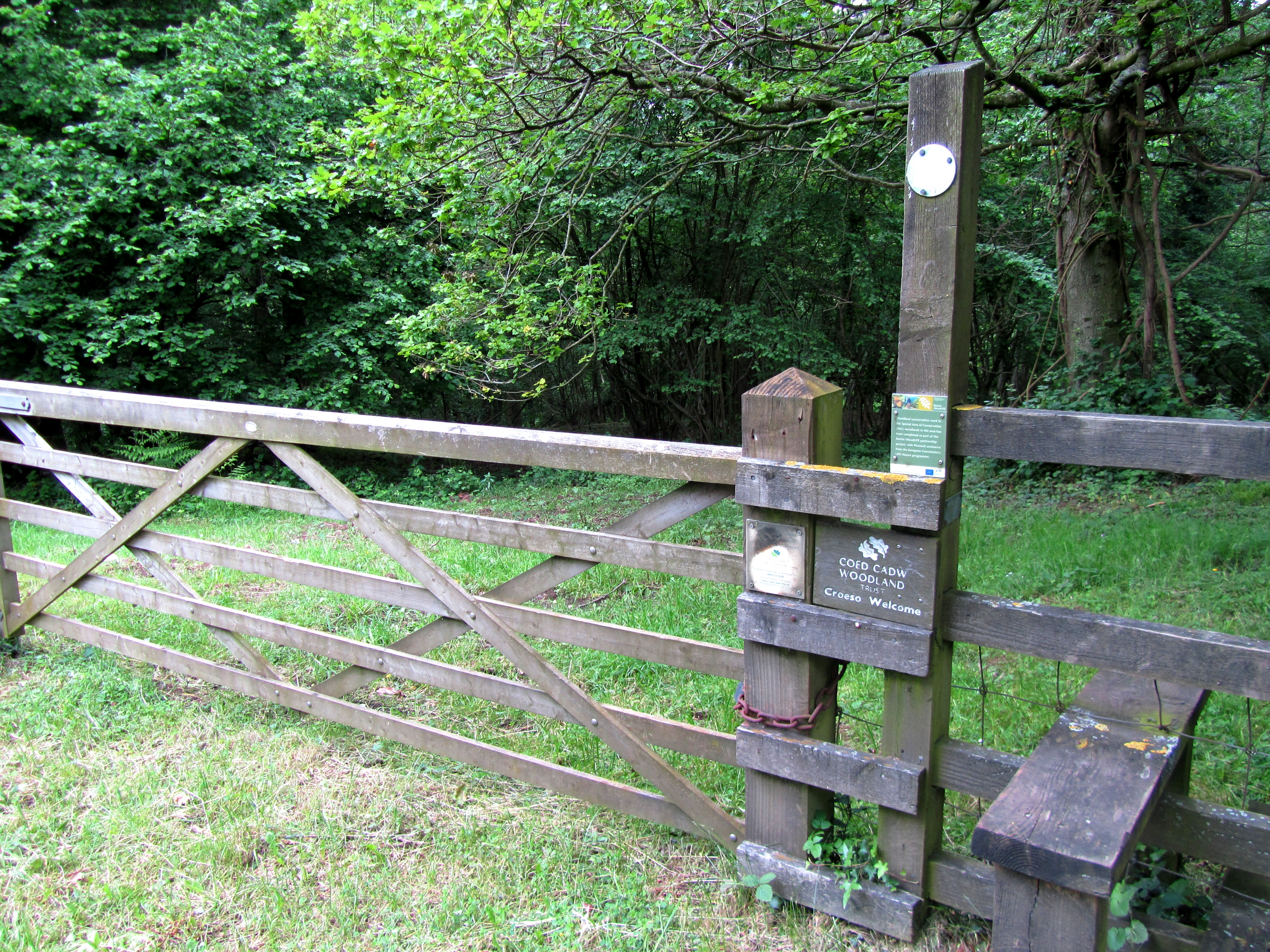
Beaulieu Wood is a sprawling woodland located in Monmouthshire, Wales. Covering an area of approximately 500 acres, it is a well-preserved forest that offers a serene and natural environment for visitors to enjoy. The wood is situated near the town of Usk and is easily accessible by car or on foot.
Beaulieu Wood is known for its diverse range of tree species, including oak, beech, and birch. These trees create a dense canopy, providing shade and shelter for a variety of wildlife. The wood is home to numerous bird species, such as woodpeckers, owls, and songbirds, making it a popular spot for birdwatching enthusiasts.
The woodland is crisscrossed with a network of footpaths and trails, allowing visitors to explore its beauty at their own pace. These paths offer an opportunity to take in the sights and sounds of nature, with occasional glimpses of wildlife along the way.
For those looking to delve deeper into the history and ecology of Beaulieu Wood, there are information boards placed strategically throughout the forest. These boards provide interesting facts about the flora and fauna found in the area, as well as the wood's significance within the local ecosystem.
Beaulieu Wood is a tranquil escape from the hustle and bustle of everyday life, offering visitors a chance to reconnect with nature. Whether it's a leisurely stroll, a picnic, or birdwatching, this woodland has something for everyone to enjoy.
If you have any feedback on the listing, please let us know in the comments section below.
Beaulieu Wood Images
Images are sourced within 2km of 51.812347/-2.6851542 or Grid Reference SO5212. Thanks to Geograph Open Source API. All images are credited.
![Monmouth houses [19] Corner Cottage, number 1 Almshouse Street, has a blue plaque which reads &quot;These cottages appear on John Speed&#039;s map of Monmouth dated 1610.&quot; However, these cottages would seem to be late 18th or early 19th century.
Monmouth is a market town at the confluence of the Rivers Monnow and Wye some 30 miles northeast of Cardiff. Although there is evidence of settlement in the Neolithic period, the town was established around the Norman castle which was the birthplace of King Henry V. The historic county town of Monmouthshire, the town is now a centre for Wye Valley tourism.](https://s3.geograph.org.uk/geophotos/06/93/50/6935003_2acf657b.jpg)
![Monmouth buildings [37] These delightful almshouses were built in 1843 to replace the almshouses of 1616 which were a part of the Haberdashers Company foundation together with Monmouth Boys School. Now used as offices, they were incorporated into the school in 1961 when they were replaced by the almshouses in Whitecross Street. Constructed of red sandstone with Bath stone dressings and a Welsh slate roof. See also <a href="https://www.geograph.org.uk/photo/6935018">SO5012 : Monmouth buildings [38]</a>. Listed, grade II, with details at: <span class="nowrap"><a title="https://cadwpublic-api.azurewebsites.net/reports/listedbuilding/FullReport?lang=&amp;id=2245" rel="nofollow ugc noopener" href="https://cadwpublic-api.azurewebsites.net/reports/listedbuilding/FullReport?lang=&amp;id=2245">Link</a><img style="margin-left:2px;" alt="External link" title="External link - shift click to open in new window" src="https://s1.geograph.org.uk/img/external.png" width="10" height="10"/></span>
Monmouth is a market town at the confluence of the Rivers Monnow and Wye some 30 miles northeast of Cardiff. Although there is evidence of settlement in the Neolithic period, the town was established around the Norman castle which was the birthplace of King Henry V. The historic county town of Monmouthshire, the town is now a centre for Wye Valley tourism.](https://s0.geograph.org.uk/geophotos/06/93/50/6935016_91b10294.jpg)
![Monmouth buildings [38] A niche in the gable end of the almshouses seen at <a href="https://www.geograph.org.uk/photo/6935016">SO5012 : Monmouth buildings [37]</a> which reads &#039;These alms-houses were founded A.D.1616 by Mr. William Jones Citizen and Haberdasher of London. Rebuilt by the Governors the Worshipful Company of Haberdashers London 1842 Thomas Howell Esq. Master J B Bunning Archt.&#039;
Now used as offices, the almshouses were incorporated into Monmouth Boys School in 1961 when they were replaced by the almshouses in Whitecross Street. Constructed of red sandstone with Bath stone dressings and a Welsh slate roof.
Listed, grade II, with details at: <span class="nowrap"><a title="https://cadwpublic-api.azurewebsites.net/reports/listedbuilding/FullReport?lang=&amp;id=2245" rel="nofollow ugc noopener" href="https://cadwpublic-api.azurewebsites.net/reports/listedbuilding/FullReport?lang=&amp;id=2245">Link</a><img style="margin-left:2px;" alt="External link" title="External link - shift click to open in new window" src="https://s1.geograph.org.uk/img/external.png" width="10" height="10"/></span>
Monmouth is a market town at the confluence of the Rivers Monnow and Wye some 30 miles northeast of Cardiff. Although there is evidence of settlement in the Neolithic period, the town was established around the Norman castle which was the birthplace of King Henry V. The historic county town of Monmouthshire, the town is now a centre for Wye Valley tourism.](https://s2.geograph.org.uk/geophotos/06/93/50/6935018_d9d27b7a.jpg)
![Monmouth buildings [39] The original schoolroom and the chapel of Monmouth Boys School. These buildings of 1865 replaced those of the 1614 Free Grammar School which was completely demolished. The original schoolroom, now the Library, is set back behind a low screen carrying a large inscription panel with the Haberdashers&#039; arms and shields above (see <a href="https://www.geograph.org.uk/photo/6935030">SO5112 : Monmouth buildings [40]</a>). The chapel, on the left, has an apron which carries the foundation stone (possibly reset). Constructed of rock faced red sandstone with Bath stone dressings and Welsh slate roofs. Listed, grade II, with details at: <span class="nowrap"><a title="https://cadwpublic-api.azurewebsites.net/reports/listedbuilding/FullReport?lang=&amp;id=85214" rel="nofollow ugc noopener" href="https://cadwpublic-api.azurewebsites.net/reports/listedbuilding/FullReport?lang=&amp;id=85214">Link</a><img style="margin-left:2px;" alt="External link" title="External link - shift click to open in new window" src="https://s1.geograph.org.uk/img/external.png" width="10" height="10"/></span>
Monmouth is a market town at the confluence of the Rivers Monnow and Wye some 30 miles northeast of Cardiff. Although there is evidence of settlement in the Neolithic period, the town was established around the Norman castle which was the birthplace of King Henry V. The historic county town of Monmouthshire, the town is now a centre for Wye Valley tourism.](https://s2.geograph.org.uk/geophotos/06/93/50/6935026_8b585eec.jpg)
![Monmouth buildings [40] The inscription panel on the low screen in front of the original schoolroom, now the Library, of Monmouth Boys School. See <a href="https://www.geograph.org.uk/photo/6935026">SO5112 : Monmouth buildings [39]</a>. These buildings of 1865 replaced those of the 1614 Free Grammar School which was completely demolished.
Listed, grade II, with details at: <span class="nowrap"><a title="https://cadwpublic-api.azurewebsites.net/reports/listedbuilding/FullReport?lang=&amp;id=85214" rel="nofollow ugc noopener" href="https://cadwpublic-api.azurewebsites.net/reports/listedbuilding/FullReport?lang=&amp;id=85214">Link</a><img style="margin-left:2px;" alt="External link" title="External link - shift click to open in new window" src="https://s1.geograph.org.uk/img/external.png" width="10" height="10"/></span>
Monmouth is a market town at the confluence of the Rivers Monnow and Wye some 30 miles northeast of Cardiff. Although there is evidence of settlement in the Neolithic period, the town was established around the Norman castle which was the birthplace of King Henry V. The historic county town of Monmouthshire, the town is now a centre for Wye Valley tourism.](https://s2.geograph.org.uk/geophotos/06/93/50/6935030_09c2210f.jpg)
![Monmouth buildings [41] Monmouth Boys School seen from the river side of the A40 road.
On the right along Wyebridge Street are the Tudorbethan style buildings of 1878 between the Design and Technology Centre and Almshouse Street, with the return meeting the earlier buildings seen at <a href="https://www.geograph.org.uk/photo/6935026">SO5112 : Monmouth buildings [39]</a>. Built of rock faced red sandstone rubble with Bath stone dressings and Welsh slate roofs. Listed, grade II, with details at: <span class="nowrap"><a title="https://cadwpublic-api.azurewebsites.net/reports/listedbuilding/FullReport?lang=&amp;id=85182" rel="nofollow ugc noopener" href="https://cadwpublic-api.azurewebsites.net/reports/listedbuilding/FullReport?lang=&amp;id=85182">Link</a><img style="margin-left:2px;" alt="External link" title="External link - shift click to open in new window" src="https://s1.geograph.org.uk/img/external.png" width="10" height="10"/></span>
In the centre is the Elizabethan style Design and Technology Centre of 1896 with a coat-of-arms and octagonal corner turret. Built of rock faced red sandstone rubble with Bath stone dressings and Welsh slate roofs. Listed, grade II, with details at: <span class="nowrap"><a title="https://cadwpublic-api.azurewebsites.net/reports/listedbuilding/FullReport?lang=&amp;id=85187" rel="nofollow ugc noopener" href="https://cadwpublic-api.azurewebsites.net/reports/listedbuilding/FullReport?lang=&amp;id=85187">Link</a><img style="margin-left:2px;" alt="External link" title="External link - shift click to open in new window" src="https://s1.geograph.org.uk/img/external.png" width="10" height="10"/></span>
Monmouth is a market town at the confluence of the Rivers Monnow and Wye some 30 miles northeast of Cardiff. Although there is evidence of settlement in the Neolithic period, the town was established around the Norman castle which was the birthplace of King Henry V. The historic county town of Monmouthshire, the town is now a centre for Wye Valley tourism.](https://s3.geograph.org.uk/geophotos/06/93/50/6935043_65fe4e9d.jpg)
![Monmouth features [21] Wye Bridge carries the A466 road over the River Wye. On the same site as its medieval predecessors, the current bridge was built in 1615 and widened in 1879. Constructed of red and buff sandstone ashlar with much patching. Five arched spans with the original pointed arches visible beneath but with both faces covered by segmental arches carried on the sharply pointed cutwaters. Listed, grade II, with details at: <span class="nowrap"><a title="https://cadwpublic-api.azurewebsites.net/reports/listedbuilding/FullReport?lang=&amp;id=2220" rel="nofollow ugc noopener" href="https://cadwpublic-api.azurewebsites.net/reports/listedbuilding/FullReport?lang=&amp;id=2220">Link</a><img style="margin-left:2px;" alt="External link" title="External link - shift click to open in new window" src="https://s1.geograph.org.uk/img/external.png" width="10" height="10"/></span>
Monmouth is a market town at the confluence of the Rivers Monnow and Wye some 30 miles northeast of Cardiff. Although there is evidence of settlement in the Neolithic period, the town was established around the Norman castle which was the birthplace of King Henry V. The historic county town of Monmouthshire, the town is now a centre for Wye Valley tourism.](https://s2.geograph.org.uk/geophotos/06/93/50/6935050_4b3c0d65.jpg)
![Monmouth buildings [42] The Queen&#039;s Head public house is dated 1630 and the building was partly rebuilt and greatly restored in 1922. On a corner site with fronts to St James&#039; Street and to Wyebridge Street. The jettied, gabled, timber framed cross wing to St James&#039; Street is 17th century. The rest of the building is constructed of rendered brick with applied timber framing, all under a Welsh slate roof. Listed, grade II, with details at: <span class="nowrap"><a title="https://cadwpublic-api.azurewebsites.net/reports/listedbuilding/FullReport?lang=&amp;id=2330" rel="nofollow ugc noopener" href="https://cadwpublic-api.azurewebsites.net/reports/listedbuilding/FullReport?lang=&amp;id=2330">Link</a><img style="margin-left:2px;" alt="External link" title="External link - shift click to open in new window" src="https://s1.geograph.org.uk/img/external.png" width="10" height="10"/></span>
Monmouth is a market town at the confluence of the Rivers Monnow and Wye some 30 miles northeast of Cardiff. Although there is evidence of settlement in the Neolithic period, the town was established around the Norman castle which was the birthplace of King Henry V. The historic county town of Monmouthshire, the town is now a centre for Wye Valley tourism.](https://s0.geograph.org.uk/geophotos/06/93/58/6935864_858f037e.jpg)
![Monmouth houses [20] Number 3 St James&#039; Street is an early or mid 18th century house, remodelled circa 1800. Converted into offices in the mid 20th century and later re-converted into flats. Constructed of rendered brick under a Welsh slate roof. Listed, grade II, with details at: <span class="nowrap"><a title="https://cadwpublic-api.azurewebsites.net/reports/listedbuilding/FullReport?lang=&amp;id=2331" rel="nofollow ugc noopener" href="https://cadwpublic-api.azurewebsites.net/reports/listedbuilding/FullReport?lang=&amp;id=2331">Link</a><img style="margin-left:2px;" alt="External link" title="External link - shift click to open in new window" src="https://s1.geograph.org.uk/img/external.png" width="10" height="10"/></span>
Monmouth is a market town at the confluence of the Rivers Monnow and Wye some 30 miles northeast of Cardiff. Although there is evidence of settlement in the Neolithic period, the town was established around the Norman castle which was the birthplace of King Henry V. The historic county town of Monmouthshire, the town is now a centre for Wye Valley tourism.](https://s1.geograph.org.uk/geophotos/06/93/58/6935865_652411b1.jpg)
![Monmouth houses [21] Number 5 St James&#039; Street is an early or mid 18th century house, remodelled circa 1800. Constructed of red brick under a Welsh slate roof. There is a 19th century rear extension. Converted into flats in the 20th century. Listed, grade II, with details at: <span class="nowrap"><a title="https://cadwpublic-api.azurewebsites.net/reports/listedbuilding/FullReport?lang=&amp;id=2332" rel="nofollow ugc noopener" href="https://cadwpublic-api.azurewebsites.net/reports/listedbuilding/FullReport?lang=&amp;id=2332">Link</a><img style="margin-left:2px;" alt="External link" title="External link - shift click to open in new window" src="https://s1.geograph.org.uk/img/external.png" width="10" height="10"/></span>
Monmouth is a market town at the confluence of the Rivers Monnow and Wye some 30 miles northeast of Cardiff. Although there is evidence of settlement in the Neolithic period, the town was established around the Norman castle which was the birthplace of King Henry V. The historic county town of Monmouthshire, the town is now a centre for Wye Valley tourism.](https://s2.geograph.org.uk/geophotos/06/93/58/6935866_14782b0b.jpg)
![Monmouth buildings [43] Number 7 St James&#039; Street was built in the early or mid 18th century and the fenestration changed circa 1800. Constructed of red brick under a Welsh slate roof. The building is now clubrooms on the ground floor with flats above. Listed, grade II, with details at: <span class="nowrap"><a title="https://cadwpublic-api.azurewebsites.net/reports/listedbuilding/FullReport?lang=&amp;id=2333" rel="nofollow ugc noopener" href="https://cadwpublic-api.azurewebsites.net/reports/listedbuilding/FullReport?lang=&amp;id=2333">Link</a><img style="margin-left:2px;" alt="External link" title="External link - shift click to open in new window" src="https://s1.geograph.org.uk/img/external.png" width="10" height="10"/></span>
Monmouth is a market town at the confluence of the Rivers Monnow and Wye some 30 miles northeast of Cardiff. Although there is evidence of settlement in the Neolithic period, the town was established around the Norman castle which was the birthplace of King Henry V. The historic county town of Monmouthshire, the town is now a centre for Wye Valley tourism.](https://s0.geograph.org.uk/geophotos/06/93/58/6935868_88d2caa5.jpg)
![Monmouth houses [22] Number 9 St James&#039; Street is an early or mid 18th century house with the fenestration altered in the 19th century. Constructed of rendered and painted brick under a Welsh slate roof. Some original internal features remain. Listed, grade II, with details at: <span class="nowrap"><a title="https://cadwpublic-api.azurewebsites.net/reports/listedbuilding/FullReport?lang=&amp;id=2334" rel="nofollow ugc noopener" href="https://cadwpublic-api.azurewebsites.net/reports/listedbuilding/FullReport?lang=&amp;id=2334">Link</a><img style="margin-left:2px;" alt="External link" title="External link - shift click to open in new window" src="https://s1.geograph.org.uk/img/external.png" width="10" height="10"/></span>
Monmouth is a market town at the confluence of the Rivers Monnow and Wye some 30 miles northeast of Cardiff. Although there is evidence of settlement in the Neolithic period, the town was established around the Norman castle which was the birthplace of King Henry V. The historic county town of Monmouthshire, the town is now a centre for Wye Valley tourism.](https://s2.geograph.org.uk/geophotos/06/93/58/6935870_8c3119c7.jpg)
![Monmouth buildings [44] This delightful little building at number 10 St James&#039; Street is used as a dental practice. Constructed in red brick under a slate roof.
Monmouth is a market town at the confluence of the Rivers Monnow and Wye some 30 miles northeast of Cardiff. Although there is evidence of settlement in the Neolithic period, the town was established around the Norman castle which was the birthplace of King Henry V. The historic county town of Monmouthshire, the town is now a centre for Wye Valley tourism.](https://s2.geograph.org.uk/geophotos/06/93/58/6935878_e019083e.jpg)
![Monmouth houses [23] Numbers 11 and 13 St James&#039; Street are late 18th century perhaps incorporating earlier structures. Constructed of rendered brick, lined to simulate ashlar under a slate roof. Unusually, the central chimney stack has angled corner fireplaces in both houses. Listed, grade II, with details at: <span class="nowrap"><a title="https://cadwpublic-api.azurewebsites.net/reports/listedbuilding/FullReport?lang=&amp;id=85029" rel="nofollow ugc noopener" href="https://cadwpublic-api.azurewebsites.net/reports/listedbuilding/FullReport?lang=&amp;id=85029">Link</a><img style="margin-left:2px;" alt="External link" title="External link - shift click to open in new window" src="https://s1.geograph.org.uk/img/external.png" width="10" height="10"/></span>
Monmouth is a market town at the confluence of the Rivers Monnow and Wye some 30 miles northeast of Cardiff. Although there is evidence of settlement in the Neolithic period, the town was established around the Norman castle which was the birthplace of King Henry V. The historic county town of Monmouthshire, the town is now a centre for Wye Valley tourism.](https://s3.geograph.org.uk/geophotos/06/93/58/6935887_77851135.jpg)
![Monmouth houses [24] Numbers 15 and 17 St James&#039; Street are a pair of early 19th century houses. Constructed of red brick under a slate roof. Number 17 is used as offices. Listed, grade II, with details at: <span class="nowrap"><a title="https://cadwpublic-api.azurewebsites.net/reports/listedbuilding/FullReport?lang=&amp;id=2336" rel="nofollow ugc noopener" href="https://cadwpublic-api.azurewebsites.net/reports/listedbuilding/FullReport?lang=&amp;id=2336">Link</a><img style="margin-left:2px;" alt="External link" title="External link - shift click to open in new window" src="https://s1.geograph.org.uk/img/external.png" width="10" height="10"/></span>
Monmouth is a market town at the confluence of the Rivers Monnow and Wye some 30 miles northeast of Cardiff. Although there is evidence of settlement in the Neolithic period, the town was established around the Norman castle which was the birthplace of King Henry V. The historic county town of Monmouthshire, the town is now a centre for Wye Valley tourism.](https://s2.geograph.org.uk/geophotos/06/93/59/6935902_e938380a.jpg)
![Monmouth houses [25] Number 16 St James&#039; Street is probably a late 18th century house. Constructed of stuccoed brick under a Welsh slate roof with a fine timber Roman Doric doorcase. For many years the building was part of The Grange preparatory school and is now accommodation for boarders at Monmouth Boys School. Listed, grade II, with details at: <span class="nowrap"><a title="https://cadwpublic-api.azurewebsites.net/reports/listedbuilding/FullReport?lang=&amp;id=2341" rel="nofollow ugc noopener" href="https://cadwpublic-api.azurewebsites.net/reports/listedbuilding/FullReport?lang=&amp;id=2341">Link</a><img style="margin-left:2px;" alt="External link" title="External link - shift click to open in new window" src="https://s1.geograph.org.uk/img/external.png" width="10" height="10"/></span>
Monmouth is a market town at the confluence of the Rivers Monnow and Wye some 30 miles northeast of Cardiff. Although there is evidence of settlement in the Neolithic period, the town was established around the Norman castle which was the birthplace of King Henry V. The historic county town of Monmouthshire, the town is now a centre for Wye Valley tourism.](https://s0.geograph.org.uk/geophotos/06/93/59/6935908_c51fc152.jpg)
![Monmouth buildings [45] Well set back from St James&#039; Street between numbers 16 and 16A is this Methodist chapel. Built in 1837, the chapel was altered in 1885 and in 1993. Constructed of stuccoed and painted brick under a Welsh slate roof. The interior is almost unaltered from the original features and fittings. Listed, grade II*, with details at: <span class="nowrap"><a title="https://cadwpublic-api.azurewebsites.net/reports/listedbuilding/FullReport?lang=&amp;id=2342" rel="nofollow ugc noopener" href="https://cadwpublic-api.azurewebsites.net/reports/listedbuilding/FullReport?lang=&amp;id=2342">Link</a><img style="margin-left:2px;" alt="External link" title="External link - shift click to open in new window" src="https://s1.geograph.org.uk/img/external.png" width="10" height="10"/></span>
Monmouth is a market town at the confluence of the Rivers Monnow and Wye some 30 miles northeast of Cardiff. Although there is evidence of settlement in the Neolithic period, the town was established around the Norman castle which was the birthplace of King Henry V. The historic county town of Monmouthshire, the town is now a centre for Wye Valley tourism.](https://s2.geograph.org.uk/geophotos/06/93/59/6935910_b1bd958b.jpg)
Beaulieu Wood is located at Grid Ref: SO5212 (Lat: 51.812347, Lng: -2.6851542)
Unitary Authority: Monmouthshire
Police Authority: Gwent
What 3 Words
///curious.lock.lighters. Near Monmouth, Monmouthshire
Nearby Locations
Related Wikis

The Kymin
The Kymin (Welsh: Cae-y-Maen), is a hill overlooking Monmouth, in Monmouthshire, Wales. It is located approximately one mile east of Monmouth, on the eastern...
Fiddler's Elbow National Nature Reserve
Fiddler's Elbow National Nature Reserve is a steep sided, woodland national nature reserve of 45 hectares in the Upper Wye Valley to the north of Monmouth...

Wyesham
Wyesham is a village and electoral ward in Monmouthshire, Wales. It is located less than one mile east of Monmouth, on the opposite side of the River Wye...
Dixton
Dixton (Welsh: Llandydiwg) is a small village located 1 mile (1.6 km) north east of Monmouth, on the banks of the River Wye, in Monmouthshire, south east...
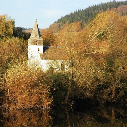
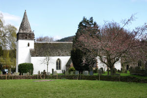
St Peter's Church, Dixton
St Peter's Church is a Church of England parish church at Dixton in Wales. It is situated on the banks of the River Wye, about 1 mile (1.6 km) north-east...
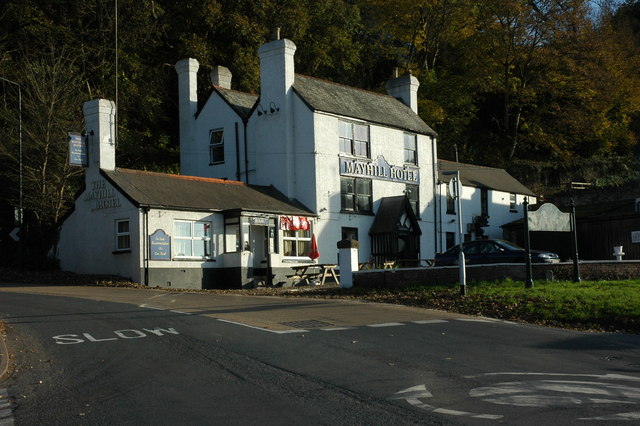
The Mayhill Hotel
The Mayhill Hotel is a public house and hotel located Wyesham Road, Monmouth, Wales. The pub is situated between the roads leading to Wyesham and the Forest...

Monmouth Gasworks
Monmouth Gasworks was the facility for making town gas in Monmouth, Wales. The gasworks had its coal delivered by the Coleford, Monmouth, Usk and Pontypool...

Harper's Grove – Lord's Grove
Harper's Grove – Lord's Grove is a Site of Special Scientific Interest (SSSI), noted for its biological characteristics, in Monmouthshire, south east Wales...
Nearby Amenities
Located within 500m of 51.812347,-2.6851542Have you been to Beaulieu Wood?
Leave your review of Beaulieu Wood below (or comments, questions and feedback).