Bigs Wood

Wood, Forest in Monmouthshire

Wales

Bigs Wood

View from The Alcove in Alcove Wood This is another welcome viewpoint on the Wye Valley Walk, just outside Chepstow and offers an excellent perspective on the castle, River Wye and the Lancaut peninsula.
View from The Alcove in Alcove Wood Credit: Jeremy Bolwell

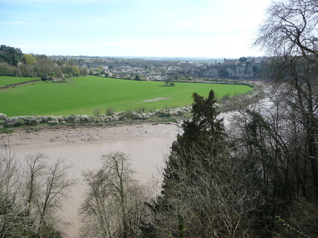
Bigs Wood, located in Monmouthshire, is a picturesque woodland area renowned for its natural beauty and rich biodiversity. Spanning over a significant area, this forest is a haven for nature enthusiasts and outdoor adventurers alike.

The wood is predominantly comprised of broadleaf trees, including oak, beech, and chestnut, which provide a vibrant and diverse canopy overhead. Its dense undergrowth of ferns, mosses, and wildflowers further adds to the beauty of the woodland floor, creating a lush and enchanting atmosphere.

Bigs Wood is home to a plethora of wildlife, making it an excellent spot for birdwatching and animal spotting. Visitors may catch sight of buzzards soaring above, woodpeckers diligently hammering on tree trunks, or even the elusive red deer that roam freely within the forest. The tranquil environment also attracts a variety of smaller creatures, such as squirrels, foxes, and rabbits.

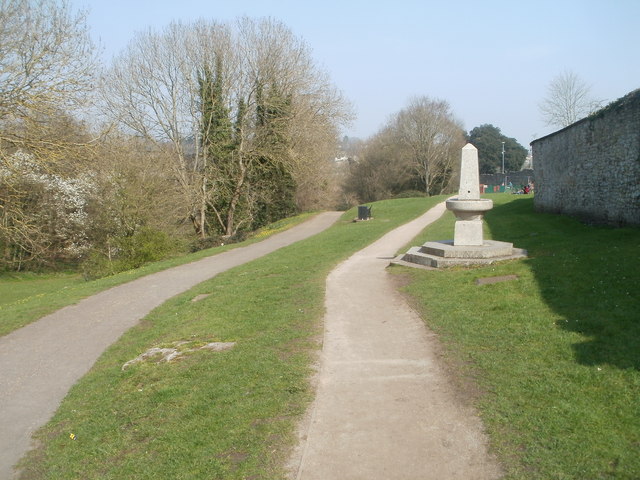
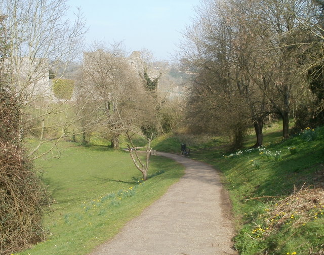
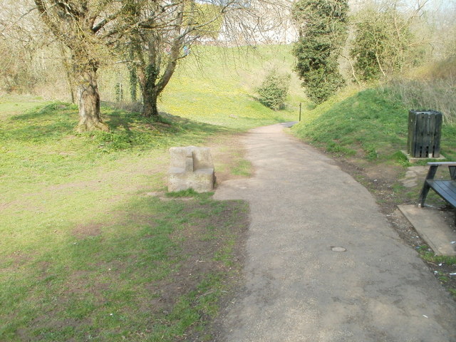
For those seeking outdoor activities, Bigs Wood offers several walking trails that wind through its enchanting landscape. These trails vary in length and difficulty, catering to both casual walkers and more experienced hikers. Along the way, visitors can enjoy breathtaking views, peaceful streams, and charming picnic spots.

Bigs Wood is a cherished natural treasure in Monmouthshire, attracting visitors from far and wide. Its serene ambiance, diverse flora and fauna, and accessibility make it a must-visit destination for anyone seeking solace in nature.

If you have any feedback on the listing, please let us know in the comments section below.
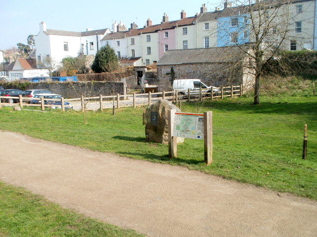
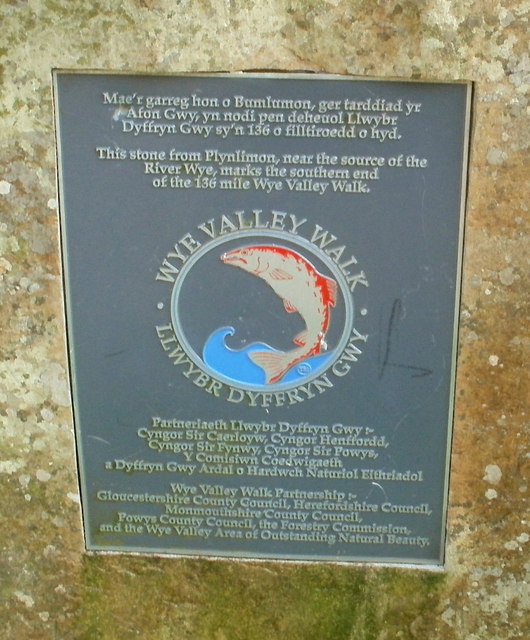
Bigs Wood Images

Images are sourced within 2km of 51.6337/-2.6957798 or Grid Reference ST5192. Thanks to Geograph Open Source API. All images are credited.

View from The Alcove in Alcove Wood This is another welcome viewpoint on the Wye Valley Walk, just outside Chepstow and offers an excellent perspective on the castle, River Wye and the Lancaut peninsula.
View from The Alcove in Alcove Wood
This is another welcome viewpoint on the Wye Valley Walk, just outside Chepstow and offers an excellent perspective on the castle, River Wye and the Lancaut peninsula.
Chepstow Castle entrance A very impressive statement of Norman power and a great feature in Chepstow town.
Chepstow Castle entrance
A very impressive statement of Norman power and a great feature in Chepstow town.
Reaching the Winning Post, Chepstow Racecourse
Two paths through Castle Dell, Chepstow Viewed from the Welsh Street side. Castle Dell is a parklike area adjacent to Chepstow Castle on the south bank of the River Wye. On the right is a drinking fountain. <a title="https://www.geograph.org.uk/photo/545582" href="https://www.geograph.org.uk/photo/545582">Link</a>
Two paths through Castle Dell, Chepstow
Viewed from the Welsh Street side. Castle Dell is a parklike area adjacent to Chepstow Castle on the south bank of the River Wye. On the right is a drinking fountain. Link
Path through Castle Dell, Chepstow This is the central section of Castle Dell, which was opened to the public in 1886 when the Duke of Beaufort leased it to the town for one shilling a year.
Faintly visible in the background is Chepstow Castle, on the south bank of the River Wye.
Path through Castle Dell, Chepstow
This is the central section of Castle Dell, which was opened to the public in 1886 when the Duke of Beaufort leased it to the town for one shilling a year. Faintly visible in the background is Chepstow Castle, on the south bank of the River Wye.
SW corner of Chepstow Castle Viewed from Castle Dell.
SW corner of Chepstow Castle
Viewed from Castle Dell.
Southern wall of Chepstow Castle Part of the long southern wall, viewed from Castle Dell.
Southern wall of Chepstow Castle
Part of the long southern wall, viewed from Castle Dell.
Stone seat, Castle Dell, Chepstow On the left side of the path through Castle Dell is a stone seat made by stonemason John Hobbs to mark the diamond jubilee of Queen Victoria in 1897.
Stone seat, Castle Dell, Chepstow
On the left side of the path through Castle Dell is a stone seat made by stonemason John Hobbs to mark the diamond jubilee of Queen Victoria in 1897.
Southern end of Wye Valley Walk, Chepstow The large stone <a title="https://www.geograph.org.uk/photo/2365731" href="https://www.geograph.org.uk/photo/2365731">Link</a> next to an information board in Castle Dell marks the southern end of the 136 mile Wye Valley Walk.
Southern end of Wye Valley Walk, Chepstow
The large stone Link next to an information board in Castle Dell marks the southern end of the 136 mile Wye Valley Walk.
Plaque on stone at southern end of Wye Valley Walk, Chepstow The plaque, in Welsh and English, records that the stone <a title="https://www.geograph.org.uk/photo/2365712" href="https://www.geograph.org.uk/photo/2365712">Link</a> to which it is fixed, is from Plynlimon, near the source of the River Wye. It marks the southern end of the 136 mile (219 km) Wye Valley Walk. The Wye empties into the Severn at Beachley Point, about 4 kilometres to the SSE.
Plaque on stone at southern end of Wye Valley Walk, Chepstow
The plaque, in Welsh and English, records that the stone Link to which it is fixed, is from Plynlimon, near the source of the River Wye. It marks the southern end of the 136 mile (219 km) Wye Valley Walk. The Wye empties into the Severn at Beachley Point, about 4 kilometres to the SSE.
Former Chepstow Board School Set back from the east side of Bridge Street is the former Chepstow Board School which opened in 1878. The school, for girls and infants, was constructed by local builder Cuthbert Whalley for Chepstow School Board.
The Elementary Education Act of 1870 required the provision of a school place for every child aged from 5 to 12. Locally elected committees (School Boards) were empowered to build additional schools if needed.
Former Chepstow Board School
Set back from the east side of Bridge Street is the former Chepstow Board School which opened in 1878. The school, for girls and infants, was constructed by local builder Cuthbert Whalley for Chepstow School Board. The Elementary Education Act of 1870 required the provision of a school place for every child aged from 5 to 12. Locally elected committees (School Boards) were empowered to build additional schools if needed.
Former Glance Back shop, Chepstow Located on the corner of Middle Street and Upper Church Street, viewed from Bridge Street. The shop closed on October 31st 2004, when the owners decided to focus entirely on an Internet presence. Glance Back had opened here in 1983, dealing in antiquarian and secondhand books, and a variety of collectables such as stamps, banknotes, coins, tokens, medals and badges.
Former Glance Back shop, Chepstow
Located on the corner of Middle Street and Upper Church Street, viewed from Bridge Street. The shop closed on October 31st 2004, when the owners decided to focus entirely on an Internet presence. Glance Back had opened here in 1983, dealing in antiquarian and secondhand books, and a variety of collectables such as stamps, banknotes, coins, tokens, medals and badges.
Late Georgian houses, Bridge Street, Chepstow The houses at the SW end of Bridge Street date from about 1800. The white building was formerly The Vicarage.
Late Georgian houses, Bridge Street, Chepstow
The houses at the SW end of Bridge Street date from about 1800. The white building was formerly The Vicarage.
Restway Wall, Garden City Way, Chepstow Part of a complex of retirement properties.
Restway Wall, Garden City Way, Chepstow
Part of a complex of retirement properties.
Portwall Road, Garden City, Chepstow
Daisies decorate Piggies Hill, Garden City, Chepstow
Junction of Hardwick Avenue, Rockwood Road and Garden City Way, Chepstow
Start of footpath from Rockwood Road to Wye Crescent, Garden City, Chepstow
Show me another place!

Bigs Wood is located at Grid Ref: ST5192 (Lat: 51.6337, Lng: -2.6957798)

Unitary Authority: Monmouthshire

Police Authority: Gwent

What 3 Words

///stolen.whom.simmer. Near Chepstow, Monmouthshire

Nearby Locations

Bigs Wood

Related Wikis

Pwllmeyric

Pwllmeyric (Welsh: Pwllmeurig) is a small village in Monmouthshire, Wales, located 1 mile south west of Chepstow, on the A48 road within the parish of...

Mounton

Mounton is a hamlet in Monmouthshire, south east Wales, United Kingdom, located two miles west of Chepstow in a rural setting. The parish was originally...

Mounton House

Mounton House, Mounton, Monmouthshire, Wales, is the last major country house built in the county, constructed between 1910 and 1912 by the architect and...

St Lawrence Hospital, Chepstow

St Lawrence Hospital (Welsh: Ysbyty St Lawrence) was a specialist plastic surgery and burns hospital on the west side of St Lawrence Road in Chepstow,...

Chepstow Town F.C.

Chepstow Town Football Club are a Welsh football club based in Chepstow, South East Wales and founded in 1878. The team play in the Ardal Leagues South...

Chepstow Community Hospital

Chepstow Community Hospital (Welsh: Ysbyty Cymunedol Cas-gwent) is a community hospital located on the east side of St Lawrence Road in Chepstow, Monmouthshire...

Wyelands

Wyelands, sometimes styled The Wyelands or Wyelands House, is a Grade II* listed building and estate located about 1 mile (1.6 km) north of the village...

Larkfield (electoral ward)

Larkfield is an electoral ward in Chepstow, Monmouthshire. The ward elects councillors to Chepstow Town Council and Monmouthshire County Council. The ward...

Nearby Amenities

Located within 500m of 51.6337,-2.6957798
Post Box
Operator: Royal Mail
Operator Wikidata: Q638098
Lat/Long: 51.6305591/-2.6916165
Post Box
Brand: Royal Mail
Brand Wikidata: Q638098
Operator: Royal Mail
Operator Wikidata: Q638098
Post Box Mounting: stone_wall
Post Box Type: wall
Lat/Long: 51.6297247/-2.6957591
Bus Stop
Pwllmeyric
Bus: yes
Public Transport: platform
Shelter: no
Tactile Paving: yes
Lat/Long: 51.629726/-2.6944646
Bus Stop
Pwllmeyric
Bus: yes
Public Transport: platform
Shelter: yes
Tactile Paving: yes
Lat/Long: 51.6303266/-2.6938833
Barrier: stile
Lat/Long: 51.6376224/-2.6976961
Barrier: stile
Lat/Long: 51.6377096/-2.6977364
Addr City: Chepstow
Addr Housename: Mounton House School
Addr Postcode: NP16 6LA
Addr Street: Pwllmeyric
Check Date: 2020-07-22
Disused Amenity: school
Old Name: Mounton House School
Website: https://www.mountonhouse.org.uk/
Lat/Long: 51.6342452/-2.7001421
Power: pole
Lat/Long: 51.6320786/-2.6901162
Power: pole
Lat/Long: 51.6313627/-2.6920259
Power: pole
Lat/Long: 51.6314359/-2.694751
Power: pole
Lat/Long: 51.6311412/-2.6962665
Power: pole
Lat/Long: 51.6308415/-2.6977149
Power: pole
Lat/Long: 51.6305602/-2.6991606
Direction: S
Generator Method: photovoltaic
Generator Output Electricity: yes
Generator Solar Modules: 16
Generator Source: solar
Generator Type: solar_photovoltaic_panel
Location: roof
Power: generator
Lat/Long: 51.6379287/-2.6952936
The data included in this document is from www.openstreetmap.org. The data is made available under ODbL.

Have you been to Bigs Wood?

Leave your review of Bigs Wood below (or comments, questions and feedback).