Briers Grove

Wood, Forest in Monmouthshire

Wales

Briers Grove

B4235 near Coppice Mawr
B4235 near Coppice Mawr Credit: Colin Pyle

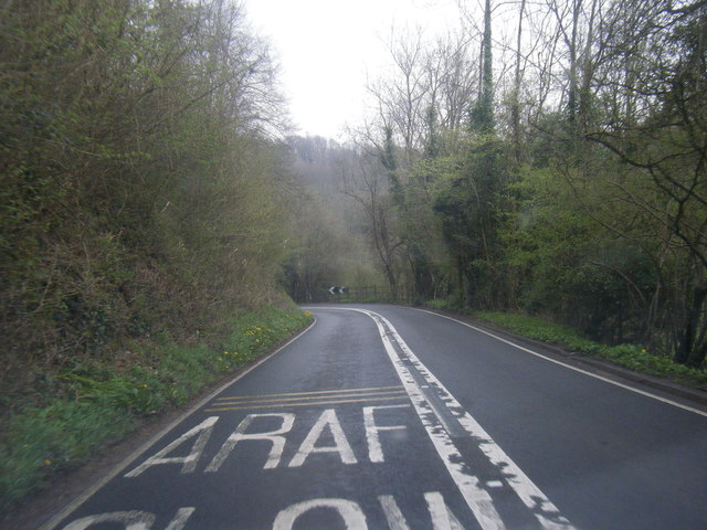
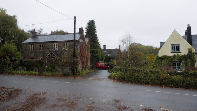
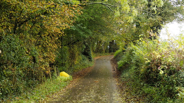
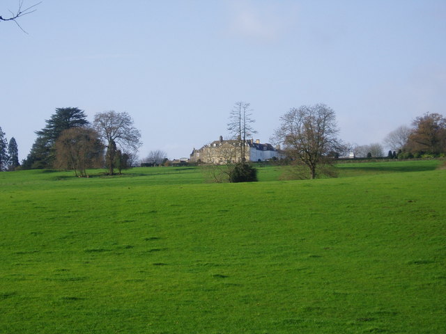
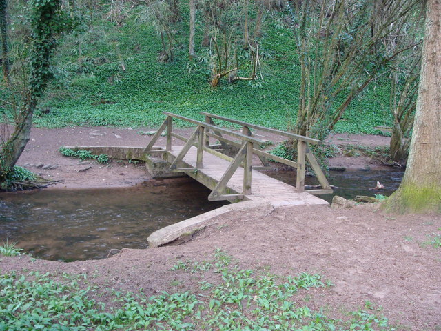
Briers Grove is a picturesque woodland area located in Monmouthshire, Wales. Covering an expansive area, it is a haven for nature enthusiasts and those seeking peace and tranquility amidst the beauty of nature. The grove is characterized by its dense collection of trees, predominantly comprising various species of broadleaf trees such as oak, beech, and ash.

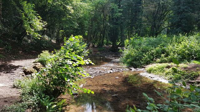
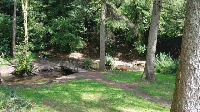
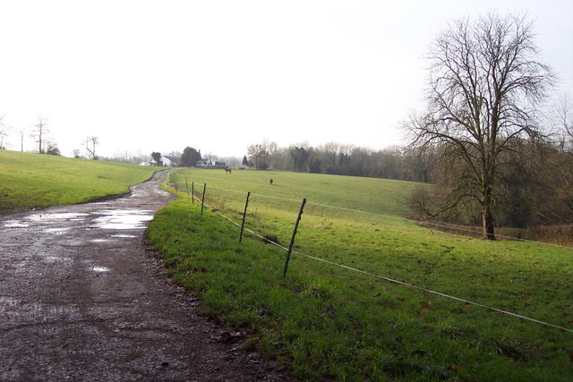
The forest floor is blanketed with a thick layer of moss and fallen leaves, providing a soft and serene walking surface. The terrain is undulating, with gentle slopes interspersed with occasional clearings. Numerous walking trails crisscross the grove, allowing visitors to explore its vast expanse and discover hidden gems along the way.

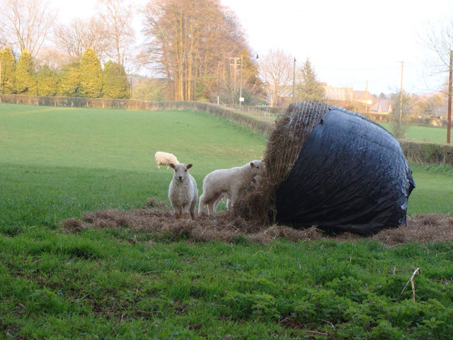
Wildlife thrives within Briers Grove, making it a haven for birdwatchers and wildlife enthusiasts. The forest is home to a wide variety of bird species, including woodpeckers, owls, and various songbirds. It is not uncommon to spot small mammals such as foxes, rabbits, and squirrels darting through the undergrowth.

Visitors to Briers Grove can enjoy a range of outdoor activities. The woodland provides an ideal setting for hiking, cycling, and picnicking. There are designated areas for camping, where visitors can immerse themselves in the peaceful ambiance and spend the night under the star-filled sky.

Briers Grove truly offers an escape from the hustle and bustle of everyday life, providing a serene retreat where one can reconnect with nature and appreciate the simple beauty of the forest.

If you have any feedback on the listing, please let us know in the comments section below.

Briers Grove Images

Images are sourced within 2km of 51.653282/-2.709465 or Grid Reference ST5195. Thanks to Geograph Open Source API. All images are credited.

B4235 near Coppice Mawr
The weir in Coppice Mawr
Bridge over the weir at Coppice Mawr
Houses by the B4293, Itton My first visit to this spot was in December 2006 when I took the First Geograph for the square; <a href="https://www.geograph.org.uk/photo/301135">ST4996 : Cottages by the B4293</a>.
Since then I visited the square in 2012; <a href="https://www.geograph.org.uk/photo/3013952">ST4996 : Entrance to Croes-Bleddyn Farm</a>, <a href="https://www.geograph.org.uk/photo/3013956">ST4996 : Itton Community Hall</a>.
There have been no other contributions to Geograph Project for this square...to date.
Houses by the B4293, Itton
My first visit to this spot was in December 2006 when I took the First Geograph for the square; ST4996 : Cottages by the B4293. Since then I visited the square in 2012; ST4996 : Entrance to Croes-Bleddyn Farm, ST4996 : Itton Community Hall. There have been no other contributions to Geograph Project for this square...to date.
Road to Itton church Lane rises through autumnal woodland south towards the church and Itton Court.
Road to Itton church
Lane rises through autumnal woodland south towards the church and Itton Court.
Itton (Llanddinol) St Deiniol's Church <span class="nowrap"><a title="http://www.churchcrawler.pwp.blueyonder.co.uk/churchcrawler/gwent.htm" rel="nofollow ugc noopener" href="http://www.churchcrawler.pwp.blueyonder.co.uk/churchcrawler/gwent.htm">Link</a><img style="margin-left:2px;" alt="External link" title="External link - shift click to open in new window" src="https://s1.geograph.org.uk/img/external.png" width="10" height="10"/></span>
Itton (Llanddinol) St Deiniol's Church
Milestone - 3 Miles to Chepstow This barely legible milestone is near the picnic spot 3 miles out of Chepstow on the B4235, Usk road.
Milestone - 3 Miles to Chepstow
This barely legible milestone is near the picnic spot 3 miles out of Chepstow on the B4235, Usk road.
Milestone - 3 Miles from Chepstow on the Usk road The milestone is centre foreground. The picnic spot is a little further on, on the right.
Milestone - 3 Miles from Chepstow on the Usk road
The milestone is centre foreground. The picnic spot is a little further on, on the right.
Itton Court, near Chepstow Set in vast parklands, Itton Court dates back to the 13th century, but was razed to the ground in the 18th century and a Queen Anne mansion built in its place.
Itton Court, near Chepstow
Set in vast parklands, Itton Court dates back to the 13th century, but was razed to the ground in the 18th century and a Queen Anne mansion built in its place.
Track to Dyer's House
Itton parish church
Itton parish church
Cottages by the B4293 Looking north from the gridline across Itton Road.
Cottages by the B4293
Looking north from the gridline across Itton Road.
Rustic Bridge over Mounton Brook
Mounton Brook from the rustic bridge, Coppice-mawr
St Deiniol's church, Itton This photo was taken at 7.30pm of an April evening.
St Deiniol's church, Itton
This photo was taken at 7.30pm of an April evening.
Post box at the entrance to Itton Court
Lambs in a field enjoying hay in the evening
Trees at the edge of Coppice Mawr Wood, Monmouthshire Viewed from the car park alongside the B4235. Coppice Mawr Wood is a National Forest for Wales site.
Trees at the edge of Coppice Mawr Wood, Monmouthshire
Viewed from the car park alongside the B4235. Coppice Mawr Wood is a National Forest for Wales site.
Show me another place!

Briers Grove is located at Grid Ref: ST5195 (Lat: 51.653282, Lng: -2.709465)

Unitary Authority: Monmouthshire

Police Authority: Gwent

What 3 Words

///printouts.dentures.quiet. Near Chepstow, Monmouthshire

Nearby Locations

Fryth Wood Briers Grove

Related Wikis

Howick Farmhouse, Itton

Howick Farmhouse, in the hamlet of Howick, near Itton, Monmouthshire is a farmhouse dating from the mid-16th century. It is a Grade II* listed building...

Chepstow Racecourse

Chepstow Racecourse is a thoroughbred horse racing course located just north of the town of Chepstow in Monmouthshire, Wales, near the southern end of...

St. Arvans

St. Arvans (Welsh: Sain Arfan or Llanarfan) is a village and community (equivalent to a parish) in Monmouthshire, south-east Wales. It is located two miles...

Itton

Itton (Welsh: Llanddinol), is a small village in Monmouthshire, south-east Wales, in the community of Devauden about 3 miles (4.8 km) north-west of Chepstow...
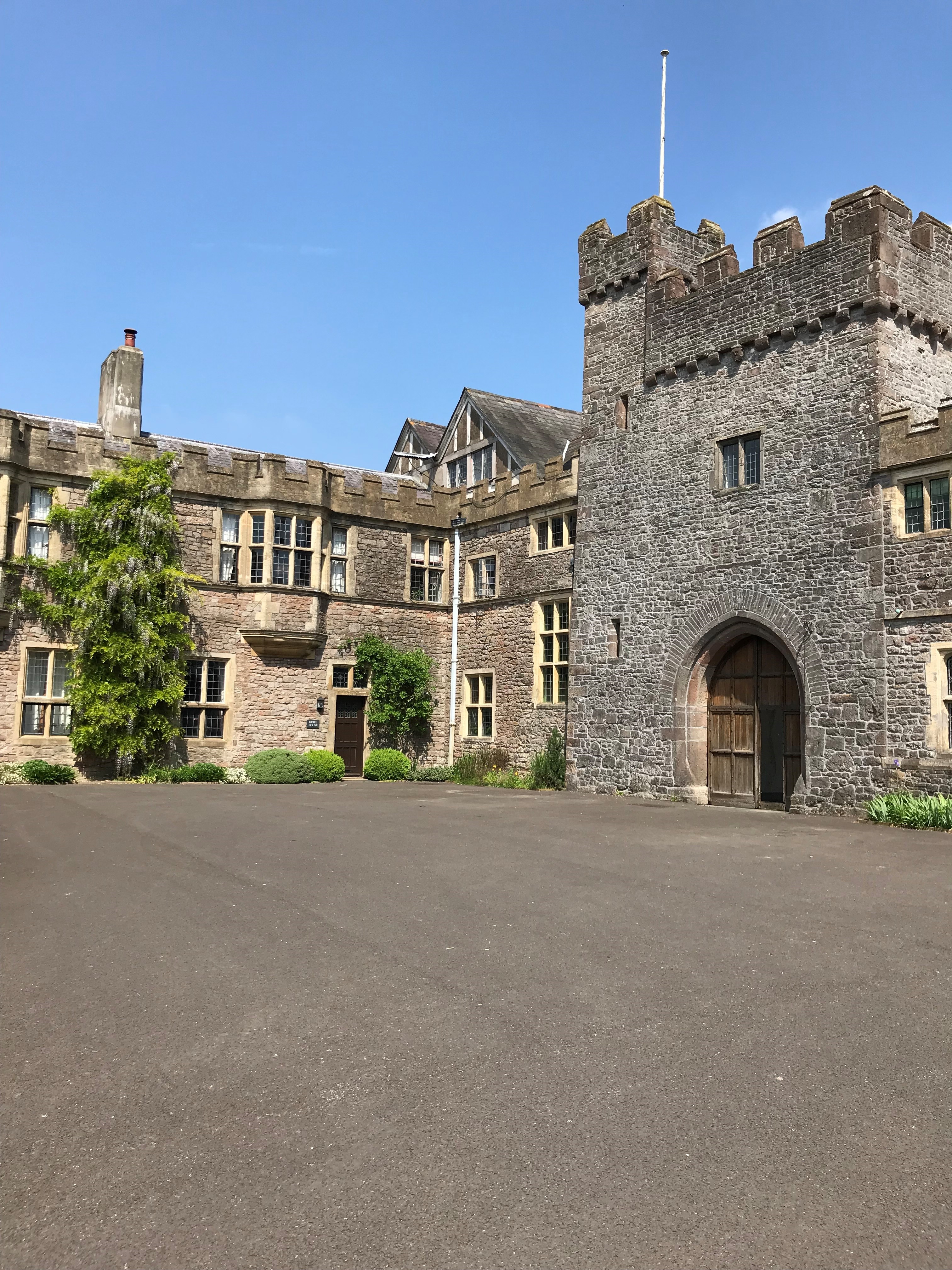
Itton Court

Itton Court, Itton, Devauden, Monmouthshire is a country house. The origin of the house was as an outstation for Chepstow Castle. In the 18th century,...

Green Gathering

The Green Gathering, formerly known as the Big Green Gathering is a festival with an environmental and social justice focus, including workshops and talks...
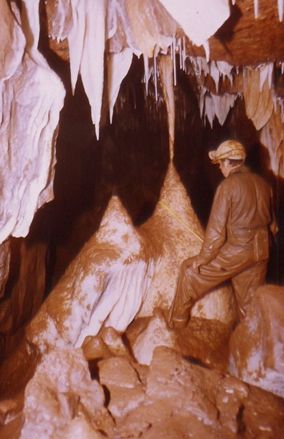
Otter Hole

Otter Hole is perhaps one of the best decorated caves in Britain. Located on the Wales–England border just north of Chepstow, the cave runs from the banks...

Piercefield House

Piercefield House is a largely ruined neo-classical country house near St Arvans, Monmouthshire, Wales, about 1.5 miles (2.4 km) north of the centre of...

Nearby Amenities

Located within 500m of 51.653282,-2.709465
Direction: 145
Generator Method: photovoltaic
Generator Output Electricity: yes
Generator Solar Modules: 6
Generator Source: solar
Generator Type: solar_photovoltaic_panel
Location: roof
Power: generator
Lat/Long: 51.6519677/-2.7147362
Direction: 145
Generator Method: photovoltaic
Generator Output Electricity: yes
Generator Solar Modules: 6
Generator Source: solar
Generator Type: solar_photovoltaic_panel
Location: roof
Power: generator
Lat/Long: 51.6519411/-2.7148019
The data included in this document is from www.openstreetmap.org. The data is made available under ODbL.

Have you been to Briers Grove?

Leave your review of Briers Grove below (or comments, questions and feedback).