California

Settlement in Suffolk Ipswich

England

California

The Golf Hotel, one of the 'Tolly Follies' Built on Foxhall Road in the 1930s, the pub was designed by the architect John Shewell Corder to emulate the style of Helmingham Hall, home of the Tollemache family, owners of the Tolly Cobbold brewery. At the time, the pub stood on the edge of Black Heath, now largely covered by Ipswich Golf Course.  There used to be a bowling green in the grounds behind the pub.
The Golf Hotel, one of the 'Tolly Follies' Credit: Simon Mortimer

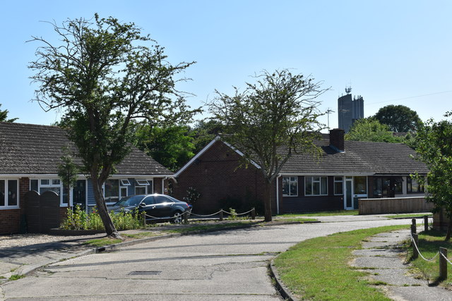
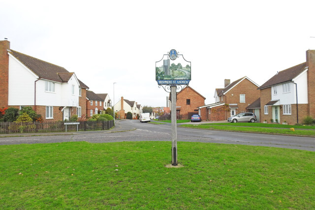
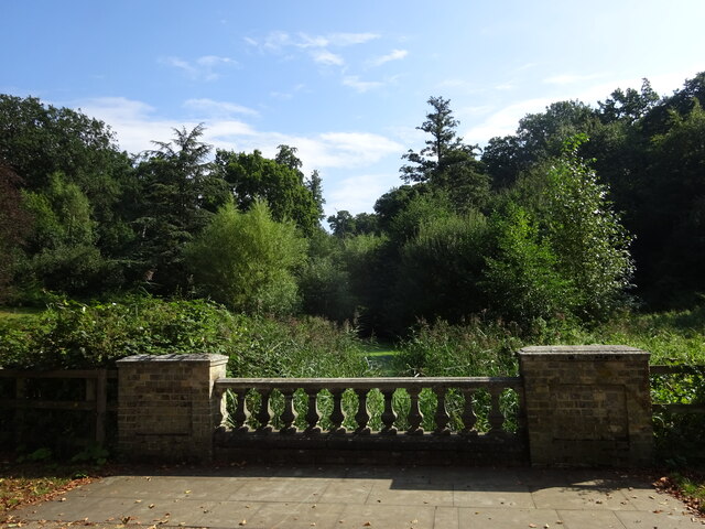
California, Suffolk is a small village located in the county of Suffolk, England. Situated in the eastern part of the country, it is a rural community that lies about 6 miles southwest of the larger town of Woodbridge. With a population of around 800 residents, California retains its charm as a close-knit and peaceful settlement.

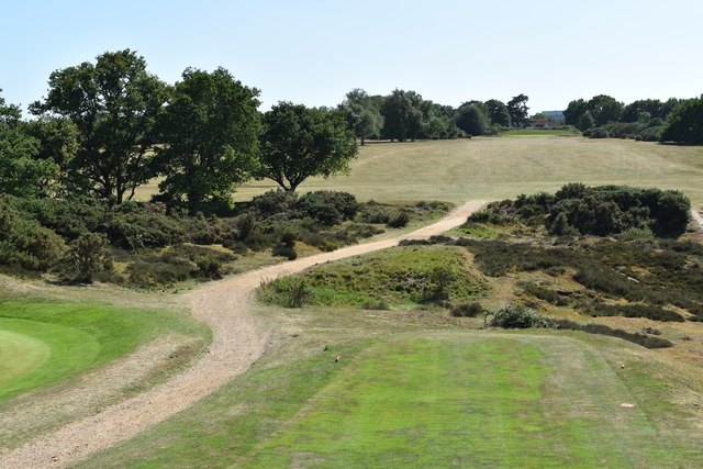
The village is known for its picturesque surroundings, characterized by rolling farmland, lush green meadows, and idyllic countryside scenery. It is surrounded by several other quaint villages and hamlets, contributing to the overall rural atmosphere of the area.

Historically, California's name has uncertain origins. Some speculate that it was named after the Gold Rush-era state of California in the United States, while others believe it may have derived from the Old English word "calk-hyl" meaning "chalky hill." Regardless of its etymology, the village has no direct connection or resemblance to its American namesake.

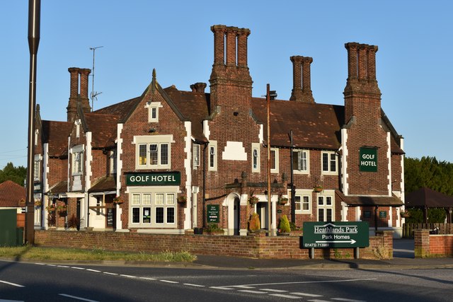
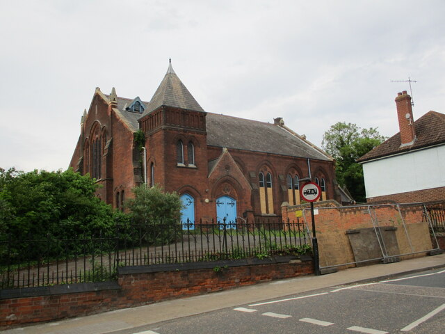
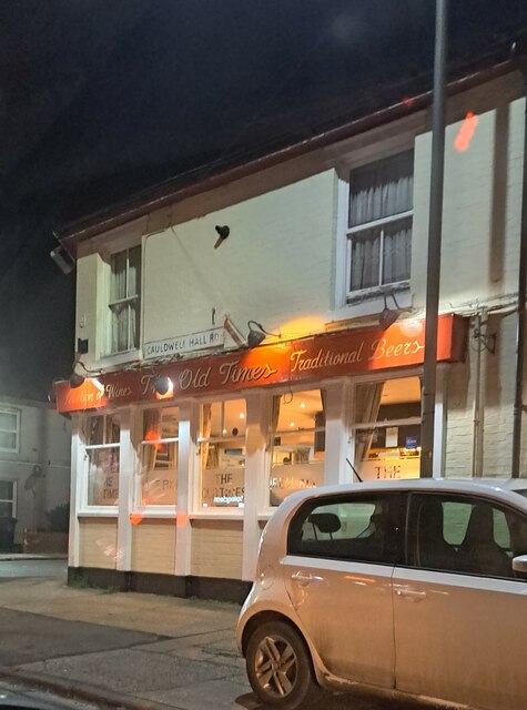
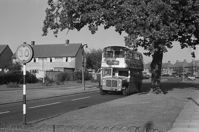
Amenities in California are limited, as is typical of small rural communities. The village features a small primary school, a church, and a pub, which serves as a social hub for the locals. Many residents commute to nearby towns for work and access to larger facilities and services.

Overall, California, Suffolk offers a peaceful and rural lifestyle, surrounded by natural beauty and a strong sense of community. Its location provides a tranquil escape from the bustle of city life, making it an attractive place for those seeking a quieter existence in the English countryside.

If you have any feedback on the listing, please let us know in the comments section below.
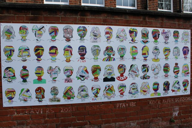
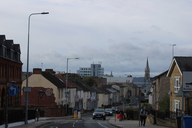
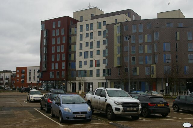
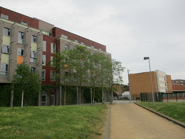
California Images

Images are sourced within 2km of 52.056004/1.192275 or Grid Reference TM1844. Thanks to Geograph Open Source API. All images are credited.

The Golf Hotel, one of the 'Tolly Follies' Built on Foxhall Road in the 1930s, the pub was designed by the architect John Shewell Corder to emulate the style of Helmingham Hall, home of the Tollemache family, owners of the Tolly Cobbold brewery. At the time, the pub stood on the edge of Black Heath, now largely covered by Ipswich Golf Course.  There used to be a bowling green in the grounds behind the pub.
The Golf Hotel, one of the 'Tolly Follies'
Built on Foxhall Road in the 1930s, the pub was designed by the architect John Shewell Corder to emulate the style of Helmingham Hall, home of the Tollemache family, owners of the Tolly Cobbold brewery. At the time, the pub stood on the edge of Black Heath, now largely covered by Ipswich Golf Course. There used to be a bowling green in the grounds behind the pub.
Golf course, Rushmere Heath Golf was first played on Rushmere Heath in the late 1800s.  In the 1920s, Ipswich Golf Club moved from the common land of Rushmere Heath to private land on Black Heath a mile to the south, and in 1927 Rushmere Golf Club was established to continue use of the course here.
Golf course, Rushmere Heath
Golf was first played on Rushmere Heath in the late 1800s. In the 1920s, Ipswich Golf Club moved from the common land of Rushmere Heath to private land on Black Heath a mile to the south, and in 1927 Rushmere Golf Club was established to continue use of the course here.
Bungalows on Blackdown Avenue, Rushmere Looking south-west, with the water tower on Rushmere Heath visible in the distance.
Bungalows on Blackdown Avenue, Rushmere
Looking south-west, with the water tower on Rushmere Heath visible in the distance.
Rushmere St Andrews village sign This is the alternative sign for Rushmere St. Andrew south of the B1214 and the housing estate built on Rushmere Heath. Illustrating a rather idyllic rural scene of a river with duck, grey heron, fox and butterflies and gorse. Standing in the meadow beyond is the water tower for the district. A strange subject to implant on an ideal landscape.
Rushmere St Andrews village sign
This is the alternative sign for Rushmere St. Andrew south of the B1214 and the housing estate built on Rushmere Heath. Illustrating a rather idyllic rural scene of a river with duck, grey heron, fox and butterflies and gorse. Standing in the meadow beyond is the water tower for the district. A strange subject to implant on an ideal landscape.
Rushmere village sign <a title="https://www.geograph.org.uk/photo/6658421" href="https://www.geograph.org.uk/photo/6658421">Link</a>
Rushmere village sign
View of an old house on the corner of Duke Street and Fore Street Looking north-northwest.
View of an old house on the corner of Duke Street and Fore Street
Looking north-northwest.
View of St. Clement's Church from Fore Street Looking north-northeast.
View of St. Clement's Church from Fore Street
Looking north-northeast.
View of the spire of St. Helen's Church from St. Helen's Street Looking north-northeast.
View of the spire of St. Helen's Church from St. Helen's Street
Looking north-northeast.
View of art on the wall of St. Helen's Primary School from the footpath between St. Helen's Street and Woodbridge Road Looking east.
View of art on the wall of St. Helen's Primary School from the footpath between St. Helen's Street and Woodbridge Road
Looking east.
View over Ipswich from the top of the hill on Woodbridge Road Looking south-southwest.
View over Ipswich from the top of the hill on Woodbridge Road
Looking south-southwest.
Ipswich: Duke Street car park and University of Suffolk buildings
Athena Hall, University of Suffolk Student accommodation. Built 2008-10. Designed by Studio One Architecture and Design.
Athena Hall, University of Suffolk
Student accommodation. Built 2008-10. Designed by Studio One Architecture and Design.
St. Clement's Congregational church, Ipswich Designed by William Eade 1887.
St. Clement's Congregational church, Ipswich
Designed by William Eade 1887.
Ipswich-Woodbridge Road East Filling Station.
Ipswich-Woodbridge Road East
Filling Station.
132-138 Fore Street, Ipswich Dated 1620 <span class="nowrap"><a title="https://historicengland.org.uk/listing/the-list/list-entry/1037737?section=official-list-entry" rel="nofollow ugc noopener" href="https://historicengland.org.uk/listing/the-list/list-entry/1037737?section=official-list-entry">Link</a><img style="margin-left:2px;" alt="External link" title="External link - shift click to open in new window" src="https://s1.geograph.org.uk/img/external.png" width="10" height="10"/></span>
132-138 Fore Street, Ipswich
Dated 1620 LinkExternal link
The Old Times pub, corner of Spring Road and Cauldwell Hall Road
Bridge over stream in Holywells Park
Renfrew Road, Ipswich – 1971 Early post-WW2 Rushmere Hall housing development with Ipswich Corporation bus 42 waiting to return to the town centre. For more recent views of the same location, see <a title="https://www.geograph.org.uk/photo/1296123" href="https://www.geograph.org.uk/photo/1296123">Link</a> (2009) and <a title="https://www.geograph.org.uk/photo/6637135" href="https://www.geograph.org.uk/photo/6637135">Link</a> (2020).

The bus is an AEC Regent V with Park Royal body, new in 1961.

This is one of a series of views featuring buses in the 60s, 70s, and 80s. <a title="https://www.geograph.org.uk/search.php?i=137652761" href="https://www.geograph.org.uk/search.php?i=137652761">Link</a>
Renfrew Road, Ipswich – 1971
Early post-WW2 Rushmere Hall housing development with Ipswich Corporation bus 42 waiting to return to the town centre. For more recent views of the same location, see Link (2009) and Link (2020). The bus is an AEC Regent V with Park Royal body, new in 1961. This is one of a series of views featuring buses in the 60s, 70s, and 80s. Link
Show me another place!

California is located at Grid Ref: TM1844 (Lat: 52.056004, Lng: 1.192275)

Administrative County: Suffolk

District: Ipswich

Police Authority: Suffolk

What 3 Words

///slang.into.plots. Near Ipswich, Suffolk

Nearby Locations

California

Related Wikis

Copleston High School

Copleston High School is a secondary school for ages 11–18 in Ipswich, England. It is an academy, and caters for around 1,800 students, as well as between...

Ipswich Hospital

Ipswich Hospital is a large district general hospital in Heath Road, Ipswich, Suffolk, England. It is now managed by East Suffolk and North Essex NHS Foundation...

St Clement's Hospital, Ipswich

St Clement's Hospital was a mental health facility at Foxhall Road in Ipswich, Suffolk, England. == History == The hospital, which was designed by William...
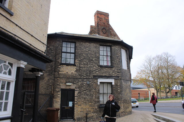
California, Ipswich

California is an area of the town of Ipswich, in the Ipswich district, in the county of Suffolk, England, which was developed by the Ipswich and Suffolk...

North East Area, Ipswich

The North East Area, Ipswich is one of five administrative areas in Ipswich, through which Ipswich Borough Council divides its spending and enables feedback...

Derby Road railway station

Derby Road railway station (also known as Derby Road (Ipswich)) is on the Felixstowe Branch Line in the east of England, serving the Rose Hill area and...

Rushmere, Ipswich

Rushmere is an area of Ipswich and former civil parish in the Ipswich district in Suffolk, England. In 1901 the parish had a population of 601.In 1894...

St Alban's Catholic High School, Ipswich

St Alban's Catholic High School is a secondary school and sixth form with academy status located in Ipswich, Suffolk, England. == References == == External... ==

Nearby Amenities

Located within 500m of 52.056004,1.192275
Mini Roundabout
Direction: clockwise
Lat/Long: 52.0600805/1.1930641
Traffic Calming: table
Lat/Long: 52.0557026/1.1905288
Turning Circle
Lat/Long: 52.0527928/1.1917771
Turning Circle
Lat/Long: 52.0550705/1.185482
Traffic Calming: table
Lat/Long: 52.055907/1.1861679
Traffic Calming: hump
Lat/Long: 52.0557015/1.1951391
Parking
Lat/Long: 52.0569247/1.1962988
Bicycle Parking
Created By: Potlatch 0.7b
Lat/Long: 52.0578002/1.1988748
Crossing
Crossing: zebra
Crossing Island: yes
Crossing Ref: zebra
Kerb: lowered
Tactile Paving: yes
Traffic Calming: bump
Lat/Long: 52.0517915/1.1941687
California
Created By: Potlatch 0.10b
Place: suburb
Lat/Long: 52.0562542/1.185613
Crossing
Crossing: marked
Crossing Markings: yes
Crossing Ref: zebra
Lat/Long: 52.0584615/1.1982948
Bicycle Parking
Lat/Long: 52.0563452/1.1989108
Crossing
Crossing: marked
Crossing Markings: yes
Crossing Ref: zebra
Lat/Long: 52.0582699/1.1980038
Crossing
Crossing: marked
Crossing Markings: yes
Lat/Long: 52.0555453/1.199364
6
Entrance: yes
Lat/Long: 52.0576093/1.1983832
6
Entrance: yes
Lat/Long: 52.0575454/1.1983996
2
Entrance: yes
Lat/Long: 52.0562428/1.1983936
Entrance: yes
Lat/Long: 52.0565993/1.1982941
15
Entrance: yes
Lat/Long: 52.0590634/1.1967587
Bus Stop
Britannia Road
Bus: yes
Layby: yes
Local Ref: adj
Naptan AtcoCode: 390030625
Naptan Bearing: W
Naptan CommonName: Britannia Road
Naptan Landmark: Britannia Road
Naptan NaptanCode: sufaptam
Naptan PlusbusZoneRef: IPSWICH
Naptan Street: Spring Road
Public Transport: platform
Shelter: no
Source: naptan_import
Timetable Case: yes
Lat/Long: 52.0594215/1.1902944
Bus Stop
Britannia Road
Bus: yes
Local Ref: opp
Naptan AtcoCode: 390030626
Naptan Bearing: E
Naptan CommonName: Britannia Road
Naptan Landmark: Britannia Road
Naptan NaptanCode: sufaptap
Naptan PlusbusZoneRef: IPSWICH
Naptan Street: Spring Road
Public Transport: platform
Shelter: no
Source: naptan_import
Lat/Long: 52.0595112/1.1898567
Bus Stop
St Clements Hospital
Local Ref: adj
Naptan AtcoCode: 390030663
Naptan Bearing: W
Naptan CommonName: St Clements Hospital
Naptan Landmark: St Clements Hospital
Naptan NaptanCode: sufaptpw
Naptan PlusbusZoneRef: IPSWICH
Naptan Street: Foxhall Road
Public Transport: platform
Shelter: yes
Source: naptan_import;survey
Timetable Case: yes
Lat/Long: 52.0516871/1.1918984
Bus Stop
Chilton Road
Local Ref: adj
Naptan AtcoCode: 390030664
Naptan Bearing: W
Naptan CommonName: Chilton Road
Naptan Landmark: Chilton Road
Naptan NaptanCode: sufaptwa
Naptan PlusbusZoneRef: IPSWICH
Naptan Street: Foxhall Road
Public Transport: platform
Shelter: yes
Source: naptan_import
Timetable Case: yes
Lat/Long: 52.0517284/1.19452
Bus Stop
Lattice Barn Pharmacy
Bus: yes
Departures Board: timetable
Local Ref: adj
Naptan AtcoCode: 390030676
Naptan Bearing: W
Naptan CommonName: Lattice Barn
Naptan Landmark: Lattice Barn
Naptan NaptanCode: sufapwat
Naptan PlusbusZoneRef: IPSWICH
Naptan Street: Woodbridge Road
Network: First Bus, Suffolk Norse
Operator: First Bus Norfolk & Suffolk, Suffolk Norse
Public Transport: platform
Shelter: yes
Source: naptan_import
Timetable Case: yes
Lat/Long: 52.0602189/1.1939927
Bus Stop
Lattice Barn Pharmacy
Bus: yes
Departures Board: timetable
Local Ref: opp
Naptan AtcoCode: 390030677
Naptan Bearing: E
Naptan CommonName: Lattice Barn
Naptan Landmark: Lattice Barn
Naptan NaptanCode: sufapwaw
Naptan PlusbusZoneRef: IPSWICH
Naptan Street: Woodbridge Road
Network: First Bus, Ipswich Buses, Suffolk Norse
Operator: First Bus Norfolk & Suffolk, Ipswich Buses, Suffolk Norse
Public Transport: platform
Shelter: no
Source: naptan_import
Timetable Case: yes
Lat/Long: 52.0603205/1.1938596
Fuel
BP
Brand: BP
Brand Wikidata: Q152057
Operator: Rontec
Operator Website: http://www.rontec-servicestations.co.uk/ss_results-id.cfm?id=7176
Operator Wikidata: Q107439152
Website: https://map.bp.com/en-GB/GB/petrol-station/ipswich/rontec-spring-road/4549
Lat/Long: 52.0594753/1.1890532
Addr Housenumber: 162
Addr Street: Freehold Road
Lat/Long: 52.055692/1.1900885
Addr Housenumber: 92
Addr Street: Freehold Road
Lat/Long: 52.0557743/1.1873065
Addr Housenumber: 47
Addr Street: Freehold Road
Lat/Long: 52.0560516/1.1854242
Addr Housenumber: 169
Addr Street: Britannia Road
Lat/Long: 52.0555426/1.1907658
Addr Housenumber: 177
Addr Street: Britannia Road
Lat/Long: 52.0552441/1.1907578
Addr Housenumber: 110
Addr Street: Henslow Road
Lat/Long: 52.0534259/1.1866392
Addr Housenumber: 22
Addr Street: Parliament Road
Lat/Long: 52.0556358/1.1892484
Addr Housenumber: 88
Addr Street: Parliament Road
Lat/Long: 52.0541861/1.1888863
Addr Housenumber: 85
Addr Street: Henslow Road
Lat/Long: 52.0531653/1.1868376
Addr Housenumber: 553
Addr Street: Foxhall Road
Lat/Long: 52.0519533/1.1949348
Addr Housenumber: 480
Addr Street: Foxhall Road
Lat/Long: 52.0517339/1.1906459
Addr Housenumber: 498
Addr Street: Foxhall Road
Lat/Long: 52.0517339/1.1913647
Addr Housenumber: 413
Addr Street: Foxhall Road
Lat/Long: 52.0519308/1.1900032
Addr Housenumber: 2
Addr Street: Woodbridge Road East
Lat/Long: 52.0599344/1.1932883
Addr Housenumber: 134
Addr Street: Britannia Road
Source Addr: survey
Lat/Long: 52.0564183/1.1903164
Addr Housenumber: 126
Addr Street: Britannia Road
Lat/Long: 52.0567408/1.1901716
8
Entrance: yes
Lat/Long: 52.0578027/1.1980789
Traffic Calming: hump
Lat/Long: 52.0557019/1.1933226
Traffic Calming: hump
Lat/Long: 52.0558603/1.1872184
Traffic Calming: hump
Lat/Long: 52.0558089/1.1884001
Premier Freehold Convenience Store
Addr City: Ipswich
Addr Country: GB
Addr Housenumber: 142
Addr Postcode: IP4 5JL
Addr Street: Freehold Road
Brand: Premier
Brand Wikidata: Q7240340
Brand Wikipedia: en:Premier Stores
Facebook: https://www.facebook.com/Premier-Freehold-Convenience-Store-342441549460258/
Fhrs Id: 594397
Opening Hours: Mo-Su 07:00-21:00
Operator: Premier
Phone: +44 1473 402467
Shop: convenience
Source Addr: FSA Food Hygiene Ratings Database
Website: https://www.premier-stores.co.uk/our-stores/freehold-convenience-store
Lat/Long: 52.0556907/1.1892291
Entrance: main
Lat/Long: 52.0559776/1.1864735
Entrance: main
Lat/Long: 52.0559204/1.1878113
Entrance: main
Lat/Long: 52.0559706/1.1866017
Entrance: main
Lat/Long: 52.0559293/1.1876531
Entrance: main
Lat/Long: 52.0559407/1.1871676
Entrance: main
Lat/Long: 52.0559545/1.1870154
Entrance: main
Lat/Long: 52.0559391/1.1872749
Entrance: main
Lat/Long: 52.0559202/1.1877665
Entrance: main
Lat/Long: 52.0559631/1.1868042
Entrance: main
Lat/Long: 52.0559321/1.1875472
Entrance: main
Lat/Long: 52.0559683/1.1866688
Entrance: main
Lat/Long: 52.0559326/1.1873805
Entrance: main
Lat/Long: 52.0559587/1.1868726
Entrance: main
Lat/Long: 52.0574567/1.1882694
Entrance: yes
Lat/Long: 52.056397/1.188189
Entrance: main
Lat/Long: 52.0561746/1.1878658
Addr Housenumber: 63
Addr Street: Bloomfield Street
Entrance: main
Lat/Long: 52.0567433/1.1881866
Addr Housenumber: 59
Addr Street: Bloomfield Street
Entrance: main
Lat/Long: 52.0568891/1.1882905
Addr Housenumber: 75
Addr Street: Bloomfield Street
Entrance: main
Lat/Long: 52.0565297/1.1882009
Addr Housenumber: 63
Addr Street: Bloomfield Street
Entrance: main
Lat/Long: 52.0567494/1.1881813
Addr Housenumber: 87
Addr Street: Bloomfield Street
Entrance: main
Lat/Long: 52.056281/1.1881832
Addr Housenumber: 61
Addr Street: Bloomfield Street
Entrance: main
Lat/Long: 52.0568823/1.1882905
Addr Housenumber: 77
Addr Street: Bloomfield Street
Entrance: main
Lat/Long: 52.0565251/1.188201
Addr Housenumber: 93
Addr Street: Bloomfield Street
Entrance: main
Lat/Long: 52.0561404/1.1882043
Addr Housenumber: 89
Addr Street: Bloomfield Street
Entrance: main
Lat/Long: 52.0562775/1.1881832
Addr Housenumber: 91
Addr Street: Bloomfield Street
Entrance: main
Lat/Long: 52.0561503/1.1882043
Addr Housenumber: 79;81;83;85
Addr Street: Bloomfield Street
Entrance: main
Lat/Long: 52.05639/1.188189
Source: Bing
Traffic Calming: hump
Lat/Long: 52.0570409/1.1861628
Source: Bing
Traffic Calming: hump
Lat/Long: 52.0580398/1.1861552
Bicycle Parking
Bicycle Parking: stands
Shelter: yes
Lat/Long: 52.0563979/1.1994593
5
Entrance: yes
Lat/Long: 52.0566831/1.1983755
3
Entrance: yes
Lat/Long: 52.0563784/1.198363
13
Entrance: yes
Lat/Long: 52.059008/1.1973499
7
Entrance: yes
Lat/Long: 52.0578809/1.1984439
Outpatients
Office: company
Lat/Long: 52.0570467/1.1980338
Woodlands
Office: company
Lat/Long: 52.0586267/1.1974222
Eye Clinic
Office: company
Lat/Long: 52.0575811/1.1979211
Emergency Assessment Unit
Office: company
Lat/Long: 52.0559242/1.1982835
Maternity Block
Office: company
Lat/Long: 52.0578747/1.1978567
Woolverstone Wing
Office: company
Lat/Long: 52.0591445/1.1960972
Restaurant
Hospital Canteen
Lat/Long: 52.0582959/1.1965159
Cafe
Costa
Addr City: Ipswich
Addr Locality: Ipswich Hospital
Addr Postcode: IP4 5PD
Addr Street: Heath Road
Brand: Costa
Brand Wikidata: Q608845
Brand Wikipedia: en:Costa Coffee
Cuisine: coffee_shop
Fhrs Id: 1653355
Source Addr: FSA Food Hygiene Ratings Database
Takeaway: yes
Lat/Long: 52.0562608/1.1980018
WHSmith
Addr City: Ipswich
Addr Locality: Ipswich Hospital
Addr Postcode: IP4 5PD
Addr Street: Heath Road
Fhrs Id: 1653264
Shop: supermarket
Source Addr: FSA Food Hygiene Ratings Database
Lat/Long: 52.056335/1.1981922
Cafe
Deli One
Lat/Long: 52.057661/1.1982673
WHSmith
Shop: supermarket
Lat/Long: 52.0574895/1.1982808
Pathology
Office: company
Lat/Long: 52.0570211/1.1971945
Postgraduate Centre
Office: company
Lat/Long: 52.0565313/1.1971489
Crossing
Crossing: marked
Crossing Markings: yes
Lat/Long: 52.0552821/1.1994772
Addr Housenumber: 552
Addr Street: Spring Road
Lat/Long: 52.059349/1.190005
Post Box
Collection Times: Mo-Fr 09:00; Sa 07:00
Operator: Royal Mail
Operator Type: private
Operator Wikidata: Q638098
Post Box Mounting: brick_pillar
Post Box Type: wall
Ref: IP3 1093D
Royal Cypher: GR
Royal Cypher Wikidata: Q33102273
Lat/Long: 52.0516627/1.1925653
Barrier: lift_gate
Lat/Long: 52.0533593/1.1943848
Bus Stop
St Clements Hospital
Naptan AtcoCode: 390039014
Naptan NaptanCode: sufjtmaw
Public Transport: platform
Lat/Long: 52.0518047/1.1922057
Turning Circle
Lat/Long: 52.0549674/1.1854653
Addr Housenumber: 111
Addr Street: Freehold Road
Entrance: main
Lat/Long: 52.0558743/1.1883616
Addr Housenumber: 109
Addr Street: Freehold Road
Entrance: main
Lat/Long: 52.0558755/1.1883274
Addr Housenumber: 16
Addr Street: Stephen's Court
Lat/Long: 52.0563227/1.1901726
Joanne Marie Hair
Addr City: Ipswich
Addr Postcode: IP4 5EY
Addr Street: Newbury Road
Email: joannemparsons@hotmail.com
Female: yes
Opening Hours: Mo 09:00-15:00; Tu 09:30-15:00; Th 09:30-15:00; Fr 09:00-15:00; Sa 09:00-17:00
Phone: +44 7941 635290
Shop: hairdresser
Lat/Long: 52.0556308/1.1948658
YM Tennis Club
Addr City: Ipswich
Addr Country: GB
Addr Postcode: IP4 5HD
Club: sport
Phone: +447941196142
Sport: tennis
Website: https://ymtennis.co.uk/
Lat/Long: 52.0537201/1.1938351
Generator Method: photovoltaic
Generator Output Electricity: yes
Generator Source: solar
Generator Type: solar_photovoltaic_panel
Power: generator
Lat/Long: 52.0570764/1.1894356
Entrance: main
Lat/Long: 52.0562006/1.1863157
Entrance: main
Lat/Long: 52.0563012/1.1862536
Entrance: main
Lat/Long: 52.056588/1.1862829
Entrance: main
Lat/Long: 52.0566313/1.1862848
Entrance: main
Lat/Long: 52.0567291/1.1863543
Entrance: main
Lat/Long: 52.0568092/1.1863424
Entrance: main
Lat/Long: 52.0570228/1.1862891
Entrance: main
Lat/Long: 52.0572092/1.1862745
Entrance: main
Lat/Long: 52.057343/1.1862769
Entrance: main
Lat/Long: 52.0573697/1.1862739
Entrance: main
Lat/Long: 52.0566575/1.1859433
Entrance: main
Lat/Long: 52.0562235/1.1859701
Entrance: main
Lat/Long: 52.0563218/1.1859708
Entrance: main
Lat/Long: 52.0561306/1.1859888
Addr Housenumber: 37
Addr Street: Henslow Road
Lat/Long: 52.0545561/1.1873385
Pub
The Brickmakers' Arms
Addr City: Ipswich
Addr Housenumber: 315
Addr Postcode: IP4 5ND
Addr Street: Spring Road
Lat/Long: 52.0594406/1.187826
Bench
Lat/Long: 52.0558369/1.1921507
Bench
Lat/Long: 52.0563532/1.1923284
Bench
Lat/Long: 52.056415/1.1916009
Traffic Calming: hump
Lat/Long: 52.0557023/1.1917947
Access: private
Barrier: lift_gate
Lat/Long: 52.0524266/1.1885253
Post Box
Operator: Royal Mail
Operator Wikidata: Q638098
Post Box Mounting: building
Post Box Type: wall
Ref: IP4 1077
Royal Cypher: EIIR
Royal Cypher Wikidata: Q33102113
Lat/Long: 52.0566033/1.1881992
Post Box
Operator: Royal Mail
Operator Wikidata: Q638098
Post Box Design: type_b
Post Box Type: pillar
Ref: IP4 1070
Royal Cypher: GR
Royal Cypher Wikidata: Q33102273
Lat/Long: 52.0587264/1.1933427
Post Box
Operator: Royal Mail
Operator Wikidata: Q638098
Post Box Design: type_b
Post Box Type: pillar
Ref: IP4 1297
Royal Cypher: GR
Royal Cypher Wikidata: Q33102273
Lat/Long: 52.0565876/1.1953854
Crossing
Lat/Long: 52.060169/1.192849
Crossing
Lat/Long: 52.060243/1.1935063
Crossing
Lat/Long: 52.0603041/1.1944009
Crossing
Lat/Long: 52.0599192/1.1930349
Crossing
Lat/Long: 52.0597986/1.1924224
Crossing
Crossing: uncontrolled
Crossing Markings: yes
Lat/Long: 52.0565033/1.199228
The data included in this document is from www.openstreetmap.org. The data is made available under ODbL.

Have you been to California?

Leave your review of California below (or comments, questions and feedback).