Coed Golley

Wood, Forest in Monmouthshire

Wales

Coed Golley

Footpath to The Farm It does what it says on the sign!
Footpath to The Farm Credit: Jonathan Billinger

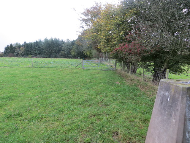
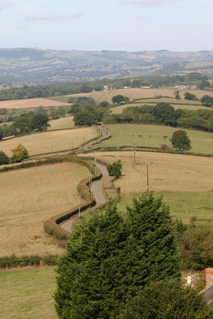
Coed Golley is a picturesque woodland located in Monmouthshire, Wales. Spread across a vast area, it is known for its dense forest and lush greenery. The woodland is a popular destination for nature lovers, hikers, and birdwatchers due to its diverse ecosystem and breathtaking scenery.

The woodland is home to a wide variety of tree species, including native oaks, beeches, and birches. The dense canopy provides shade and creates a tranquil atmosphere, making it an ideal place for relaxation and unwinding. The forest floor is adorned with a carpet of ferns, wildflowers, and moss, adding to its natural beauty.

Coed Golley offers numerous walking trails, allowing visitors to explore the forest at their own pace. Along these trails, one can encounter an array of wildlife, such as deer, foxes, badgers, and a variety of bird species. Birdwatchers are particularly drawn to the woodland for the chance to spot rare species like the red kite and the lesser-spotted woodpecker.

In addition to its natural beauty, Coed Golley is also of historical significance. It is believed that the woodland has been present for centuries, with evidence of human presence dating back to the Iron Age. The woodland has also played a role in local folklore and legends, adding an element of mystique to its already enchanting atmosphere.

Overall, Coed Golley is a captivating forested area that offers a unique blend of natural beauty, diverse wildlife, and historical significance. Whether it's a peaceful walk, birdwatching, or simply immersing oneself in nature, this woodland provides a serene escape from the hustle and bustle of everyday life.

If you have any feedback on the listing, please let us know in the comments section below.

Coed Golley Images

Images are sourced within 2km of 51.754401/-2.743906 or Grid Reference SO4806. Thanks to Geograph Open Source API. All images are credited.

Footpath to The Farm It does what it says on the sign!
Footpath to The Farm
It does what it says on the sign!
B4293 to Trellech A damaged bus stop sign.
B4293 to Trellech
A damaged bus stop sign.
Private drive, public footpath Leading to Loysey which seems to be completely surrounded by Loysey Wood.
Private drive, public footpath
Leading to Loysey which seems to be completely surrounded by Loysey Wood.
Bridleway to Loysey, 2016 The same path as <a href="https://www.geograph.org.uk/photo/324044">SO4805 : Bridleway to Loysey</a>, nine years later.
Bridleway to Loysey, 2016
The same path as SO4805 : Bridleway to Loysey, nine years later.
Edge of woodland The bridleway heads to the nearest corner of the wood and then follows its edge to the right.
Edge of woodland
The bridleway heads to the nearest corner of the wood and then follows its edge to the right.
Pasture and woodland Looking across to the top edge of Croes-Robert Wood.
Pasture and woodland
Looking across to the top edge of Croes-Robert Wood.
Lane on Cwmcarfan Hill Looking west.
Lane on Cwmcarfan Hill
Looking west.
Monmouthshire lane Rolling countryside to the north of Llwyn-y-celyn.
Monmouthshire lane
Rolling countryside to the north of Llwyn-y-celyn.
Monmouthshire countryside A symphony of subtle winter colours to the north of Llwyn-y-celyn.
Monmouthshire countryside
A symphony of subtle winter colours to the north of Llwyn-y-celyn.
Lane above Llwyn-y-celyn A fine view to the north.
Lane above Llwyn-y-celyn
A fine view to the north.
Farm buildings at Llwyn-y-celyn Farm is on the steep north side of Cwmcarfan Hill.
Farm buildings at Llwyn-y-celyn
Farm is on the steep north side of Cwmcarfan Hill.
View from Ffosydd Lane Looking north-east over some typical pasture and woodland Monmouthshire countryside.
View from Ffosydd Lane
Looking north-east over some typical pasture and woodland Monmouthshire countryside.
Track to Little Ffosydd, 1 Also a public footpath alongside Ffosydd-Orles Wood.
Track to Little Ffosydd, 1
Also a public footpath alongside Ffosydd-Orles Wood.
Track to Little Ffosydd, 2 Taken from same spot as <a href="https://www.geograph.org.uk/photo/4804543">SO4806 : Track to Little Ffosydd, 1</a> with telephoto.
Also a public footpath alongside Ffosydd-Orles Wood.
Track to Little Ffosydd, 2
Taken from same spot as SO4806 : Track to Little Ffosydd, 1 with telephoto. Also a public footpath alongside Ffosydd-Orles Wood.
Unnamed brook near The Perrogs Compare with similar shot taken in October 2010; <a href="https://www.geograph.org.uk/photo/2106934">SO4607 : Field near Perrogs, Cwmcarvan</a>.
Unnamed brook near The Perrogs
Compare with similar shot taken in October 2010; SO4607 : Field near Perrogs, Cwmcarvan.
Short track Access to the pasture near The Perrogs.
Short track
Access to the pasture near The Perrogs.
Field edge view from Cwmcarfan Hill Triangulation Pillar Looking south-westward.
Field edge view from Cwmcarfan Hill Triangulation Pillar
Looking south-westward.
Ordnance Survey Flush Bracket S1292 This can be found on the roadside (B4293) wall of the former Gocket Inn.
For more detail see : <span class="nowrap"><a title="http://www.bench-marks.org.uk/bm19967" rel="nofollow ugc noopener" href="http://www.bench-marks.org.uk/bm19967">Link</a><img style="margin-left:2px;" alt="External link" title="External link - shift click to open in new window" src="https://s1.geograph.org.uk/img/external.png" width="10" height="10"/></span>
Ordnance Survey Flush Bracket S1292
This can be found on the roadside (B4293) wall of the former Gocket Inn. For more detail see : LinkExternal link
Show me another place!

Coed Golley is located at Grid Ref: SO4806 (Lat: 51.754401, Lng: -2.743906)

Unitary Authority: Monmouthshire

Police Authority: Gwent

What 3 Words

///barstool.ashes.outdone. Near Mitchel Troy, Monmouthshire

Related Wikis

Croes Robert Wood

Croes Robert Wood is a nature reserve and Site of Special Scientific Interest (SSSI), noted for its biological characteristics, in Monmouthshire, south...

St Catwg's Church, Cwmcarvan

The Church of St Catwg in Cwmcarvan, Monmouthshire, Wales, is a parish church dating from the late 13th or early 14th century. It is dedicated to Saint...

Cwmcarvan

Cwmcarvan (Welsh: Cwmcarfan) is a small rural village in Monmouthshire, south east Wales. It is located 4 miles south west of Monmouth and about 4 miles...

Church of St Nicholas, Trellech

The Church of St Nicholas, Trellech, Monmouthshire is a parish church with its origins in the 14th century. The historical and architectural evidence suggests...

Nearby Amenities

Located within 500m of 51.754401,-2.743906
The data included in this document is from www.openstreetmap.org. The data is made available under ODbL.

Have you been to Coed Golley?

Leave your review of Coed Golley below (or comments, questions and feedback).