Caeparbet Wood
Wood, Forest in Flintshire
Wales
Caeparbet Wood

The requested URL returned error: 429 Too Many Requests
If you have any feedback on the listing, please let us know in the comments section below.
Caeparbet Wood Images
Images are sourced within 2km of 52.986606/-2.7855986 or Grid Reference SJ4743. Thanks to Geograph Open Source API. All images are credited.


Caeparbet Wood is located at Grid Ref: SJ4743 (Lat: 52.986606, Lng: -2.7855986)
Unitary Authority: Wrexham
Police Authority: North Wales
What 3 Words
///trader.forensic.chosen. Near Malpas, Cheshire
Nearby Locations
Related Wikis
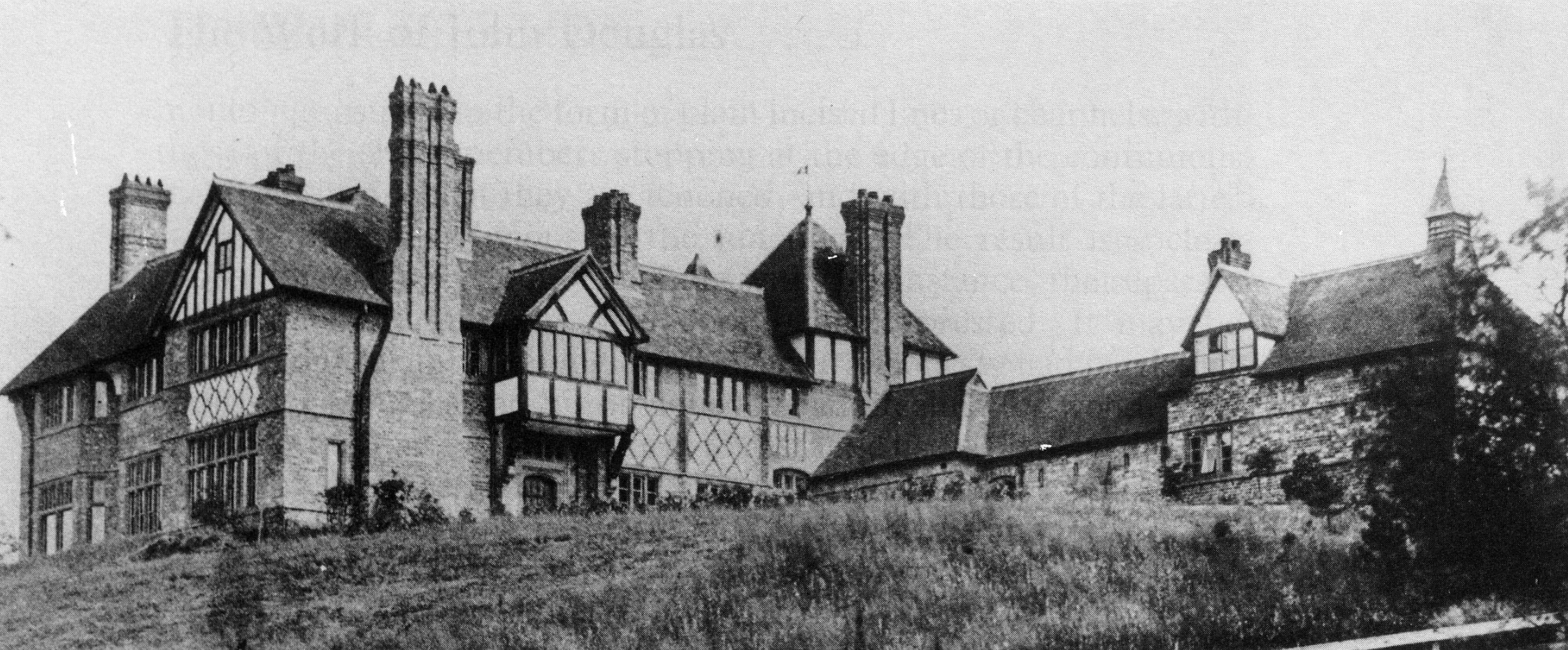
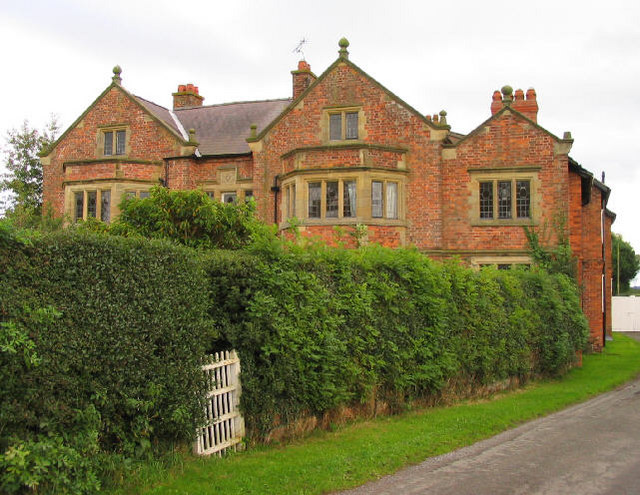
The Gelli
The Gelli is a small country house situated between Tallarn Green and Tybroughton in Wrexham County Borough, Wales. It is a Grade II* listed building...

Tybroughton
Tybroughton, occasionally written Ty Broughton, is the name of a former civil parish, historically in the Maelor Saesneg area of Flintshire, Wales and...
Stockton, Cheshire
Stockton is a former civil parish, now in the parish of Malpas, in the Cheshire West and Chester district and ceremonial county of Cheshire in England...
Oldcastle, Cheshire
Oldcastle is a former civil parish, now in the parishes of Malpas and Threapwood, in the Cheshire West and Chester district and ceremonial county of Cheshire...
Nearby Amenities
Located within 500m of 52.986606,-2.7855986Have you been to Caeparbet Wood?
Leave your review of Caeparbet Wood below (or comments, questions and feedback).