Foresters' Oaks

Wood, Forest in Monmouthshire

Wales

Foresters' Oaks

Descending Gray Hill Overlooking Wentwood.
See <a title="https://www.geograph.org.uk/photo/1097852" href="https://www.geograph.org.uk/photo/1097852">Link</a> for a similar view 13 years later.
Descending Gray Hill Credit: Robin Drayton

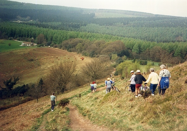
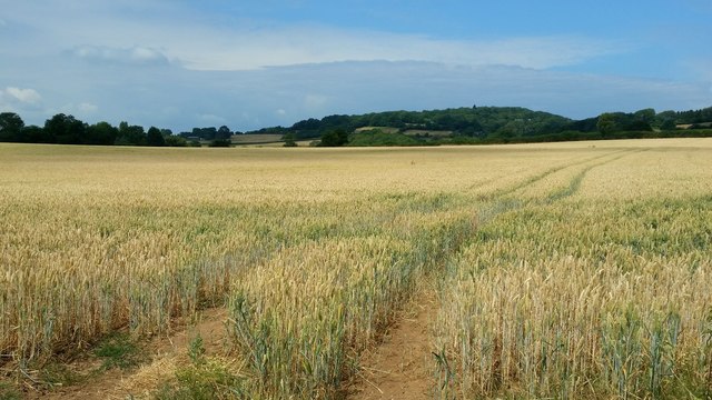
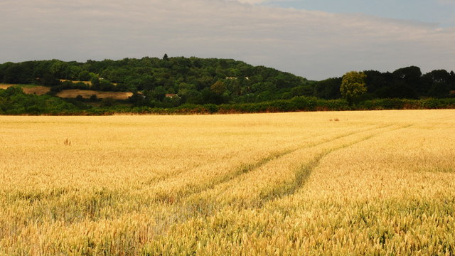
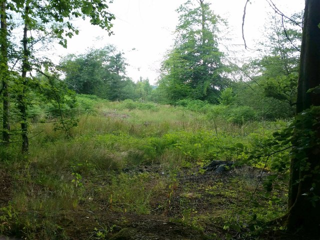
Foresters’ Oaks is a picturesque woodland located in Monmouthshire, Wales. Spanning over a vast area, the forest is home to a diverse range of flora and fauna, making it a popular destination for nature enthusiasts and hikers alike. The woodland is situated at an altitude of approximately 250 meters above sea level and is known for its scenic beauty and tranquil atmosphere.

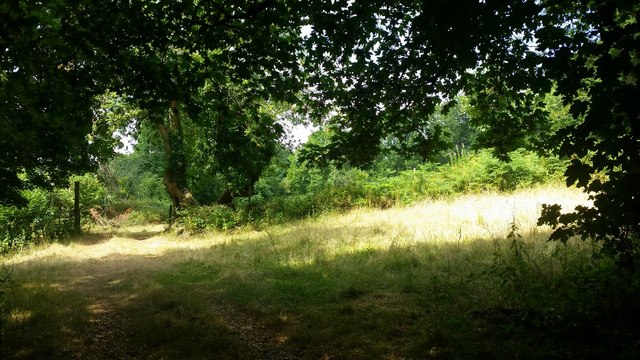
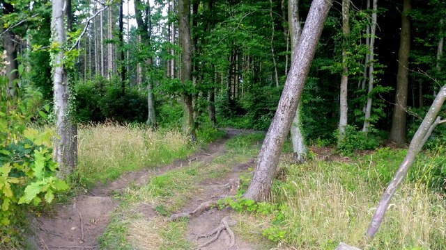
The forest is predominantly composed of oak trees, giving it its name. These majestic trees provide a dense canopy, creating a cool and shaded environment even on the hottest summer days. The woodland floor is adorned with a carpet of lush green ferns and wildflowers, adding to its natural beauty.

Foresters’ Oaks is also home to a variety of wildlife. Visitors may spot native species such as red squirrels, badgers, and foxes, as well as a wide range of bird species including woodpeckers, owls, and pheasants. The forest is a haven for birdwatchers, offering opportunities for observation and photography.

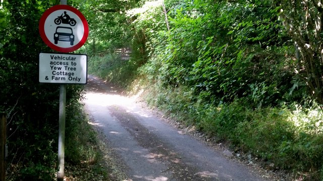
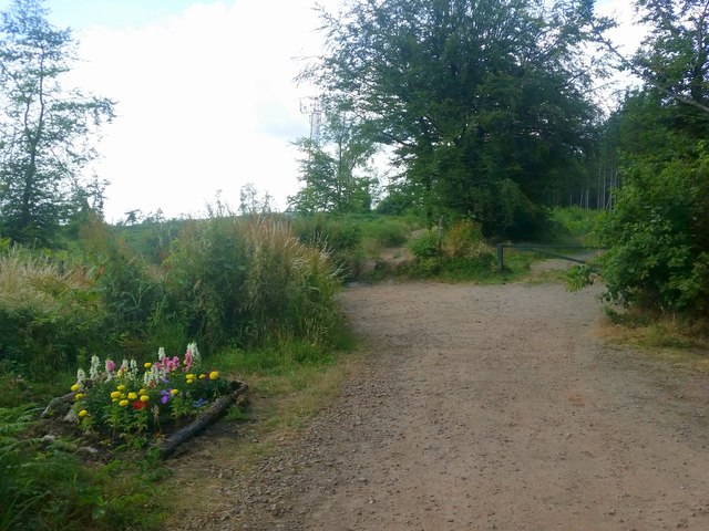
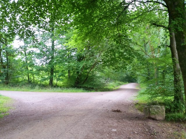
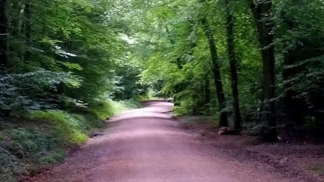
The woodland has several well-marked trails that cater to different levels of difficulty, accommodating both casual strollers and experienced hikers. The paths wind through the forest, leading visitors past babbling brooks, peaceful ponds, and ancient stone ruins. Along the way, there are designated picnic areas and benches where visitors can rest and enjoy the serenity of the surroundings.

Foresters’ Oaks is a protected area, and visitors are encouraged to respect the forest and its inhabitants. The woodland is open to the public year-round, and admission is free, making it an accessible and affordable destination for nature lovers in Monmouthshire and beyond.

If you have any feedback on the listing, please let us know in the comments section below.

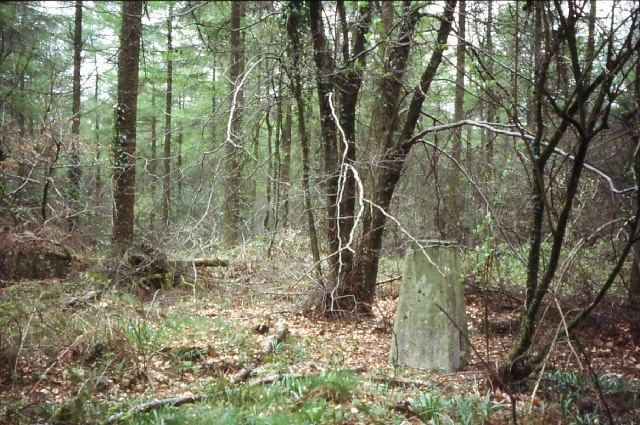
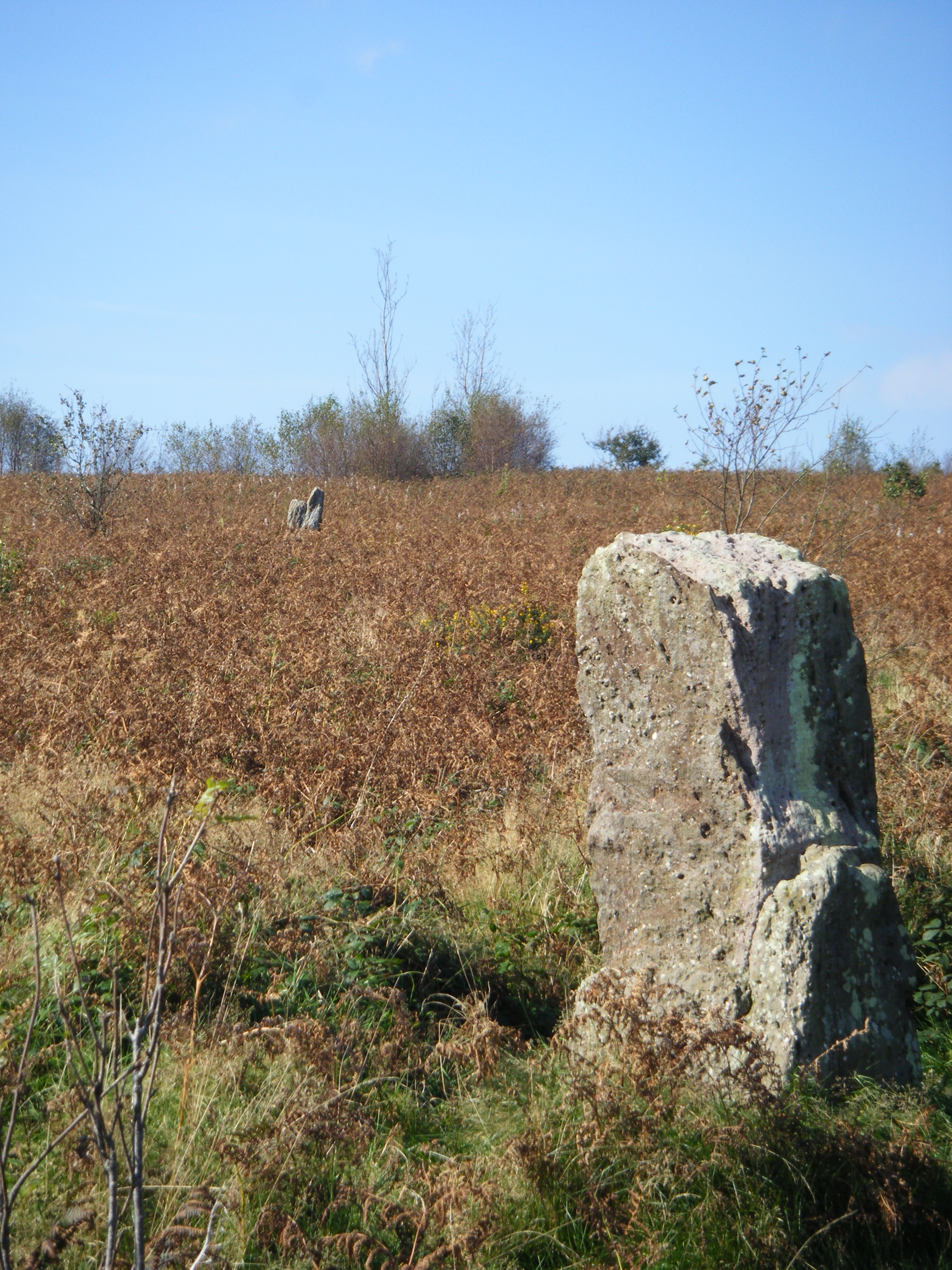
Foresters' Oaks Images

Images are sourced within 2km of 51.641076/-2.8256637 or Grid Reference ST4293. Thanks to Geograph Open Source API. All images are credited.

Descending Gray Hill Overlooking Wentwood.
See <a title="https://www.geograph.org.uk/photo/1097852" href="https://www.geograph.org.uk/photo/1097852">Link</a> for a similar view 13 years later.
Descending Gray Hill
Overlooking Wentwood. See Link for a similar view 13 years later.
Path to the common ground Crossing a bright sunlit grassy field,
Path to the common ground
Crossing a bright sunlit grassy field,
Vehicular access Best believe it; park up here and enjoy the walk.
Vehicular access
Best believe it; park up here and enjoy the walk.
Tile House Farm The substantial building is next to the road that leads to the Gray Hill access area.
Tile House Farm
The substantial building is next to the road that leads to the Gray Hill access area.
Ripening wheat An arable field to the west of Llanfair-Discoed and east of Llanvaches.
Ripening wheat
An arable field to the west of Llanfair-Discoed and east of Llanvaches.
Ripening wheat, 2 Telephoto shot from the same spot as <a href="https://www.geograph.org.uk/photo/5849974">ST4392 : Ripening wheat</a>.
The wooded hill in the distance is at Castell-prin Wood.
Ripening wheat, 2
Telephoto shot from the same spot as ST4392 : Ripening wheat. The wooded hill in the distance is at Castell-prin Wood.
View from Little Oak, Wentwood In the foreground, some clearfell of the conifers of Wentwood. Centre middle distance is the wooded top of Mynydd Alltir-fach. In the far distance is the Second Severn Crossing and Bristolshire on the English side.
View from Little Oak, Wentwood
In the foreground, some clearfell of the conifers of Wentwood. Centre middle distance is the wooded top of Mynydd Alltir-fach. In the far distance is the Second Severn Crossing and Bristolshire on the English side.
Beech-lined forest track Broadleaves are established along roads and tracks and the forest is infilled with conifers.
Beech-lined forest track
Broadleaves are established along roads and tracks and the forest is infilled with conifers.
Approaching Wentwood summit Looking west towards the phone mast.
To the left is one of those shrines that are increasingly popping-up on scenic locations and scenes of accidents.
Approaching Wentwood summit
Looking west towards the phone mast. To the left is one of those shrines that are increasingly popping-up on scenic locations and scenes of accidents.
Track into Wentwood Looks like an entry point, authorised or otherwise, for 4x4 vehicles into the forest.
Track into Wentwood
Looks like an entry point, authorised or otherwise, for 4x4 vehicles into the forest.
Wentwood at Cadira Beeches, 1 A view of an open broadleaf section of the forest.
Wentwood at Cadira Beeches, 1
A view of an open broadleaf section of the forest.
Wentwood at Cadira Beeches, 2 Track to the left is a bridleway north over the summit and descending to Bluebell Farm.
Wentwood at Cadira Beeches, 2
Track to the left is a bridleway north over the summit and descending to Bluebell Farm.
Wentwood forest track Cambered bridleway heading east towards Shirenewton.
Wentwood forest track
Cambered bridleway heading east towards Shirenewton.
Track towards the Five Paths The Wentwood forest tracks dissect the forested plateau.
Track towards the Five Paths
The Wentwood forest tracks dissect the forested plateau.
Wentwood forest track The Wentwood forest tracks dissect the forested plateau.
Wentwood forest track
The Wentwood forest tracks dissect the forested plateau.
Clearfell in Wentwood A lot of seedling conifers are popping up here but the general view is open to the south and east of the camera position.
Clearfell in Wentwood
A lot of seedling conifers are popping up here but the general view is open to the south and east of the camera position.
Gray Hill prehistoric stone row A probable single stone row measuring 78.7m long, including 6 different sized stones. The row is orientated north west to south east and leads from one side of a kerbed cairn. <span class="nowrap"><a title="https://stonerows.wordpress.com/gazetteer/region/wales/gray-hill/" rel="nofollow ugc noopener" href="https://stonerows.wordpress.com/gazetteer/region/wales/gray-hill/">Link</a><img style="margin-left:2px;" alt="External link" title="External link - shift click to open in new window" src="https://s1.geograph.org.uk/img/external.png" width="10" height="10"/></span>
Gray Hill prehistoric stone row
A probable single stone row measuring 78.7m long, including 6 different sized stones. The row is orientated north west to south east and leads from one side of a kerbed cairn. LinkExternal link
Wentwood Summit The highest point of Wentwood, deep in the forest.
Wentwood Summit
The highest point of Wentwood, deep in the forest.
Show me another place!

Foresters' Oaks is located at Grid Ref: ST4293 (Lat: 51.641076, Lng: -2.8256637)

Unitary Authority: Monmouthshire

Police Authority: Gwent

What 3 Words

///tweed.eased.fields. Near Llanvaches, Newport

Related Wikis

Gray Hill, Monmouthshire

Gray Hill (Welsh: Mynydd Llwyd) is a hill immediately to the north of the village of Llanvair Discoed, Monmouthshire, South Wales, rising to 896 feet...

Wentwood

Wentwood (Welsh: Coed Gwent), in Monmouthshire, South Wales, is a forested area of hills, rising to 1,014 feet (309 m) above sea level. It is located to...

Pen-y-cae-mawr

Pen-y-cae-mawr is a small hamlet above the Wentwood Forest in Monmouthshire, Wales. It lies about 2 miles (3.2 km) east of Llantrisant. There are two farms...

Llanvaches

Llanvaches or Llanfaches is a village and community parish within the boundaries of the city of Newport, Wales. It lies to the east of the urban area...

Llanvair Discoed

Llanvair Discoed (Welsh: Llanfair Is Coed) is a small village in Monmouthshire, south-east Wales, 6 miles west of Chepstow and 10 miles east of Newport...

Earlswood, Monmouthshire

Earlswood (Welsh: Coed-yr-iarll) is a rural area of scattered settlement in Monmouthshire, south east Wales, United Kingdom. It is located five miles...

Penhow

Penhow (Welsh: Pen-hŵ) is a small village and community (parish) just inside the eastern edge of the boundary of the city of Newport, South Wales, within...

Parc-Seymour

Parc-Seymour is a suburban hamlet on the northern edge of Penhow just off the A48 road.

Nearby Amenities

Located within 500m of 51.641076,-2.8256637
Tourism: picnic_site
Lat/Long: 51.6410309/-2.8272883
Ford: yes
Lat/Long: 51.6442339/-2.8280681
Woodwork by John Phillip
Addr City: Llanvaches
Addr Housename: Wentwood Timber Centre
Addr Postcode: NP26 3AZ
Addr Street: Usk Road
Craft: carpenter
Email: info@woodworkjohnphillip.co.uk
Phone: +44 1633 400 044
Source Addr Postcode: FHRS Open Data
Website: https://www.woodworkjohnphillip.co.uk/
Lat/Long: 51.6441783/-2.8299165
Cafe
The Glade Tea Rooms
Addr City: Llanvaches
Addr Postcode: NP26 3AZ
Addr Street: Usk Road
Description: Basic cafe. Accepts muddy people
Facebook: https://www.facebook.com/thegladetearooms/
Fhrs Id: 1212911
Opening Hours: Mo-Th off; Fr 11:00-16:00; Sa-Su 10:00-17:00
Outdoor Seating: yes
Phone: +44 7964 836 737
Source Addr Postcode: FHRS Open Data
Website: https://www.thegladetearooms.co.uk/
Lat/Long: 51.6435084/-2.8292545
Handmade in the forest
Addr City: Llanvaches
Addr Postcode: NP26 3AZ
Addr Street: Usk Road
Facebook: https://www.facebook.com/HandmadeintheForest/
Shop: art
Source Addr Postcode: FHRS Open Data
Website: http://www.wentwoodtimbercentre.co.uk/MakersShop.htm
Lat/Long: 51.6435553/-2.8291576
Direction: SSE
Generator Method: photovoltaic
Generator Output Electricity: yes
Generator Solar Modules: 14
Generator Source: solar
Generator Type: solar_photovoltaic_panel
Location: roof
Power: generator
Lat/Long: 51.640073/-2.8200932
The data included in this document is from www.openstreetmap.org. The data is made available under ODbL.

Have you been to Foresters' Oaks?

Leave your review of Foresters' Oaks below (or comments, questions and feedback).