Calder

Settlement in Cumberland Copeland

England

Calder

Triangulation Pillar, Seascale The Ordnance Survey triangulation pillar adjacent to Seascale Golf Course was constructed in 1949. The flush bracket benchmark number S5760 on the west face of the pillar marks a height of 41.3431m above sea level (Ordnance Datum Newlyn) last verified in 1965 (photograph <a href="https://www.geograph.org.uk/photo/7219327">NY0301 : Flush Bracket Benchmark, Seascale</a>).
Triangulation Pillar, Seascale Credit: Adrian Taylor

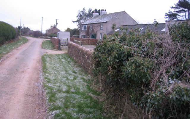
Calder is a small village located in the district of Cumberland, England. Situated in the northern part of the country, Calder is nestled within the breathtaking landscapes of the Lake District National Park. This picturesque village is surrounded by rolling hills, lush green fields, and serene lakes, making it an idyllic destination for nature lovers and outdoor enthusiasts.

Historically, Calder has been known for its agricultural roots, with farming playing a significant role in the local economy. The village has managed to retain its traditional charm, with a scattering of charming cottages and farmhouses dotting the landscape. The community in Calder is close-knit, and residents take pride in preserving their rural heritage.

Despite its small size, Calder offers a range of amenities to its inhabitants and visitors. There is a local pub, where locals often gather to socialize and enjoy a pint of ale. The village also has a village hall, which serves as a hub for various community activities and events.

For those seeking outdoor adventures, Calder is a gateway to the stunning Lake District National Park. The area boasts an array of activities, including hiking, cycling, boating, and fishing. Popular nearby attractions include the tranquil Caldbeck Fells, the picturesque Skiddaw Mountain, and the serene Bassenthwaite Lake.

In summary, Calder is a charming village in Cumberland, England, offering a peaceful retreat for those looking to immerse themselves in the beauty of the Lake District. Its picturesque surroundings, friendly community, and proximity to outdoor activities make it a delightful destination for both residents and visitors alike.

If you have any feedback on the listing, please let us know in the comments section below.
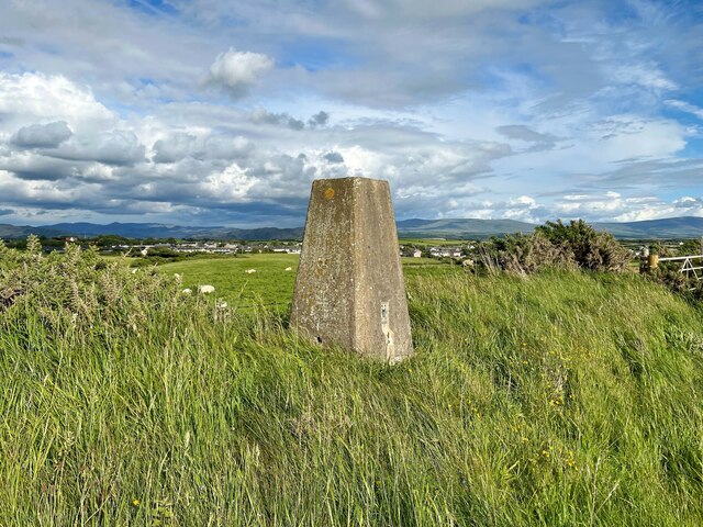
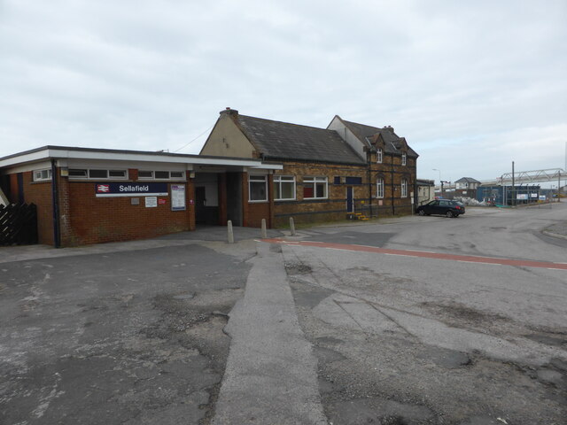
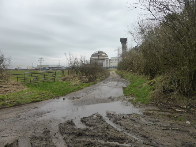
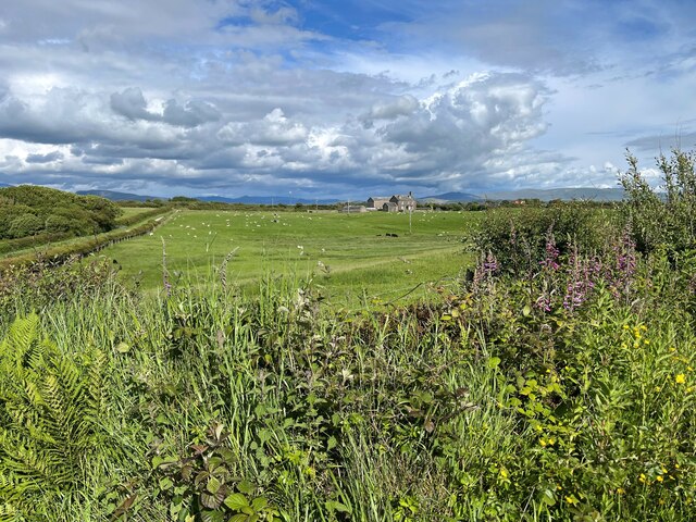
Calder Images

Images are sourced within 2km of 54.418205/-3.482343 or Grid Reference NY0303. Thanks to Geograph Open Source API. All images are credited.

Triangulation Pillar, Seascale The Ordnance Survey triangulation pillar adjacent to Seascale Golf Course was constructed in 1949. The flush bracket benchmark number S5760 on the west face of the pillar marks a height of 41.3431m above sea level (Ordnance Datum Newlyn) last verified in 1965 (photograph <a href="https://www.geograph.org.uk/photo/7219327">NY0301 : Flush Bracket Benchmark, Seascale</a>).
Triangulation Pillar, Seascale
The Ordnance Survey triangulation pillar adjacent to Seascale Golf Course was constructed in 1949. The flush bracket benchmark number S5760 on the west face of the pillar marks a height of 41.3431m above sea level (Ordnance Datum Newlyn) last verified in 1965 (photograph NY0301 : Flush Bracket Benchmark, Seascale).
Flush Bracket Benchmark, Seascale Detail of the flush bracket benchmark on the Ordnance Survey triangulation pillar at Seascale (photograph <a href="https://www.geograph.org.uk/photo/7219324">NY0301 : Triangulation Pillar, Seascale</a>). The flush bracket, benchmark number S5760, is on the west face of the pillar and marks a height of 41.3431m above sea level (Ordnance Datum Newlyn), last verified in 1965.
Flush Bracket Benchmark, Seascale
Detail of the flush bracket benchmark on the Ordnance Survey triangulation pillar at Seascale (photograph NY0301 : Triangulation Pillar, Seascale). The flush bracket, benchmark number S5760, is on the west face of the pillar and marks a height of 41.3431m above sea level (Ordnance Datum Newlyn), last verified in 1965.
Sellafield Station
Sellafield Station
Spare rails and a spare locomotive In the goods yard at Sellafield.
Spare rails and a spare locomotive
In the goods yard at Sellafield.
Looking towards Building B30 Home to one of the early plutonium-based reactors.  ""It is the most hazardous industrial building in western Europe," according to George Beveridge, Sellafield's deputy managing director - in The Guardian 2009.
Looking towards Building B30
Home to one of the early plutonium-based reactors. ""It is the most hazardous industrial building in western Europe," according to George Beveridge, Sellafield's deputy managing director - in The Guardian 2009.
Where the River Calder joins the River Ehen
The Nature Reserve outside the nuclear site fence
A strange artefact and the mouth of the Calder This 'thing' is quite big, but its purpose is unclear. See: <a title="https://www.geograph.org.uk/photo/4665386" href="https://www.geograph.org.uk/photo/4665386">Link</a>
A strange artefact and the mouth of the Calder
This 'thing' is quite big, but its purpose is unclear. See: Link
The railway bridge over the Calder It seems bizarre that one of the most secure (hopefully) sites in Britain has a river running through the middle of it.
The railway bridge over the Calder
It seems bizarre that one of the most secure (hopefully) sites in Britain has a river running through the middle of it.
The England Coast Path near Sellafield
Golf course and high security The multiple security fences of Sellafield are visible beyond the fairway. No searching for lost balls over there.
Golf course and high security
The multiple security fences of Sellafield are visible beyond the fairway. No searching for lost balls over there.
Muddy tracks near Fleming Hall farm
Lane near Fleming Hall The lane is a public bridleway and runs from Seascale Hall to Gosforth.
Lane near Fleming Hall
The lane is a public bridleway and runs from Seascale Hall to Gosforth.
Stored construction materials Stored construction materials beside the access track to Seascale Hall Farm.
Stored construction materials
Stored construction materials beside the access track to Seascale Hall Farm.
Field gateway near Seascale Hall
Fields near Seascale Lane Head Farm is in the distance with the Lake District fells beyond.
Fields near Seascale
Lane Head Farm is in the distance with the Lake District fells beyond.
Lane near Fleming Hall The lane is a public bridleway from Seascale Hall to Gosforth.
Lane near Fleming Hall
The lane is a public bridleway from Seascale Hall to Gosforth.
Field near Fleming Hall
Show me another place!

Calder is located at Grid Ref: NY0303 (Lat: 54.418205, Lng: -3.482343)

Administrative County: Cumbria

District: Copeland

Police Authority: Cumbria

What 3 Words

///airstrip.signs.turntable. Near Seascale, Cumbria

Nearby Locations

Calder

Related Wikis

Calder, Cumbria

Calder is a small hamlet in Cumbria, England. It is overlooked by the Sellafield nuclear plant—Calder Hall Nuclear Power Station was the world's first...

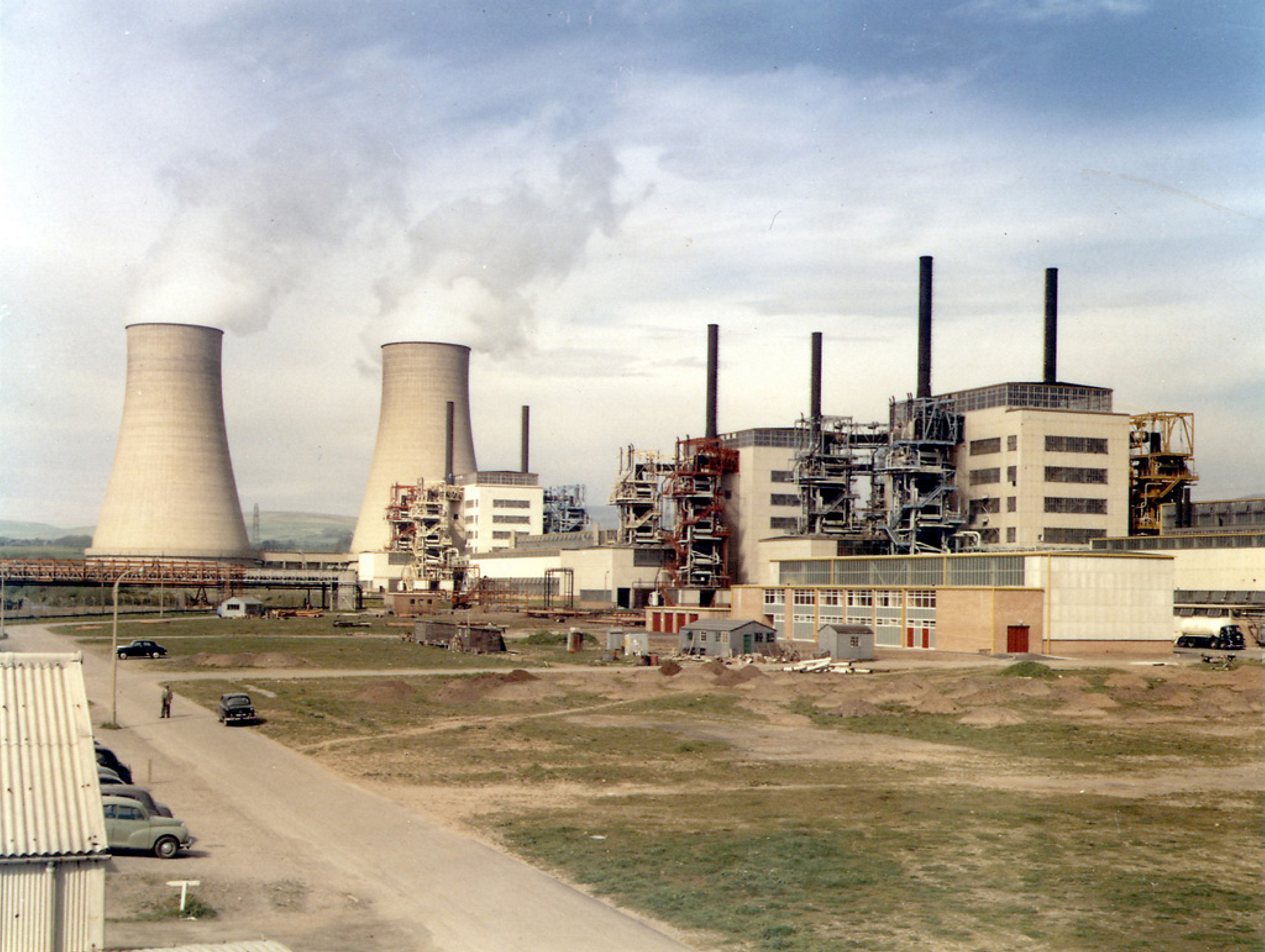
Calder Hall nuclear power station

Calder Hall Nuclear Power Station is a former Magnox nuclear power station at Sellafield in Cumbria in North West England. Calder Hall was the world's...

Sellafield

Sellafield, formerly known as Windscale, is a large multi-function nuclear site close to Seascale on the coast of Cumbria, England. As of August 2022,...

Windscale Piles

The Windscale Piles were two air-cooled graphite-moderated nuclear reactors on the Windscale nuclear site in Cumberland (now known as Sellafield site,...

Nearby Amenities

Located within 500m of 54.418205,-3.482343
Power: tower
Lat/Long: 54.4200225/-3.4834405
Power: tower
Lat/Long: 54.4203571/-3.4875719
Power: tower
Lat/Long: 54.4204321/-3.4880876
Barrier: unknown
Lat/Long: 54.4164361/-3.4894092
Power: pole
Source: bing
Lat/Long: 54.419969/-3.4849134
Power: pole
Source: bing
Lat/Long: 54.415231/-3.4868692
Power: pole
Source: bing
Lat/Long: 54.4208004/-3.485069
Power: pole
Source: bing
Lat/Long: 54.4144243/-3.4861678
Power: pole
Source: bing
Lat/Long: 54.4199804/-3.4847928
Power: pole
Source: bing
Lat/Long: 54.4216063/-3.4854857
Power: pole
Source: bing
Lat/Long: 54.4192253/-3.4846561
Power: pole
Source: bing
Lat/Long: 54.4191727/-3.4845084
Power: pole
Source: bing
Lat/Long: 54.4207888/-3.4852087
Power: pole
Source: bing
Lat/Long: 54.421605/-3.485366
Man Made: chimney
Source: bing
Lat/Long: 54.4189677/-3.4896066
Power: tower
Lat/Long: 54.4188307/-3.4807469
Power: tower
Lat/Long: 54.4171477/-3.4769157
Power: tower
Lat/Long: 54.4213475/-3.4858699
Power: pole
Lat/Long: 54.4138298/-3.4819255
Power: pole
Lat/Long: 54.4139492/-3.4831258
Power: pole
Lat/Long: 54.4139241/-3.4817633
Power: pole
Lat/Long: 54.4140638/-3.4828389
Man Made: chimney
Lat/Long: 54.4182083/-3.4886914
Man Made: chimney
Lat/Long: 54.418062/-3.4883258
Man Made: chimney
Lat/Long: 54.4179215/-3.4879533
Man Made: chimney
Lat/Long: 54.4194789/-3.4885696
The data included in this document is from www.openstreetmap.org. The data is made available under ODbL.

Have you been to Calder?

Leave your review of Calder below (or comments, questions and feedback).