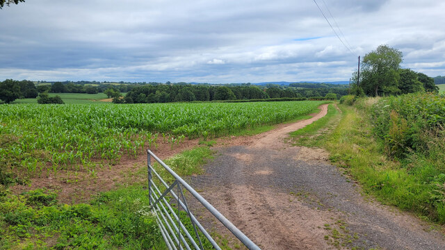
Pen-y-lan Wood

Wood, Forest in Monmouthshire

Wales

Pen-y-lan Wood

Trees in hedgerow near Court Robert Trees in a hedgerow in farmland near Court Robert.
Trees in hedgerow near Court Robert Credit: Philip Halling

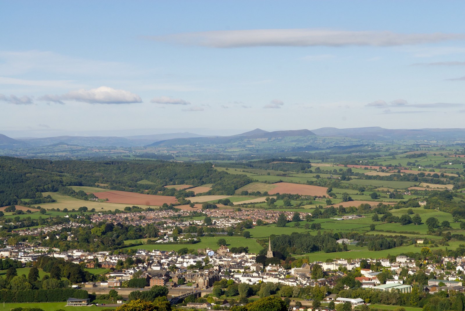
Pen-y-lan Wood is a picturesque woodland located in Monmouthshire, Wales. Covering an area of approximately 100 acres, this ancient forest is known for its diverse range of flora and fauna, making it a popular destination for nature enthusiasts and hikers.

The woodland is predominantly composed of broadleaf trees, including oak, beech, and birch. These towering trees provide a canopy that creates a cool and peaceful atmosphere, perfect for a leisurely stroll or a picnic. The forest floor is carpeted with a variety of wildflowers, such as bluebells and primroses, adding to the visual appeal of the woodland.

Pen-y-lan Wood is home to a rich array of wildlife, including numerous bird species like woodpeckers, owls, and songbirds. Small mammals, such as squirrels, rabbits, and foxes, can also be spotted scurrying through the undergrowth. The woodland's tranquil environment and abundance of food sources make it an ideal habitat for these creatures.

Several well-maintained trails wind their way through Pen-y-lan Wood, providing visitors with opportunities to explore its natural beauty. These paths vary in difficulty and length, catering to both casual walkers and experienced hikers. Along the way, visitors may come across several viewpoints that offer stunning panoramic vistas of the surrounding countryside.

Pen-y-lan Wood is open to the public year-round, and the changing seasons bring their own unique charm to this woodland. Whether it is the vibrant colors of autumn, the fresh greenery of spring, or the peaceful stillness of winter, there is always something captivating to discover in Pen-y-lan Wood.

If you have any feedback on the listing, please let us know in the comments section below.

Pen-y-lan Wood Images

Images are sourced within 2km of 51.791207/-2.8833984 or Grid Reference SO3910. Thanks to Geograph Open Source API. All images are credited.

Trees in hedgerow near Court Robert Trees in a hedgerow in farmland near Court Robert.
Trees in hedgerow near Court Robert
Trees in a hedgerow in farmland near Court Robert.
Road passing Court Robert Country road passing Court Robert which can be seen on the right.
Road passing Court Robert
Country road passing Court Robert which can be seen on the right.
National Speed Limit sign, Llanarth, Monmouthshire Viewed from the 30mph zone.
National Speed Limit sign, Llanarth, Monmouthshire
Viewed from the 30mph zone.
Towards road markings, Llanarth Looking towards broken white lines in the middle of a hedge-lined road in rural Monmouthshire.
Towards road markings, Llanarth
Looking towards broken white lines in the middle of a hedge-lined road in rural Monmouthshire.
Warning sign in a hedge, Llanarth, Monmouthshire  On the approach to a minor junction.
Warning sign in a hedge, Llanarth, Monmouthshire
On the approach to a minor junction.
Former church for sale in January 2022, Llanarth The former St Teilo's church in the Church in Wales Diocese of Monmouth was for sale when I was here in September 2020. It remains for sale on January 2nd 2022.
Former church for sale in January 2022, Llanarth
The former St Teilo's church in the Church in Wales Diocese of Monmouth was for sale when I was here in September 2020. It remains for sale on January 2nd 2022.
Deciduous trees in winter, Llanarth, Monmouthshire Leafless trees viewed on January 2nd 2022.
Deciduous trees in winter, Llanarth, Monmouthshire
Leafless trees viewed on January 2nd 2022.
Muddy field in winter, Llanarth, Monmouthshire Viewed on January 2nd 2022.
Muddy field in winter, Llanarth, Monmouthshire
Viewed on January 2nd 2022.
Stile access to a public footpath, Llanarth Near the stile, a public footpath sign points towards this <a title="https://www.geograph.org.uk/photo/7060546" href="https://www.geograph.org.uk/photo/7060546">Link</a> field, muddy on January 2nd 2022.
Stile access to a public footpath, Llanarth
Near the stile, a public footpath sign points towards this Link field, muddy on January 2nd 2022.
Church For Sale board, January 2022, Llanarth The Hutchings & Thomas chartered surveyors board refers to the nearby former St Teilo's Church <a title="https://www.geograph.org.uk/photo/7060540" href="https://www.geograph.org.uk/photo/7060540">Link</a>. A Heritage Llanarth September 2021 Newsletter <a title="https://www.geograph.org.uk/photo/7060552" href="https://www.geograph.org.uk/photo/7060552">Link</a> is on the lower left corner of the board on January 2nd 2022.
Church For Sale board, January 2022, Llanarth
The Hutchings & Thomas chartered surveyors board refers to the nearby former St Teilo's Church Link. A Heritage Llanarth September 2021 Newsletter Link is on the lower left corner of the board on January 2nd 2022.
Heritage Llanarth September 2021 Newsletter  On this <a title="https://www.geograph.org.uk/photo/7060551" href="https://www.geograph.org.uk/photo/7060551">Link</a> Church For Sale board on January 2nd 2022.
Heritage Llanarth September 2021 Newsletter
On this Link Church For Sale board on January 2nd 2022.
Monmouthshire wheat field To the north of Llanarth, looking north-west.
Monmouthshire wheat field
To the north of Llanarth, looking north-west.
Monmouthshire maize field To the north of Llanarth, looking north-east.
Monmouthshire maize field
To the north of Llanarth, looking north-east.
Green Lane to Tynewydd Farm Through route to Llanarth.
Green Lane to Tynewydd Farm
Through route to Llanarth.
Oak tree by the green lane Looking west towards Llaca-du.
Oak tree by the green lane
Looking west towards Llaca-du.
Rough grazing at Llaca-du Looking north-west.
Rough grazing at Llaca-du
Looking north-west.
Narrow Monmouthshire Lane Looking towards Argoed Farm.
Narrow Monmouthshire Lane
Looking towards Argoed Farm.
Small mixed plantation Adjacent to the byway to Tregare.
Small mixed plantation
Adjacent to the byway to Tregare.
Show me another place!

Pen-y-lan Wood is located at Grid Ref: SO3910 (Lat: 51.791207, Lng: -2.8833984)

Unitary Authority: Monmouthshire

Police Authority: Gwent

What 3 Words

///tech.ratio.darkens. Near Llanarth, Monmouthshire

Nearby Locations

Clawdd Wood Pen-y-lan Wood

Related Wikis

Church of St Mary and St Michael, Llanarth

The Church of St Mary and St Michael, Llanarth, Monmouthshire, was built as the family chapel for Llanarth Court. It was the first Roman Catholic church...
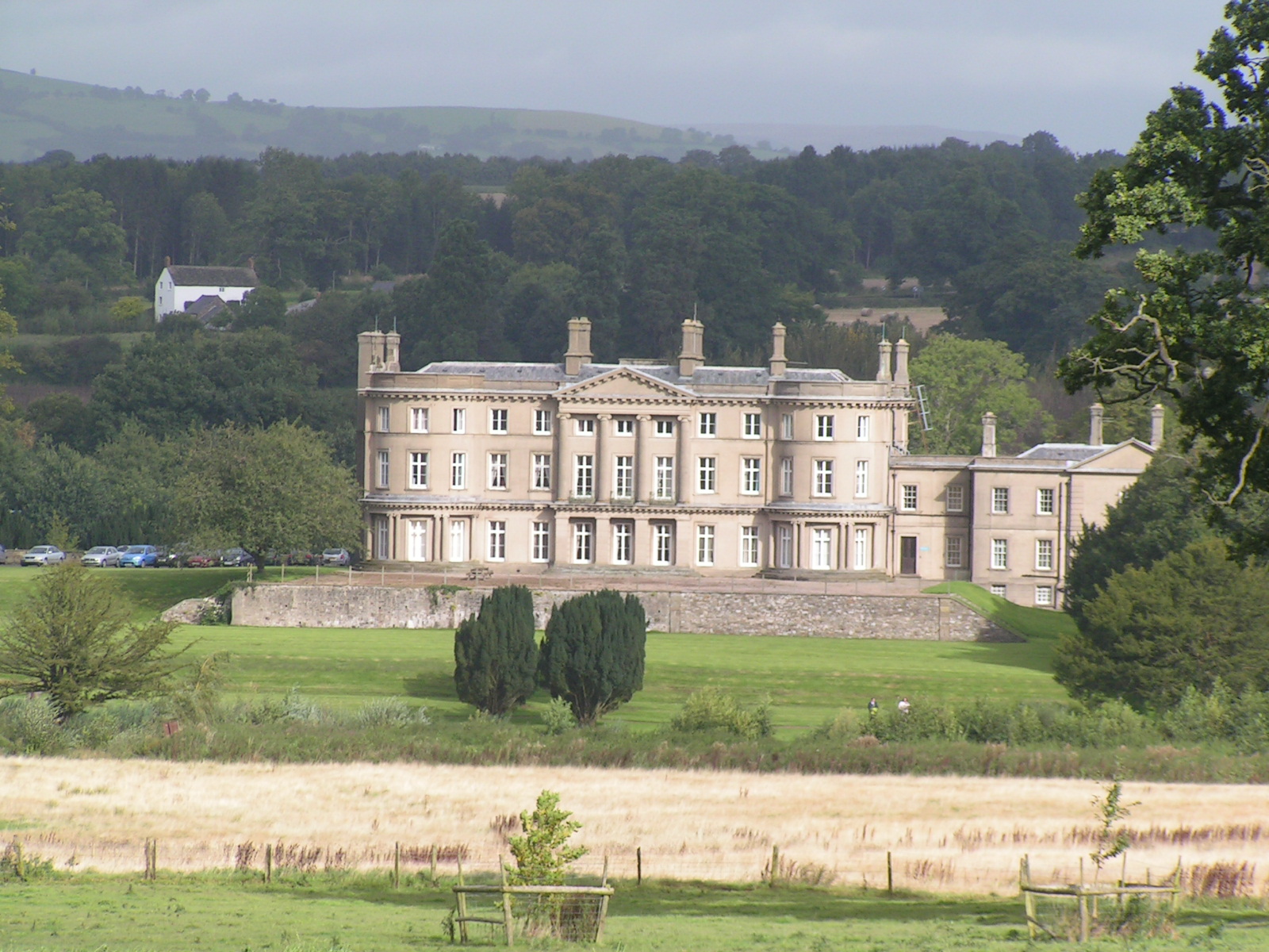
Llanarth Court

Llanarth Court is a late-18th-century country house with substantial 19th-century alterations in Llanarth, Monmouthshire, Wales. The court was built for...

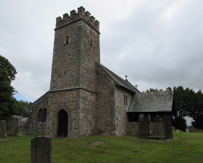
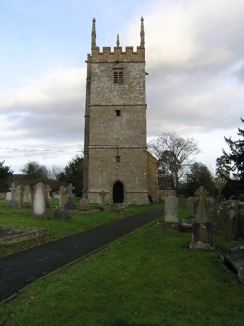
St Peter's Church, Bryngwyn

The Church of St Peter, Bryngwyn, Monmouthshire, Wales is a parish church with its origins in the 13th century. It is a Grade II* listed building. ��2...

Bryngwyn

Bryngwyn is a village and rural location in Monmouthshire, south east Wales. == Location == Bryngwyn is located two miles to the west of Raglan in Monmouthshire...

Llwyn-y-gaer House, Tregare

Llwyn-y-gaer House, Tregare, Monmouthshire is a farmhouse dating from the mid 17th century, although with earlier origins. Described by John Newman as...

Monmouthshire

Monmouthshire ( MON-məth-shər, MUN-; Welsh: Sir Fynwy) is a county in the south east of Wales. It borders Powys to the north; the English counties of Herefordshire...

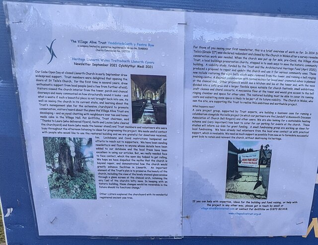
St Teilo's Church, Llanarth

The Church of St Teilo, Llanarth, Monmouthshire, Wales is a former parish church with its origins in the 15th century. Renovations took place in the 18th...

Llanarth, Monmouthshire

Llanarth is a privately owned estate village and community within a conservation area in the Welsh county of Monmouthshire. Llanarth is roughly six miles...

Have you been to Pen-y-lan Wood?

Leave your review of Pen-y-lan Wood below (or comments, questions and feedback).