Dyffryn Wood

Wood, Forest in Monmouthshire

Wales

Dyffryn Wood

Entrance to Werngochlyn Farm The cone of Y Fal, Sugarloaf, in the distance.
Entrance to Werngochlyn Farm Credit: Jonathan Billinger

Dyffryn Wood, located in Monmouthshire, Wales, is a picturesque forest that covers an area of approximately 100 hectares. The wood is nestled in the beautiful Wye Valley, offering visitors a tranquil and serene environment to explore and appreciate the natural beauty of the region.

The forest is predominantly composed of broadleaf trees, including oak, beech, and ash, creating a diverse and vibrant ecosystem. This variety of tree species provides a habitat for a wide range of wildlife, making it a popular destination for nature enthusiasts and birdwatchers. Visitors may be lucky enough to spot species such as red kites, buzzards, and woodpeckers during their visit.

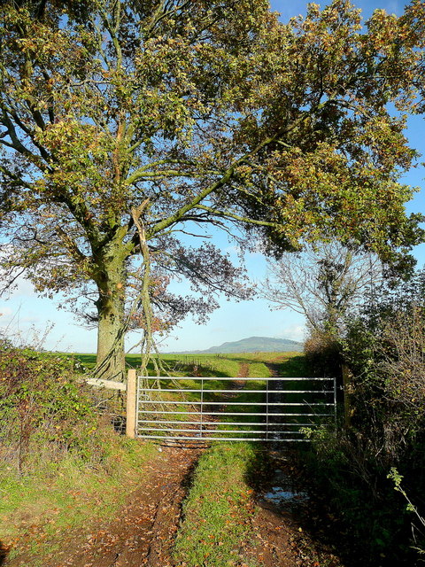
Dyffryn Wood is crisscrossed by a network of well-maintained footpaths, allowing visitors to easily explore the forest and enjoy leisurely walks or more challenging hikes. The paths wind through the forest, offering glimpses of the surrounding countryside and providing opportunities for visitors to immerse themselves in the peaceful atmosphere.

The wood is also home to a number of historic features, including remnants of ancient boundary banks and ditches, which add to the area's charm and intrigue. As a designated Site of Special Scientific Interest (SSSI), Dyffryn Wood is of significant ecological importance and is protected to preserve its unique flora and fauna.

In conclusion, Dyffryn Wood in Monmouthshire is a stunning forest that showcases the natural beauty of the Wye Valley. With its diverse ecosystem, well-maintained paths, and historic features, it offers a delightful experience for nature lovers and those seeking a peaceful retreat in the heart of Wales.

If you have any feedback on the listing, please let us know in the comments section below.
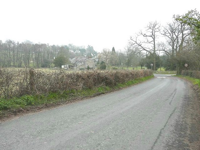
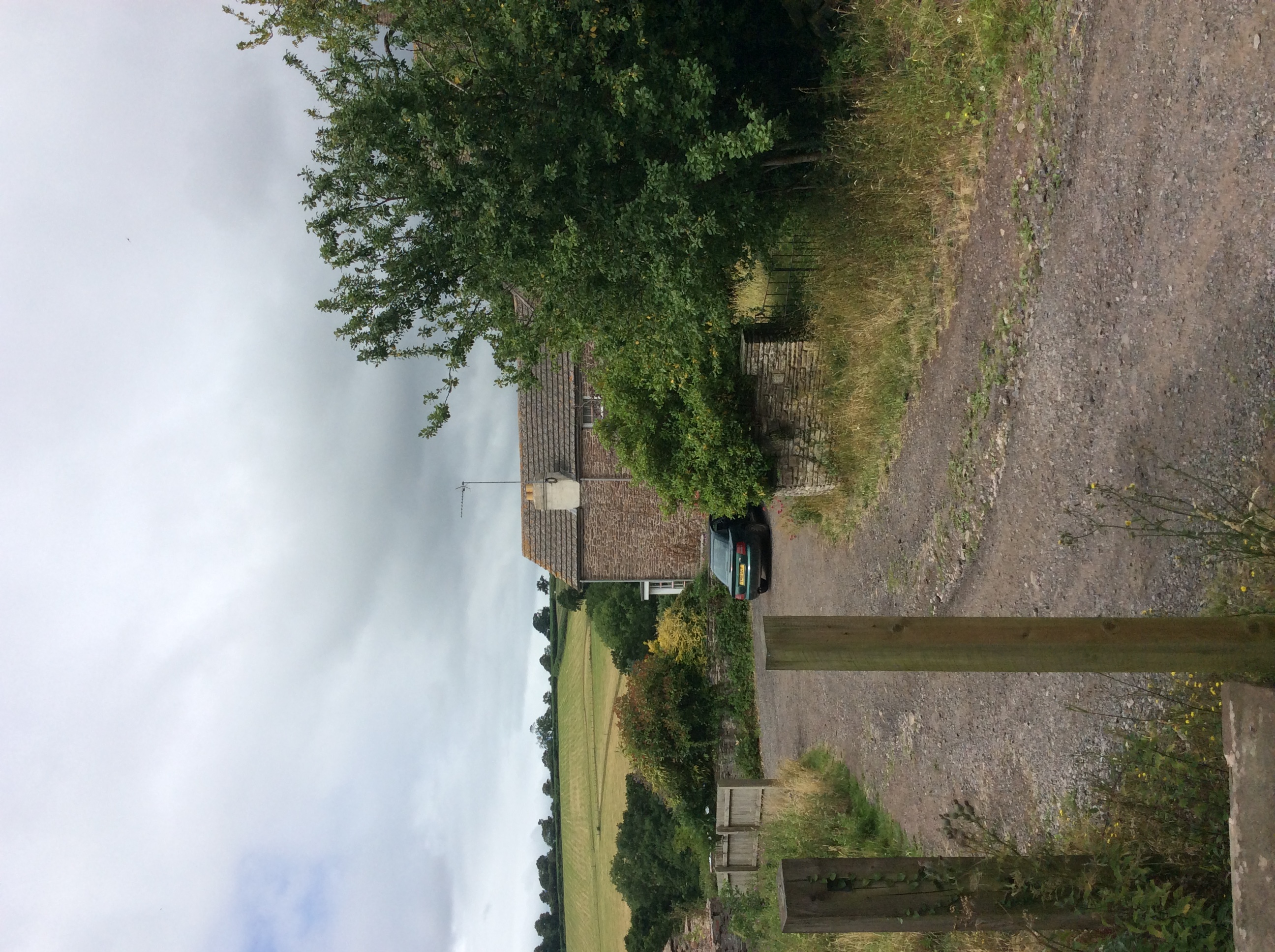
Dyffryn Wood Images

Images are sourced within 2km of 51.833569/-2.9374166 or Grid Reference SO3515. Thanks to Geograph Open Source API. All images are credited.

Entrance to Werngochlyn Farm The cone of Y Fal, Sugarloaf, in the distance.
Entrance to Werngochlyn Farm
The cone of Y Fal, Sugarloaf, in the distance.
Pasture land Blorenge in the distance, right.
Pasture land
Blorenge in the distance, right.
Small haylage field Some bales and a substantial area of uncultivated in the foreground.
Cereal crop beyond.
Small haylage field
Some bales and a substantial area of uncultivated in the foreground. Cereal crop beyond.
Lane near Llandwr Looking west.
Lane near Llandwr
Looking west.
Grassland at The Tump The view south-west towards Mynachdy Farm
Grassland at The Tump
The view south-west towards Mynachdy Farm
Narrow lane Emmasfield Farm is by the bend at the bottom of the road.
Narrow lane
Emmasfield Farm is by the bend at the bottom of the road.
B4233 towards Abergavenny Looking west past the former White Swan pub.
B4233 towards Abergavenny
Looking west past the former White Swan pub.
Corrugated Village Hall, Llanddewi Skirrid, Monmouthshire Llanddewi Skirrid Village Hall is a corrugated iron sheeting building dating from the 1880s. It was Grade II listed in 1998 as a rare example of a well designed and largely unaltered late 19th century prefabricated iron hall.
Corrugated Village Hall, Llanddewi Skirrid, Monmouthshire
Llanddewi Skirrid Village Hall is a corrugated iron sheeting building dating from the 1880s. It was Grade II listed in 1998 as a rare example of a well designed and largely unaltered late 19th century prefabricated iron hall.
Llanddewi Skirrid Village Hall noticeboard, Monmouthshire In July 2022, during the Russian invasion of Ukraine, the board includes a depiction of the blue and yellow National Flag of Ukraine. The board shows LLANDEWI whereas most references to the village show Llanddewi.
Llanddewi Skirrid Village Hall noticeboard, Monmouthshire
In July 2022, during the Russian invasion of Ukraine, the board includes a depiction of the blue and yellow National Flag of Ukraine. The board shows LLANDEWI whereas most references to the village show Llanddewi.
Dead-end road, Llanddewi Skirrid, Monmouthshire Descending from the B4521 Old Ross Road.
Dead-end road, Llanddewi Skirrid, Monmouthshire
Descending from the B4521 Old Ross Road.
Old Ross Road, Llanddewi Skirrid, Monmouthshire Looking to the SE up the B4521 Old Ross Road.
Old Ross Road, Llanddewi Skirrid, Monmouthshire
Looking to the SE up the B4521 Old Ross Road.
West along the B4521, Llanddewi Skirrid, Monmouthshire Ahead on the B4521 Old Ross Road for Abergavenny.
West along the B4521, Llanddewi Skirrid, Monmouthshire
Ahead on the B4521 Old Ross Road for Abergavenny.
Road towards St David's Church, Llanddewi Skirrid, Monmouthshire Ahead for this <a title="https://www.geograph.org.uk/photo/5563467" href="https://www.geograph.org.uk/photo/5563467">Link</a> church in the Church in Wales Diocese of Monmouth.
Road towards St David's Church, Llanddewi Skirrid, Monmouthshire
Ahead for this Link church in the Church in Wales Diocese of Monmouth.
Grassland near Ton Uchaf Farm Most likely ready for cutting soon.
Grassland near Ton Uchaf Farm
Most likely ready for cutting soon.
Village Hall, Llandewi Skirrid
The B4233 road entering Llanvapley From the Abergavenny direction
The B4233 road entering Llanvapley
From the Abergavenny direction
Grassland of the Trothy valley In the distance is Edmund's Tump.
Grassland of the Trothy valley
In the distance is Edmund's Tump.
Field entrance opposite Crossways The eye is drawn to Edmund's Tump beyond.
Field entrance opposite Crossways
The eye is drawn to Edmund's Tump beyond.
Show me another place!

Dyffryn Wood is located at Grid Ref: SO3515 (Lat: 51.833569, Lng: -2.9374166)

Unitary Authority: Monmouthshire

Police Authority: Gwent

What 3 Words

///stun.tidal.soon. Near Abergavenny, Monmouthshire

Nearby Locations

Dyffryn Wood

Related Wikis

Newhouse Farmhouse, Llanvetherine

Newhouse Farmhouse, Llanvetherine, Monmouthshire is a farmhouse dating from the late-16th century. It is a Grade II* listed building. Its associated barns...

Llanvapley

Llanvapley (Welsh: Llanfable) is a village in the community of Gobion Fawr, in Monmouthshire, south east Wales, United Kingdom. Llan has replaced the...

Gelli Farmhouse, Llanvetherine

Gelli Farmhouse, Llanvetherine, Monmouthshire, is a farmhouse dating from the early 17th century. The settlement at Gelli-wig has a recorded history dating...

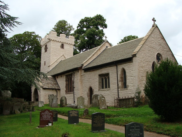
St Mapley's Church, Llanvapley

The Church of St Mapley, Llanvapley, Monmouthshire is a parish church with its origins in the 15th century. Dedicated to St Mable, variants of the dedication...

Nearby Amenities

Located within 500m of 51.833569,-2.9374166
Power: pole
Lat/Long: 51.8333875/-2.9331887
Power: pole
Lat/Long: 51.8334671/-2.9342213
Power: pole
Lat/Long: 51.8341002/-2.9363349
Power: pole
Lat/Long: 51.8347508/-2.9385732
Power: pole
Lat/Long: 51.8352016/-2.9400618
Power: pole
Lat/Long: 51.8352206/-2.9417181
Power: pole
Lat/Long: 51.835219/-2.943365
The data included in this document is from www.openstreetmap.org. The data is made available under ODbL.

Have you been to Dyffryn Wood?

Leave your review of Dyffryn Wood below (or comments, questions and feedback).