Coed-y-glyn Wood

Wood, Forest in Denbighshire

Wales

Coed-y-glyn Wood

Wrexham bus station – 1969 A feature of the bus station was the hand-painted destination boards on the shelters.

Bay 6 is occupied by a venerable Bristol LL5G of Crosville Motor Services (No.SLG191) on one of the routes to Moss. Built in 1950, at the age of 19 it was well beyond the average life of a bus in those days.

This is one of a series of views featuring buses in the 60s, 70s, and 80s. <a title="https://www.geograph.org.uk/search.php?i=137652761" href="https://www.geograph.org.uk/search.php?i=137652761">Link</a>
Wrexham bus station – 1969 Credit: Alan Murray-Rust

Coed-y-glyn Wood is a picturesque woodland located in Denbighshire, Wales. Covering an area of approximately 50 acres, this enchanting forest is situated in the rural countryside, offering a tranquil and serene atmosphere for visitors to enjoy.

The wood is characterized by a variety of tree species, including oak, beech, and silver birch, which create a diverse and vibrant landscape. The canopy of the trees provides a natural shelter, allowing sunlight to filter through the leaves and create a dappled effect on the forest floor.

Coed-y-glyn Wood is home to a rich array of wildlife, making it a popular destination for nature enthusiasts. Visitors may encounter a multitude of bird species, such as woodpeckers, owls, and red kites, as well as woodland mammals like squirrels and badgers. The wood also boasts a diverse flora, with bluebells, wildflowers, and ferns adorning the forest floor during the spring and summer months.

Several walking trails meander through the wood, allowing visitors to explore its beauty at their own pace. These paths lead to hidden glades, babbling brooks, and small waterfalls, enhancing the magical ambiance of the woodland.

Coed-y-glyn Wood is not only a haven for wildlife but also a popular recreational area. The forest offers picnic spots and benches where visitors can relax and enjoy a peaceful break in nature. Additionally, there is a small car park at the entrance, providing convenient access for those wishing to explore this beautiful woodland gem.

If you have any feedback on the listing, please let us know in the comments section below.

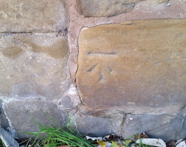
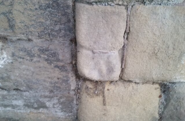
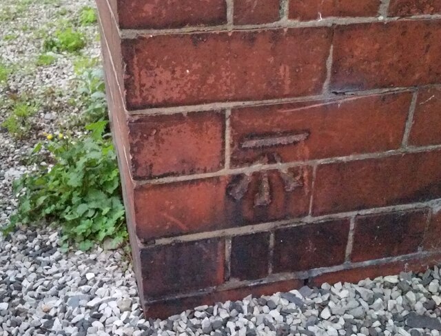
Coed-y-glyn Wood Images

Images are sourced within 2km of 53.032629/-2.9992461 or Grid Reference SJ3348. Thanks to Geograph Open Source API. All images are credited.

Wrexham bus station – 1969 A feature of the bus station was the hand-painted destination boards on the shelters.

Bay 6 is occupied by a venerable Bristol LL5G of Crosville Motor Services (No.SLG191) on one of the routes to Moss. Built in 1950, at the age of 19 it was well beyond the average life of a bus in those days.

This is one of a series of views featuring buses in the 60s, 70s, and 80s. <a title="https://www.geograph.org.uk/search.php?i=137652761" href="https://www.geograph.org.uk/search.php?i=137652761">Link</a>
Wrexham bus station – 1969
A feature of the bus station was the hand-painted destination boards on the shelters. Bay 6 is occupied by a venerable Bristol LL5G of Crosville Motor Services (No.SLG191) on one of the routes to Moss. Built in 1950, at the age of 19 it was well beyond the average life of a bus in those days. This is one of a series of views featuring buses in the 60s, 70s, and 80s. Link
From 2 to 1 at Wrexham General station Looking south along platform 1 from platform 2.
From 2 to 1 at Wrexham General station
Looking south along platform 1 from platform 2.
Ordnance Survey Cut Mark This OS cut mark can be found on the wall of No25 Hightown Road. It marks a point 73.289m above mean sea level.
Ordnance Survey Cut Mark
This OS cut mark can be found on the wall of No25 Hightown Road. It marks a point 73.289m above mean sea level.
Ordnance Survey Cut Mark This OS cut mark can be found on the north face of the Wynnstay Arms Hotel. It marks a point 80.330m above mean sea level.
Ordnance Survey Cut Mark
This OS cut mark can be found on the north face of the Wynnstay Arms Hotel. It marks a point 80.330m above mean sea level.
Ordnance Survey Cut Mark This OS cut mark can be found on the wall west side of Chester Road. It marks a point 84.725m above mean sea level.
Ordnance Survey Cut Mark
This OS cut mark can be found on the wall west side of Chester Road. It marks a point 84.725m above mean sea level.
Ordnance Survey Cut Mark This OS cut mark can be found on the Old Courts/Police Station building. It marks a point 86.786m above mean sea level.
Ordnance Survey Cut Mark
This OS cut mark can be found on the Old Courts/Police Station building. It marks a point 86.786m above mean sea level.
Ordnance Survey Cut Mark This OS cut mark can be found on No35 Hope Street. It marks a point 85.777m above mean sea level.
Ordnance Survey Cut Mark
This OS cut mark can be found on No35 Hope Street. It marks a point 85.777m above mean sea level.
Ordnance Survey Cut Mark This OS cut mark can be found on the outbuilding of Ael-y-bryn on Tenters Lane. It marks a point 86.194m above mean sea level.
Ordnance Survey Cut Mark
This OS cut mark can be found on the outbuilding of Ael-y-bryn on Tenters Lane. It marks a point 86.194m above mean sea level.
Ordnance Survey Cut Mark This OS cut mark can be found on No5 Grosvenor Road. It marks a point 87.910m above mean sea level.
Ordnance Survey Cut Mark
This OS cut mark can be found on No5 Grosvenor Road. It marks a point 87.910m above mean sea level.
Ordnance Survey Cut Mark This very worn OS cut mark can be found on the wall NW side of Grosvenor Road. It marks a point 87.084m above mean sea level.
Ordnance Survey Cut Mark
This very worn OS cut mark can be found on the wall NW side of Grosvenor Road. It marks a point 87.084m above mean sea level.
Ordnance Survey Cut Mark This OS cut mark can be found on the NE face of the Presbyterian Church on Rhos Ddu Road. It marks a point 86.585m above mean sea level.
Ordnance Survey Cut Mark
This OS cut mark can be found on the NE face of the Presbyterian Church on Rhos Ddu Road. It marks a point 86.585m above mean sea level.
Wrexham Town Centre A deserted Regent Street and Hope Street at 8pm on a Sunday evening.
Wrexham Town Centre
A deserted Regent Street and Hope Street at 8pm on a Sunday evening.
View to St Giles Church from Hope Street
Wrexham General Railway Station
Weathered benchmark on Regent Street railway bridge This very weathered benchmark is on the Regent Street railway bridge over the single line into Wrexham Central. Levelled at 89.239m above Newlyn Datum, verified 1959. For a wider view see: <a href="https://www.geograph.org.uk/photo/7543336">SJ3250 : ATS vehicle service centre, Regent Street, Wrexham</a> Benchmark database: <span class="nowrap"><a title="https://www.bench-marks.org.uk/bm175937" rel="nofollow ugc noopener" href="https://www.bench-marks.org.uk/bm175937">Link</a><img style="margin-left:2px;" alt="External link" title="External link - shift click to open in new window" src="https://s1.geograph.org.uk/img/external.png" width="10" height="10"/></span>
Weathered benchmark on Regent Street railway bridge
This very weathered benchmark is on the Regent Street railway bridge over the single line into Wrexham Central. Levelled at 89.239m above Newlyn Datum, verified 1959. For a wider view see: SJ3250 : ATS vehicle service centre, Regent Street, Wrexham Benchmark database: LinkExternal link
ATS vehicle service centre, Regent Street, Wrexham Looking across Regent Street to the ATS vehicle service centre. There is an Ordnance Survey benchmark near the end of the stone railway bridge parapet: <a href="https://www.geograph.org.uk/photo/7543323">SJ3250 : Weathered benchmark on Regent Street railway bridge</a>
ATS vehicle service centre, Regent Street, Wrexham
Looking across Regent Street to the ATS vehicle service centre. There is an Ordnance Survey benchmark near the end of the stone railway bridge parapet: SJ3250 : Weathered benchmark on Regent Street railway bridge
Benchmark on Regent Street railway bridge parapet Ordnance Survey benchmark on Regent Street railway bridge parapet above Wrexham General station. For a wider view see: <a href="https://www.geograph.org.uk/photo/7544091">SJ3250 : Premier Inn from Regent Street, Wrexham</a>
Benchmark database: <span class="nowrap"><a title="https://www.bench-marks.org.uk/bm29773" rel="nofollow ugc noopener" href="https://www.bench-marks.org.uk/bm29773">Link</a><img style="margin-left:2px;" alt="External link" title="External link - shift click to open in new window" src="https://s1.geograph.org.uk/img/external.png" width="10" height="10"/></span>
Benchmark on Regent Street railway bridge parapet
Ordnance Survey benchmark on Regent Street railway bridge parapet above Wrexham General station. For a wider view see: SJ3250 : Premier Inn from Regent Street, Wrexham Benchmark database: LinkExternal link
Premier Inn from Regent Street, Wrexham Looking across Regent Street towards Wrexham's Premier Inn. There is an Ordnance Survey benchmark on the end of the parapet of the railway bridge: <a href="https://www.geograph.org.uk/photo/7544078">SJ3250 : Benchmark on Regent Street railway bridge parapet</a>
Premier Inn from Regent Street, Wrexham
Looking across Regent Street towards Wrexham's Premier Inn. There is an Ordnance Survey benchmark on the end of the parapet of the railway bridge: SJ3250 : Benchmark on Regent Street railway bridge parapet
Show me another place!

Coed-y-glyn Wood is located at Grid Ref: SJ3348 (Lat: 53.032629, Lng: -2.9992461)

Unitary Authority: Wrexham

Police Authority: North Wales

What 3 Words

///extremely.again.judge. Near Wrexham

Related Wikis

St Joseph's Catholic and Anglican High School

St Joseph's Catholic and Anglican High School (Welsh: Ysgol Uwchradd Gatholig ac Anglicanaidd Sant Joseff) is a secondary school in Wrexham, Wales, located...

Erddig

Erddig Hall (Welsh: Neuadd Erddig; or simply Erddig; Welsh pronunciation: [ˈɛrðɪɡ]) is a Grade-I listed National Trust property near Wrexham, North Wales...
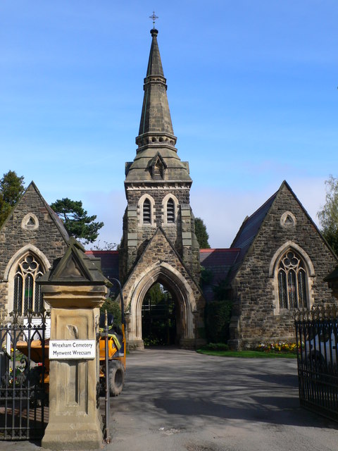
Wrexham Cemetery

Wrexham Cemetery (Welsh: Mynwent Wrecsam) is a Victorian garden cemetery in Wrexham, North Wales, which served as the main burial site for the city. It...

Offa, Wrexham

Offa is a community and electoral ward in Wrexham County Borough, Wales, covering most of the south-western portion of the city of Wrexham. It is bordered...

Nearby Amenities

Located within 500m of 53.032629,-2.9992461
Barrier: cattle_grid
Bicycle: no
Foot: no
Lat/Long: 53.0331394/-3.0024461
Turning Circle
Lat/Long: 53.0327684/-2.9936365
Turning Circle
Lat/Long: 53.0332237/-2.9963008
Turning Circle
Lat/Long: 53.0331783/-2.9989888
Barrier: kissing_gate
Lat/Long: 53.0336609/-3.0047207
Turning Circle
Lat/Long: 53.0336501/-3.0012358
Barrier: kissing_gate
Lat/Long: 53.0335121/-3.003168
Direction: 190
Generator Method: photovoltaic
Generator Output Electricity: yes
Generator Solar Modules: 16
Generator Source: solar
Generator Type: solar_photovoltaic_panel
Location: roof
Power: generator
Lat/Long: 53.035573/-3.0009928
Direction: 165
Generator Method: photovoltaic
Generator Output Electricity: yes
Generator Solar Modules: 17
Generator Source: solar
Generator Type: solar_photovoltaic_panel
Location: roof
Power: generator
Lat/Long: 53.0353225/-3.0023661
Direction: 165
Generator Method: photovoltaic
Generator Output Electricity: yes
Generator Solar Modules: 11
Generator Source: solar
Generator Type: solar_photovoltaic_panel
Location: roof
Power: generator
Lat/Long: 53.0351923/-3.0028178
Direction: SSE
Generator Method: photovoltaic
Generator Output Electricity: yes
Generator Solar Modules: 16
Generator Source: solar
Generator Type: solar_photovoltaic_panel
Location: roof
Power: generator
Lat/Long: 53.0352414/-3.002672
Direction: SSW
Generator Method: photovoltaic
Generator Output Electricity: yes
Generator Solar Modules: 22
Generator Source: solar
Generator Type: solar_photovoltaic_panel
Location: roof
Power: generator
Lat/Long: 53.0349392/-3.0016712
Direction: WSW
Generator Method: photovoltaic
Generator Output Electricity: yes
Generator Solar Modules: 16
Generator Source: solar
Generator Type: solar_photovoltaic_panel
Location: roof
Power: generator
Lat/Long: 53.03476/-3.002648
Direction: 195
Generator Method: photovoltaic
Generator Output Electricity: yes
Generator Solar Modules: 16
Generator Source: solar
Generator Type: solar_photovoltaic_panel
Location: roof
Power: generator
Lat/Long: 53.034818/-3.0012133
Direction: SW
Generator Method: photovoltaic
Generator Output Electricity: yes
Generator Solar Modules: 12
Generator Source: solar
Generator Type: solar_photovoltaic_panel
Location: roof
Power: generator
Lat/Long: 53.034242/-3.0009619
Direction: SE
Generator Method: photovoltaic
Generator Output Electricity: yes
Generator Solar Modules: 16
Generator Source: solar
Generator Type: solar_photovoltaic_panel
Location: roof
Power: generator
Lat/Long: 53.0338716/-2.9984865
Direction: 125
Generator Method: photovoltaic
Generator Output Electricity: yes
Generator Solar Modules: 12
Generator Source: solar
Generator Type: solar_photovoltaic_panel
Location: roof
Power: generator
Lat/Long: 53.0334607/-2.9983037
Direction: SSW
Generator Method: photovoltaic
Generator Output Electricity: yes
Generator Solar Modules: 16
Generator Source: solar
Generator Type: solar_photovoltaic_panel
Location: roof
Power: generator
Lat/Long: 53.0331903/-2.9972041
Direction: 215
Generator Method: photovoltaic
Generator Output Electricity: yes
Generator Solar Modules: 12
Generator Source: solar
Generator Type: solar_photovoltaic_panel
Location: roof
Power: generator
Lat/Long: 53.0350796/-2.9979081
Direction: 185
Generator Method: photovoltaic
Generator Output Electricity: yes
Generator Solar Modules: 10
Generator Source: solar
Generator Type: solar_photovoltaic_panel
Location: roof
Power: generator
Lat/Long: 53.0370733/-2.9990865
Direction: S
Generator Method: photovoltaic
Generator Output Electricity: yes
Generator Solar Modules: 16
Generator Source: solar
Generator Type: solar_photovoltaic_panel
Location: roof
Power: generator
Lat/Long: 53.034815/-2.9948936
Direction: 165
Generator Method: photovoltaic
Generator Output Electricity: yes
Generator Solar Modules: 16
Generator Source: solar
Generator Type: solar_photovoltaic_panel
Location: roof
Power: generator
Lat/Long: 53.0331362/-2.9925378
Direction: 165
Generator Method: photovoltaic
Generator Output Electricity: yes
Generator Solar Modules: 10
Generator Source: solar
Generator Type: solar_photovoltaic_panel
Location: roof
Power: generator
Lat/Long: 53.0317869/-2.992014
Direction: 85
Generator Method: photovoltaic
Generator Output Electricity: yes
Generator Solar Modules: 9
Generator Source: solar
Generator Type: solar_photovoltaic_panel
Location: roof
Power: generator
Source: Maxar Premium Imagery
Lat/Long: 53.0352462/-3.0016874
Direction: 265
Generator Method: photovoltaic
Generator Output Electricity: yes
Generator Solar Modules: 9
Generator Source: solar
Generator Type: solar_photovoltaic_panel
Location: roof
Power: generator
Source: Maxar Premium Imagery
Lat/Long: 53.0352802/-3.0017591
Direction: 185
Generator Method: photovoltaic
Generator Output Electricity: yes
Generator Solar Modules: 17
Generator Source: solar
Generator Type: solar_photovoltaic_panel
Location: roof
Power: generator
Source: Maxar Premium Imagery
Lat/Long: 53.0323563/-2.9964927
Coed-y-Glyn
Name Cy: Coed-y-Glyn
Name En: Coed-y-Glyn
Place: neighbourhood
Lat/Long: 53.0339409/-2.9980326
Coed-y-glyn Wood
Name Cy: Coed-y-glyn
Name En: Coed-y-glyn Wood
Natural: wood
Lat/Long: 53.0326067/-2.9953919
Big Wood
Name Cy: Coed Fawr
Name En: Big Wood
Natural: wood
Lat/Long: 53.0296379/-3.0025794
Polling Station
Bishop's Own Scouts Hut
Polling Station: yes
Lat/Long: 53.0362908/-2.9950209
Erddig Motte
Alt Name: Erddig Castle
Alt Name Cy: Castell Erddig
Alt Name En: Erddig Castle
Castle Type: castle
Historic: ruins
Name Cy: Mwnt Erddig
Name En: Erddig Motte
Ruins: castle
Lat/Long: 53.0305522/-3.0046689
Barrier: kissing_gate
Lat/Long: 53.0330543/-3.0025151
Barrier: cattle_grid
Lat/Long: 53.0346756/-3.0010773
Barrier: kissing_gate
Bicycle: dismount
Foot: yes
Horse: no
Motor Vehicle: no
Lat/Long: 53.0346807/-3.0011016
Board Type: plants
Information: board
Tourism: information
Lat/Long: 53.0331574/-3.0023329
Waste Basket
Waste: dog_excrement
Lat/Long: 53.0331481/-3.002591
Board Type: history
Information: board
Tourism: information
Lat/Long: 53.0302955/-3.0053082
Information: guidepost
Tourism: information
Lat/Long: 53.0324086/-3.0034044
The data included in this document is from www.openstreetmap.org. The data is made available under ODbL.

Have you been to Coed-y-glyn Wood?

Leave your review of Coed-y-glyn Wood below (or comments, questions and feedback).