Carminish

Settlement in Inverness-shire

Scotland

Carminish

Inside Am Bothan Bunkhouse, Leverburgh
Inside Am Bothan Bunkhouse, Leverburgh Credit: Phil Thirkell

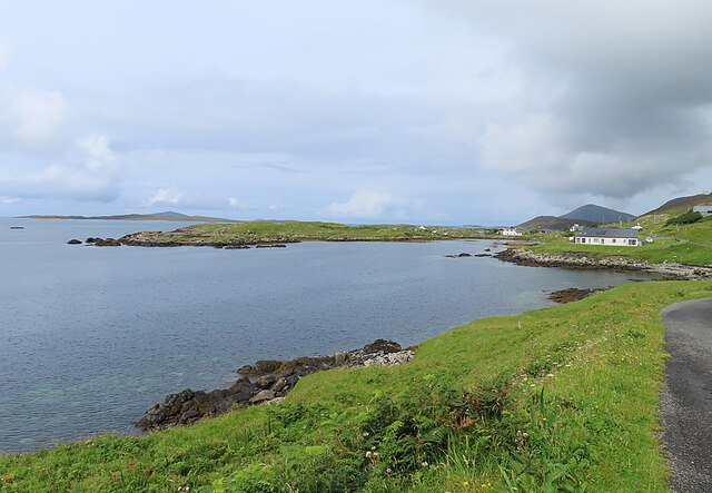
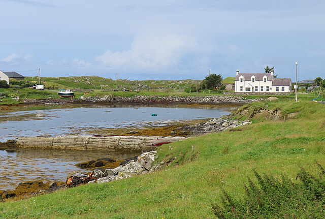
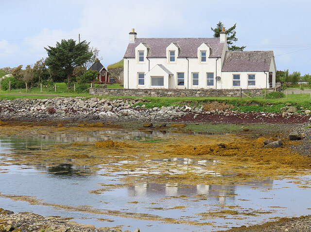
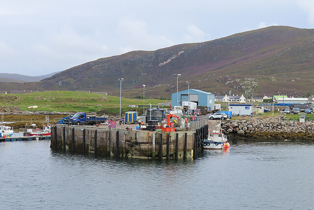
Carminish is a small coastal village located in the county of Inverness-shire, Scotland. Situated on the western coast of the country, it is nestled between the majestic hills of the Scottish Highlands and the picturesque shores of the Atlantic Ocean. With a population of around 300 residents, it offers a tranquil and close-knit community atmosphere.

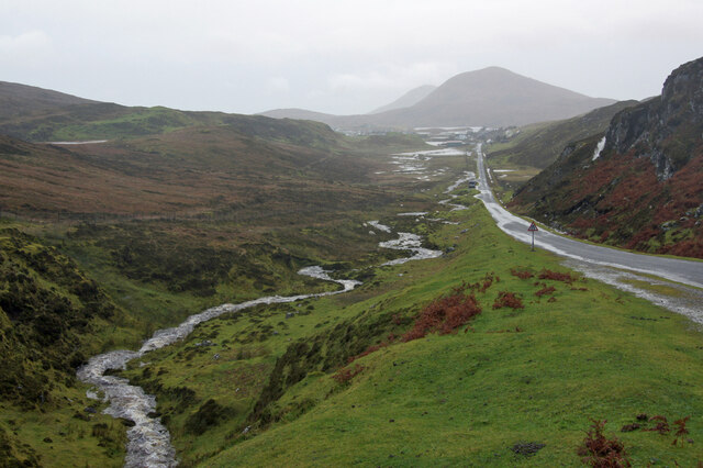
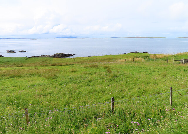
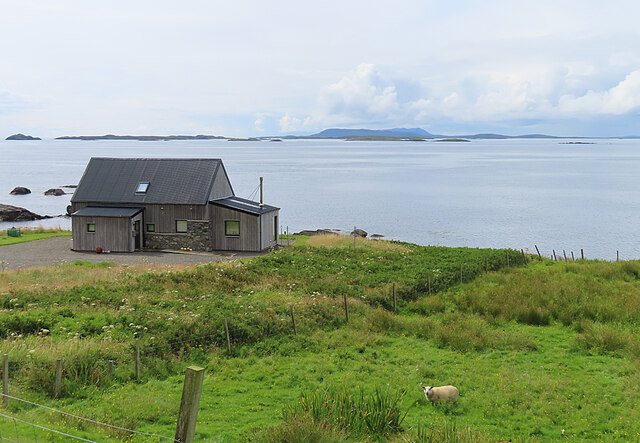
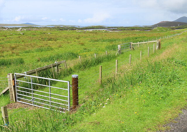
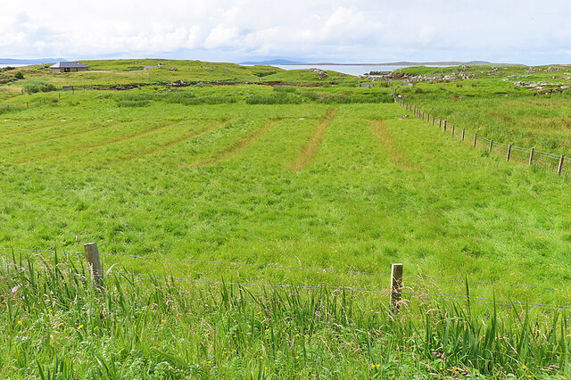
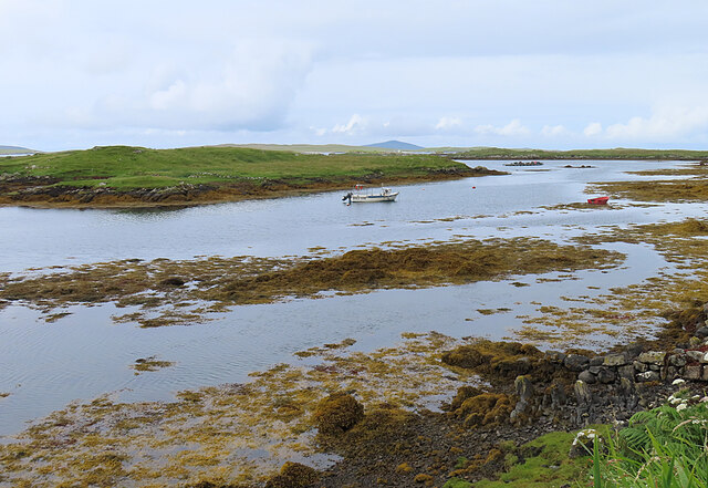
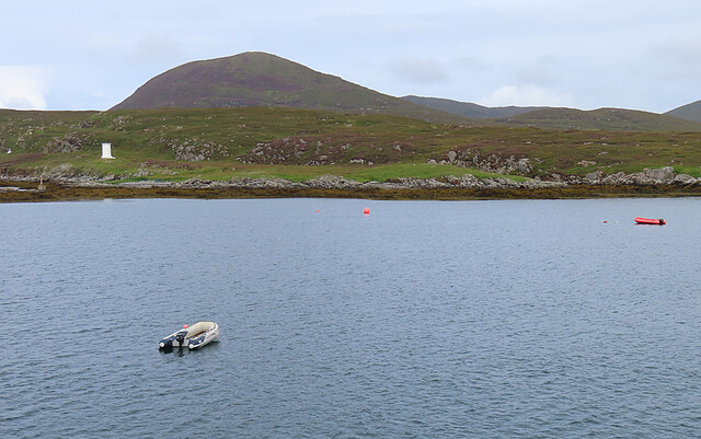
The village is known for its breathtaking natural beauty, with stunning landscapes that include rugged cliffs, pristine beaches, and lush green fields. It is a popular destination for nature lovers and outdoor enthusiasts, offering a wide range of activities such as hiking, birdwatching, and fishing.

Carminish has a rich history, with evidence of human settlement dating back thousands of years. The area is home to several ancient archaeological sites, including standing stones and burial mounds, which provide a glimpse into its past.

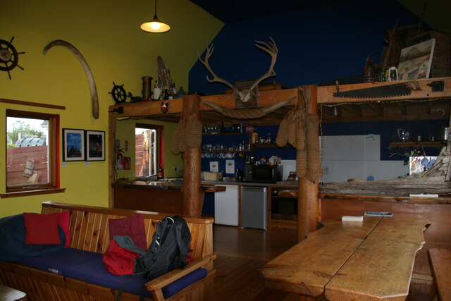
Despite its small size, Carminish boasts a few amenities to cater to both locals and visitors. The village has a charming pub that serves traditional Scottish cuisine and showcases local musicians, offering a taste of the region's vibrant cultural scene.

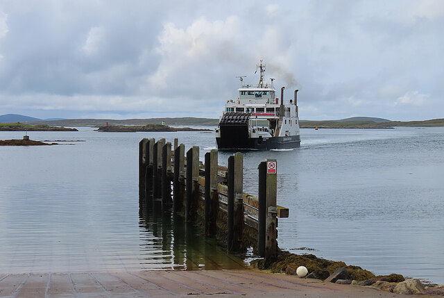
For those seeking a peaceful retreat away from the hustle and bustle of city life, Carminish provides a serene environment surrounded by breathtaking natural landscapes. Its proximity to other popular destinations in the Scottish Highlands, such as the Isle of Skye and Loch Ness, makes it an ideal base for exploring the region.

If you have any feedback on the listing, please let us know in the comments section below.
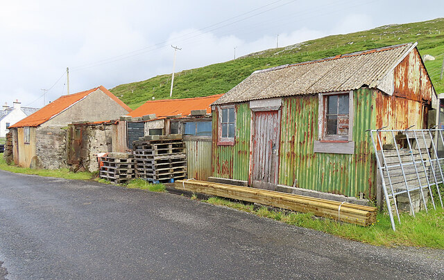
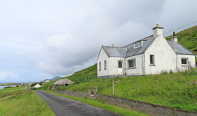
Carminish Images

Images are sourced within 2km of 57.755548/-7.0089004 or Grid Reference NG0285. Thanks to Geograph Open Source API. All images are credited.

Inside Am Bothan Bunkhouse, Leverburgh
Wet view towards Leverburgh Looking north west down Gleann Shranndabhal on a very wet November morning.
Wet view towards Leverburgh
Looking north west down Gleann Shranndabhal on a very wet November morning.
Leverburgh Ferry Terminal Entrance A sign at the entrance to the Leverburgh Ferry Terminal
Leverburgh Ferry Terminal Entrance
A sign at the entrance to the Leverburgh Ferry Terminal
Leverburgh Ferry Terminal Leverburgh Ferry Terminal, Isle of Harris while Caledonian MacBrayne's Motor Vessel 'Loch Portain' loading up for departure
Leverburgh Ferry Terminal
Leverburgh Ferry Terminal, Isle of Harris while Caledonian MacBrayne's Motor Vessel 'Loch Portain' loading up for departure
Corrugated Iron Sheds Colourful if somewhat dilapidated. The closest one was the local Post Office for half a century. See <a href="https://www.geograph.org.uk/photo/5873968">NG0383 : Strond: the old post office</a>.
Corrugated Iron Sheds
Colourful if somewhat dilapidated. The closest one was the local Post Office for half a century. See NG0383 : Strond: the old post office.
House at Borghasdal Looking north-west along the road towards Srannda (Strond).
House at Borghasdal
Looking north-west along the road towards Srannda (Strond).
Srannda (Strond) Looking down over small rough fields to the sea, with a distant glimpse of Berneray and North Uist beyond.
Srannda (Strond)
Looking down over small rough fields to the sea, with a distant glimpse of Berneray and North Uist beyond.
Wooden House at Srannda Wooden houses are unusual in the Hebrides, but this one looks quite in harmony with its surroundings. In the distance is a glimpse of North Uist.
Wooden House at Srannda
Wooden houses are unusual in the Hebrides, but this one looks quite in harmony with its surroundings. In the distance is a glimpse of North Uist.
Cairminis (Carminish) Bagh Cairminis (Carminish Bay) is well sheltered by Eilean nan Bridianach, which is actually a peninsula rather than an island.
Cairminis (Carminish)
Bagh Cairminis (Carminish Bay) is well sheltered by Eilean nan Bridianach, which is actually a peninsula rather than an island.
Bàgh Chàirminis Carminish Bay is a sheltered tidal inlet, but too shallow to offer safe anchorage to more than a very small boat.
Bàgh Chàirminis
Carminish Bay is a sheltered tidal inlet, but too shallow to offer safe anchorage to more than a very small boat.
Reflections The house at the head of Bàgh Chàirminis (Carminish Bay) is reflected in the mirror-like water.
Reflections
The house at the head of Bàgh Chàirminis (Carminish Bay) is reflected in the mirror-like water.
Field Access It may be that the end of the access road here is sometimes used to pen livestock.
Field Access
It may be that the end of the access road here is sometimes used to pen livestock.
Old Lazybeds The parallel lines in this field are the remains of lazybeds. These are raised beds which are separated by ditches to assist in draining the land. They can be found all over the Hebrides, but few are still in regular cultivation.
Old Lazybeds
The parallel lines in this field are the remains of lazybeds. These are raised beds which are separated by ditches to assist in draining the land. They can be found all over the Hebrides, but few are still in regular cultivation.
Near Càirminis I think the nearest island is Eilean Chàirminis (Carminish Island).
Near Càirminis
I think the nearest island is Eilean Chàirminis (Carminish Island).
MV 'Lochportain' approaching Leverburgh MV 'Lochportain' operates the shuttle ferry between Leverburgh in Harris and Berneray.
MV 'Lochportain' approaching Leverburgh
MV 'Lochportain' operates the shuttle ferry between Leverburgh in Harris and Berneray.
Docking at Leverburgh MV 'Lochportain' has just completed the crossing of the Sound of Harris from Berneray.
Docking at Leverburgh
MV 'Lochportain' has just completed the crossing of the Sound of Harris from Berneray.
Leverburgh Pier This is the pier used by various commercial enterprises, a short distance from the ferry pier.
Leverburgh Pier
This is the pier used by various commercial enterprises, a short distance from the ferry pier.
Rubh' an Losaid The small headland north of Leverburgh Harbour.
Rubh' an Losaid
The small headland north of Leverburgh Harbour.
Show me another place!

Carminish is located at Grid Ref: NG0285 (Lat: 57.755548, Lng: -7.0089004)

Unitary Authority: Na h-Eileanan an Iar

Police Authority: Highlands and Islands

Also known as: Cairminis

What 3 Words

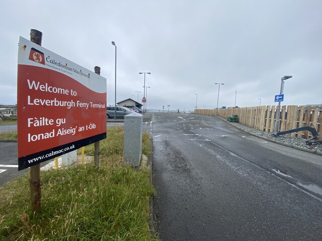
///unlimited.racetrack.beefed. Near Leverburgh, Na h-Eileanan Siar

Related Wikis

Outer Hebrides

The Outer Hebrides ( HEB-rid-eez) or Western Isles (Scottish Gaelic: na h-Eileanan Siar [nə ˈhelanən ˈʃiəɾ] , na h-Eileanan an Iar [nə ˈhelanən əɲ ˈiəɾ...
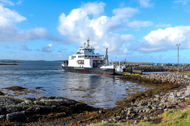
Leverburgh

Leverburgh (Scottish Gaelic: An t-Òb [ən̪ˠ ˈt̪ɔːp]) is the second largest village, after Tarbert, in Harris in the Outer Hebrides of Scotland. Leverburgh...

Roineabhal

Roineabhal is a hill in Harris, in the Western Isles of Scotland. The granite on the summit plateau of the mountain is anorthosite, and is similar in composition...

Rodel

Rodel (Scottish Gaelic: Roghadal) is a village on the south-eastern coast of Harris, an island in the Scottish Outer Hebrides. Rodel is situated in the...

Nearby Amenities

Located within 500m of 57.755548,-7.0089004
Cairminis
Is In: An Hearach
Name En: Carminish
Name Gd: Cairminis
Place: hamlet
Lat/Long: 57.756469/-7.0048355
Bagh Chairminis
Natural: bay
Lat/Long: 57.753521/-7.0059299
Carminish
Naptan AtcoCode: 6010731595
Naptan Bearing: NW
Naptan BusStopType: CUS
Naptan CommonName: Carminish
Naptan Indicator: Village
Naptan Landmark: Road junction
Naptan NaptanCode: 94723597
Naptan Street: Unclassified road
Naptan Verified: no
Source: naptan_import
Lat/Long: 57.7561158/-7.0076028
Post Box
Ref: HS5 125
Source: survey
Lat/Long: 57.7561046/-7.0076271
Passing Place
Lat/Long: 57.7595764/-7.011855
Turning Circle
Lat/Long: 57.7552958/-7.0097296
Passing Place
Lat/Long: 57.7578886/-7.0095593
Barrier: cattle_grid
Lat/Long: 57.7569379/-7.0082771
Material: wood
Power: pole
Lat/Long: 57.753557/-7.0015948
Material: wood
Power: pole
Lat/Long: 57.7546139/-7.0039491
Material: wood
Power: pole
Lat/Long: 57.7541231/-7.0028505
Material: wood
Power: pole
Lat/Long: 57.7549664/-7.0047333
Material: wood
Power: pole
Lat/Long: 57.7553326/-7.0055539
Material: wood
Power: pole
Lat/Long: 57.755286/-7.0056063
Material: wood
Power: pole
Lat/Long: 57.7555017/-7.0062079
Material: wood
Power: pole
Lat/Long: 57.7558391/-7.0066752
Material: wood
Power: pole
Lat/Long: 57.7563837/-7.0076664
Material: wood
Power: pole
Lat/Long: 57.75658/-7.0073844
Passing Place
Lat/Long: 57.757241/-7.0087495
Passing Place
Lat/Long: 57.755729/-7.0072898
Material: wood
Power: pole
Lat/Long: 57.7576375/-7.0084265
Material: wood
Power: pole
Lat/Long: 57.7582632/-7.0090474
Material: wood
Power: pole
Lat/Long: 57.7571557/-7.0079156
Material: wood
Power: pole
Lat/Long: 57.7590474/-7.0098199
Material: wood
Power: pole
Lat/Long: 57.7594666/-7.0105441
Material: wood
Power: pole
Lat/Long: 57.755718/-7.0068335
Material: wood
Power: pole
Lat/Long: 57.7562061/-7.0079343
Material: wood
Power: pole
Lat/Long: 57.7559343/-7.0082347
Material: wood
Power: pole
Lat/Long: 57.7557797/-7.0090796
Material: wood
Power: pole
Lat/Long: 57.7554949/-7.0093706
Material: wood
Power: pole
Lat/Long: 57.7552645/-7.0096535
Street Lamp
Lamp Mount: pole
Lamp Type: electric
Support: pole
Lat/Long: 57.7560094/-7.007715
The data included in this document is from www.openstreetmap.org. The data is made available under ODbL.

Have you been to Carminish?

Leave your review of Carminish below (or comments, questions and feedback).