Coed Mawr

Wood, Forest in Monmouthshire

Wales

Coed Mawr

Henllan Baptist Chapel, Monmouthshire Set back from the road to the ruins of Llanthony Priory, the chapel is on the left.
Henllan Baptist Chapel, Monmouthshire Credit: Jaggery

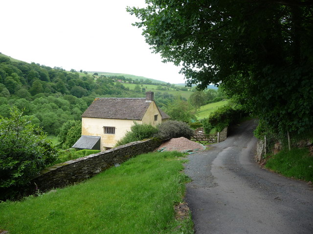
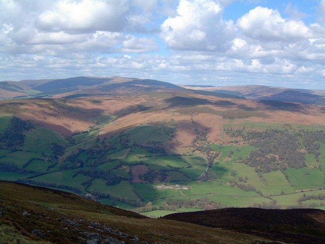
Coed Mawr, located in Monmouthshire, is a picturesque woodland area that encompasses an impressive forest. The name itself translates to "big wood" in Welsh, aptly representing the vastness and natural beauty of this area. Situated near the town of Caerwent, Coed Mawr is a popular destination for nature enthusiasts and outdoor lovers alike.

The forest boasts an extensive range of flora and fauna, making it a haven for biodiversity. Visitors can expect to encounter a diverse array of trees, including oak, beech, and ash, among others. These towering giants provide a stunning canopy overhead, creating a sense of tranquility and serenity.

Walking trails meander through the woodland, offering visitors the opportunity to explore the forest at their own pace. The paths are well-maintained and suitable for all ages and abilities. Along the way, hikers may stumble upon hidden gems, such as clearings or babbling brooks, adding to the enchantment of the experience.

Coed Mawr is not only a haven for nature, but also a place of historical significance. The area is dotted with remnants of ancient settlements and medieval sites, providing a glimpse into the rich history of the region. Exploring these remnants adds an extra layer of fascination to any visit.

Overall, Coed Mawr in Monmouthshire is a captivating woodland, offering a harmonious blend of natural beauty, tranquility, and historical significance. Whether one seeks solace amidst nature, a chance to uncover hidden treasures, or simply an escape from the bustling city, Coed Mawr provides an idyllic setting for all.

If you have any feedback on the listing, please let us know in the comments section below.

Coed Mawr Images

Images are sourced within 2km of 51.912055/-3.0491043 or Grid Reference SO2724. Thanks to Geograph Open Source API. All images are credited.

Henllan Baptist Chapel, Monmouthshire Set back from the road to the ruins of Llanthony Priory, the chapel is on the left.
Henllan Baptist Chapel, Monmouthshire
Set back from the road to the ruins of Llanthony Priory, the chapel is on the left.
Road NNE from a layby, Lower Henllan, Monmouthshire Ahead for Llanthony and Hay-on-Wye.
Road NNE from a layby, Lower Henllan, Monmouthshire
Ahead for Llanthony and Hay-on-Wye.
Long layby, Lower Henllan, Monmouthshire Ahead for Llanvihangel Crucorney. Behind the camera for Llanthony and Hay-on-Wye.
Long layby, Lower Henllan, Monmouthshire
Ahead for Llanvihangel Crucorney. Behind the camera for Llanthony and Hay-on-Wye.
Cwmyoy direction sign, Monmouthshire Viewed across the unclassified road from Llanvihangel Crucorney to Llanthony and Hay-on-Wye. The black arrow on the direction sign points towards this <a title="https://www.geograph.org.uk/photo/7175568" href="https://www.geograph.org.uk/photo/7175568">Link</a> road. A National Cycle Network Route 42 direction sign is also in view.
Cwmyoy direction sign, Monmouthshire
Viewed across the unclassified road from Llanvihangel Crucorney to Llanthony and Hay-on-Wye. The black arrow on the direction sign points towards this Link road. A National Cycle Network Route 42 direction sign is also in view.
Descent towards Cwmyoy, Monmouthshire Viewed from the unclassified road from Llanvihangel Crucorney to Llanthony and Hay-on-Wye. Ahead for the River Honddu and Cwmyoy (Cwmiou in Welsh). <a title="https://www.geograph.org.uk/photo/4516695" href="https://www.geograph.org.uk/photo/4516695">Link</a>
Descent towards Cwmyoy, Monmouthshire
Viewed from the unclassified road from Llanvihangel Crucorney to Llanthony and Hay-on-Wye. Ahead for the River Honddu and Cwmyoy (Cwmiou in Welsh). Link
Unclassified road towards Llanthony Ahead for Llanthony and Hay-on-Wye. Behind the camera for Llanvihangel Crucorney and Abergavenny. The broken white lines on the right are at edge of this <a title="https://www.geograph.org.uk/photo/7175568" href="https://www.geograph.org.uk/photo/7175568">Link</a> road descending towards Cwmyoy (Cwmiou in Welsh).
Unclassified road towards Llanthony
Ahead for Llanthony and Hay-on-Wye. Behind the camera for Llanvihangel Crucorney and Abergavenny. The broken white lines on the right are at edge of this Link road descending towards Cwmyoy (Cwmiou in Welsh).
Weight limit sign near Cwmyoy, Monmouthshire The sign at the top of this <a title="https://www.geograph.org.uk/photo/7175568" href="https://www.geograph.org.uk/photo/7175568">Link</a> descent towards the River Honddu and Cwmyoy shows "Weight limit 3 tonnes ¼ mile ahead".
Weight limit sign near Cwmyoy, Monmouthshire
The sign at the top of this Link descent towards the River Honddu and Cwmyoy shows "Weight limit 3 tonnes ¼ mile ahead".
Towards a bend in the road near Cwmyoy, Monmouthshire Ahead for Llanvihangel Crucorney and Abergavenny. 
Behind the camera for Llanthony and Hay-on-Wye.
Towards a bend in the road near Cwmyoy, Monmouthshire
Ahead for Llanvihangel Crucorney and Abergavenny. Behind the camera for Llanthony and Hay-on-Wye.
Field and wooded hillside near Cwmyoy, Monmouthshire Behind the camera for this <a title="https://www.geograph.org.uk/photo/7175568" href="https://www.geograph.org.uk/photo/7175568">Link</a> road descending towards the River Honddu and Cwmyoy (Cwmiou in Welsh).
Field and wooded hillside near Cwmyoy, Monmouthshire
Behind the camera for this Link road descending towards the River Honddu and Cwmyoy (Cwmiou in Welsh).
Road towards woodland, Cwmyoy, Monmouthshire Turn left at the distant junction for Llanvihangel Crucorney and Abergavenny. Turn right for Llanthony.
Road towards woodland, Cwmyoy, Monmouthshire
Turn left at the distant junction for Llanvihangel Crucorney and Abergavenny. Turn right for Llanthony.
Narrow part of a minor road, Cwmyoy, Monmouthshire Ahead for St Martin's Church. 
Behind the camera for this <a title="https://www.geograph.org.uk/photo/7248165" href="https://www.geograph.org.uk/photo/7248165">Link</a> road.
Narrow part of a minor road, Cwmyoy, Monmouthshire
Ahead for St Martin's Church. Behind the camera for this Link road.
Road on a weak bridge, Cwmyoy, Monmouthshire The bridge carries a minor road over the River Honddu. A 3T sign  <a title="https://www.geograph.org.uk/photo/7248274" href="https://www.geograph.org.uk/photo/7248274">Link</a> behind the camera indicates a 3 tons vehicle weight limit on the bridge.
Road on a weak bridge, Cwmyoy, Monmouthshire
The bridge carries a minor road over the River Honddu. A 3T sign Link behind the camera indicates a 3 tons vehicle weight limit on the bridge.
3T road sign, Cwmyoy, Monmouthshire The sign indicates a 3 tons maximun vehicle weight on the weak bridge ahead. <a title="https://www.geograph.org.uk/photo/7248270" href="https://www.geograph.org.uk/photo/7248270">Link</a>
3T road sign, Cwmyoy, Monmouthshire
The sign indicates a 3 tons maximun vehicle weight on the weak bridge ahead. Link
Wooden signpost for walkers, Cwmyoy, Monmouthshire Left for Llanthony, right for (other parts of) Cwmyoy. A yellow / golden depiction of a walker is on each direction sign.
Wooden signpost for walkers, Cwmyoy, Monmouthshire
Left for Llanthony, right for (other parts of) Cwmyoy. A yellow / golden depiction of a walker is on each direction sign.
Ascent into gloom, Cwmyoy, Monmouthshire The tree-dominated road ahead is gloomy on a sunny day in early August 2022. Ahead for St Martin's Church.
Ascent into gloom, Cwmyoy, Monmouthshire
The tree-dominated road ahead is gloomy on a sunny day in early August 2022. Ahead for St Martin's Church.
Line spur pole, Cwmyoy, Monmouthshire Located behind a house, the line spur pole is a rural part of the Western Power Distribution electricity supply infrastructure.
Line spur pole, Cwmyoy, Monmouthshire
Located behind a house, the line spur pole is a rural part of the Western Power Distribution electricity supply infrastructure.
Hillside view from the churchyard, Cwmyoy, Monmouthshire Viewed from St Martin's churchyard in the Church in Wales Diocese of Monmouth.
Hillside view from the churchyard, Cwmyoy, Monmouthshire
Viewed from St Martin's churchyard in the Church in Wales Diocese of Monmouth.
Ordnance Survey Cut Mark This OS cut mark can be found on the porch of St Ishow's Church. It marks a point 297.406m above mean sea level.
Ordnance Survey Cut Mark
This OS cut mark can be found on the porch of St Ishow's Church. It marks a point 297.406m above mean sea level.
Show me another place!

Coed Mawr is located at Grid Ref: SO2724 (Lat: 51.912055, Lng: -3.0491043)

Unitary Authority: Monmouthshire

Police Authority: Gwent

What 3 Words

///diverged.gather.monorail. Near Longtown, Herefordshire

Nearby Locations

Coed Mawr

Related Wikis

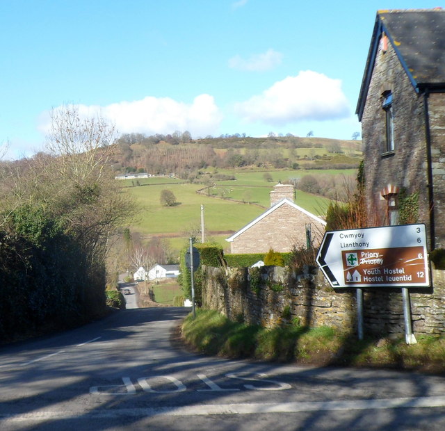
Ty-mawr Farmhouse, Cwmyoy

Ty-mawr Farmhouse, Ffwthog, Cwmyoy, Monmouthshire, is a farmhouse dating from the early 16th century, which was extended in the 17th century and then reduced...

Crucorney

Crucorney Welsh: Crucornau is a community in the county of Monmouthshire, Wales. It is the northernmost community in the county and covers the villages...

Tabernacle Baptist Chapel, Cwmyoy

The Tabernacle Baptist Chapel, Ffwthog, near Cwmyoy, Monmouthshire is a Baptist chapel, with attached manse, dating from 1837. Largely unaltered externally...

St Issui's Church, Partrishow

The Church of St Issui, Partrishow, Powys, Wales, is a parish church dating from 1060. The existing building was mainly constructed in the 14th and 15th...

Partrishow

Partrishow, also known as Patricio, Patrishow, or by its Welsh names Merthyr Isw and Llanisw, is a small village and historic parish in the county of Powys...

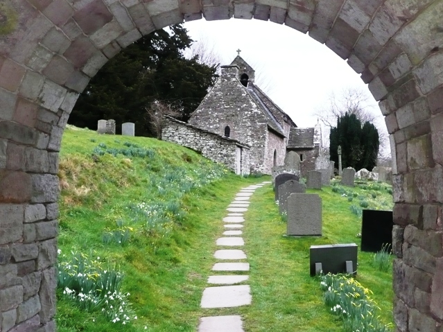
St Martin's Church, Cwmyoy

The Church of St Martin, Cwmyoy, Monmouthshire, Wales, was begun in the 12th century, although most of the current structure dates from the 13th century...
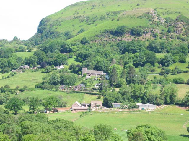
Cwmyoy

Cwmyoy is an extensive rural parish in Monmouthshire, Wales (Welsh: Cwm Iou, for the valley and parish; Welsh: Cwm-iou, for the village). The standard...

Crug Mawr

Crug Mawr is a hill in the Black Mountains in the Brecon Beacons National Park in southern Powys, Wales. Its summit at a height of 550 m (1,805 ft) is...

Nearby Amenities

Located within 500m of 51.912055,-3.0491043
Dial Garreg
Place: locality
Lat/Long: 51.9111315/-3.04399
The data included in this document is from www.openstreetmap.org. The data is made available under ODbL.

Have you been to Coed Mawr?

Leave your review of Coed Mawr below (or comments, questions and feedback).