Coed Alice
Wood, Forest in Monmouthshire
Wales
Coed Alice

Coed Alice is a picturesque woodland area located in Monmouthshire, Wales. Situated within the larger Forest of Dean, Coed Alice stands out for its natural beauty and tranquil surroundings. Covering an expansive area of lush greenery and ancient trees, it offers a serene escape for nature enthusiasts and hikers alike.
The woodland is home to a diverse range of flora and fauna, with towering oak, beech, and chestnut trees dominating the landscape. The forest floor is adorned with a vibrant carpet of bluebells, wildflowers, and ferns, creating a magical atmosphere during springtime. Wildlife enthusiasts can expect to spot a variety of species, including deer, foxes, badgers, and an array of birdlife.
Coed Alice offers a network of well-maintained walking trails, making it a popular destination for outdoor activities. Visitors can explore the forest on foot, taking in the breathtaking scenery and enjoying the peaceful ambiance. The trails vary in difficulty, catering to both casual strollers and experienced hikers. The area also features picnic spots and benches, providing opportunities for visitors to relax and soak in the natural surroundings.
Coed Alice is easily accessible, with ample parking facilities available nearby. Local authorities have implemented measures to preserve the woodland's natural integrity and protect its delicate ecosystem. Visitors are encouraged to follow designated paths and adhere to responsible tourism practices to ensure the longevity of this enchanting forest.
In summary, Coed Alice in Monmouthshire is a captivating woodland sanctuary, offering a harmonious blend of scenic beauty, diverse wildlife, and recreational opportunities. It is a must-visit destination for nature lovers and those seeking a peaceful retreat in the heart of Wales.
If you have any feedback on the listing, please let us know in the comments section below.
Coed Alice Images
Images are sourced within 2km of 51.696772/-3.0453616 or Grid Reference SO2700. Thanks to Geograph Open Source API. All images are credited.


Coed Alice is located at Grid Ref: SO2700 (Lat: 51.696772, Lng: -3.0453616)
Unitary Authority: Torfaen
Police Authority: Gwent
What 3 Words
///cheer.ahead.bride. Near Pontypool, Torfaen
Nearby Locations
Related Wikis

Pontnewynydd
Pontnewynydd is a predominantly working class suburb of Pontypool, Torfaen, in Wales. It should not be confused with Pontnewydd in nearby Cwmbran. ��2...
Pontypool Crane Street railway station
Pontypool Crane Street railway station served the town of Pontypool in the Welsh county of Monmouthshire. == History == With industry in the South Wales...

West Monmouth School
West Monmouth School (Welsh: Ysgol Gorllewin Mynwy; colloquially: West Mon) is a state-funded and non-selective secondary school in Pontypool, Torfaen...
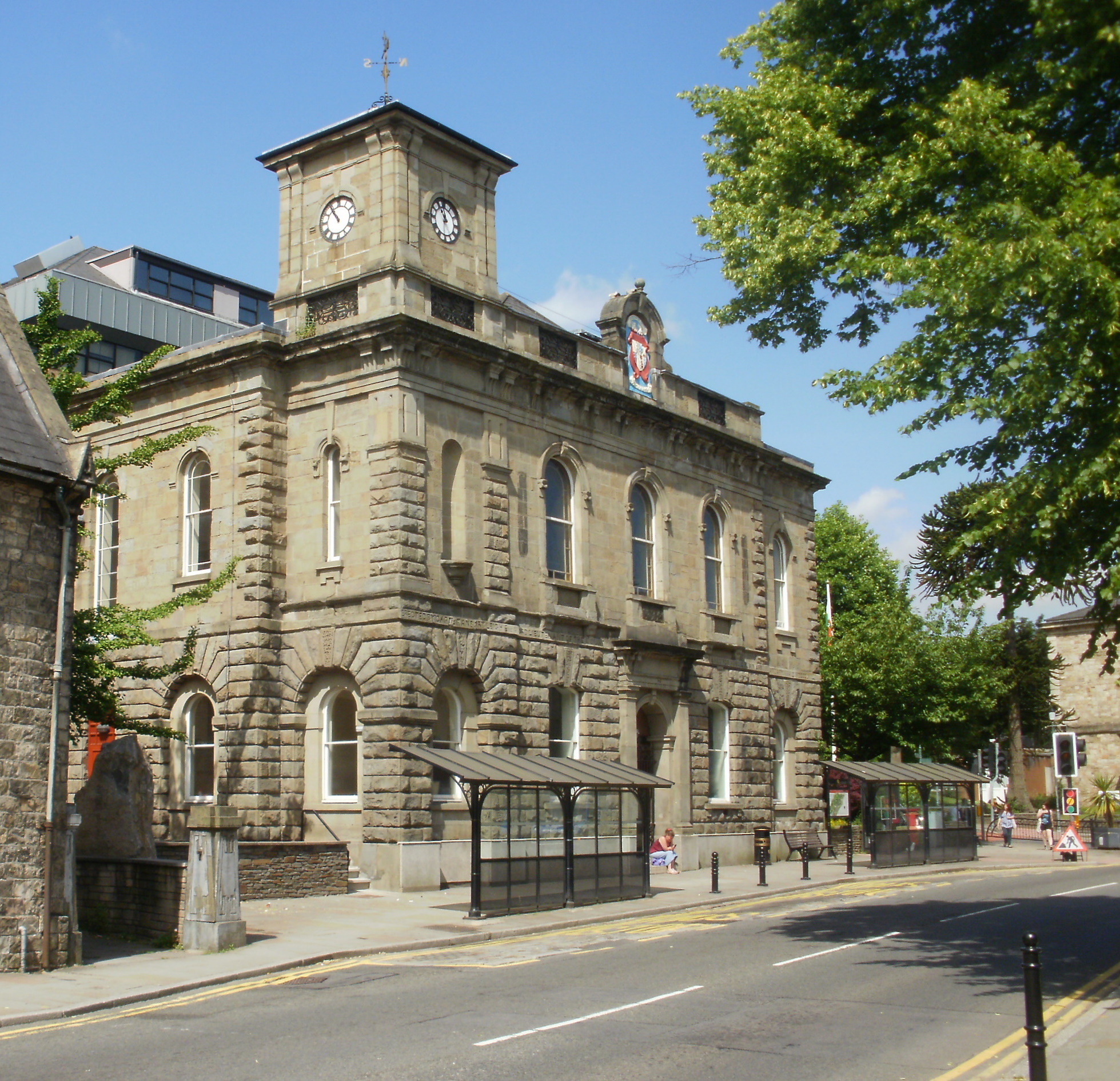
Pontypool Town Hall
Pontypool Town Hall (Welsh: Neuadd y Dref Pont-y-pŵl) is a municipal structure in Hanbury Road, Pontypool, Wales. The town hall, which forms the original...
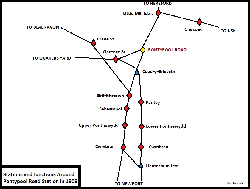
Pontypool Clarence Street railway station
Pontypool Clarence Street railway station was a station on the former Taff Vale Extension (TVE) of the Newport, Abergavenny and Hereford Railway. The TVE...

Blaendare Road Halt railway station
Blaendare Road Halt railway station served Pontymoile and Cwmynyscoy to the south of Pontypool town centre in Torfaen, South Wales, UK. == History == The...
Pen Tranch
Pen Tranch is a large village and a community in Torfaen, South East Wales. It lies to the west of Pontypool in the valley leading west to Crumlin. It...

Pontypool
Pontypool (Welsh: Pont-y-pŵl [ˌpɔntəˈpuːl]) is a town and the administrative centre of the county borough of Torfaen, within the historic boundaries of...
Nearby Amenities
Located within 500m of 51.696772,-3.0453616Have you been to Coed Alice?
Leave your review of Coed Alice below (or comments, questions and feedback).