Caggle Street
Settlement in Monmouthshire
Wales
Caggle Street

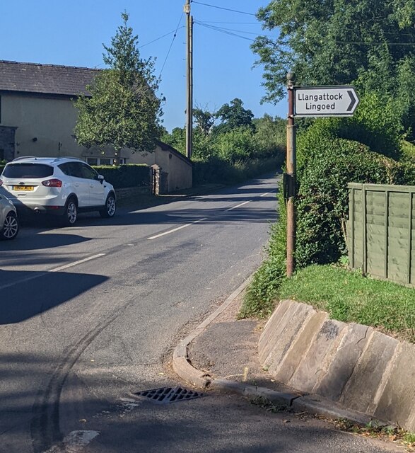
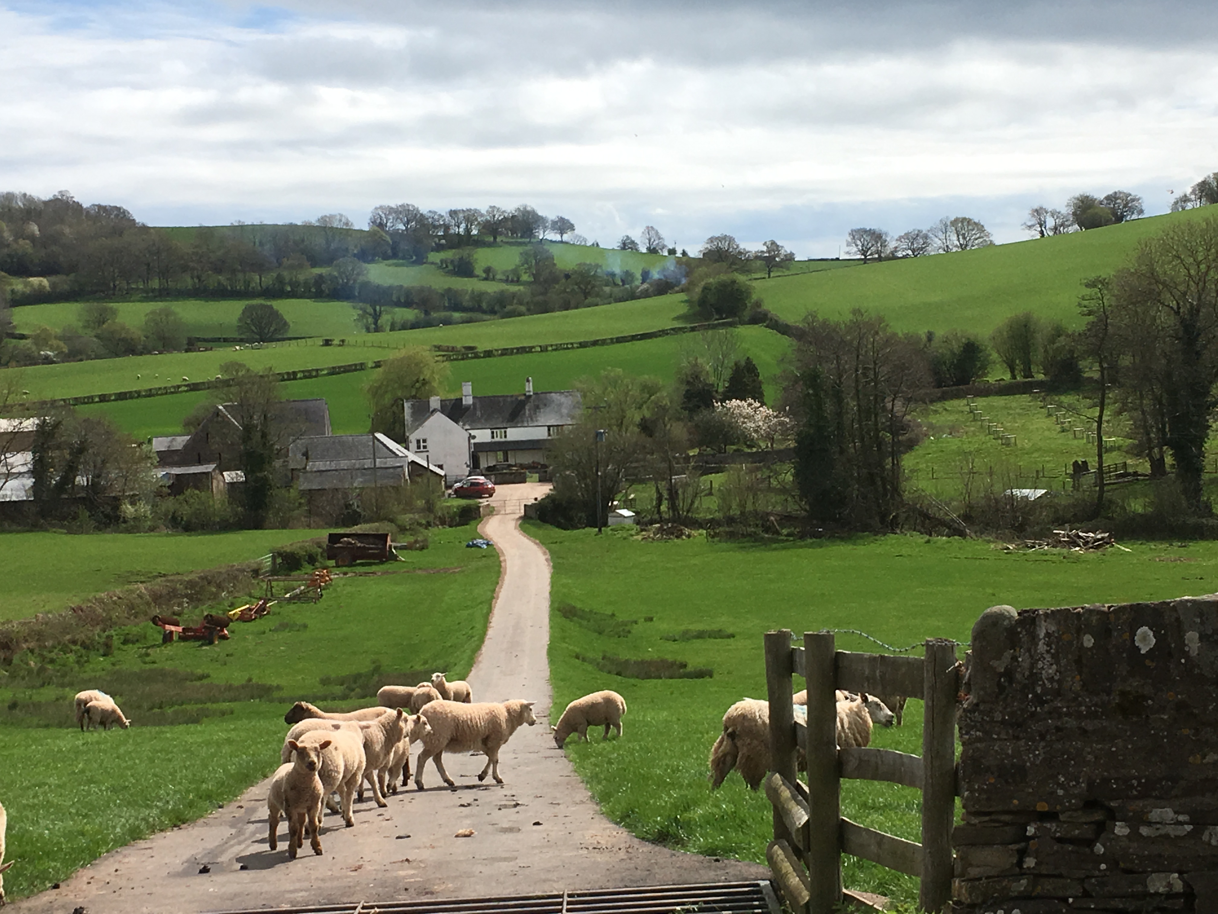
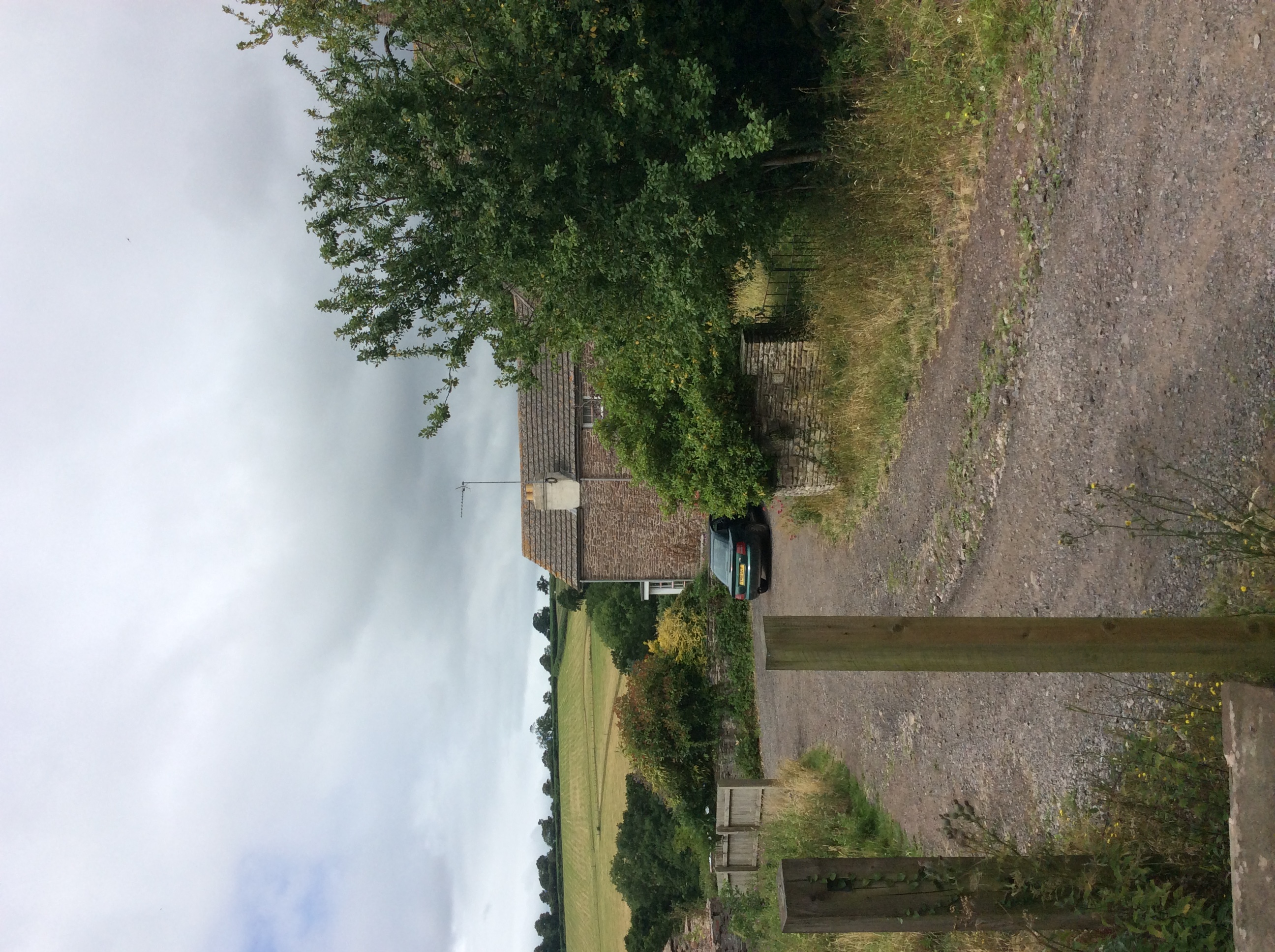
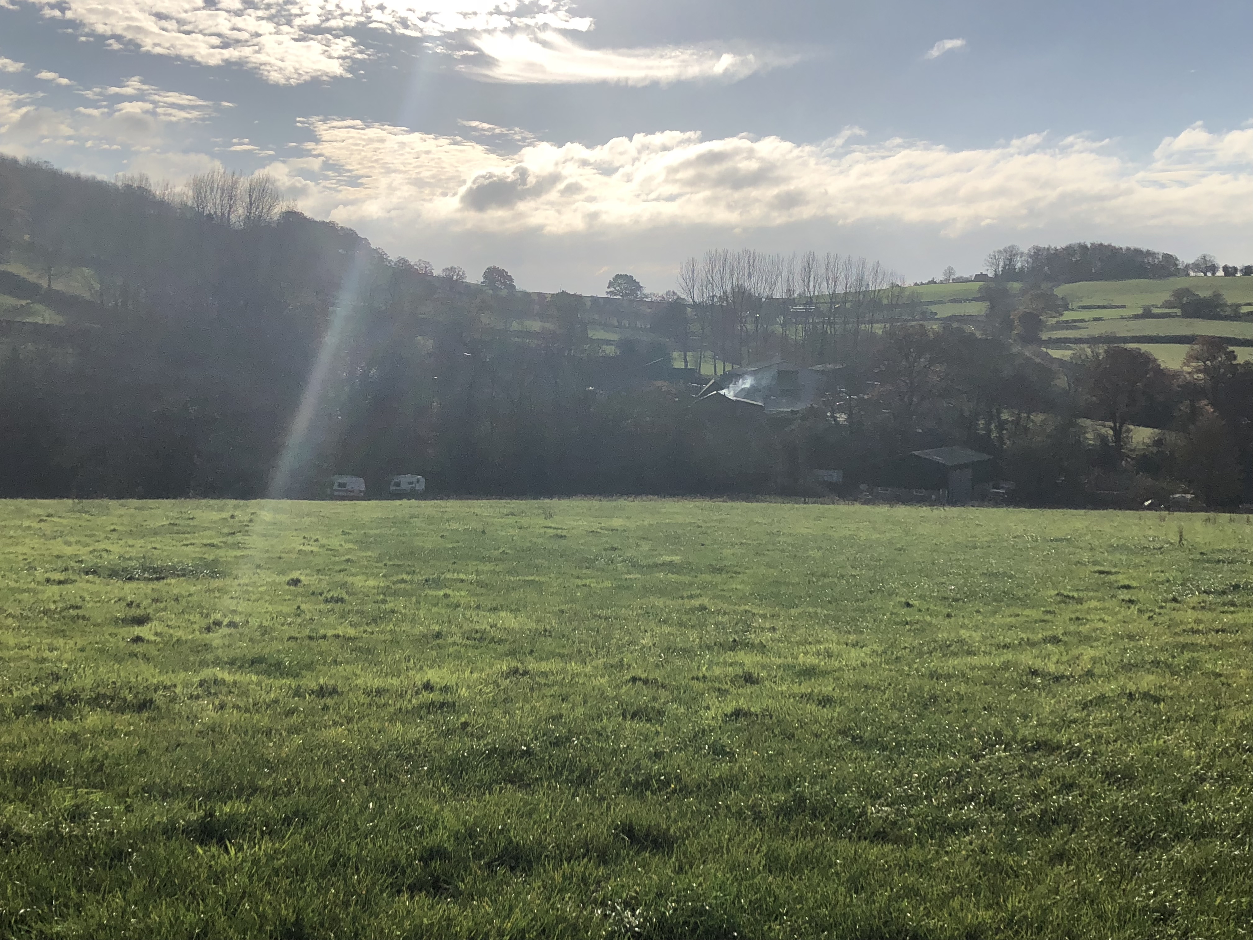
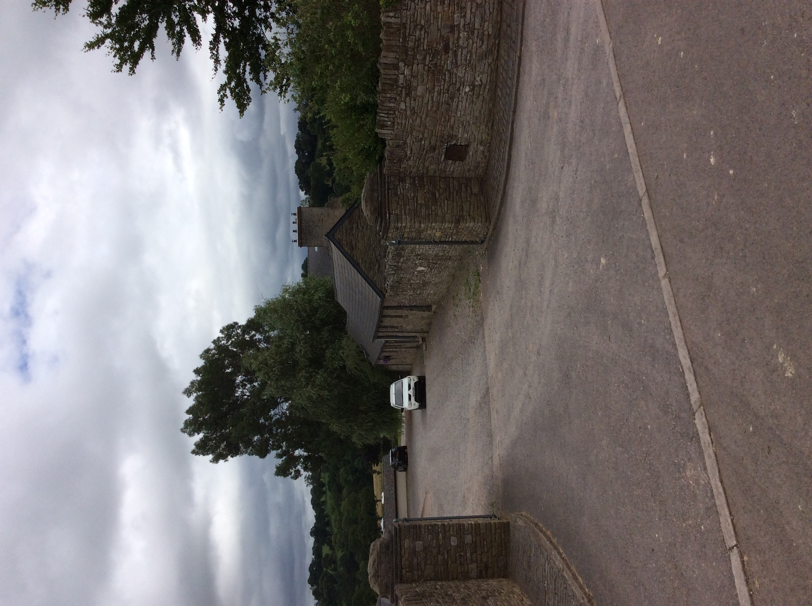
Caggle Street is a small village located in the county of Monmouthshire, Wales. Situated in the picturesque Welsh countryside, it is known for its charming rural setting and idyllic surroundings. The village is nestled between rolling hills and lush green fields, offering residents and visitors a peaceful and tranquil environment.
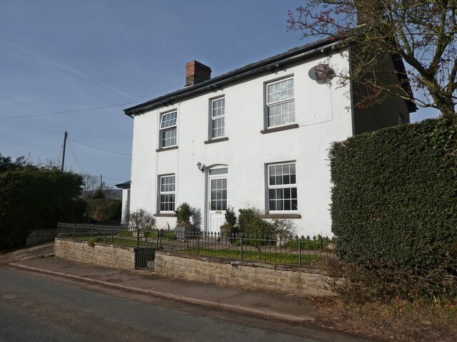
Caggle Street is a tight-knit community with a population of approximately 100 people. The village is characterized by its quaint and traditional cottages, many of which date back several centuries. These buildings add to the village's charming character and contribute to its overall appeal.
Despite its small size, Caggle Street boasts a strong sense of community spirit. Residents often come together for various events and activities, fostering a close-knit and friendly atmosphere. The village also has a local pub, which serves as a social hub for both residents and visitors.
Nature enthusiasts will find plenty to explore in and around Caggle Street. The area is rich in natural beauty, with numerous walking trails and scenic spots to discover. The nearby countryside offers opportunities for outdoor activities such as hiking, cycling, and birdwatching.
Although Caggle Street is primarily a residential area, it is conveniently located within a short distance of larger towns and cities. The village is approximately 10 miles away from the town of Monmouth, where residents can find a wider range of amenities, including shops, restaurants, and schools.
Overall, Caggle Street offers a peaceful and picturesque living environment, making it an ideal place for those seeking a tranquil rural retreat in Monmouthshire.
If you have any feedback on the listing, please let us know in the comments section below.
Caggle Street Images
Images are sourced within 2km of 51.852488/-2.918534 or Grid Reference SO3617. Thanks to Geograph Open Source API. All images are credited.


![White Castle [1] An information board about White Castle being one of three.
White Castle (Welsh: Castell Gwyn), also known historically as Llantilio Castle, is sited near the village of Llantilio Crossenny in Monmouthshire. The first castle, of earth and timber, was probably built soon after the Norman conquest. The castle was rebuilt in stone in the early 13th century with curtain walls, mural towers and a gatehouse. In the mid 13th century the large outer ward was enclosed with a curtain wall and its own gatehouse. The castle never saw action, became disused and was in ruins by the early 17th century. The ruins are of red sandstone rubble stone, with ashlar dressings. The remains are in the care of Cadw and are listed, grade I, with details at: <span class="nowrap"><a title="https://cadwpublic-api.azurewebsites.net/reports/listedbuilding/FullReport?lang=&amp;id=" rel="nofollow ugc noopener" href="https://cadwpublic-api.azurewebsites.net/reports/listedbuilding/FullReport?lang=&amp;id=">Link</a><img style="margin-left:2px;" alt="External link" title="External link - shift click to open in new window" src="https://s1.geograph.org.uk/img/external.png" width="10" height="10"/></span> 2079 The site is a Scheduled Ancient Monument with details at: <span class="nowrap"><a title="https://cadwpublic-api.azurewebsites.net/reports/sam/FullReport?lang=&amp;id=" rel="nofollow ugc noopener" href="https://cadwpublic-api.azurewebsites.net/reports/sam/FullReport?lang=&amp;id=">Link</a><img style="margin-left:2px;" alt="External link" title="External link - shift click to open in new window" src="https://s1.geograph.org.uk/img/external.png" width="10" height="10"/></span> 2957](https://s2.geograph.org.uk/geophotos/07/56/21/7562146_9a8f2e7c.jpg)
![White Castle [2] The remains of the gatehouse leading into the outer ward.
White Castle (Welsh: Castell Gwyn), also known historically as Llantilio Castle, is sited near the village of Llantilio Crossenny in Monmouthshire. The first castle, of earth and timber, was probably built soon after the Norman conquest. The castle was rebuilt in stone in the early 13th century with curtain walls, mural towers and a gatehouse. In the mid 13th century the large outer ward was enclosed with a curtain wall and its own gatehouse. The castle never saw action, became disused and was in ruins by the early 17th century. The ruins are of red sandstone rubble stone, with ashlar dressings. The remains are in the care of Cadw and are listed, grade I, with details at: <span class="nowrap"><a title="https://cadwpublic-api.azurewebsites.net/reports/listedbuilding/FullReport?lang=&amp;id=" rel="nofollow ugc noopener" href="https://cadwpublic-api.azurewebsites.net/reports/listedbuilding/FullReport?lang=&amp;id=">Link</a><img style="margin-left:2px;" alt="External link" title="External link - shift click to open in new window" src="https://s1.geograph.org.uk/img/external.png" width="10" height="10"/></span> 2079 The site is a Scheduled Ancient Monument with details at: <span class="nowrap"><a title="https://cadwpublic-api.azurewebsites.net/reports/sam/FullReport?lang=&amp;id=" rel="nofollow ugc noopener" href="https://cadwpublic-api.azurewebsites.net/reports/sam/FullReport?lang=&amp;id=">Link</a><img style="margin-left:2px;" alt="External link" title="External link - shift click to open in new window" src="https://s1.geograph.org.uk/img/external.png" width="10" height="10"/></span> 2957](https://s0.geograph.org.uk/geophotos/07/56/21/7562148_74752bd1.jpg)
![White Castle [3] An information board about the development of the castle.
White Castle (Welsh: Castell Gwyn), also known historically as Llantilio Castle, is sited near the village of Llantilio Crossenny in Monmouthshire. The first castle, of earth and timber, was probably built soon after the Norman conquest. The castle was rebuilt in stone in the early 13th century with curtain walls, mural towers and a gatehouse. In the mid 13th century the large outer ward was enclosed with a curtain wall and its own gatehouse. The castle never saw action, became disused and was in ruins by the early 17th century. The ruins are of red sandstone rubble stone, with ashlar dressings. The remains are in the care of Cadw and are listed, grade I, with details at: <span class="nowrap"><a title="https://cadwpublic-api.azurewebsites.net/reports/listedbuilding/FullReport?lang=&amp;id=" rel="nofollow ugc noopener" href="https://cadwpublic-api.azurewebsites.net/reports/listedbuilding/FullReport?lang=&amp;id=">Link</a><img style="margin-left:2px;" alt="External link" title="External link - shift click to open in new window" src="https://s1.geograph.org.uk/img/external.png" width="10" height="10"/></span> 2079 The site is a Scheduled Ancient Monument with details at: <span class="nowrap"><a title="https://cadwpublic-api.azurewebsites.net/reports/sam/FullReport?lang=&amp;id=" rel="nofollow ugc noopener" href="https://cadwpublic-api.azurewebsites.net/reports/sam/FullReport?lang=&amp;id=">Link</a><img style="margin-left:2px;" alt="External link" title="External link - shift click to open in new window" src="https://s1.geograph.org.uk/img/external.png" width="10" height="10"/></span> 2957](https://s2.geograph.org.uk/geophotos/07/56/21/7562150_f54dbe53.jpg)
![White Castle [4] The inner ward seen from the outer ward. The remains of the outer gatehouse are on the left.
White Castle (Welsh: Castell Gwyn), also known historically as Llantilio Castle, is sited near the village of Llantilio Crossenny in Monmouthshire. The first castle, of earth and timber, was probably built soon after the Norman conquest. The castle was rebuilt in stone in the early 13th century with curtain walls, mural towers and a gatehouse. In the mid 13th century the large outer ward was enclosed with a curtain wall and its own gatehouse. The castle never saw action, became disused and was in ruins by the early 17th century. The ruins are of red sandstone rubble stone, with ashlar dressings. The remains are in the care of Cadw and are listed, grade I, with details at: <span class="nowrap"><a title="https://cadwpublic-api.azurewebsites.net/reports/listedbuilding/FullReport?lang=&amp;id=" rel="nofollow ugc noopener" href="https://cadwpublic-api.azurewebsites.net/reports/listedbuilding/FullReport?lang=&amp;id=">Link</a><img style="margin-left:2px;" alt="External link" title="External link - shift click to open in new window" src="https://s1.geograph.org.uk/img/external.png" width="10" height="10"/></span> 2079 The site is a Scheduled Ancient Monument with details at: <span class="nowrap"><a title="https://cadwpublic-api.azurewebsites.net/reports/sam/FullReport?lang=&amp;id=" rel="nofollow ugc noopener" href="https://cadwpublic-api.azurewebsites.net/reports/sam/FullReport?lang=&amp;id=">Link</a><img style="margin-left:2px;" alt="External link" title="External link - shift click to open in new window" src="https://s1.geograph.org.uk/img/external.png" width="10" height="10"/></span> 2957](https://s0.geograph.org.uk/geophotos/07/56/21/7562152_499ce364.jpg)
![White Castle [5] The curtain wall around the outer ward.
White Castle (Welsh: Castell Gwyn), also known historically as Llantilio Castle, is sited near the village of Llantilio Crossenny in Monmouthshire. The first castle, of earth and timber, was probably built soon after the Norman conquest. The castle was rebuilt in stone in the early 13th century with curtain walls, mural towers and a gatehouse. In the mid 13th century the large outer ward was enclosed with a curtain wall and its own gatehouse. The castle never saw action, became disused and was in ruins by the early 17th century. The ruins are of red sandstone rubble stone, with ashlar dressings. The remains are in the care of Cadw and are listed, grade I, with details at: <span class="nowrap"><a title="https://cadwpublic-api.azurewebsites.net/reports/listedbuilding/FullReport?lang=&amp;id=" rel="nofollow ugc noopener" href="https://cadwpublic-api.azurewebsites.net/reports/listedbuilding/FullReport?lang=&amp;id=">Link</a><img style="margin-left:2px;" alt="External link" title="External link - shift click to open in new window" src="https://s1.geograph.org.uk/img/external.png" width="10" height="10"/></span> 2079 The site is a Scheduled Ancient Monument with details at: <span class="nowrap"><a title="https://cadwpublic-api.azurewebsites.net/reports/sam/FullReport?lang=&amp;id=" rel="nofollow ugc noopener" href="https://cadwpublic-api.azurewebsites.net/reports/sam/FullReport?lang=&amp;id=">Link</a><img style="margin-left:2px;" alt="External link" title="External link - shift click to open in new window" src="https://s1.geograph.org.uk/img/external.png" width="10" height="10"/></span> 2957](https://s2.geograph.org.uk/geophotos/07/56/21/7562154_3e4510b5.jpg)
Caggle Street is located at Grid Ref: SO3617 (Lat: 51.852488, Lng: -2.918534)
Unitary Authority: Monmouthshire
Police Authority: Gwent
What 3 Words
///frowns.cyber.heckler. Near Llancillo, Herefordshire
Nearby Locations
Related Wikis
Llanvetherine
Llanvetherine (Welsh: Llanwytherin) is a village in the community of Skenfrith, Monmouthshire, Wales. It is located five miles north east of Abergavenny...

Gelli Farmhouse, Llanvetherine
Gelli Farmhouse, Llanvetherine, Monmouthshire, is a farmhouse dating from the early 17th century. The settlement at Gelli-wig has a recorded history dating...
Barn, Stable and Cider House, Great Tre-Rhew Farm, Llantilio Crossenny
The Corn Barn, Stable and Cider House at Great Tre-Rhew Farm, Llantilio Crossenny, Monmouthshire form part of "one of the most completely surviving farmsteads...
Newhouse Farmhouse, Llanvetherine
Newhouse Farmhouse, Llanvetherine, Monmouthshire is a farmhouse dating from the late-16th century. It is a Grade II* listed building. Its associated barns...
Croft Farm Barn, Llantilio Crossenny
The Barn at Croft Farm, Llantilio Crossenny, Monmouthshire is a remarkably rare example of a 16th-century barn. Originally built as part of the Great Tre...
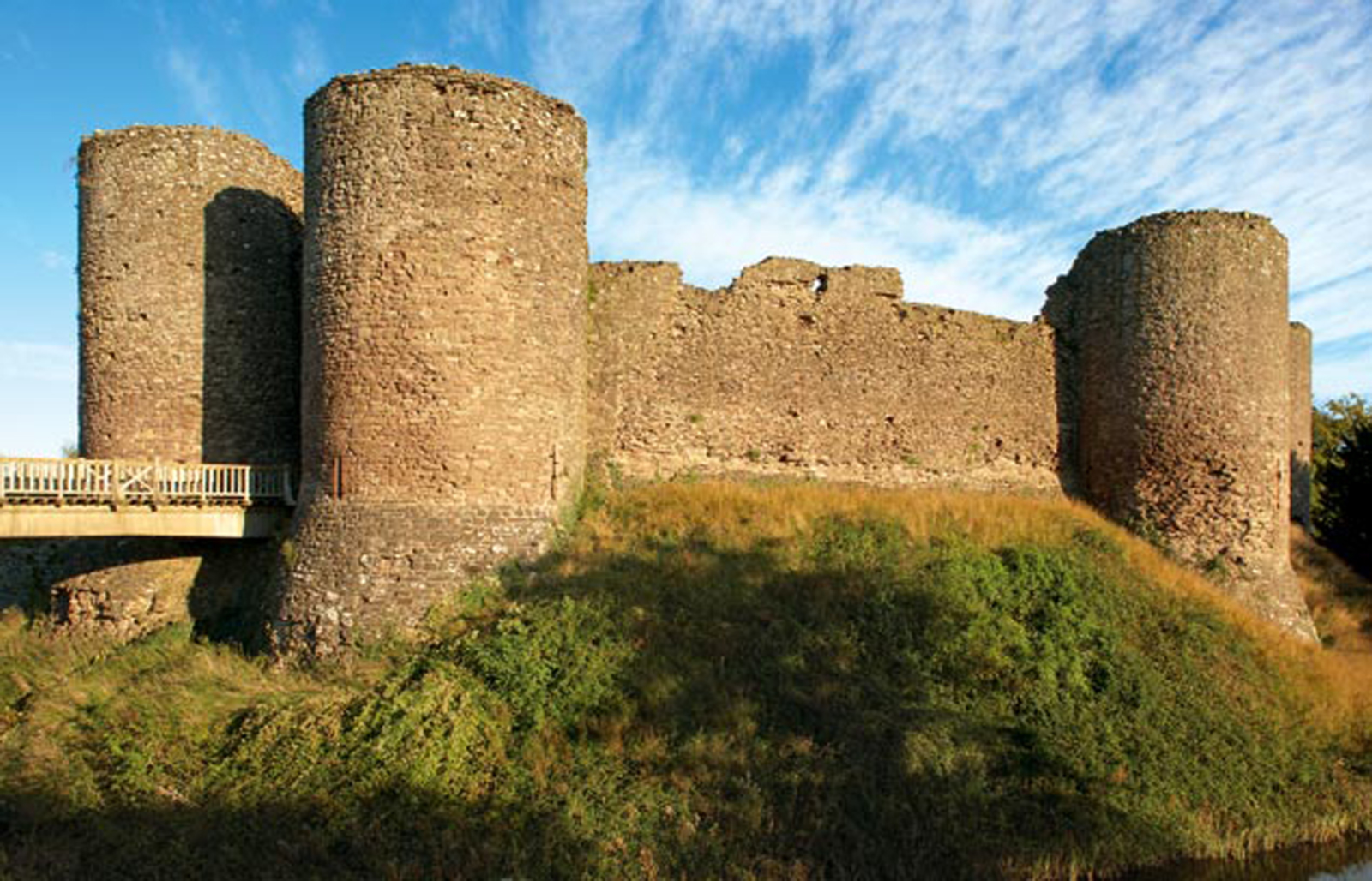
White Castle, Monmouthshire
White Castle (Welsh: Castell Gwyn), also known historically as Llantilio Castle, is a ruined castle near the village of Llantilio Crossenny in Monmouthshire...

Upper White Castle Farmhouse
Upper White Castle Farmhouse, Llantilio Crossenny, Monmouthshire is a farmhouse dating from the late 17th century. Standing adjacent to the White Castle...
Great Pool Hall, Llanvetherine
Great Pool Hall, Llanvetherine, Monmouthshire is a mansion dating from the early 17th century. Its construction is unusual in that it is built around a...
Nearby Amenities
Located within 500m of 51.852488,-2.918534Have you been to Caggle Street?
Leave your review of Caggle Street below (or comments, questions and feedback).