Llwyn y Gelli

Wood, Forest in Denbighshire

Wales

Llwyn y Gelli

Chirk Castle Chirk castle, beautiful gardens and woods around the castle.
Chirk Castle Credit: Dave Smethurst

Llwyn y Gelli is a stunning woodland located in Denbighshire, Wales. Covering an area of approximately 100 acres, it is a natural haven for both wildlife and visitors seeking tranquility and natural beauty.

The woodland is predominantly made up of a mixture of native deciduous trees, including oak, ash, birch, and beech. These trees create a rich and diverse ecosystem, providing habitat for a wide range of bird species, mammals, and insects. The forest floor is adorned with a carpet of wildflowers during the spring and summer months, adding bursts of color to the landscape.

A network of well-maintained pathways and trails winds its way through Llwyn y Gelli, allowing visitors to explore the woodland at their own pace. The paths are suitable for walkers of all abilities, including families with young children. Along these routes, visitors can enjoy breathtaking views of the surrounding countryside and take in the peaceful atmosphere of the forest.

Llwyn y Gelli is a popular destination for nature enthusiasts, photographers, and those seeking a peaceful retreat. The woodland offers opportunities for wildlife spotting, birdwatching, and even picnicking amidst the serene surroundings. Visitors can also learn more about the flora and fauna of the area through interpretive signs and information boards that are strategically placed throughout the woodland.

Managed by a dedicated team, Llwyn y Gelli is carefully conserved to protect its natural beauty and biodiversity. It is open to the public throughout the year, providing a place for people to connect with nature and enjoy the wonders of this enchanting woodland.

If you have any feedback on the listing, please let us know in the comments section below.

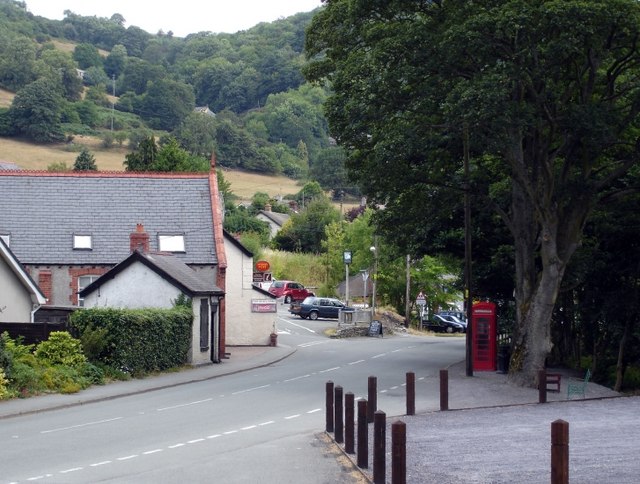
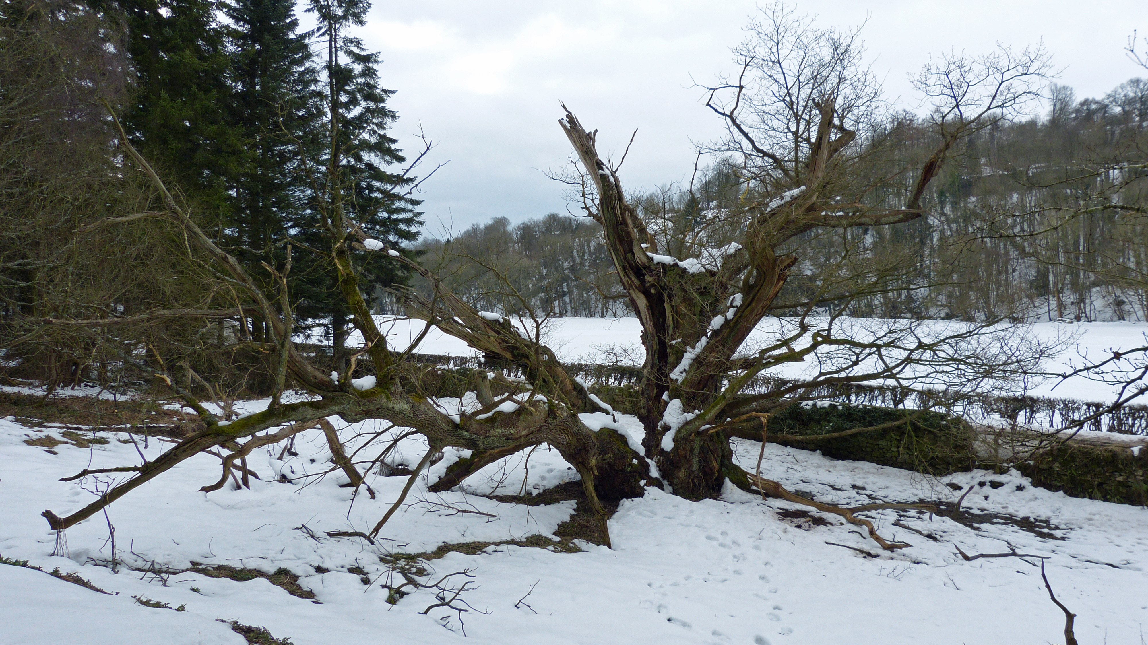
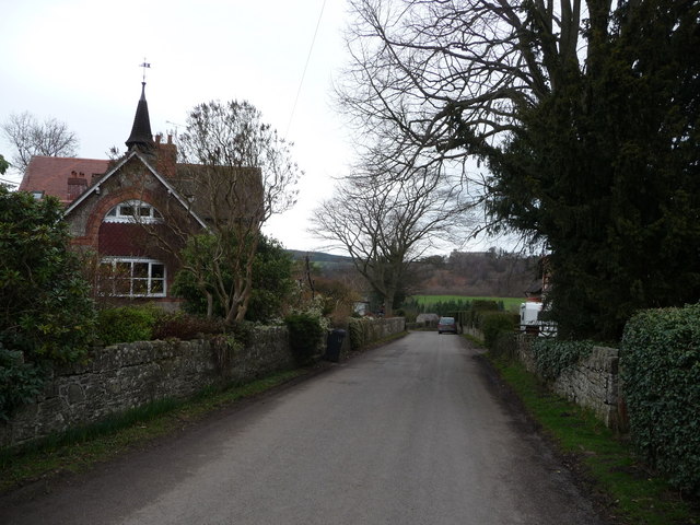
Llwyn y Gelli Images

Images are sourced within 2km of 52.935017/-3.120504 or Grid Reference SJ2438. Thanks to Geograph Open Source API. All images are credited.

Chirk Castle Chirk castle, beautiful gardens and woods around the castle.
Chirk Castle
Chirk castle, beautiful gardens and woods around the castle.
The Kennels at Tyn-y-groes Great rural house with a traditional set of kennels.
The Kennels at Tyn-y-groes
Great rural house with a traditional set of kennels.
Pontfadog Pontfadog - former tramway halt, chapel, post office, sign for the
Swan Inn (hidden) and view of the north side of the Ceiriog valley.
From the car park by the lower bridge over the Ceiriog.
Pontfadog
Pontfadog - former tramway halt, chapel, post office, sign for the Swan Inn (hidden) and view of the north side of the Ceiriog valley. From the car park by the lower bridge over the Ceiriog.
Pontfadog - bridleway at Garth Tynddol Pontfadog - bridleway at Garth Tynddol. This traverses the slopes of Garth Tynddol below Pen-y-bryn and above the B4500 on the north slope of the Ceiriog Valley.
Pontfadog - bridleway at Garth Tynddol
Pontfadog - bridleway at Garth Tynddol. This traverses the slopes of Garth Tynddol below Pen-y-bryn and above the B4500 on the north slope of the Ceiriog Valley.
Pontfadog - Pennant Pennant Farm stands high above Pontfadog on the north slope of the Ceiriog valley. There appears to be a small chapel or schoolhouse in the grounds. The woodland walk through Tynant wood, down the valley south to the B4500 at Tynddol is recommended.
Pontfadog - Pennant
Pennant Farm stands high above Pontfadog on the north slope of the Ceiriog valley. There appears to be a small chapel or schoolhouse in the grounds. The woodland walk through Tynant wood, down the valley south to the B4500 at Tynddol is recommended.
Pontfadog - Pant-ddu Pant-ddu farm is on a minor road high above Pontfadog and almost at the summit level of the ridge that separates the Ceiriog and Dee valleys - although there is still a good "puff" to the top. Apologies to our Welsh colleagues if I have mis-spelled the name. The sign at the farm uses the soft mutation but the OS map has the radical form "Pant-du" - and as an Englishman I don't know which is right, although my guess is that the second element of a compound should be softened.
Pontfadog - Pant-ddu
Pant-ddu farm is on a minor road high above Pontfadog and almost at the summit level of the ridge that separates the Ceiriog and Dee valleys - although there is still a good "puff" to the top. Apologies to our Welsh colleagues if I have mis-spelled the name. The sign at the farm uses the soft mutation but the OS map has the radical form "Pant-du" - and as an Englishman I don't know which is right, although my guess is that the second element of a compound should be softened.
Llwybr Ceiriog Trail above Pentre Farm Llwybr Ceiriog Trail in the Ceiriog Valley from above Pentre Farm. The Pontfadog loop of the trail descends a side valley towards the Afon Ceiriog. The bridleway makes an attractive descent from the ridge, through hill pasture and woodland. The view shows the lower Ceiriog valley.
Llwybr Ceiriog Trail above Pentre Farm
Llwybr Ceiriog Trail in the Ceiriog Valley from above Pentre Farm. The Pontfadog loop of the trail descends a side valley towards the Afon Ceiriog. The bridleway makes an attractive descent from the ridge, through hill pasture and woodland. The view shows the lower Ceiriog valley.
Pontfadog - St. John's church The village of Pontfadog and its church of St. John lie on the left bank of the Afon Ceiriog. The view is from the hamlet of Graig, just outside the village and situated on an elevated terrace above the right bank.
Pontfadog - St. John's church
The village of Pontfadog and its church of St. John lie on the left bank of the Afon Ceiriog. The view is from the hamlet of Graig, just outside the village and situated on an elevated terrace above the right bank.
Llwyn Afon cottage, Bronygarth Llwyn means bush or grove and Afon means river. Bronygarth is in the picturesque Ceiriog valley.
Llwyn Afon cottage, Bronygarth
Llwyn means bush or grove and Afon means river. Bronygarth is in the picturesque Ceiriog valley.
Crogen Iddon
Crogen Iddon
Cottage at Pen-y-gelli Near to Pontfadog in the Ceiriog valley. Pen-y-gelli means "top of the grove".
Cottage at Pen-y-gelli
Near to Pontfadog in the Ceiriog valley. Pen-y-gelli means "top of the grove".
Limekilns at Bronygarth No longer used, these kilns date from the early 19th century and are listed Grade II (List Entry Number 1367366): "Roughly coursed limestone rubble. Two tall round-headed arches to left ... and two segmental arches to right with buttress between and remains of kilns to rear".
Limekilns at Bronygarth
No longer used, these kilns date from the early 19th century and are listed Grade II (List Entry Number 1367366): "Roughly coursed limestone rubble. Two tall round-headed arches to left ... and two segmental arches to right with buttress between and remains of kilns to rear".
Ceiriog Valley from Pen-y-gelli
Houses in Graig
Houses in Graig
Ceiriog valley Photo of Pontfadog, from Graig.
Ceiriog valley
Photo of Pontfadog, from Graig.
St John the Baptist church, Pontfadog
Offas Dyke and the Welsh border Are the natives friendly?  Looking over the border fence into Wales from Offa's Dyke west of Chirk.
Offas Dyke and the Welsh border
Are the natives friendly? Looking over the border fence into Wales from Offa's Dyke west of Chirk.
Offa's Dyke near Bronygarth Offa was the King of Mercia in the 8th century. The dyke was started in 785 A.D. and took several years to build - not surprising considering it (generally) marks the boundary between England and Wales. For more info, see <span class="nowrap"><a title="http://www.offasdyke.demon.co.uk/dyke.htm" rel="nofollow ugc noopener" href="http://www.offasdyke.demon.co.uk/dyke.htm">Link</a><img style="margin-left:2px;" alt="External link" title="External link - shift click to open in new window" src="https://s1.geograph.org.uk/img/external.png" width="10" height="10"/></span>
Offa's Dyke near Bronygarth
Offa was the King of Mercia in the 8th century. The dyke was started in 785 A.D. and took several years to build - not surprising considering it (generally) marks the boundary between England and Wales. For more info, see LinkExternal link
Show me another place!

Llwyn y Gelli is located at Grid Ref: SJ2438 (Lat: 52.935017, Lng: -3.120504)

Unitary Authority: Wrexham

Police Authority: North Wales

What 3 Words

///swimmer.quiz.ounce. Near Chirk, Wrexham

Nearby Locations

Llwyn y Gelli

Related Wikis

Clwyd South (UK Parliament constituency)

Clwyd South (Welsh: De Clwyd) is a constituency of the House of Commons of the Parliament of the United Kingdom (Westminster). The constituency was created...

Battle of Crogen

The Battle of Crogen is an engagement said to have taken place in Wales during Henry II of England's summer 1165 campaign against an alliance of Welsh...

Pontfadog

Pontfadog is a village in the Ceiriog Valley west of Chirk in Wrexham County Borough, Wales; it is part of the community of Glyntraian. Like the neighbouring...

Pontfadog Oak

The Pontfadog Oak was a sessile oak tree (Quercus petraea) that stood on Cilcochwyn farm above the village of Pontfadog, in the Ceiriog Valley west of...

Glyntraian

Glyntraian (Welsh: Glyntraean) is a community in Wrexham County Borough, Wales. The parish of Glyntraian, lying at the mouth of the Ceiriog Valley, was...

Oak at the Gate of the Dead

The Oak at the Gate of the Dead (in Welsh: "Derwen Adwy'r Meirwon"), or Crogen Oak is a veteran tree in Wrexham County Borough, Wales. Located near the...
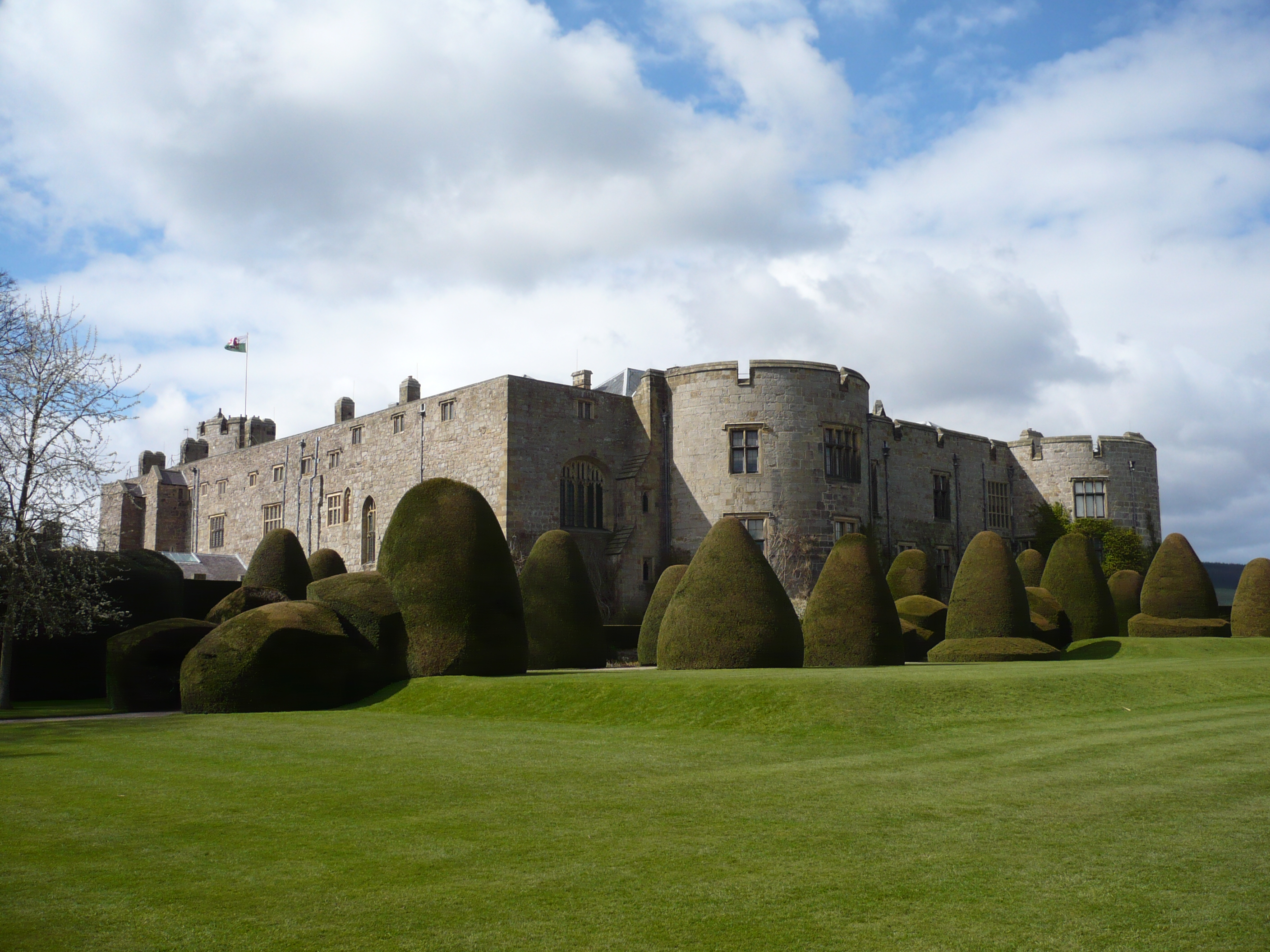
Chirk Castle

Chirk Castle (Welsh: Castell y Waun) is a Grade I listed castle located in Chirk, Wrexham County Borough, Wales. It is now owned and run by the National...

Bronygarth

Bronygarth is a small village in the Ceiriog Valley near Oswestry in Shropshire, England at grid reference SJ268370. The village is on the England–Wales...

Nearby Amenities

Located within 500m of 52.935017,-3.120504
Waterway: rapids
Lat/Long: 52.9367745/-3.1154716
Waterway: rapids
Lat/Long: 52.9368493/-3.1166464
Place: farm
Lat/Long: 52.9339179/-3.1268985
Building: yes
Lat/Long: 52.9332343/-3.1208644
Waterway: rapids
Lat/Long: 52.9367509/-3.1160295
Waterway: rapids
Lat/Long: 52.9365238/-3.1135136
The data included in this document is from www.openstreetmap.org. The data is made available under ODbL.

Have you been to Llwyn y Gelli?

Leave your review of Llwyn y Gelli below (or comments, questions and feedback).