Cae-mawr Coppice

Wood, Forest in Montgomeryshire

Wales

Cae-mawr Coppice

Shropshire Union Canal (Montgomery Branch) at Pont-y-Person near Four Crosses
Shropshire Union Canal (Montgomery Branch) at Pont-y-Person near Four Crosses Credit: Colin Park

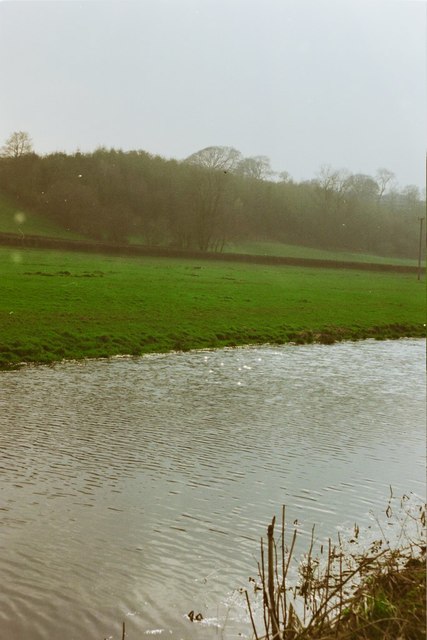
Cae-mawr Coppice is a picturesque woodland located in Montgomeryshire, Wales. Covering an area of approximately 50 acres, this enchanting forest is known for its diverse range of flora and fauna, making it a haven for nature enthusiasts and wildlife lovers alike.

The coppice is primarily composed of native deciduous trees such as oak, beech, and birch, which create a dense canopy that provides shade and shelter for the various species that call this woodland home. The forest floor is adorned with a carpet of bluebells in the spring, creating a stunning display of color and fragrance.

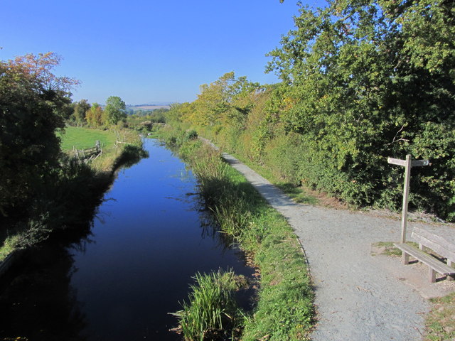
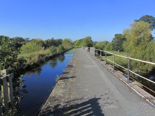
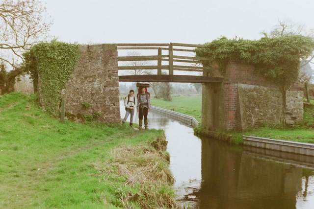
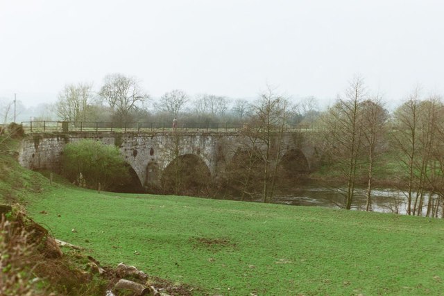
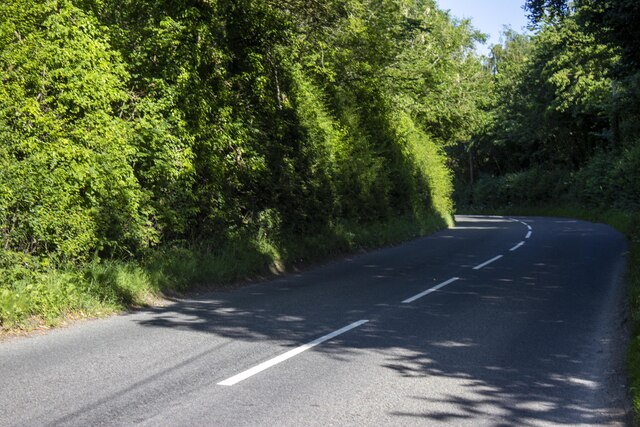
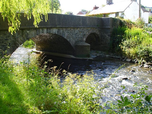
A network of well-maintained footpaths winds its way through the woodland, allowing visitors to explore the area and take in the natural beauty that surrounds them. Along these trails, one may stumble upon a charming stream that meanders through the forest, providing a tranquil ambiance and attracting various species of birds and small mammals.

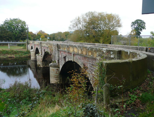
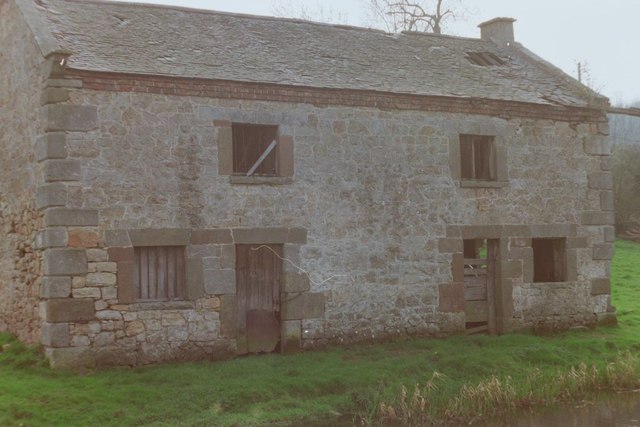
Cae-mawr Coppice is not only a sanctuary for wildlife but also a place of historical significance. The woodland has remnants of ancient earthworks and archaeological sites, serving as a testament to the rich history of the area.

Visitors to Cae-mawr Coppice can enjoy a range of activities, including birdwatching, photography, and simply immersing themselves in the peaceful atmosphere of the forest. With its stunning natural scenery and cultural heritage, this wood is a must-visit destination for those seeking a connection with nature and a glimpse into the past.

If you have any feedback on the listing, please let us know in the comments section below.

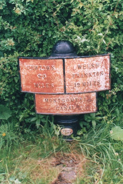
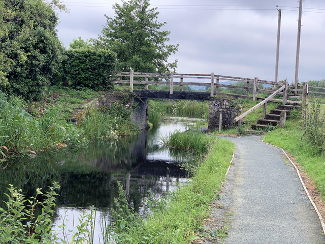
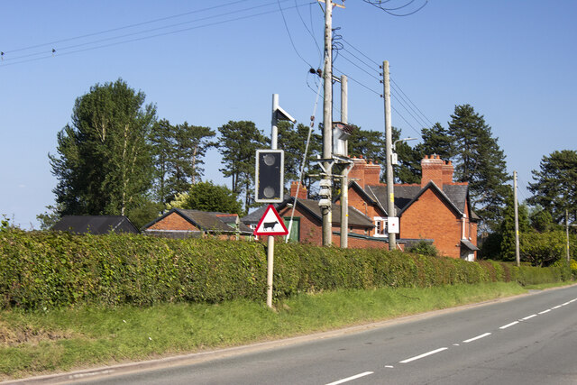
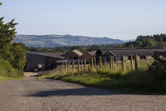
Cae-mawr Coppice Images

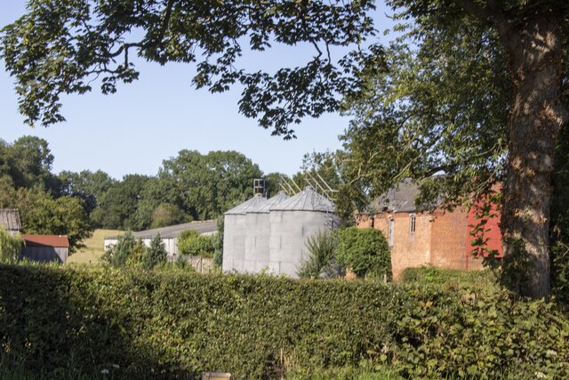
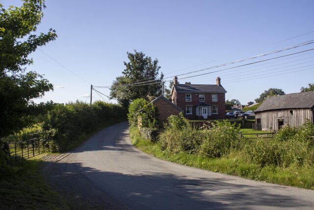
Images are sourced within 2km of 52.76536/-3.1204999 or Grid Reference SJ2419. Thanks to Geograph Open Source API. All images are credited.

Shropshire Union Canal (Montgomery Branch) at Pont-y-Person near Four Crosses
Shropshire Union Canal (Montgomery Branch) at the Vyrnwy Aqueduct
New Bridge over the River Vyrnwy This carries the B4398, which goes to the A483 at Llanymynech.
New Bridge over the River Vyrnwy
This carries the B4398, which goes to the A483 at Llanymynech.
Pont-y-Person Bridge, 1988
Montgomery Canal near Pentreheylin Hall, 1988
The Old Salt Warehouse, Pentreheylin, 1988 A look at Google Street View in 2018 shows that the building has since been restored into a private house. Not only was the building made habitable again, but the crane at the right-hand side of the building was also restored.
The Old Salt Warehouse, Pentreheylin, 1988
A look at Google Street View in 2018 shows that the building has since been restored into a private house. Not only was the building made habitable again, but the crane at the right-hand side of the building was also restored.
Vyrnwy Aqueduct, 1988
Old Milepost by the B4393, Waen Turner Arrow Casting by the B4393, in parish of Llansantffraidd-ym-Mechain (Powys District), Waen, by bungalow "Wind Chimes", on verge.

Inscription reads:-
: LLANFYLLIN / 7 - M / {arrow} : : SHREWSBURY / {arrow} / 18 - M : : OSWESTRY / 8 - M / {arrow} :

Grade II listed by Cadw. Reference Number: 82555
<span class="nowrap"><a title="https://cadwpublic-api.azurewebsites.net/reports/listedbuilding/FullReport?lang=&id=82555" rel="nofollow ugc noopener" href="https://cadwpublic-api.azurewebsites.net/reports/listedbuilding/FullReport?lang=&id=82555">Link</a><img style="margin-left:2px;" alt="External link" title="External link - shift click to open in new window" src="https://s1.geograph.org.uk/img/external.png" width="10" height="10"/></span>

Surveyed

Milestone Society National ID: MOT_LFOW07.
Old Milepost by the B4393, Waen
Turner Arrow Casting by the B4393, in parish of Llansantffraidd-ym-Mechain (Powys District), Waen, by bungalow "Wind Chimes", on verge. Inscription reads:- : LLANFYLLIN / 7 - M / {arrow} : : SHREWSBURY / {arrow} / 18 - M : : OSWESTRY / 8 - M / {arrow} : Grade II listed by Cadw. Reference Number: 82555 LinkExternal link Surveyed Milestone Society National ID: MOT_LFOW07.
Canal milemarker by the Montgomery Canal, Vyrnwy Viaduct Replica Milemarker by the Montgomery Canal, in parish of Carreghofa (Powys District), near the  Vyrnwy Aqueduct.

Inscription reads:
: NEWTOWN / 23 / MILES : : MONTGOMERY / CANAL : : WELSH / FRANKTON / 12 MILES :
Sponsor:-
: MWRT / 1984 :
(Montgomery Waterway Restoration Trust)

Milestone Society National ID: MGY-12R
Canal milemarker by the Montgomery Canal, Vyrnwy Viaduct
Replica Milemarker by the Montgomery Canal, in parish of Carreghofa (Powys District), near the Vyrnwy Aqueduct. Inscription reads: : NEWTOWN / 23 / MILES : : MONTGOMERY / CANAL : : WELSH / FRANKTON / 12 MILES : Sponsor:- : MWRT / 1984 : (Montgomery Waterway Restoration Trust) Milestone Society National ID: MGY-12R
Canal bridge at Pentreheylin Carrying a minor road over the Montgomery Canal. The towpath here is used by Offa's Dyke Path.
Canal bridge at Pentreheylin
Carrying a minor road over the Montgomery Canal. The towpath here is used by Offa's Dyke Path.
Farmstead
Farmstead
Lane to Coedmawre Farm Modern farm buildings and house at Coedmawre Farm
Lane to Coedmawre Farm
Modern farm buildings and house at Coedmawre Farm
Hedgerows and meadow Hedgerows and meadow near Deuddwr
Hedgerows and meadow
Hedgerows and meadow near Deuddwr
Rhysnant Farm Vernacular and modern farm buildings at Rhysnant Farm
Rhysnant Farm
Vernacular and modern farm buildings at Rhysnant Farm
Road B4393 Woodland next to B4393
Road B4393
Woodland next to B4393
Waen Farm Modern and vernacular farm buildings at Waen farm
Waen Farm
Modern and vernacular farm buildings at Waen farm
Farmstead at Cross Lane Vernacular and modern farm buildings at Cross Lane
Farmstead at Cross Lane
Vernacular and modern farm buildings at Cross Lane
Pont-y-person
Pont-y-person
Show me another place!

Cae-mawr Coppice is located at Grid Ref: SJ2419 (Lat: 52.76536, Lng: -3.1204999)

Unitary Authority: Powys

Police Authority: Dyfed Powys

What 3 Words

///shortens.boomed.according. Near Four Crosses, Powys

Nearby Locations

Cae-mawr Coppice

Related Wikis

Carreghofa

Carreghofa (Welsh: Carreghwfa) is a community in Montgomeryshire, Powys, Wales, and is 89.6 miles (144.2 km) from Cardiff and 153.6 miles (247.2 km) from...

Afon Tanat

Afon Tanat is a river in northern Powys, Wales. Its source is close to the Cyrniau Nod mountain, to the north of Lake Vyrnwy. The river flows in a generally...

River Cain

The River Cain (Afon Cain in Welsh) is a river in north Powys which flows into the River Vyrnwy. Cain's source is just west of Llanfyllin, at the confluence...

Carreghofa Halt railway station

Carreghofa Halt railway station is a disused station in Carreghofa, Powys, Wales. The station opened in 1938 and closed in 1965. == References == ��2...

Nearby Amenities

Located within 500m of 52.76536,-3.1204999
The data included in this document is from www.openstreetmap.org. The data is made available under ODbL.

Have you been to Cae-mawr Coppice?

Leave your review of Cae-mawr Coppice below (or comments, questions and feedback).