Caergwrle

Settlement in Flintshire

Wales

Caergwrle

View of Cymau Village in the Snow Woke up to more snow! 10th March 2023
View of Cymau Village in the Snow Credit: Isabel Blore

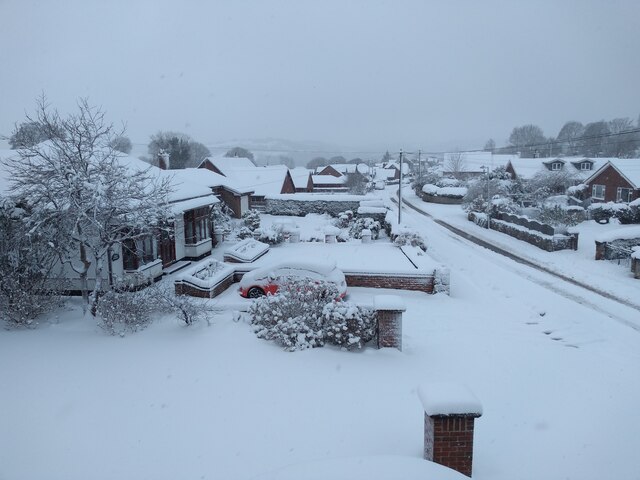
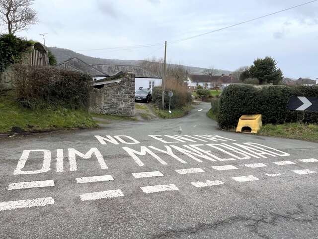
Caergwrle is a small village located in Flintshire, Wales. Situated on the banks of the River Alyn, it is nestled between the towns of Wrexham and Mold. With a population of around 2,500 people, Caergwrle is known for its picturesque landscapes and historic charm.

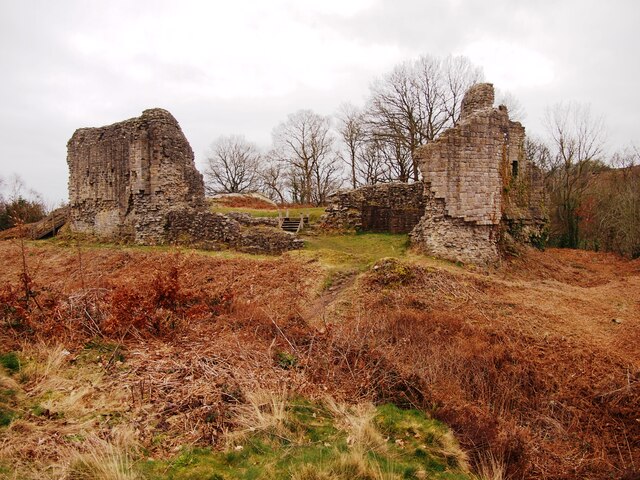
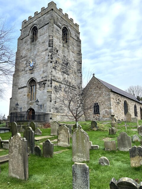
The village is dominated by the ruins of Caergwrle Castle, a medieval fortress that dates back to the 13th century. The castle offers a glimpse into the area's rich history and attracts visitors from near and far. The surrounding countryside provides ample opportunities for outdoor activities, including hiking, cycling, and fishing.

Caergwrle is home to a close-knit community that takes pride in its heritage. The village has a primary school, a local pub, a post office, and a few small shops catering to the daily needs of its residents. Additionally, there are several community events held throughout the year, such as the Caergwrle Bowl Festival and the Christmas Lights Switch-On, which bring the community together.

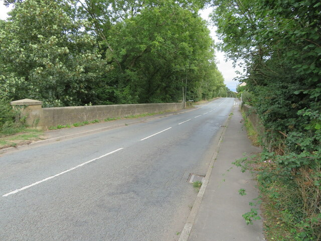
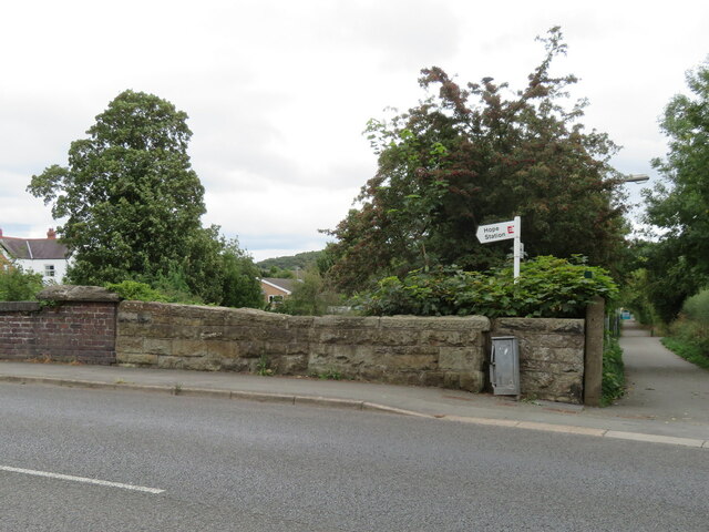
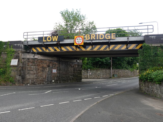
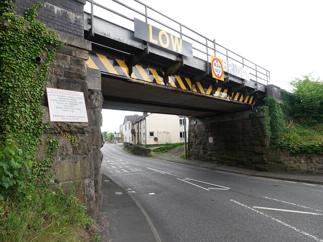
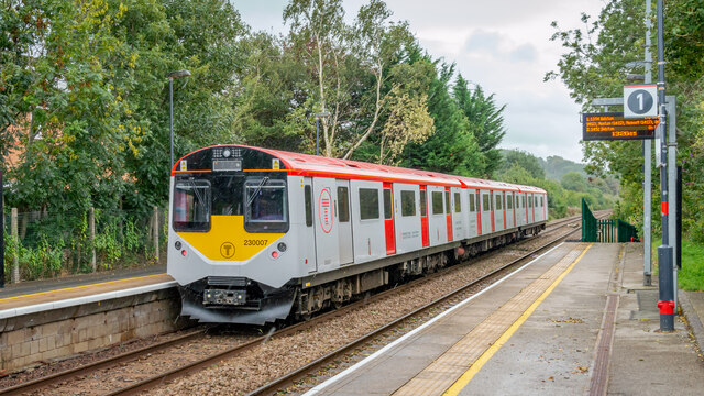
The village benefits from excellent transport links, with easy access to the A541 road and nearby railway stations at Cefn-y-Bedd and Hope. This makes it an attractive place to live for those who work in the neighboring towns or cities.

Overall, Caergwrle is a charming village that offers a peaceful and picturesque setting, rich history, and a strong sense of community.

If you have any feedback on the listing, please let us know in the comments section below.
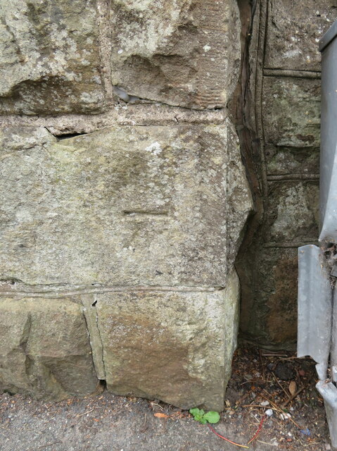
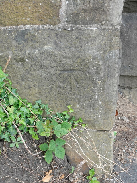
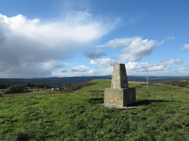
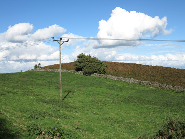
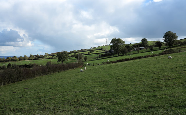
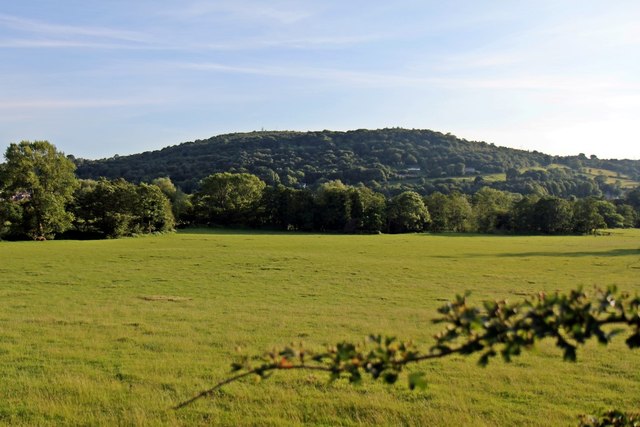
Caergwrle Images

Images are sourced within 2km of 53.10881/-3.035952 or Grid Reference SJ3057. Thanks to Geograph Open Source API. All images are credited.

View of Cymau Village in the Snow Woke up to more snow! 10th March 2023
View of Cymau Village in the Snow
Woke up to more snow! 10th March 2023
Caergwrle Castle
Caergwrle Castle
Rivet benchmark on the Afon Alun bridge, Fagl Lane, Hope Ordnance Survey rivet benchmark on the north parapet of the Fagl Lane bridge over the Afon Alun/River Alyn. The bridge was built in 1933/4 to straighten the road and replaced the earlier Pont y Delyn, which still exists to the south. Levelled at 82.802m above Newlyn Datum, verified 1959. For a wider view see <a href="https://www.geograph.org.uk/photo/7516282">SJ3058 : Bridge over Afon Alun/River Alyn, Fagl Lane, Hope</a>                                                                                        
<span class="nowrap"><a title="https://www.bench-marks.org.uk/bm195082" rel="nofollow ugc noopener" href="https://www.bench-marks.org.uk/bm195082">Link</a><img style="margin-left:2px;" alt="External link" title="External link - shift click to open in new window" src="https://s1.geograph.org.uk/img/external.png" width="10" height="10"/></span>
Rivet benchmark on the Afon Alun bridge, Fagl Lane, Hope
Ordnance Survey rivet benchmark on the north parapet of the Fagl Lane bridge over the Afon Alun/River Alyn. The bridge was built in 1933/4 to straighten the road and replaced the earlier Pont y Delyn, which still exists to the south. Levelled at 82.802m above Newlyn Datum, verified 1959. For a wider view see SJ3058 : Bridge over Afon Alun/River Alyn, Fagl Lane, Hope LinkExternal link
Bridge over Afon Alun/River Alyn, Fagl Lane, Hope Looking east along Fagl Lane over the bridge that was built in 1933/4 to straighten the road and replace Pont y Delyn, which is out of sight on the right. There is an Ordnance Survey rivet benchmark on top of the left hand/north parapet <a href="https://www.geograph.org.uk/photo/7516156">SJ3058 : Rivet benchmark on the Afon Alun bridge, Fagl Lane, Hope</a>.
Bridge over Afon Alun/River Alyn, Fagl Lane, Hope
Looking east along Fagl Lane over the bridge that was built in 1933/4 to straighten the road and replace Pont y Delyn, which is out of sight on the right. There is an Ordnance Survey rivet benchmark on top of the left hand/north parapet SJ3058 : Rivet benchmark on the Afon Alun bridge, Fagl Lane, Hope.
Benchmark on wall by Hope railway bridge, Fagl Lane Ordnance Survey benchmark on the stone wall by the south parapet of Hope railway bridge in Fagl Lane. Levelled at 87.063m above Newlyn Datum, verified 1959. The bridge creates an 'S' bend in the road and judging by the damage to the adjacent metal box the cut mark has done well to survive. For a wider view see <a href="https://www.geograph.org.uk/photo/7516365">SJ3058 : Stone wall by Hope railway bridge, Fagl Lane</a>                                                                                 
<span class="nowrap"><a title="https://www.bench-marks.org.uk/bm195085" rel="nofollow ugc noopener" href="https://www.bench-marks.org.uk/bm195085">Link</a><img style="margin-left:2px;" alt="External link" title="External link - shift click to open in new window" src="https://s1.geograph.org.uk/img/external.png" width="10" height="10"/></span>
Benchmark on wall by Hope railway bridge, Fagl Lane
Ordnance Survey benchmark on the stone wall by the south parapet of Hope railway bridge in Fagl Lane. Levelled at 87.063m above Newlyn Datum, verified 1959. The bridge creates an 'S' bend in the road and judging by the damage to the adjacent metal box the cut mark has done well to survive. For a wider view see SJ3058 : Stone wall by Hope railway bridge, Fagl Lane LinkExternal link
Stone wall by Hope railway bridge, Fagl Lane Looking across Fagl Lane towards the stone wall between the railway bridge on the left, and the access lane to Hope Station. There is an Ordnance Survey benchmark on the wall to the left of the damaged electricity cabinet <a href="https://www.geograph.org.uk/photo/7516332">SJ3058 : Benchmark on wall by Hope railway bridge, Fagl Lane</a>
Stone wall by Hope railway bridge, Fagl Lane
Looking across Fagl Lane towards the stone wall between the railway bridge on the left, and the access lane to Hope Station. There is an Ordnance Survey benchmark on the wall to the left of the damaged electricity cabinet SJ3058 : Benchmark on wall by Hope railway bridge, Fagl Lane
Benchmark on Cefn-y-Bedd railway bridge, Wrexham Road Ordnance Survey benchmark on the northwest corner of the railway bridge over Wrexham Road, Cefn-y-Bedd. Levelled at 82.601m above Newlyn Datum, verified 1959. For wider views see: <a href="https://www.geograph.org.uk/photo/7523770">SJ3156 : Low Bridge over Wrexham Road, Cefn-y-Bedd</a> and <a href="https://www.geograph.org.uk/photo/7523783">SJ3156 : Low Bridge over Wrexham Road, Cefn-y-Bedd</a>

Benchmark database: <span class="nowrap"><a title="https://www.bench-marks.org.uk/bm195726" rel="nofollow ugc noopener" href="https://www.bench-marks.org.uk/bm195726">Link</a><img style="margin-left:2px;" alt="External link" title="External link - shift click to open in new window" src="https://s1.geograph.org.uk/img/external.png" width="10" height="10"/></span>
Benchmark on Cefn-y-Bedd railway bridge, Wrexham Road
Ordnance Survey benchmark on the northwest corner of the railway bridge over Wrexham Road, Cefn-y-Bedd. Levelled at 82.601m above Newlyn Datum, verified 1959. For wider views see: SJ3156 : Low Bridge over Wrexham Road, Cefn-y-Bedd and SJ3156 : Low Bridge over Wrexham Road, Cefn-y-Bedd Benchmark database: LinkExternal link
Low Bridge over Wrexham Road, Cefn-y-Bedd Despite the warning signs Cefn-y-Bedd railway bridge is often hit with oversize lorries or loads. There is an Ordnance Survey benchmark on the left hand corner of the bridge <a href="https://www.geograph.org.uk/photo/7523731">SJ3156 : Benchmark on Cefn-y-Bedd railway bridge, Wrexham Road</a>
Low Bridge over Wrexham Road, Cefn-y-Bedd
Despite the warning signs Cefn-y-Bedd railway bridge is often hit with oversize lorries or loads. There is an Ordnance Survey benchmark on the left hand corner of the bridge SJ3156 : Benchmark on Cefn-y-Bedd railway bridge, Wrexham Road
DEMU 230007 leaving Hope (Flintshire) Station for Wrexham Converted from London Underground stock
DEMU 230007 leaving Hope (Flintshire) Station for Wrexham
Converted from London Underground stock
Church of St Cynfarch and St Cynfar, Hope, Flintshire
No Entry - in either language To Kiln Drive, Hope.
No Entry - in either language
To Kiln Drive, Hope.
Barn at Bridge End
Barn at Bridge End
Trees in winter
Trees in winter
Summit area of Hope Mountain Hope Mountain is a local high point and a 'Marilyn' north-west of Wrexham; the trig point is seen here at the hill top.
Summit area of Hope Mountain
Hope Mountain is a local high point and a 'Marilyn' north-west of Wrexham; the trig point is seen here at the hill top.
Field north-east of summit of Hope Mountain Hope Mountain is a hill of modest height west of the village of Caergwrle. Beyond the field and the bracken a slope drops steeply to the village.
Field north-east of summit of Hope Mountain
Hope Mountain is a hill of modest height west of the village of Caergwrle. Beyond the field and the bracken a slope drops steeply to the village.
Ground rising to Hope Mountain A view over fields from a minor road near to the settlement of Horeb.
Ground rising to Hope Mountain
A view over fields from a minor road near to the settlement of Horeb.
Hope Mountain Viewed from Hope railway station.
Hope Mountain
Viewed from Hope railway station.
Show me another place!

Caergwrle is located at Grid Ref: SJ3057 (Lat: 53.10881, Lng: -3.035952)

Unitary Authority: Flintshire

Police Authority: North Wales

What 3 Words

///toys.balconies.guilty. Near Caergwrle, Flintshire

Nearby Locations

Caergwrle

Related Wikis

Hope, Flintshire

Hope (Welsh: Yr Hôb) is a small village and community in Flintshire, north-east Wales. The village is located approximately 3 miles / 4.5 km from the Wales...
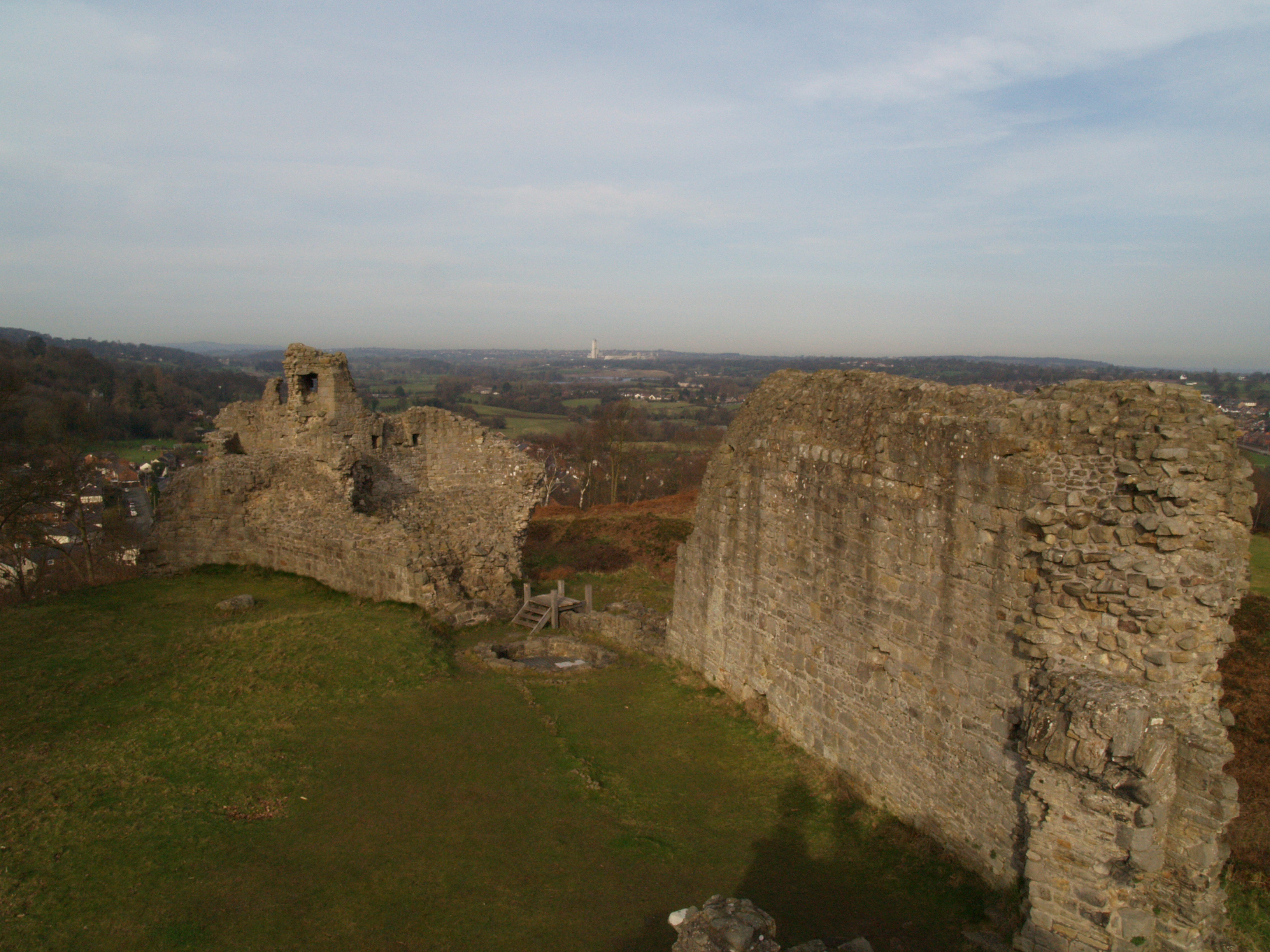
Caergwrle Castle

Caergwrle Castle (Welsh: Castell Caergwrle), also known as Queen's Hope in scholarly texts, is located in the town of Caergwrle, in Flintshire, Wales....

Caergwrle railway station

Caergwrle railway station serves the village of Caergwrle in Flintshire, Wales. The station is 4¾ miles (7 km) north of Wrexham Central on the Borderlands...

Caergwrle

Caergwrle () is a village in the county of Flintshire, in north east Wales. Approximately 5–6 miles (8.0–9.7 km) from Wrexham and situated on the A541...

Nearby Amenities

Located within 500m of 53.10881,-3.035952
Caergwrle
Is In: Flintshire, Wales, United Kingdom
Is In Country: United Kingdom
Is In County: Flintshire
Is In Nation: Wales
Name Cy: Caergwrle
Name En: Caergwrle
Place: village
Wikidata: Q2483466
Lat/Long: 53.1103777/-3.0398311
Caergwrle
Naptan AtcoCode: 9100CAERGWL
Network: National Rail
Network Website: https://www.nationalrail.co.uk/stations/cgw/
Network Wikidata: Q26334
Operator En: Transport for Wales
Operator Website: https://tfw.wales/places/stations/caergwrle
Operator Wikidata: Q104878180
Public Transport: station
Railway: station
Ref Crs: CGW
Wikidata: Q2684872
Wikipedia: en:Caergwrle railway station
Lat/Long: 53.1080896/-3.0332375
Noexit: yes
Lat/Long: 53.1083311/-3.0420547
Turning Circle
Lat/Long: 53.1089187/-3.0419127
Place Of Worship
Caergwrle Methodist Church
Denomination: methodist
Religion: christian
Wikidata: Q99449274
Lat/Long: 53.1097878/-3.0355144
Pub
The Castle Inn
Lat/Long: 53.1106687/-3.0408134
Restaurant
Country Spice
Lat/Long: 53.1120883/-3.0326686
Bus Stop
Bus: yes
Naptan AtcoCode: 5120WDB22142
Naptan NaptanCode: flijtwj
Public Transport: platform
Shelter: yes
Lat/Long: 53.1083043/-3.0335214
Post Box
Lat/Long: 53.1128198/-3.0325917
Trident
Office: accountant
Lat/Long: 53.1102372/-3.0403047
Waterway: weir
Lat/Long: 53.1094044/-3.0326067
Caergwrle Castle
Ele: 137
Natural: peak
Wikidata: Q106710288
Lat/Long: 53.1073315/-3.0369743
Power: pole
Lat/Long: 53.1070569/-3.0427608
Power: pole
Lat/Long: 53.1056684/-3.0411682
Power: pole
Lat/Long: 53.1064617/-3.0420919
Direction: SW
Generator Method: photovoltaic
Generator Output Electricity: yes
Generator Solar Modules: 14
Generator Source: solar
Generator Type: solar_photovoltaic_panel
Location: roof
Power: generator
Lat/Long: 53.1093694/-3.0419333
Direction: SW
Generator Method: photovoltaic
Generator Output Electricity: yes
Generator Solar Modules: 14
Generator Source: solar
Generator Type: solar_photovoltaic_panel
Location: roof
Power: generator
Lat/Long: 53.1094177/-3.0420132
Direction: SW
Generator Method: photovoltaic
Generator Output Electricity: yes
Generator Solar Modules: 14
Generator Source: solar
Generator Type: solar_photovoltaic_panel
Location: roof
Power: generator
Lat/Long: 53.1094668/-3.0420909
Direction: SE
Generator Method: photovoltaic
Generator Output Electricity: yes
Generator Solar Modules: 12
Generator Source: solar
Generator Type: solar_photovoltaic_panel
Location: roof
Power: generator
Lat/Long: 53.1095917/-3.0420003
Direction: SE
Generator Method: photovoltaic
Generator Output Electricity: yes
Generator Solar Modules: 12
Generator Source: solar
Generator Type: solar_photovoltaic_panel
Location: roof
Power: generator
Lat/Long: 53.1096418/-3.0419143
Direction: SE
Generator Method: photovoltaic
Generator Output Electricity: yes
Generator Solar Modules: 12
Generator Source: solar
Generator Type: solar_photovoltaic_panel
Location: roof
Power: generator
Lat/Long: 53.1096814/-3.0418463
Direction: SE
Generator Method: photovoltaic
Generator Output Electricity: yes
Generator Solar Modules: 12
Generator Source: solar
Generator Type: solar_photovoltaic_panel
Location: roof
Power: generator
Lat/Long: 53.1097307/-3.0417618
Direction: 175
Generator Method: photovoltaic
Generator Output Electricity: yes
Generator Solar Modules: 12
Generator Source: solar
Generator Type: solar_photovoltaic_panel
Location: roof
Power: generator
Lat/Long: 53.1115954/-3.0329582
Direction: 175
Generator Method: photovoltaic
Generator Output Electricity: yes
Generator Solar Modules: 12
Generator Source: solar
Generator Type: solar_photovoltaic_panel
Location: roof
Power: generator
Lat/Long: 53.1115874/-3.0330816
Direction: 175
Generator Method: photovoltaic
Generator Output Electricity: yes
Generator Solar Modules: 12
Generator Source: solar
Generator Type: solar_photovoltaic_panel
Location: roof
Power: generator
Lat/Long: 53.1115471/-3.0332265
Direction: 175
Generator Method: photovoltaic
Generator Output Electricity: yes
Generator Solar Modules: 12
Generator Source: solar
Generator Type: solar_photovoltaic_panel
Location: roof
Power: generator
Lat/Long: 53.1115133/-3.0333391
Direction: 175
Generator Method: photovoltaic
Generator Output Electricity: yes
Generator Solar Modules: 12
Generator Source: solar
Generator Type: solar_photovoltaic_panel
Location: roof
Power: generator
Lat/Long: 53.1114859/-3.0334598
Direction: 175
Generator Method: photovoltaic
Generator Output Electricity: yes
Generator Solar Modules: 12
Generator Source: solar
Generator Type: solar_photovoltaic_panel
Location: roof
Power: generator
Lat/Long: 53.1114376/-3.0336851
Direction: 175
Generator Method: photovoltaic
Generator Output Electricity: yes
Generator Solar Modules: 12
Generator Source: solar
Generator Type: solar_photovoltaic_panel
Location: roof
Power: generator
Lat/Long: 53.1114086/-3.0337897
Direction: 85
Generator Method: photovoltaic
Generator Output Electricity: yes
Generator Solar Modules: 12
Generator Source: solar
Generator Type: solar_photovoltaic_panel
Location: roof
Power: generator
Lat/Long: 53.1115266/-3.0339152
Direction: 85
Generator Method: photovoltaic
Generator Output Electricity: yes
Generator Solar Modules: 12
Generator Source: solar
Generator Type: solar_photovoltaic_panel
Location: roof
Power: generator
Lat/Long: 53.1115974/-3.0339253
Direction: 165
Generator Method: photovoltaic
Generator Output Electricity: yes
Generator Solar Modules: 12
Generator Source: solar
Generator Type: solar_photovoltaic_panel
Location: roof
Power: generator
Lat/Long: 53.111742/-3.0335162
Direction: 165
Generator Method: photovoltaic
Generator Output Electricity: yes
Generator Solar Modules: 12
Generator Source: solar
Generator Type: solar_photovoltaic_panel
Location: roof
Power: generator
Lat/Long: 53.1117612/-3.0334156
Direction: 165
Generator Method: photovoltaic
Generator Output Electricity: yes
Generator Solar Modules: 14
Generator Source: solar
Generator Type: solar_photovoltaic_panel
Location: roof
Power: generator
Lat/Long: 53.111787/-3.0333137
Direction: 165
Generator Method: photovoltaic
Generator Output Electricity: yes
Generator Solar Modules: 12
Generator Source: solar
Generator Type: solar_photovoltaic_panel
Location: roof
Power: generator
Lat/Long: 53.1118096/-3.0332117
Direction: 165
Generator Method: photovoltaic
Generator Output Electricity: yes
Generator Solar Modules: 10
Generator Source: solar
Generator Type: solar_photovoltaic_panel
Location: roof
Power: generator
Lat/Long: 53.1118341/-3.0330796
Direction: 165
Generator Method: photovoltaic
Generator Output Electricity: yes
Generator Solar Modules: 12
Generator Source: solar
Generator Type: solar_photovoltaic_panel
Location: roof
Power: generator
Lat/Long: 53.1118449/-3.0330032
Direction: 165
Generator Method: photovoltaic
Generator Output Electricity: yes
Generator Solar Modules: 10
Generator Source: solar
Generator Type: solar_photovoltaic_panel
Location: roof
Power: generator
Lat/Long: 53.1118576/-3.0329127
Direction: 165
Generator Method: photovoltaic
Generator Output Electricity: yes
Generator Solar Modules: 10
Generator Source: solar
Generator Type: solar_photovoltaic_panel
Location: roof
Power: generator
Lat/Long: 53.1118677/-3.0328409
Crossing
Crossing: traffic_signals
Lat/Long: 53.1101333/-3.0397419
Direction: 105
Generator Method: photovoltaic
Generator Output Electricity: yes
Generator Solar Modules: 5
Generator Source: solar
Generator Type: solar_photovoltaic_panel
Location: roof
Power: generator
Lat/Long: 53.1111107/-3.0311309
Direction: 265
Generator Method: photovoltaic
Generator Output Electricity: yes
Generator Solar Modules: 10
Generator Source: solar
Generator Type: solar_photovoltaic_panel
Location: roof
Power: generator
Lat/Long: 53.1115704/-3.0327845
Direction: 265
Generator Method: photovoltaic
Generator Output Electricity: yes
Generator Solar Modules: 10
Generator Source: solar
Generator Type: solar_photovoltaic_panel
Location: roof
Power: generator
Lat/Long: 53.1116429/-3.0327912
Direction: 265
Generator Method: photovoltaic
Generator Output Electricity: yes
Generator Solar Modules: 10
Generator Source: solar
Generator Type: solar_photovoltaic_panel
Location: roof
Power: generator
Lat/Long: 53.1114054/-3.0329146
Direction: 265
Generator Method: photovoltaic
Generator Output Electricity: yes
Generator Solar Modules: 10
Generator Source: solar
Generator Type: solar_photovoltaic_panel
Location: roof
Power: generator
Lat/Long: 53.1114802/-3.0329306
Direction: 175
Generator Method: photovoltaic
Generator Output Electricity: yes
Generator Solar Modules: 10
Generator Source: solar
Generator Type: solar_photovoltaic_panel
Location: roof
Power: generator
Lat/Long: 53.1114641/-3.0335663
Direction: 170
Generator Method: photovoltaic
Generator Output Electricity: yes
Generator Solar Modules: 19
Generator Source: solar
Generator Type: solar_photovoltaic_panel
Location: roof
Power: generator
Lat/Long: 53.1048054/-3.0331855
Direction: 190
Generator Method: photovoltaic
Generator Output Electricity: yes
Generator Solar Modules: 4
Generator Source: solar
Generator Type: solar_photovoltaic_panel
Location: roof
Power: generator
Lat/Long: 53.1055135/-3.0335583
Direction: SSW
Generator Method: photovoltaic
Generator Output Electricity: yes
Generator Solar Modules: 14
Generator Source: solar
Generator Type: solar_photovoltaic_panel
Location: roof
Power: generator
Lat/Long: 53.1060195/-3.0334376
Direction: 215
Generator Method: photovoltaic
Generator Output Electricity: yes
Generator Solar Modules: 12
Generator Source: solar
Generator Type: solar_photovoltaic_panel
Location: roof
Power: generator
Lat/Long: 53.1094564/-3.0398688
Direction: 215
Generator Method: photovoltaic
Generator Output Electricity: yes
Generator Solar Modules: 12
Generator Source: solar
Generator Type: solar_photovoltaic_panel
Location: roof
Power: generator
Lat/Long: 53.1094178/-3.0397823
Direction: 215
Generator Method: photovoltaic
Generator Output Electricity: yes
Generator Solar Modules: 12
Generator Source: solar
Generator Type: solar_photovoltaic_panel
Location: roof
Power: generator
Lat/Long: 53.1093695/-3.0397046
Direction: 215
Generator Method: photovoltaic
Generator Output Electricity: yes
Generator Solar Modules: 12
Generator Source: solar
Generator Type: solar_photovoltaic_panel
Location: roof
Power: generator
Lat/Long: 53.1093308/-3.0396134
Direction: 125
Generator Method: photovoltaic
Generator Output Electricity: yes
Generator Solar Modules: 12
Generator Source: solar
Generator Type: solar_photovoltaic_panel
Location: roof
Power: generator
Lat/Long: 53.1090893/-3.0396965
Direction: 125
Generator Method: photovoltaic
Generator Output Electricity: yes
Generator Solar Modules: 14
Generator Source: solar
Generator Type: solar_photovoltaic_panel
Location: roof
Power: generator
Lat/Long: 53.1091344/-3.0396342
Direction: 125
Generator Method: photovoltaic
Generator Output Electricity: yes
Generator Solar Modules: 14
Generator Source: solar
Generator Type: solar_photovoltaic_panel
Location: roof
Power: generator
Lat/Long: 53.1091899/-3.039557
Bicycle Parking
Bicycle Parking: lockers
Lat/Long: 53.1080408/-3.0332921
The data included in this document is from www.openstreetmap.org. The data is made available under ODbL.

Have you been to Caergwrle?

Leave your review of Caergwrle below (or comments, questions and feedback).