Coed Pant-y-dwr
Wood, Forest in Flintshire
Wales
Coed Pant-y-dwr

Coed Pant-y-dwr is a picturesque woodland located in Flintshire, Wales. Covering an area of approximately 50 hectares, it is a haven for nature lovers and outdoor enthusiasts alike. The name "Pant-y-dwr" translates to "Valley of the Water" in English, which is fitting as the woodland is intersected by a small stream, adding to its natural charm.
The woodland is predominantly made up of native broadleaf trees, including oak, ash, beech, and birch. These trees provide a diverse habitat for a wide range of flora and fauna. Walking through the woodland, visitors can enjoy the tranquil atmosphere and observe various bird species, such as woodpeckers, tits, and finches. Squirrels can also be spotted scurrying among the branches, adding a touch of playfulness to the woodland experience.
Coed Pant-y-dwr is dotted with well-maintained footpaths and trails, allowing visitors to explore its beauty at their own pace. The paths wind through the woodland, passing by patches of wildflowers and ferns, creating a vibrant tapestry of colors during the spring and summer months. The diversity of the woodland also makes it an ideal location for educational activities, such as nature walks and tree identification workshops.
The woodland is open to the public year-round, providing a peaceful retreat from the hustle and bustle of modern life. Whether visitors are seeking a leisurely stroll, a picnic spot, or a chance to reconnect with nature, Coed Pant-y-dwr offers a truly enchanting experience.
If you have any feedback on the listing, please let us know in the comments section below.
Coed Pant-y-dwr Images
Images are sourced within 2km of 53.074751/-3.1918085 or Grid Reference SJ2053. Thanks to Geograph Open Source API. All images are credited.


Coed Pant-y-dwr is located at Grid Ref: SJ2053 (Lat: 53.074751, Lng: -3.1918085)
Unitary Authority: Denbighshire
Police Authority: North Wales
What 3 Words
///painters.behalf.squabbles. Near Llandegla, Denbighshire
Nearby Locations
Related Wikis
Llandegla
Llandegla or Llandegla-yn-Iâl is a village and community in the county of Denbighshire in Wales. In the 2011 census, the community had a population of...
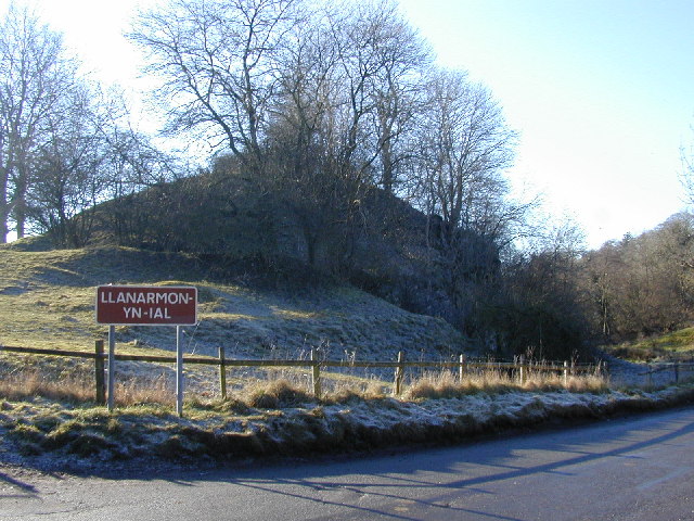
Llanarmon-yn-Iâl
Llanarmon-yn-Iâl is a village, and local government community, in Denbighshire, Wales, lying in limestone country in the valley of the River Alyn. The...
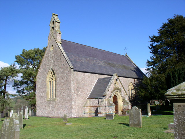
St Garmon's Church, Llanarmon-yn-Iâl
St Garmon's Church is in the centre of the village of Llanarmon-yn-Iâl, Denbighshire, Wales. It is an active Anglican church in the diocese of St Asaph...

Graianrhyd
Graianrhyd, also spelt Graeanrhyd, is a small, scattered village in the community of Llanarmon-yn-Iâl, Denbighshire, Wales. It lies in hilly limestone...

Spring Quarry Limestone
The Spring Quarry Limestone is a geologic formation in Wales. It preserves fossils dating back to the Carboniferous period. == See also == List of fossiliferous...
Graig, Llanarmon-yn-Ial
Graig, Llanarmon-yn-Ial is a Site of Special Scientific Interest in the preserved county of Clwyd, north Wales. == See also == List of Sites of Special...
Rhydtalog
Rhydtalog is a small, isolated village in Flintshire, Wales. It lies in hilly country on the border with Denbighshire in the community of Treuddyn. The...
Llandegla Forest
Llandegla Forest (Welsh: Coed Llandegla) is a forest of planted conifers covering 2.5 sq miles (6.5 km2) in Denbighshire, north-east Wales. It is situated...
Have you been to Coed Pant-y-dwr?
Leave your review of Coed Pant-y-dwr below (or comments, questions and feedback).