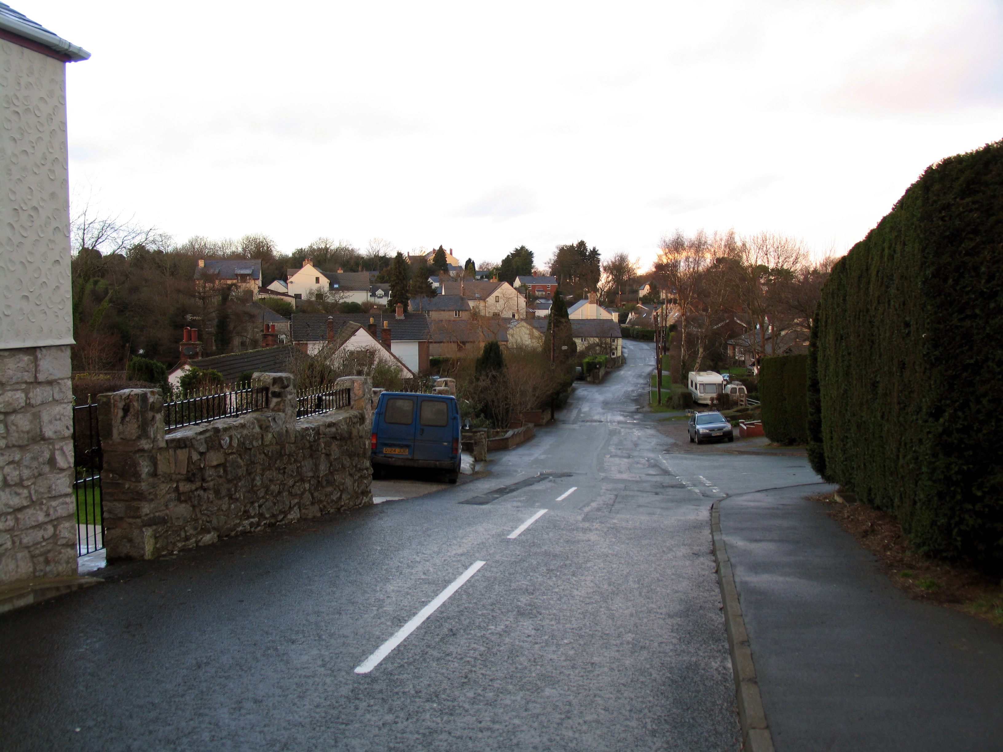
Coed Pandy

Wood, Forest in Flintshire

Wales

Coed Pandy

A541, Hendre The A541 runs for 26 miles, linking St Asaph with Wrexham. Its northern end starts at the crossroads in the middle of the village of Trefnant (just south of St Asaph). It ends at Wrexham, where it joins the B5101 road. On the way, it passes the town of Mold and also passes through many villages.
A541, Hendre Credit: David Dixon

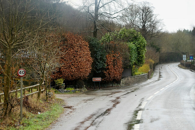
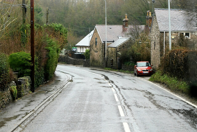
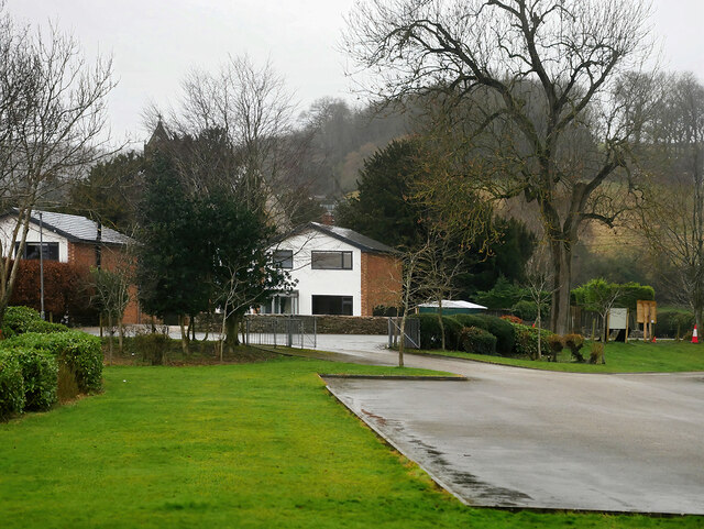
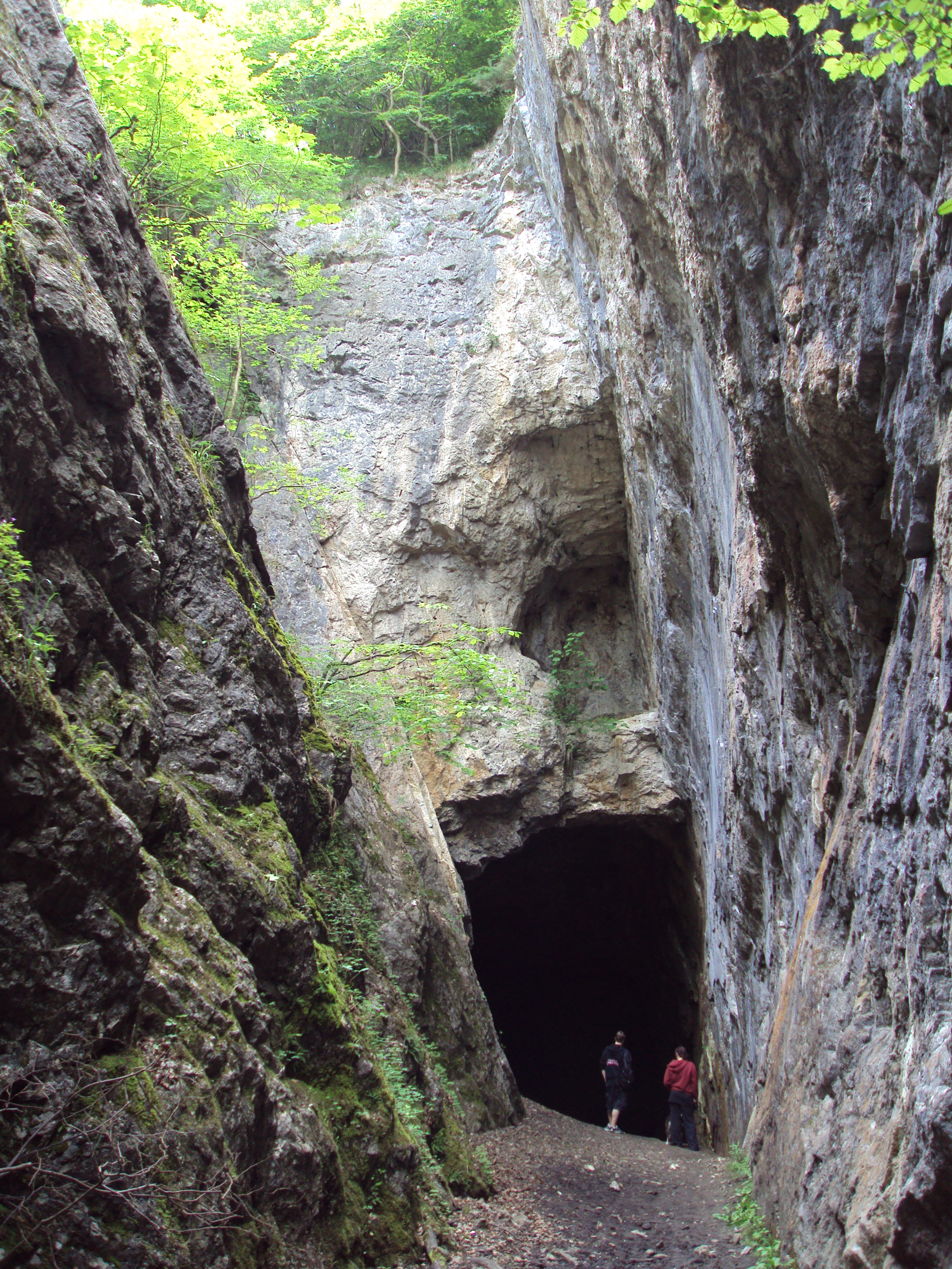
Coed Pandy is a picturesque woodland and forest located in Flintshire, Wales. Covering an area of approximately 100 acres, this natural haven offers visitors a unique and tranquil experience surrounded by nature's beauty.

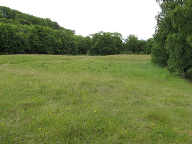
The woodland is characterized by an abundance of mature trees, including oak, birch, and beech, which create a dense canopy overhead. These trees provide a habitat for a diverse range of wildlife, including squirrels, birds, and various insects. Walking through the forest, visitors can enjoy the peaceful atmosphere while listening to the soothing sounds of chirping birds and rustling leaves.

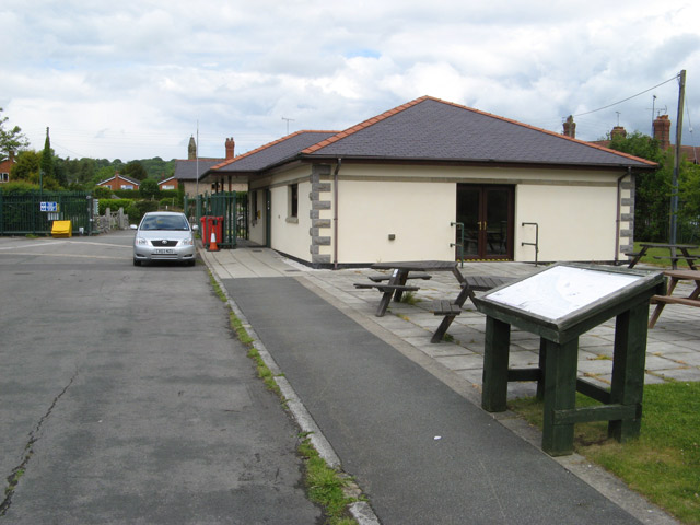
Coed Pandy offers a network of well-maintained trails, perfect for walking, hiking, and nature enthusiasts. The trails wind their way through the forest, providing opportunities to explore the different areas and discover hidden gems along the way. There are also designated picnic areas where visitors can relax and enjoy a meal amidst the serene surroundings.

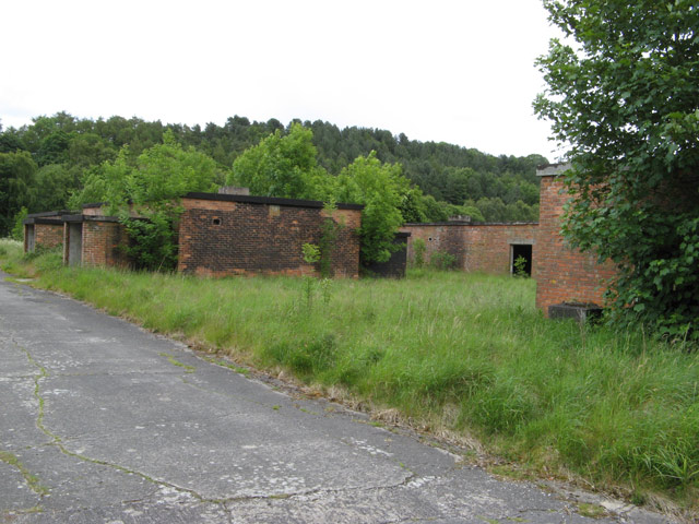
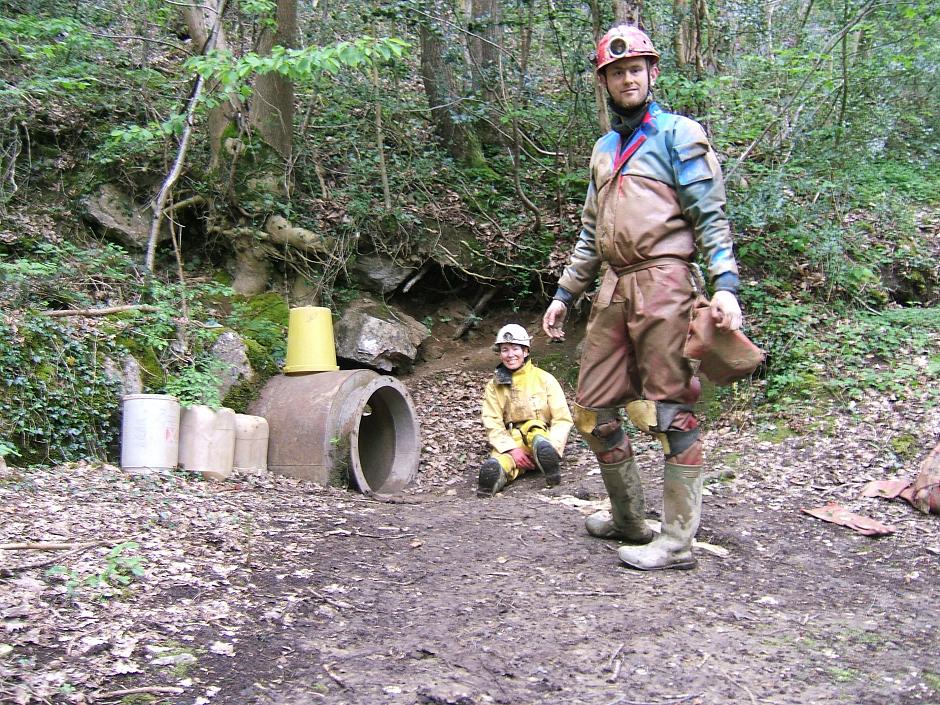
In addition to its natural beauty, Coed Pandy is also known for its historical significance. The woodland has remnants of old mining works, providing a glimpse into the area's industrial past. Visitors can explore these remains and learn about the region's mining heritage.

Coed Pandy is a popular destination for families, nature lovers, and those seeking a peaceful retreat. With its lush greenery, diverse wildlife, and rich history, this woodland offers a delightful escape from the hustle and bustle of daily life.

If you have any feedback on the listing, please let us know in the comments section below.

Coed Pandy Images

Images are sourced within 2km of 53.183122/-3.2085492 or Grid Reference SJ1965. Thanks to Geograph Open Source API. All images are credited.

A541, Hendre The A541 runs for 26 miles, linking St Asaph with Wrexham. Its northern end starts at the crossroads in the middle of the village of Trefnant (just south of St Asaph). It ends at Wrexham, where it joins the B5101 road. On the way, it passes the town of Mold and also passes through many villages.
A541, Hendre
The A541 runs for 26 miles, linking St Asaph with Wrexham. Its northern end starts at the crossroads in the middle of the village of Trefnant (just south of St Asaph). It ends at Wrexham, where it joins the B5101 road. On the way, it passes the town of Mold and also passes through many villages.
Hendre, A541 The A541 runs for 26 miles, linking St Asaph with Wrexham. Its northern end starts at the crossroads in the middle of the village of Trefnant (just south of St Asaph). It ends at Wrexham, where it joins the B5101 road. On the way, it passes the town of Mold and also passes through many villages.
Hendre, A541
The A541 runs for 26 miles, linking St Asaph with Wrexham. Its northern end starts at the crossroads in the middle of the village of Trefnant (just south of St Asaph). It ends at Wrexham, where it joins the B5101 road. On the way, it passes the town of Mold and also passes through many villages.
The Crown Inn, Pantymwyn
Caeau ger Cilcain / Fields near Cilcain
Blwch Post / Postbox I don't know whether this dates from the reign of George V or George VI.
Blwch Post / Postbox
I don't know whether this dates from the reign of George V or George VI.
Y porth i Eglwys Santes Fair / The gateway to St Mary's Church
Benchmark on St Mary's church, Cilcain This weathered Ordnance Survey benchmark is on the north west buttress of the church tower.
Benchmark on St Mary's church, Cilcain
This weathered Ordnance Survey benchmark is on the north west buttress of the church tower.
Benchmark on cemetery building, Ffordd-y-Llan, Cilcain Ordnance Survey benchmark on the corner of the small cemetery building alongside Ffordd-y-Llan, Cilcain.
Benchmark on cemetery building, Ffordd-y-Llan, Cilcain
Ordnance Survey benchmark on the corner of the small cemetery building alongside Ffordd-y-Llan, Cilcain.
A541, Rhydymwyn The A541 runs for 26 miles, linking St Asaph with Wrexham. Its northern end starts at the crossroads in the middle of the village of Trefnant (just south of St Asaph). It ends at Wrexham, where it joins the B5101 road. On the way, it passes the town of Mold and also passes through many villages.
A541, Rhydymwyn
The A541 runs for 26 miles, linking St Asaph with Wrexham. Its northern end starts at the crossroads in the middle of the village of Trefnant (just south of St Asaph). It ends at Wrexham, where it joins the B5101 road. On the way, it passes the town of Mold and also passes through many villages.
Rhydymwyn Rhydymwyn is a village located in the upper Alyn valley in Flintshire. Once a district of Mold, it was recognised as a separate parish from 1865. 

The village takes its placename from the ford across the River Alyn (now replaced by a small iron bridge); the name in Welsh means 'Ford of the Ore' (<span class="nowrap"><a title="https://en.wikipedia.org/wiki/Rhydymwyn" rel="nofollow ugc noopener" href="https://en.wikipedia.org/wiki/Rhydymwyn">Link</a><img style="margin-left:2px;" alt="External link" title="External link - shift click to open in new window" src="https://s1.geograph.org.uk/img/external.png" width="10" height="10"/></span> Wikipedia).
Rhydymwyn
Rhydymwyn is a village located in the upper Alyn valley in Flintshire. Once a district of Mold, it was recognised as a separate parish from 1865. The village takes its placename from the ford across the River Alyn (now replaced by a small iron bridge); the name in Welsh means 'Ford of the Ore' (LinkExternal link Wikipedia).
Victorian letterbox in Church Lane, Gwernaffield, Flintshire A fine Victorian wall box with an enlarged opening set in a wall close to the Hand Inn, Gwernaffield.

Maker:-
W T Allen & Co London

Reference: CH7 20

Unfortunately 'Lost' between 2012 and 2016.
Victorian letterbox in Church Lane, Gwernaffield, Flintshire
A fine Victorian wall box with an enlarged opening set in a wall close to the Hand Inn, Gwernaffield. Maker:- W T Allen & Co London Reference: CH7 20 Unfortunately 'Lost' between 2012 and 2016.
17 Nant Alyn Road The new building at the Rhydymwyn Valley nature reserve which is headquarters to the North East Wales Wildlife.
17 Nant Alyn Road
The new building at the Rhydymwyn Valley nature reserve which is headquarters to the North East Wales Wildlife.
Wartime buildings Buildings remaining on the secret Rhydymwyn wartime manufacturing and supply depot which is now administered as a nature reserve.
Wartime buildings
Buildings remaining on the secret Rhydymwyn wartime manufacturing and supply depot which is now administered as a nature reserve.
Rhydymwyn nature reserve The site of the secret wartime facility has been kept free of interference for so long that it is now maintained as a nature reserve. The River Alyn used to meander across the site between the wooded slopes, but was taken into a culvert at the south-western edge and the floor of the valley levelled by taking the spoil from the creation of a series of huge underground storage levels. The suspicious contours remain from this time but grass has taken over the spoil.
Rhydymwyn nature reserve
The site of the secret wartime facility has been kept free of interference for so long that it is now maintained as a nature reserve. The River Alyn used to meander across the site between the wooded slopes, but was taken into a culvert at the south-western edge and the floor of the valley levelled by taking the spoil from the creation of a series of huge underground storage levels. The suspicious contours remain from this time but grass has taken over the spoil.
Tower Lane Footpath  track off Tower Lane,Pantymwyn.
Tower Lane
Footpath track off Tower Lane,Pantymwyn.
Building work underway on a cottage in Pontnewydd in the Alyn Valley Hopefully they will get all the important work done before any cold weather sets in.
Building work underway on a cottage in Pontnewydd in the Alyn Valley
Hopefully they will get all the important work done before any cold weather sets in.
Entrance to Ty Bont Caravan Park Discreet entrance to a riverside caravan park.
Entrance to Ty Bont Caravan Park
Discreet entrance to a riverside caravan park.
Bridge over the River Alyn / Afon Alun A nice new bridge with wooden safety bollards.
Bridge over the River Alyn / Afon Alun
A nice new bridge with wooden safety bollards.
Show me another place!

Coed Pandy is located at Grid Ref: SJ1965 (Lat: 53.183122, Lng: -3.2085492)

Unitary Authority: Flintshire

Police Authority: North Wales

What 3 Words

///tumblers.swimsuits.inclined. Near Halkyn, Flintshire

Related Wikis

Ogof Hesp Alyn

Ogof Hesp Alyn (Welsh for: Dry Alyn Cave) was discovered by North Wales Caving Club in 1973 in the Alyn Gorge near Cilcain, Flintshire, Wales. Reaching...

Ogof Hen Ffynhonnau

Ogof Hen Ffynhonnau (sometimes known in English as Poacher's Cave) lies in the Alyn Gorge in Flintshire, Wales close to Ogof Hesp Alyn. It was discovered...

Ogof Nadolig

Ogof Nadolig is a cave in the Alyn Gorge near Cilcain, Flintshire, Wales. It is mostly crawling, 300 metres (980 ft) long, and ends with a shaft up to...

Pantymwyn

Pantymwyn is a small village just outside Mold in Flintshire, Wales, in the community of Gwernaffield with Pantymwyn. The village is located within the...
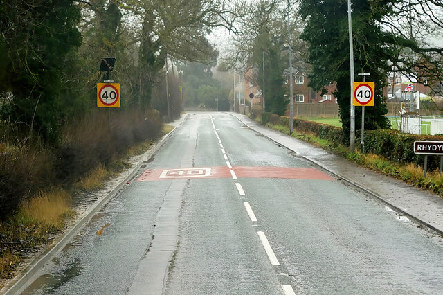
Rhydymwyn

Rhydymwyn (Welsh for 'Ford of the Ore') is a village in Flintshire, Wales, located in the upper Alyn valley. Once a district of Mold, it was recognised...

M. S. Factory, Valley

The M.S. (Ministry of Supply) Factory, Valley was a Second World War site in Rhydymwyn, Flintshire, Wales, that was used for the storage and production...

Gwernaffield with Pantymwyn

Gwernaffield with Pantymwyn is a community in Flintshire, Wales with a population of 1942 as of the 2011 UK census. It includes the villages of Gwernaffield...

Alyn Valley Woods and Alyn Gorge Caves

Alyn Valley Woods and Alyn Gorge Caves is a Site of Special Scientific Interest on the border of Flintshire and Denbighshire in north Wales. Most of the...

Nearby Amenities

Located within 500m of 53.183122,-3.2085492
Place Of Worship
Denomination: methodist
Religion: christian
Lat/Long: 53.1829589/-3.203437
Post Box
Lat/Long: 53.1822297/-3.2045002
Direction: 220
Generator Method: photovoltaic
Generator Output Electricity: yes
Generator Solar Modules: 6
Generator Source: solar
Generator Type: solar_photovoltaic_panel
Location: roof
Power: generator
Lat/Long: 53.1834797/-3.2100195
Direction: 130
Generator Method: photovoltaic
Generator Output Electricity: yes
Generator Solar Modules: 10
Generator Source: solar
Generator Type: solar_photovoltaic_panel
Location: roof
Power: generator
Lat/Long: 53.1834588/-3.2099243
The data included in this document is from www.openstreetmap.org. The data is made available under ODbL.

Have you been to Coed Pandy?

Leave your review of Coed Pandy below (or comments, questions and feedback).