Coed Pont-ystyllod
Wood, Forest in Flintshire
Wales
Coed Pont-ystyllod

Coed Pont-ystyllod is a woodland area located in Flintshire, Wales. Situated near the village of Pont-ystyllod, the woodland covers an approximate area of 200 acres. The name "Coed Pont-ystyllod" translates to "Wood, Forest of the Bridge with the Waterfall," which accurately describes some of the key features found within the area.
The woodland is predominantly composed of native broadleaf trees, including oak, beech, and ash. These trees create a dense and vibrant canopy, providing a habitat for various bird species, mammals, and insects. The woodland is particularly notable for its diverse bird population, with species such as the great spotted woodpecker, tawny owl, and nuthatch being frequently spotted.
One of the main attractions of Coed Pont-ystyllod is its picturesque waterfall, which cascades down a small stream that runs through the woodland. This waterfall, along with the surrounding lush greenery, creates a tranquil and serene atmosphere, making it a popular spot for nature enthusiasts and photographers.
The woodland also features several well-maintained walking trails, allowing visitors to explore the area and enjoy its natural beauty. These trails offer opportunities for birdwatching, wildlife spotting, and simply immersing oneself in the peaceful surroundings. Additionally, Coed Pont-ystyllod offers picnic areas and benches, providing visitors with a chance to relax and enjoy a meal amidst nature.
Overall, Coed Pont-ystyllod is a charming woodland area in Flintshire, offering a peaceful retreat and a chance to connect with nature. Its combination of diverse flora and fauna, scenic waterfall, and well-marked trails make it a popular destination for both locals and tourists seeking respite from the hustle and bustle of everyday life.
If you have any feedback on the listing, please let us know in the comments section below.
Coed Pont-ystyllod Images
Images are sourced within 2km of 53.074153/-3.2056591 or Grid Reference SJ1953. Thanks to Geograph Open Source API. All images are credited.


Coed Pont-ystyllod is located at Grid Ref: SJ1953 (Lat: 53.074153, Lng: -3.2056591)
Unitary Authority: Denbighshire
Police Authority: North Wales
What 3 Words
///procures.lucky.proposes. Near Llandegla, Denbighshire
Nearby Locations
Related Wikis
Llandegla
Llandegla or Llandegla-yn-Iâl is a village and community in the county of Denbighshire in Wales. In the 2011 census, the community had a population of...
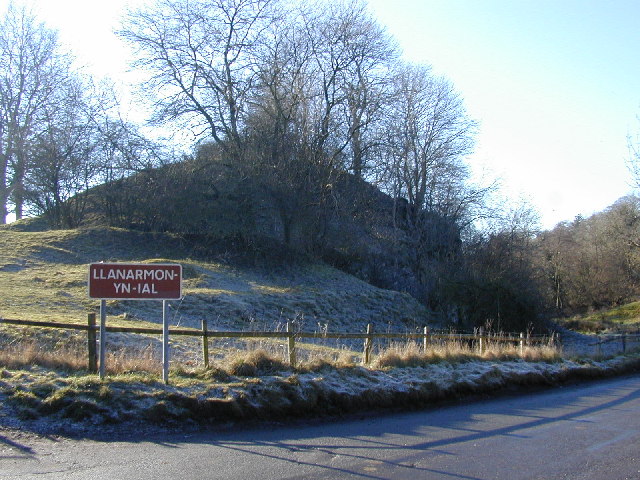
Llanarmon-yn-Iâl
Llanarmon-yn-Iâl is a village, and local government community, in Denbighshire, Wales, lying in limestone country in the valley of the River Alyn. The...
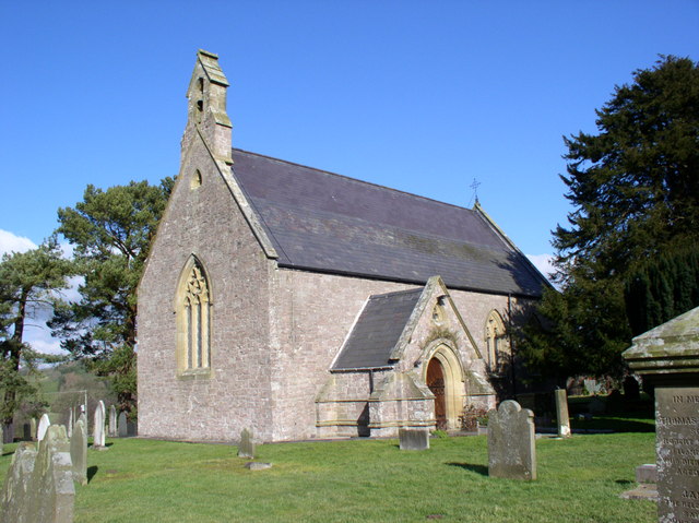
St Garmon's Church, Llanarmon-yn-Iâl
St Garmon's Church is in the centre of the village of Llanarmon-yn-Iâl, Denbighshire, Wales. It is an active Anglican church in the diocese of St Asaph...

Spring Quarry Limestone
The Spring Quarry Limestone is a geologic formation in Wales. It preserves fossils dating back to the Carboniferous period. == See also == List of fossiliferous...
Graig, Llanarmon-yn-Ial
Graig, Llanarmon-yn-Ial is a Site of Special Scientific Interest in the preserved county of Clwyd, north Wales. == See also == List of Sites of Special...

Graianrhyd
Graianrhyd, also spelt Graeanrhyd, is a small, scattered village in the community of Llanarmon-yn-Iâl, Denbighshire, Wales. It lies in hilly limestone...

Pentrecelyn
Pentrecelyn is a rural village in Denbighshire, North East Wales just off the A525 between Ruthin and Wrexham. The village can be located by turning off...
Rhydtalog
Rhydtalog is a small, isolated village in Flintshire, Wales. It lies in hilly country on the border with Denbighshire in the community of Treuddyn. The...
Nearby Amenities
Located within 500m of 53.074153,-3.2056591Have you been to Coed Pont-ystyllod?
Leave your review of Coed Pont-ystyllod below (or comments, questions and feedback).