Berth-gôch Wood

Wood, Forest in Monmouthshire

Wales

Berth-gôch Wood

Seat by the track, Sirhowy Valley Country Park A 26 mile walk in the west of the former county of Gwent from the Aneurin Bevan Memorial, Tredegar to Tredegar House, Newport. The route follows the ridgeways and valley floors through three counties, mainly off road and never far from the Sirhowy or Ebbw Rivers or the Monmouthshire & Brecon Canal (Crumlin Arm). 
The route has been extended from Tredegar House south eastwards to join the Wales Coast Path at Lighthouse Road and follows the Path on the Wentlooge Levels as far as West Usk Lighthouse.
Seat by the track, Sirhowy Valley Country Park Credit: David Smith

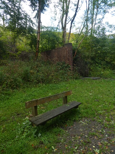
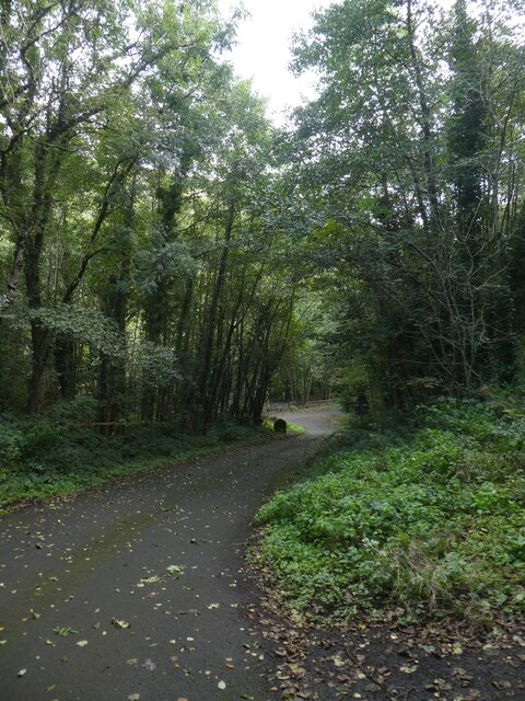
Berth-gôch Wood is a picturesque woodland located in Monmouthshire, Wales. Covering an area of approximately 150 acres, it is known for its rich biodiversity and stunning natural beauty. The woodland is situated on the slopes of the Blorenge Mountain, providing visitors with breathtaking views of the surrounding countryside.

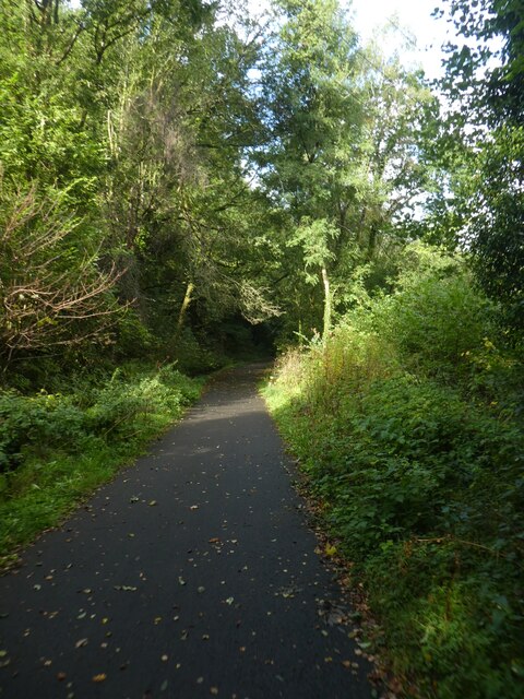
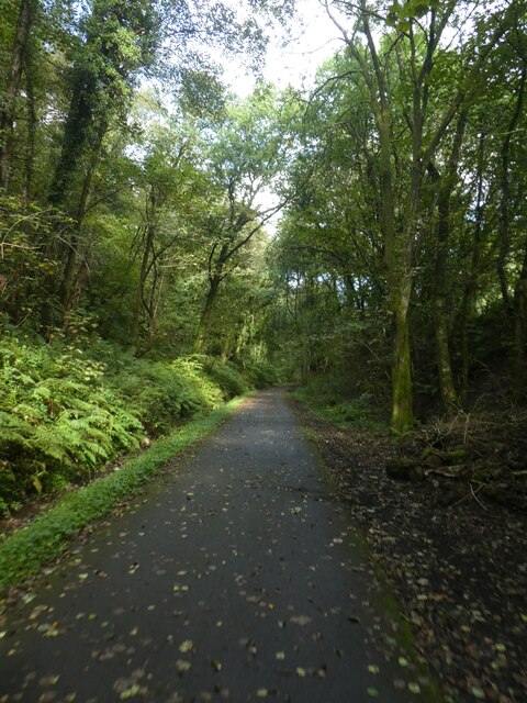
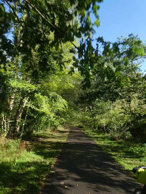
Berth-gôch Wood is predominantly made up of native broadleaf trees such as oak, beech, and birch, which create a dense and vibrant canopy. The forest floor is adorned with a carpet of wildflowers, including bluebells and primroses, during the spring months, adding to the charm of the woodland.

The wood is home to a diverse range of wildlife, making it a popular spot for nature enthusiasts and birdwatchers. Visitors may be lucky enough to spot species such as buzzards, woodpeckers, and tawny owls. The tranquil atmosphere and peaceful surroundings make Berth-gôch Wood an ideal destination for those seeking a quiet escape from the hustle and bustle of everyday life.

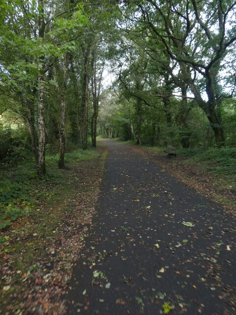
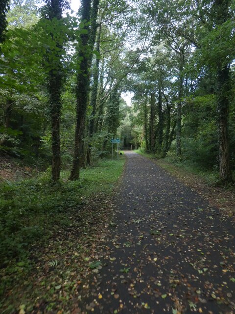
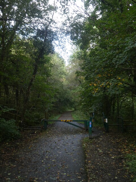
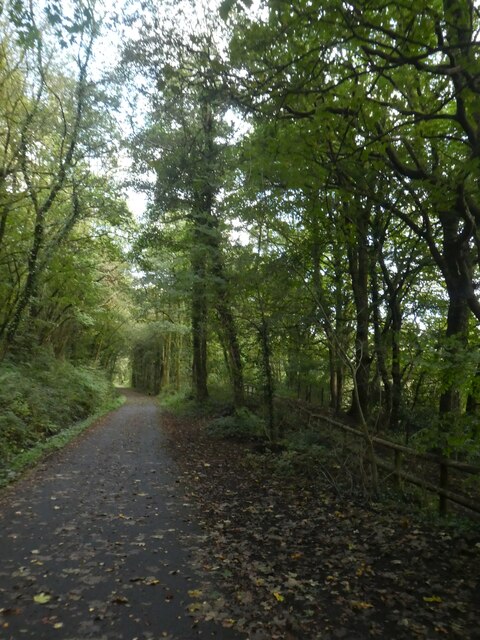
There are several well-maintained footpaths and trails that wind their way through the wood, allowing visitors to explore its beauty at their own pace. These paths offer opportunities for leisurely walks, jogging, or even picnicking in the heart of nature.

Berth-gôch Wood is a hidden gem in Monmouthshire, offering visitors a chance to immerse themselves in the beauty of the Welsh countryside. Whether it's for a peaceful stroll, birdwatching, or simply enjoying the tranquility of the forest, this woodland is a must-visit for nature lovers and those seeking a connection with the natural world.

If you have any feedback on the listing, please let us know in the comments section below.

Berth-gôch Wood Images

Images are sourced within 2km of 51.603046/-3.1798469 or Grid Reference ST1890. Thanks to Geograph Open Source API. All images are credited.

Seat by the track, Sirhowy Valley Country Park A 26 mile walk in the west of the former county of Gwent from the Aneurin Bevan Memorial, Tredegar to Tredegar House, Newport. The route follows the ridgeways and valley floors through three counties, mainly off road and never far from the Sirhowy or Ebbw Rivers or the Monmouthshire & Brecon Canal (Crumlin Arm). 
The route has been extended from Tredegar House south eastwards to join the Wales Coast Path at Lighthouse Road and follows the Path on the Wentlooge Levels as far as West Usk Lighthouse.
Seat by the track, Sirhowy Valley Country Park
A 26 mile walk in the west of the former county of Gwent from the Aneurin Bevan Memorial, Tredegar to Tredegar House, Newport. The route follows the ridgeways and valley floors through three counties, mainly off road and never far from the Sirhowy or Ebbw Rivers or the Monmouthshire & Brecon Canal (Crumlin Arm). The route has been extended from Tredegar House south eastwards to join the Wales Coast Path at Lighthouse Road and follows the Path on the Wentlooge Levels as far as West Usk Lighthouse.
Shared path in Sirhowy Valley Country Park A 26 mile walk in the west of the former county of Gwent from the Aneurin Bevan Memorial, Tredegar to Tredegar House, Newport. The route follows the ridgeways and valley floors through three counties, mainly off road and never far from the Sirhowy or Ebbw Rivers or the Monmouthshire & Brecon Canal (Crumlin Arm). 
The route has been extended from Tredegar House south eastwards to join the Wales Coast Path at Lighthouse Road and follows the Path on the Wentlooge Levels as far as West Usk Lighthouse.
Shared path in Sirhowy Valley Country Park
A 26 mile walk in the west of the former county of Gwent from the Aneurin Bevan Memorial, Tredegar to Tredegar House, Newport. The route follows the ridgeways and valley floors through three counties, mainly off road and never far from the Sirhowy or Ebbw Rivers or the Monmouthshire & Brecon Canal (Crumlin Arm). The route has been extended from Tredegar House south eastwards to join the Wales Coast Path at Lighthouse Road and follows the Path on the Wentlooge Levels as far as West Usk Lighthouse.
Barrier across path in Sirhowy Valley Country Park The shared use path for walkers and cyclists is a temptation for motorcyclists and therefore there are several barriers to limit access
Barrier across path in Sirhowy Valley Country Park
The shared use path for walkers and cyclists is a temptation for motorcyclists and therefore there are several barriers to limit access
Road in Sirhowy Valley Country Park One of the roads that cross the park, looking downhill to the river
Road in Sirhowy Valley Country Park
One of the roads that cross the park, looking downhill to the river
Shared path in Sirhowy Valley Country Park A 26 mile walk in the west of the former county of Gwent from the Aneurin Bevan Memorial, Tredegar to Tredegar House, Newport. The route follows the ridgeways and valley floors through three counties, mainly off road and never far from the Sirhowy or Ebbw Rivers or the Monmouthshire & Brecon Canal (Crumlin Arm). 
The route has been extended from Tredegar House south eastwards to join the Wales Coast Path at Lighthouse Road and follows the Path on the Wentlooge Levels as far as West Usk Lighthouse.
Shared path in Sirhowy Valley Country Park
A 26 mile walk in the west of the former county of Gwent from the Aneurin Bevan Memorial, Tredegar to Tredegar House, Newport. The route follows the ridgeways and valley floors through three counties, mainly off road and never far from the Sirhowy or Ebbw Rivers or the Monmouthshire & Brecon Canal (Crumlin Arm). The route has been extended from Tredegar House south eastwards to join the Wales Coast Path at Lighthouse Road and follows the Path on the Wentlooge Levels as far as West Usk Lighthouse.
Bracken by the path in Sirhowy Valley Country Park
Dense woodland by track in Sirhowy Valley Country Park A 26 mile walk in the west of the former county of Gwent from the Aneurin Bevan Memorial, Tredegar to Tredegar House, Newport. The route follows the ridgeways and valley floors through three counties, mainly off road and never far from the Sirhowy or Ebbw Rivers or the Monmouthshire & Brecon Canal (Crumlin Arm). 
The route has been extended from Tredegar House south eastwards to join the Wales Coast Path at Lighthouse Road and follows the Path on the Wentlooge Levels as far as West Usk Lighthouse.
Dense woodland by track in Sirhowy Valley Country Park
A 26 mile walk in the west of the former county of Gwent from the Aneurin Bevan Memorial, Tredegar to Tredegar House, Newport. The route follows the ridgeways and valley floors through three counties, mainly off road and never far from the Sirhowy or Ebbw Rivers or the Monmouthshire & Brecon Canal (Crumlin Arm). The route has been extended from Tredegar House south eastwards to join the Wales Coast Path at Lighthouse Road and follows the Path on the Wentlooge Levels as far as West Usk Lighthouse.
NCN47 in Sirhowy Valley Country Park A 26 mile walk in the west of the former county of Gwent from the Aneurin Bevan Memorial, Tredegar to Tredegar House, Newport. The route follows the ridgeways and valley floors through three counties, mainly off road and never far from the Sirhowy or Ebbw Rivers or the Monmouthshire & Brecon Canal (Crumlin Arm). 
The route has been extended from Tredegar House south eastwards to join the Wales Coast Path at Lighthouse Road and follows the Path on the Wentlooge Levels as far as West Usk Lighthouse.
NCN47 in Sirhowy Valley Country Park
A 26 mile walk in the west of the former county of Gwent from the Aneurin Bevan Memorial, Tredegar to Tredegar House, Newport. The route follows the ridgeways and valley floors through three counties, mainly off road and never far from the Sirhowy or Ebbw Rivers or the Monmouthshire & Brecon Canal (Crumlin Arm). The route has been extended from Tredegar House south eastwards to join the Wales Coast Path at Lighthouse Road and follows the Path on the Wentlooge Levels as far as West Usk Lighthouse.
B4251 at Cwmfelinfach
Bedrock on approach to summit Approaching the summit of Mynydd y Grug.
Bedrock on approach to summit
Approaching the summit of Mynydd y Grug.
Bedrock fracture I don’t know whether this is a fracture, a joint or whether some other geological term is appropriate.  Any help, please?
Bedrock fracture
I don’t know whether this is a fracture, a joint or whether some other geological term is appropriate. Any help, please?
Spoil heap on Mynydd y Grug
Mountain Road to Mynydd y Grug
A bench beside National Cycle Route 47 In the Sirhowy Valley Country Park.
Overlooking the Sirhowy River.
Houses in Brynawel can be seen on the other side of the valley.
A bench beside National Cycle Route 47
In the Sirhowy Valley Country Park. Overlooking the Sirhowy River. Houses in Brynawel can be seen on the other side of the valley.
View towards the Sirhowy Valley
Redundant cattle grid
Flooded footpath
Flooded footpath
Show me another place!

Berth-gôch Wood is located at Grid Ref: ST1890 (Lat: 51.603046, Lng: -3.1798469)

Unitary Authority: Caerphilly

Police Authority: Gwent

What 3 Words

///widget.swaps.depths. Near Bedwas, Caerphilly

Related Wikis

Bedwas Navigation Colliery

Bedwas Navigation Colliery was a coal mine in the small Welsh village of Bedwas, two miles (3.2 km) north of Caerphilly. The colliery opened in 1913, and...

Trethomas railway station

Trethomas railway station served the village of Trethomas, Caerphilly, Wales, from 1915 to 1962 on the Brecon and Merthyr Tydfil Junction Railway. ��2...

Mynydd y Grug

Mynydd y Grug is a hill lying just west of the village of Cwmfelinfach and about 4 km to the northeast of Caerphilly in Caerphilly county borough in South...

Trethomas

Trethomas (English: Thomastown) is a small village 2+1⁄2 miles (4 km) northeast of Caerphilly, southeast Wales, situated in the Caerphilly county borough...

Graig-y-Rhacca

Graig-y-Rhacca is a housing estate bordering Trethomas, Bedwas and Machen in the borough of Caerphilly, southeastern Wales. The town is about 8 miles to...

Nine Mile Point Colliery

Nine Mile Point colliery was a coal mine at Cwmfelinfach in the South Wales Valleys, originally known as "Coronation Colliery", and constructed between...

Bedwas Workmen's Hall

Bedwas Workmen's Hall, built in 1923, is a community hall situated in the village of Bedwas, in south Wales. It is a Grade II listed building, but still...

Cwmfelinfach

Cwmfelinfach is a small village located in the Sirhowy valley of south-east Wales. It is part of the district of Caerphilly within the historic boundaries...

Nearby Amenities

Located within 500m of 51.603046,-3.1798469
Power: pole
Lat/Long: 51.5992571/-3.1810194
The data included in this document is from www.openstreetmap.org. The data is made available under ODbL.

Have you been to Berth-gôch Wood?

Leave your review of Berth-gôch Wood below (or comments, questions and feedback).