Coed Cae-Hugh

Wood, Forest in Monmouthshire

Wales

Coed Cae-Hugh

Shared path in Sirhowy Valley Country Park A 26 mile walk in the west of the former county of Gwent from the Aneurin Bevan Memorial, Tredegar to Tredegar House, Newport. The route follows the ridgeways and valley floors through three counties, mainly off road and never far from the Sirhowy or Ebbw Rivers or the Monmouthshire & Brecon Canal (Crumlin Arm). 
The route has been extended from Tredegar House south eastwards to join the Wales Coast Path at Lighthouse Road and follows the Path on the Wentlooge Levels as far as West Usk Lighthouse.
Shared path in Sirhowy Valley Country Park Credit: David Smith

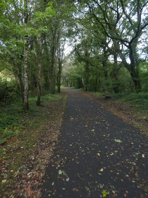
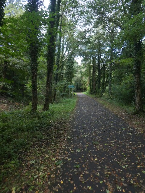
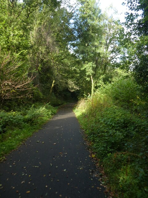
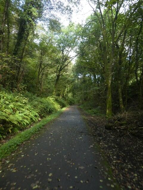
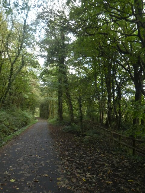
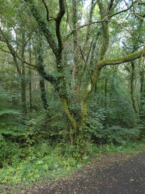
Coed Cae-Hugh is a woodland area located in Monmouthshire, Wales. This forested area covers approximately 30 hectares and is known for its diverse range of tree species, including oak, beech, and ash. The forest is home to a variety of wildlife, including deer, squirrels, and a wide range of bird species.

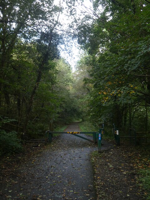
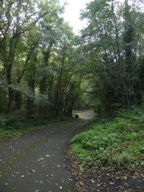
Coed Cae-Hugh offers visitors the opportunity to explore nature through a network of walking trails and paths that wind through the trees. The forest is a popular destination for hikers, nature enthusiasts, and birdwatchers.

The woodland is well-maintained and managed by the local authorities, with efforts made to protect and preserve the natural habitat. The forest is also used for educational purposes, with school groups often visiting to learn about the importance of conservation and the natural environment.

Overall, Coed Cae-Hugh is a peaceful and scenic woodland area that provides a tranquil escape from the hustle and bustle of everyday life. Whether you are looking to take a leisurely stroll, spot some wildlife, or simply enjoy the beauty of nature, Coed Cae-Hugh is a wonderful destination to visit in Monmouthshire.

If you have any feedback on the listing, please let us know in the comments section below.

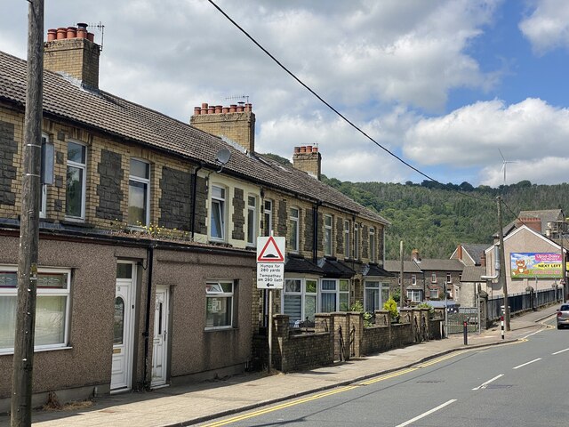
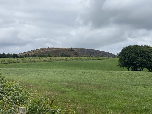
Coed Cae-Hugh Images

Images are sourced within 2km of 51.61663/-3.1889521 or Grid Reference ST1791. Thanks to Geograph Open Source API. All images are credited.

Shared path in Sirhowy Valley Country Park A 26 mile walk in the west of the former county of Gwent from the Aneurin Bevan Memorial, Tredegar to Tredegar House, Newport. The route follows the ridgeways and valley floors through three counties, mainly off road and never far from the Sirhowy or Ebbw Rivers or the Monmouthshire & Brecon Canal (Crumlin Arm). 
The route has been extended from Tredegar House south eastwards to join the Wales Coast Path at Lighthouse Road and follows the Path on the Wentlooge Levels as far as West Usk Lighthouse.
Shared path in Sirhowy Valley Country Park
A 26 mile walk in the west of the former county of Gwent from the Aneurin Bevan Memorial, Tredegar to Tredegar House, Newport. The route follows the ridgeways and valley floors through three counties, mainly off road and never far from the Sirhowy or Ebbw Rivers or the Monmouthshire & Brecon Canal (Crumlin Arm). The route has been extended from Tredegar House south eastwards to join the Wales Coast Path at Lighthouse Road and follows the Path on the Wentlooge Levels as far as West Usk Lighthouse.
Barrier across path in Sirhowy Valley Country Park The shared use path for walkers and cyclists is a temptation for motorcyclists and therefore there are several barriers to limit access
Barrier across path in Sirhowy Valley Country Park
The shared use path for walkers and cyclists is a temptation for motorcyclists and therefore there are several barriers to limit access
Road in Sirhowy Valley Country Park One of the roads that cross the park, looking downhill to the river
Road in Sirhowy Valley Country Park
One of the roads that cross the park, looking downhill to the river
Shared path in Sirhowy Valley Country Park A 26 mile walk in the west of the former county of Gwent from the Aneurin Bevan Memorial, Tredegar to Tredegar House, Newport. The route follows the ridgeways and valley floors through three counties, mainly off road and never far from the Sirhowy or Ebbw Rivers or the Monmouthshire & Brecon Canal (Crumlin Arm). 
The route has been extended from Tredegar House south eastwards to join the Wales Coast Path at Lighthouse Road and follows the Path on the Wentlooge Levels as far as West Usk Lighthouse.
Shared path in Sirhowy Valley Country Park
A 26 mile walk in the west of the former county of Gwent from the Aneurin Bevan Memorial, Tredegar to Tredegar House, Newport. The route follows the ridgeways and valley floors through three counties, mainly off road and never far from the Sirhowy or Ebbw Rivers or the Monmouthshire & Brecon Canal (Crumlin Arm). The route has been extended from Tredegar House south eastwards to join the Wales Coast Path at Lighthouse Road and follows the Path on the Wentlooge Levels as far as West Usk Lighthouse.
Bracken by the path in Sirhowy Valley Country Park
Dense woodland by track in Sirhowy Valley Country Park A 26 mile walk in the west of the former county of Gwent from the Aneurin Bevan Memorial, Tredegar to Tredegar House, Newport. The route follows the ridgeways and valley floors through three counties, mainly off road and never far from the Sirhowy or Ebbw Rivers or the Monmouthshire & Brecon Canal (Crumlin Arm). 
The route has been extended from Tredegar House south eastwards to join the Wales Coast Path at Lighthouse Road and follows the Path on the Wentlooge Levels as far as West Usk Lighthouse.
Dense woodland by track in Sirhowy Valley Country Park
A 26 mile walk in the west of the former county of Gwent from the Aneurin Bevan Memorial, Tredegar to Tredegar House, Newport. The route follows the ridgeways and valley floors through three counties, mainly off road and never far from the Sirhowy or Ebbw Rivers or the Monmouthshire & Brecon Canal (Crumlin Arm). The route has been extended from Tredegar House south eastwards to join the Wales Coast Path at Lighthouse Road and follows the Path on the Wentlooge Levels as far as West Usk Lighthouse.
Lichen-covered tree in Sirhowy Valley Country Park A 26 mile walk in the west of the former county of Gwent from the Aneurin Bevan Memorial, Tredegar to Tredegar House, Newport. The route follows the ridgeways and valley floors through three counties, mainly off road and never far from the Sirhowy or Ebbw Rivers or the Monmouthshire & Brecon Canal (Crumlin Arm). 
The route has been extended from Tredegar House south eastwards to join the Wales Coast Path at Lighthouse Road and follows the Path on the Wentlooge Levels as far as West Usk Lighthouse.
Lichen-covered tree in Sirhowy Valley Country Park
A 26 mile walk in the west of the former county of Gwent from the Aneurin Bevan Memorial, Tredegar to Tredegar House, Newport. The route follows the ridgeways and valley floors through three counties, mainly off road and never far from the Sirhowy or Ebbw Rivers or the Monmouthshire & Brecon Canal (Crumlin Arm). The route has been extended from Tredegar House south eastwards to join the Wales Coast Path at Lighthouse Road and follows the Path on the Wentlooge Levels as far as West Usk Lighthouse.
NCN47 in Sirhowy Valley Country Park A 26 mile walk in the west of the former county of Gwent from the Aneurin Bevan Memorial, Tredegar to Tredegar House, Newport. The route follows the ridgeways and valley floors through three counties, mainly off road and never far from the Sirhowy or Ebbw Rivers or the Monmouthshire & Brecon Canal (Crumlin Arm). 
The route has been extended from Tredegar House south eastwards to join the Wales Coast Path at Lighthouse Road and follows the Path on the Wentlooge Levels as far as West Usk Lighthouse.
NCN47 in Sirhowy Valley Country Park
A 26 mile walk in the west of the former county of Gwent from the Aneurin Bevan Memorial, Tredegar to Tredegar House, Newport. The route follows the ridgeways and valley floors through three counties, mainly off road and never far from the Sirhowy or Ebbw Rivers or the Monmouthshire & Brecon Canal (Crumlin Arm). The route has been extended from Tredegar House south eastwards to join the Wales Coast Path at Lighthouse Road and follows the Path on the Wentlooge Levels as far as West Usk Lighthouse.
Artwork in Sirhowy Valley Country Park There was no explanation of this metal arrow
Artwork in Sirhowy Valley Country Park
There was no explanation of this metal arrow
Ordnance Survey Rivet This damaged OS rivet can be found on the rock outcrop at the track and road junction. It marked a point 178.588m above mean sea level.
Ordnance Survey Rivet
This damaged OS rivet can be found on the rock outcrop at the track and road junction. It marked a point 178.588m above mean sea level.
B4251 at Ynysddu
B4251 at Ynysddu
B4251 at Cwmfelinfach
Bedrock on approach to summit Approaching the summit of Mynydd y Grug.
Bedrock on approach to summit
Approaching the summit of Mynydd y Grug.
Bedrock fracture I don’t know whether this is a fracture, a joint or whether some other geological term is appropriate.  Any help, please?
Bedrock fracture
I don’t know whether this is a fracture, a joint or whether some other geological term is appropriate. Any help, please?
Spoil heap on Mynydd y Grug
Mountain Road to Mynydd y Grug
View towards the Sirhowy Valley
Show me another place!

Coed Cae-Hugh is located at Grid Ref: ST1791 (Lat: 51.61663, Lng: -3.1889521)

Unitary Authority: Caerphilly

Police Authority: Gwent

What 3 Words

///headliner.kitchens.gravitate. Near Bedwas, Caerphilly

Related Wikis

Cwmfelinfach

Cwmfelinfach is a small village located in the Sirhowy valley of south-east Wales. It is part of the district of Caerphilly within the historic boundaries...

Mynydd y Grug

Mynydd y Grug is a hill lying just west of the village of Cwmfelinfach and about 4 km to the northeast of Caerphilly in Caerphilly county borough in South...

Ynysddu railway station

Ynysddu railway station served the village of Ynysddu, in the historical county of Monmouthshire, Wales, from 1871 to 1960 on the Sirhowy Railway. ��2...

Ynysddu

Ynysddu is a small village and community in the Sirhowy valley of south-east Wales. It is part of the district of Caerphilly within the historic boundaries...

Related Videos

Mynydd y Grug: A South Wales Hill Walk

Mynydd y Grug is my local hill, topped by a spoil tip it shouldn't be worth walking, but it is... This hill forms part of 'The Miners' list, ...

Survive the night: £40 Aliexpress Ultralight Tarp & Bivy Snow camp

Snow camping in a £40 ultralight tarp setup from Aliexpress... what could possibly go wrong. If you want to support the channel, ...

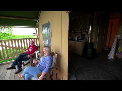
Welcome to Under the Oak Glamping

A little introduction to our gorgeous glampsite.

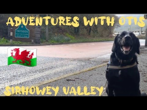
Easter Monday morning walk in the woods alongside the Riverbank in the #Sirhowy Valley #Ynysddu

Otis enjoys his Easter Monday morning walk in the woods alongside the Riverbank in the Sirhowy Valley and invests the local real ...

Lockdown Diaries #2 Hitting the Squirrel on the Trek Remedy!

Hey guy's so a nice sunny September ride on a Sunday with my mate Steve, we headed from his house down to Machen masts ...

Flight over Cwmfelinfach

Flight over Cwmfelinfach on a Thursday morning What was encountered was truly unbelievable.

RIDING ACROSS A CLIFF

Riding one of my favourite local enduro tracks, Cliffhanger. This track has a little bit of everything. It has some steep technical ...

Our first time checking out Wyllie Bike Park! | South Wales Mountain Biking

We've been wanting to check out Wyllie for a while now so when we got the opportunity to get a guided tour we couldn't refuse.

Flat out Friday, Wyllie Bike Park, Covid 19, Cliffhanger and Quarantine TOP 2 BOTTOM

Top to Bottom edit of Wyllie bike park featuring trails Covid 19, section of Cliffhanger, Quarantine and a wall ride on top the fire ...

Nearby Amenities

Located within 500m of 51.61663,-3.1889521
Trailhead
Lat/Long: 51.6206875/-3.1877836
Trailhead
Lat/Long: 51.6161445/-3.1916734
Trailhead
Lat/Long: 51.617536/-3.192065
Trailhead
Mountain crossroads
Lat/Long: 51.615968/-3.1946308
Trailhead
Lat/Long: 51.6160837/-3.1932817
Generator Method: wind_turbine
Generator Source: wind
Power: generator
Lat/Long: 51.6179031/-3.1952006
Location Transition: yes
Power: pole
Lat/Long: 51.6180432/-3.1825215
Power: pole
Lat/Long: 51.6185628/-3.1847048
Power: pole
Lat/Long: 51.6192656/-3.1916893
The data included in this document is from www.openstreetmap.org. The data is made available under ODbL.

Have you been to Coed Cae-Hugh?

Leave your review of Coed Cae-Hugh below (or comments, questions and feedback).