Coed Saith-aelwyd

Wood, Forest in Flintshire

Wales

Coed Saith-aelwyd

St Winefride's Chapel View from south in 1980.
St Winefride's Chapel Credit: Sandy Gerrard

The requested URL returned error: 429 Too Many Requests

If you have any feedback on the listing, please let us know in the comments section below.

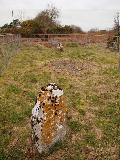
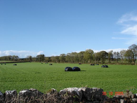
Coed Saith-aelwyd Images

Images are sourced within 2km of 53.278281/-3.2445583 or Grid Reference SJ1776. Thanks to Geograph Open Source API. All images are credited.

St Winefride's Chapel View from south in 1980.
St Winefride's Chapel
View from south in 1980.
St Winefride's Well & Chapel in 1995 View from the north
St Winefride's Well & Chapel in 1995
View from the north
St Winefride's Well, Holywell A religious site popular with European Roman Catholics. There is an outdoor bathing pool but this indoor well within St Winefride's Chapel is strictly not for bathing. You can see the water rising within it.
St Winefride's Well, Holywell
A religious site popular with European Roman Catholics. There is an outdoor bathing pool but this indoor well within St Winefride's Chapel is strictly not for bathing. You can see the water rising within it.
St James's Church, Holywell The edge of St Winefride's Chapel is seen on the left.
St James's Church, Holywell
The edge of St Winefride's Chapel is seen on the left.
Holway Level Mine, Holywell This is the entrance to the Holway Level, a two mile tunnel that lead to one of the most productive lead mines in Britain. The Level drained the water from the mine and also allowed the ore to be brought out by boat. The tunnel was developed into a tourist attraction in 1788. The galena in the mine contained up to 80% lead and 12% silver. Since 1917 this level has supplied St Winefride's well as the original supply was interrupted by the construction of the Milwr Tunnel.
Holway Level Mine, Holywell
This is the entrance to the Holway Level, a two mile tunnel that lead to one of the most productive lead mines in Britain. The Level drained the water from the mine and also allowed the ore to be brought out by boat. The tunnel was developed into a tourist attraction in 1788. The galena in the mine contained up to 80% lead and 12% silver. Since 1917 this level has supplied St Winefride's well as the original supply was interrupted by the construction of the Milwr Tunnel.
St Winefride's Chapel. Holywell This covers St Winefride's Well and is very popular with European Catholics. The access is from the other side at a lower level.
St Winefride's Chapel. Holywell
This covers St Winefride's Well and is very popular with European Catholics. The access is from the other side at a lower level.
St Winefride's Well, Holywell This is the outdoor bathing area where visitors are allowed to bathe at specified times. The source is inside the chapel behind the photographer and bathing is not allowed in there.
St Winefride's Well, Holywell
This is the outdoor bathing area where visitors are allowed to bathe at specified times. The source is inside the chapel behind the photographer and bathing is not allowed in there.
Naid-y-March Standing Stones Possibly re-positioned Bronze Age stones, a filled mine shaft lies between them.
Naid-y-March Standing Stones
Possibly re-positioned Bronze Age stones, a filled mine shaft lies between them.
Pub and beer garden
Pub and beer garden
Tŷ Coch Farm The Dee estuary and the Wirral form the backcloth.
Tŷ Coch Farm
The Dee estuary and the Wirral form the backcloth.
Metal stile near Stokyn Hall
Footbridge over Afon Marsiandwr Replacing an earlier bridge.
Footbridge over Afon Marsiandwr
Replacing an earlier bridge.
Ordnance Survey Cut Mark This OS cut mark can be found on the wall of the chapel on Whitford Street. It marks a point 113.201m above mean sea level.
Ordnance Survey Cut Mark
This OS cut mark can be found on the wall of the chapel on Whitford Street. It marks a point 113.201m above mean sea level.
Ordnance Survey Cut Mark This OS cut mark can be found on the wall of No32 Whitford Street. It marks a point 367.5ft above mean sea level.
Ordnance Survey Cut Mark
This OS cut mark can be found on the wall of No32 Whitford Street. It marks a point 367.5ft above mean sea level.
Ordnance Survey Cut Mark This OS cut mark can be found on the Town Hall, High Street. It marks a point 107.675m above mean sea level.
Ordnance Survey Cut Mark
This OS cut mark can be found on the Town Hall, High Street. It marks a point 107.675m above mean sea level.
Ordnance Survey Cut Mark This OS cut mark can be found on the old bank, High Street. It marks a point 109.746m above mean sea level.
Ordnance Survey Cut Mark
This OS cut mark can be found on the old bank, High Street. It marks a point 109.746m above mean sea level.
Ordnance Survey Cut Mark This OS cut mark can be found on the NW buttress of the school. It marks a point 372.23ft above mean sea level.
Ordnance Survey Cut Mark
This OS cut mark can be found on the NW buttress of the school. It marks a point 372.23ft above mean sea level.
Ordnance Survey Cut Mark This OS cut mark can be found on the old Court House, Halkyn Street. It marks a point 112.872m above mean sea level.
Ordnance Survey Cut Mark
This OS cut mark can be found on the old Court House, Halkyn Street. It marks a point 112.872m above mean sea level.
Show me another place!

Coed Saith-aelwyd is located at Grid Ref: SJ1776 (Lat: 53.278281, Lng: -3.2445583)

Unitary Authority: Flintshire

Police Authority: North Wales

What 3 Words

///committee.daydreams.craftsman. Near Holywell, Flintshire

Nearby Locations

Coed Saith-aelwyd Holway

Related Wikis

Carmel, Flintshire

Carmel is a small village in Flintshire, Wales, just outside Holywell. Carmel has a primary school and a village hall. The village had two functioning...

Pantasaph

Pantasaph is a small village in Flintshire, north-east Wales, two miles south of Holywell in the community of Whitford. Its name translates into English...

St Winefride's Well

St Winefride's Well (Welsh: Ffynnon Wenffrewi) is a holy well and national shrine located in the Welsh town of Holywell in Flintshire. The patron saint...

St Winefride's Church, Holywell

St Winefride's Church (also known as St Winifred's Church or St Winefred's Church) is a Roman Catholic Parish church in Holywell, Flintshire. It was founded...

Nearby Amenities

Located within 500m of 53.278281,-3.2445583
Holway
Place: village
Wikidata: Q99887480
Lat/Long: 53.2780768/-3.2390591
Power: pole
Lat/Long: 53.2823552/-3.2438814
Power: pole
Lat/Long: 53.281439/-3.2429258
Power: pole
Lat/Long: 53.2805642/-3.2420016
Power: pole
Lat/Long: 53.2799341/-3.2413608
Direction: 195
Generator Method: photovoltaic
Generator Output Electricity: yes
Generator Solar Modules: 12
Generator Source: solar
Generator Type: solar_photovoltaic_panel
Location: roof
Power: generator
Lat/Long: 53.2806526/-3.2486052
Direction: ESE
Generator Method: photovoltaic
Generator Output Electricity: yes
Generator Solar Modules: 12
Generator Source: solar
Generator Type: solar_photovoltaic_panel
Location: roof
Power: generator
Lat/Long: 53.2813895/-3.2484389
Man Made: mineshaft
Lat/Long: 53.2742674/-3.2473997
Man Made: mineshaft
Lat/Long: 53.2740987/-3.247305
Man Made: mineshaft
Lat/Long: 53.2746553/-3.247669
Man Made: mineshaft
Lat/Long: 53.2751408/-3.2472018
Man Made: mineshaft
Lat/Long: 53.2752129/-3.2480772
Man Made: mineshaft
Lat/Long: 53.2758025/-3.2482985
Man Made: mineshaft
Lat/Long: 53.277443/-3.2494237
Man Made: mineshaft
Lat/Long: 53.2771844/-3.2492834
Man Made: mineshaft
Lat/Long: 53.2763495/-3.2486809
Man Made: mineshaft
Lat/Long: 53.2761585/-3.2484843
Man Made: mineshaft
Lat/Long: 53.2759476/-3.2483137
Man Made: mineshaft
Lat/Long: 53.2755717/-3.2482484
Man Made: mineshaft
Lat/Long: 53.2754586/-3.2472238
Man Made: mineshaft
Lat/Long: 53.2755962/-3.2471637
Holway Lead Mine Whimsey Shaft
Man Made: mineshaft
Lat/Long: 53.2790325/-3.2402688
Man Made: mineshaft
Lat/Long: 53.280916/-3.2427473
Power: pole
Lat/Long: 53.2787666/-3.2409604
Power: pole
Lat/Long: 53.2782975/-3.2409302
Power: pole
Lat/Long: 53.2776033/-3.2408532
Power: pole
Lat/Long: 53.2769785/-3.2407874
Direction: ESE
Generator Method: photovoltaic
Generator Output Electricity: yes
Generator Solar Modules: 2
Generator Source: solar
Generator Type: solar_photovoltaic_panel
Location: roof
Power: generator
Lat/Long: 53.2808031/-3.2460382
Direction: SSW
Generator Method: photovoltaic
Generator Output Electricity: yes
Generator Solar Modules: 3
Generator Source: solar
Generator Type: solar_photovoltaic_panel
Location: roof
Power: generator
Lat/Long: 53.2813937/-3.2485306
Direction: WNW
Generator Method: photovoltaic
Generator Output Electricity: yes
Generator Solar Modules: 3
Generator Source: solar
Generator Type: solar_photovoltaic_panel
Location: roof
Power: generator
Lat/Long: 53.2814321/-3.2484535
Direction: SSW
Generator Method: photovoltaic
Generator Output Electricity: yes
Generator Solar Modules: 5
Generator Source: solar
Generator Type: solar_photovoltaic_panel
Location: roof
Power: generator
Lat/Long: 53.2807538/-3.2461461
Direction: ESE
Generator Method: photovoltaic
Generator Output Electricity: yes
Generator Solar Modules: 7
Generator Source: solar
Generator Type: solar_photovoltaic_panel
Location: roof
Power: generator
Lat/Long: 53.2807394/-3.2460764
Direction: SSW
Fixme: solar thermal ?
Generator Method: photovoltaic
Generator Output Electricity: yes
Generator Solar Modules: 2
Generator Source: solar
Generator Type: solar_photovoltaic_panel
Location: roof
Power: generator
Lat/Long: 53.2786064/-3.2395546
Direction: SSW
Fixme: solar thermal ?
Generator Method: photovoltaic
Generator Output Electricity: yes
Generator Solar Modules: 2
Generator Source: solar
Generator Type: solar_photovoltaic_panel
Location: roof
Power: generator
Lat/Long: 53.2786858/-3.239729
Direction: SSW
Fixme: solar thermal ?
Generator Method: photovoltaic
Generator Output Electricity: yes
Generator Solar Modules: 2
Generator Source: solar
Generator Type: solar_photovoltaic_panel
Location: roof
Power: generator
Lat/Long: 53.2787788/-3.239902
Direction: 105
Generator Method: photovoltaic
Generator Output Electricity: yes
Generator Solar Modules: 7
Generator Source: solar
Generator Type: solar_photovoltaic_panel
Location: roof
Power: generator
Lat/Long: 53.2795354/-3.2389732
Direction: 285
Generator Method: photovoltaic
Generator Output Electricity: yes
Generator Solar Modules: 7
Generator Source: solar
Generator Type: solar_photovoltaic_panel
Location: roof
Power: generator
Lat/Long: 53.2795414/-3.2390718
Direction: ESE
Generator Method: photovoltaic
Generator Output Electricity: yes
Generator Solar Modules: 6
Generator Source: solar
Generator Type: solar_photovoltaic_panel
Location: roof
Power: generator
Lat/Long: 53.2807813/-3.2397233
Direction: 215
Generator Method: photovoltaic
Generator Output Electricity: yes
Generator Solar Modules: 8
Generator Source: solar
Generator Type: solar_photovoltaic_panel
Location: roof
Power: generator
Lat/Long: 53.2809019/-3.2395127
Direction: SSW
Generator Method: photovoltaic
Generator Output Electricity: yes
Generator Solar Modules: 8
Generator Source: solar
Generator Type: solar_photovoltaic_panel
Location: roof
Power: generator
Lat/Long: 53.2808749/-3.2398688
Direction: SSW
Generator Method: photovoltaic
Generator Output Electricity: yes
Generator Solar Modules: 8
Generator Source: solar
Generator Type: solar_photovoltaic_panel
Location: roof
Power: generator
Lat/Long: 53.2808947/-3.2399362
The data included in this document is from www.openstreetmap.org. The data is made available under ODbL.

Have you been to Coed Saith-aelwyd?

Leave your review of Coed Saith-aelwyd below (or comments, questions and feedback).