Black Rough

Wood, Forest in Montgomeryshire

Wales

Black Rough

Glyndwr's Way near Cefn-Pentre
Glyndwr's Way near Cefn-Pentre Credit: Dave Kelly

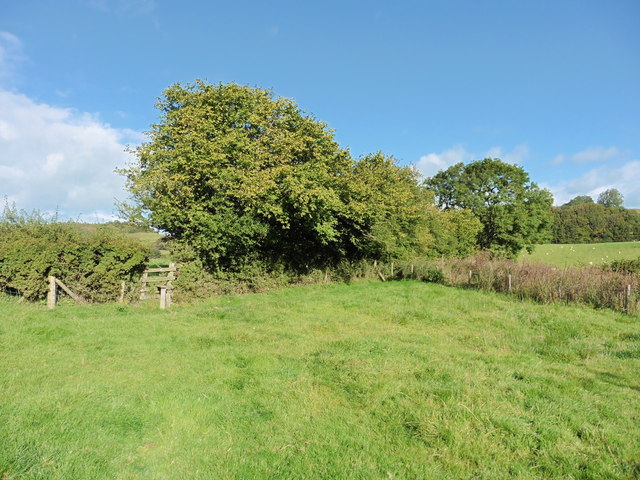
Black Rough, Montgomeryshire is a dense woodland located in the county of Montgomeryshire, Wales. Spanning an area of approximately 100 acres, this forest is characterized by its dark and rough terrain, hence the name "Black Rough." It is situated in a rural area, surrounded by picturesque countryside and rolling hills.

The woodland is a diverse ecosystem, housing a wide range of flora and fauna. The dense canopy of trees, predominantly consisting of oak, birch, and beech, provides a habitat for several species of birds, including woodpeckers, owls, and various songbirds. Small mammals such as rabbits, squirrels, and foxes can also be spotted within the forest.

Black Rough offers a tranquil and serene environment, making it a popular destination for nature enthusiasts and hikers. The forest features several walking trails that wind through its lush vegetation, allowing visitors to explore its beauty and connect with nature. These trails vary in difficulty, catering to both casual walkers and more experienced hikers.

In addition to its natural beauty, Black Rough also holds historical significance. It is said to have been used as a hiding place for Welsh rebels during various periods of unrest in the region. The forest's dense vegetation and secluded location made it an ideal refuge for those seeking to evade capture.

Overall, Black Rough, Montgomeryshire is a captivating woodland that offers a unique blend of natural beauty, wildlife, and historical importance. It stands as a testament to the rich biodiversity and cultural heritage of the Montgomeryshire county.

If you have any feedback on the listing, please let us know in the comments section below.

Black Rough Images

Images are sourced within 2km of 52.678065/-3.2458403 or Grid Reference SJ1509. Thanks to Geograph Open Source API. All images are credited.

Glyndwr's Way near Cefn-Pentre
Glyndwr's Way near Cefn-Pentre A broken stile.
Glyndwr's Way near Cefn-Pentre
A broken stile.
Glyndwr's Way near Cefn-Pentre
The B4392 near Maesmawr Hall
Entrance drive to Hidden Valley caravan park The drive is not very inconspicuous considering the name. Caravan people seem to like this though. In my experience caravan parks have their own vernacular, their own reference points that their users must see.
Entrance drive to Hidden Valley caravan park
The drive is not very inconspicuous considering the name. Caravan people seem to like this though. In my experience caravan parks have their own vernacular, their own reference points that their users must see.
Part of Hidden Valley caravan park The static caravans are laid out below, bringing to mind Butlins holiday camps, prefab homes and images of happy campers but I like these places, and they are certainly valuable businesses.
Part of Hidden Valley caravan park
The static caravans are laid out below, bringing to mind Butlins holiday camps, prefab homes and images of happy campers but I like these places, and they are certainly valuable businesses.
Chalets at Hidden Valley Holiday Park The park has a variety of accommodation for all types of user.
Chalets at Hidden Valley Holiday Park
The park has a variety of accommodation for all types of user.
Pant Farm and the hub of Hidden Valley Holiday Park The centre of the caravan and chalet park.
Pant Farm and the hub of Hidden Valley Holiday Park
The centre of the caravan and chalet park.
Waymarker on part of Glyndwr's Way Yes another loose post, not in its original position.
Waymarker on part of Glyndwr's Way
Yes another loose post, not in its original position.
Snowdrops on Glyndwr's Way The banks of the stream here are bedecked with lovely February Snowdrops.
Snowdrops on Glyndwr's Way
The banks of the stream here are bedecked with lovely February Snowdrops.
Snowdrops beside Glyndwr's Way Beside the stream here too.
Snowdrops beside Glyndwr's Way
Beside the stream here too.
View down the valley A graceful little valley with attractive outlook.
View down the valley
A graceful little valley with attractive outlook.
Lane carrying Glyndwr's Way The lane here seems to be an ancient route.
Lane carrying Glyndwr's Way
The lane here seems to be an ancient route.
Fields beside Glyndwr's Way The fields and pastures here undulate and play with the light on a February afternoon.
Fields beside Glyndwr's Way
The fields and pastures here undulate and play with the light on a February afternoon.
Wooded knoll above Glyndwr's Way The hill here is attractive in February afternoon sunshine. Two rams keep each other company just below it.
Wooded knoll above Glyndwr's Way
The hill here is attractive in February afternoon sunshine. Two rams keep each other company just below it.
Stile on Glyndwr's Way With some lively horses in the field behind.
Stile on Glyndwr's Way
With some lively horses in the field behind.
Rural property near Glyndwr's Way A well kept old farm.
Rural property near Glyndwr's Way
A well kept old farm.
Show me another place!

Black Rough is located at Grid Ref: SJ1509 (Lat: 52.678065, Lng: -3.2458403)

Unitary Authority: Powys

Police Authority: Dyfed Powys

What 3 Words

///chin.radiated.regulator. Near Llanfair Caereinion, Powys

Nearby Locations

Black Rough

Related Wikis

Cyfronydd Hall

Cyfronydd Hall is a Welsh country house located on the A458 road between Welshpool and the hamlet of Cyfronydd, Llanfair Caereinion. It was built in about...

River Banwy

The River Banwy is a river about 19 miles (31 km) long in Powys, Wales. It is a tributary of the River Vyrnwy. The Banwy rises in the hills near the pass...
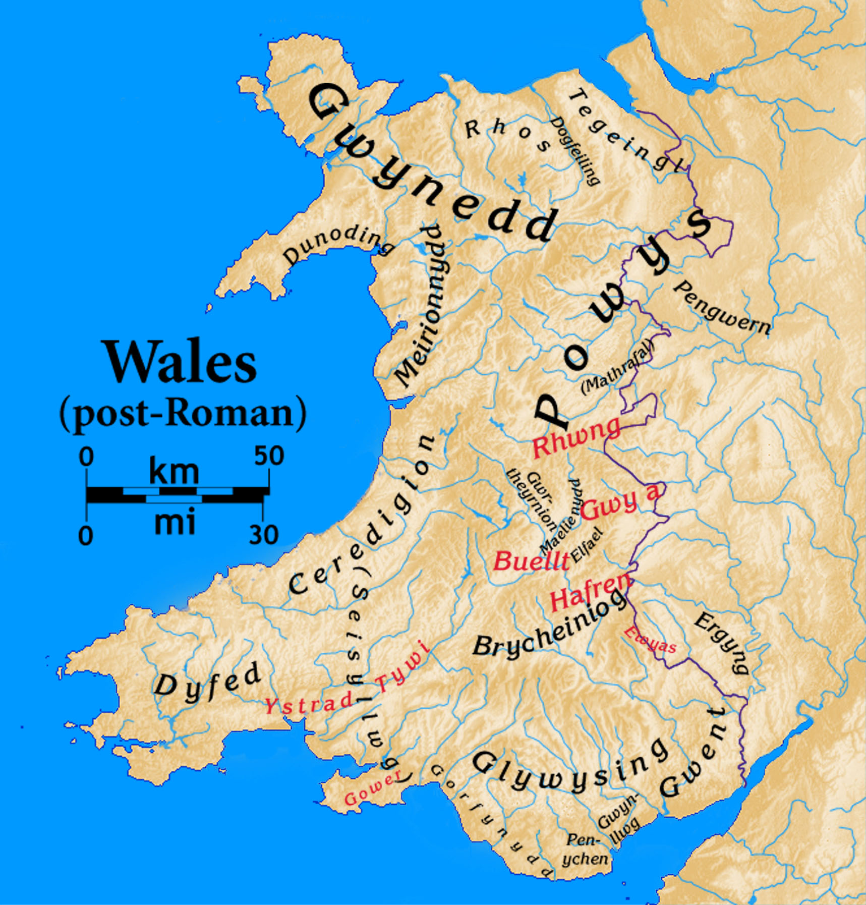
Dogfeiling

Dogfeiling was a minor sub-kingdom and later a commote in north Wales. It formed part of the eastern border of the Kingdom of Gwynedd in early medieval...

Cyfronydd railway station

Cyfronydd railway station lies 9.2 km (5.7 mi) from Welshpool's Raven Square station on the narrow gauge Welshpool and Llanfair Light Railway in Mid Wales...

Nearby Amenities

Located within 500m of 52.678065,-3.2458403
Turning Loop
Lat/Long: 52.6801032/-3.2520587
The data included in this document is from www.openstreetmap.org. The data is made available under ODbL.

Have you been to Black Rough?

Leave your review of Black Rough below (or comments, questions and feedback).