Nantywylan Wood

Wood, Forest in Radnorshire

Wales

Nantywylan Wood

Road from Castle Pren Very recent hedge trimmer activity. Despite carrying the bike I was punctured.
Road from Castle Pren Credit: Richard Webb

Nantywylan Wood is a picturesque forest located in Radnorshire, Wales. Covering an area of approximately 100 hectares, this woodland is known for its diverse range of flora and fauna, making it a popular spot for nature enthusiasts and hikers alike.

The forest is dominated by a mix of broadleaf trees such as oak, beech, and ash, providing a rich habitat for a variety of wildlife including birds, mammals, and insects. Visitors to Nantywylan Wood may catch a glimpse of red squirrels, badgers, and various species of birds nesting in the trees.

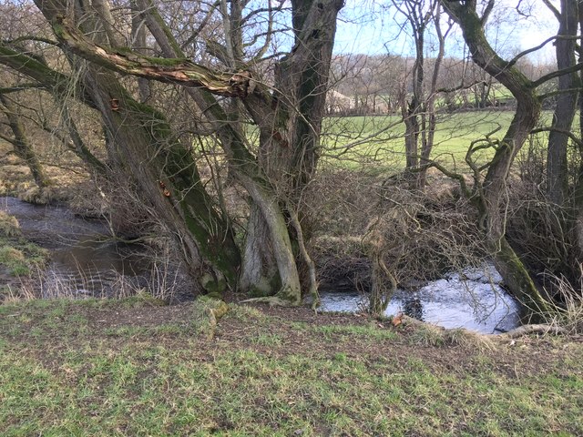
Tranquil streams and small ponds can also be found within the woodland, adding to its natural beauty and serene atmosphere. The forest is crisscrossed with a network of walking trails, allowing visitors to explore the area and enjoy the sights and sounds of the forest.

Nantywylan Wood is a designated Site of Special Scientific Interest (SSSI) due to its importance for biodiversity and conservation. The forest is carefully managed to protect its precious ecosystems and ensure that future generations can continue to enjoy its natural wonders.

If you have any feedback on the listing, please let us know in the comments section below.

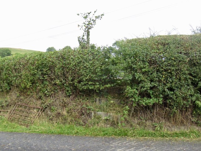
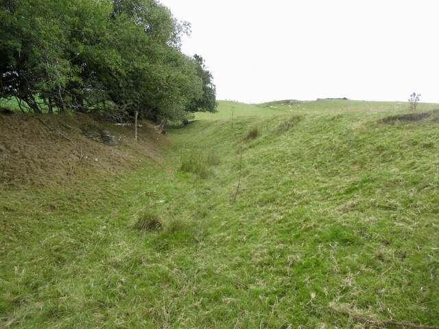
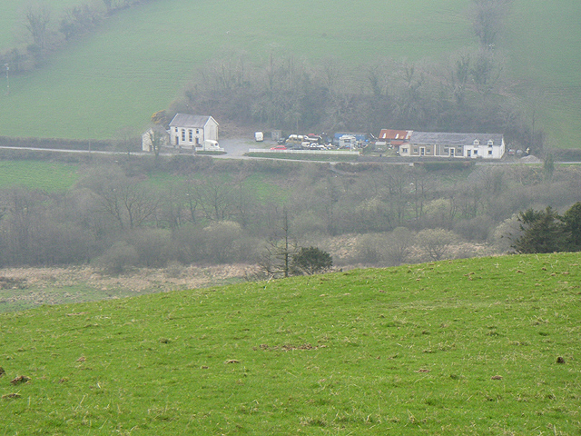
Nantywylan Wood Images

Images are sourced within 2km of 52.302048/-3.2380138 or Grid Reference SO1567. Thanks to Geograph Open Source API. All images are credited.

Road from Castle Pren Very recent hedge trimmer activity. Despite carrying the bike I was punctured.
Road from Castle Pren
Very recent hedge trimmer activity. Despite carrying the bike I was punctured.
Overgrown stile
Overgrown stile
An old road, Castle Pren A sunken byway.
An old road, Castle Pren
A sunken byway.
Holiday accommodation, Castle Pren
An old road, Castle Pren A sunken byway.
An old road, Castle Pren
A sunken byway.
Sign Wood
Sign Wood
Hedge trimmer Taken just after fixing the puncture.
Hedge trimmer
Taken just after fixing the puncture.
Another Hidden Yew Tucked away in the corner of the churchyard at Llanfihangel is this jumble of weeds, briar, Ivy and general rubbish that actually hides the Churches biggest asset in its Old Yew Tree. Its central core now rotted the living parts of the remaining tree now give the illusion of there being two Trees rather than the split single tree.
Another Hidden Yew
Tucked away in the corner of the churchyard at Llanfihangel is this jumble of weeds, briar, Ivy and general rubbish that actually hides the Churches biggest asset in its Old Yew Tree. Its central core now rotted the living parts of the remaining tree now give the illusion of there being two Trees rather than the split single tree.
Dolau railway station
Old Milestone by the A488, Craffryn, Llanfihangel Rhydithon Parish By the A488, in parish of Llanfihangel Rhydithon (Powys District), Craffryn, West side of junction on verge.

Inscription reads:-
KNIGHTON
11
MILES
PENYBONT
2½

Grade II listed by Cadw. Reference Number: 9278
<span class="nowrap"><a title="https://cadwpublic-api.azurewebsites.net/reports/listedbuilding/FullReport?lang=&id=9278" rel="nofollow ugc noopener" href="https://cadwpublic-api.azurewebsites.net/reports/listedbuilding/FullReport?lang=&id=9278">Link</a><img style="margin-left:2px;" alt="External link" title="External link - shift click to open in new window" src="https://s1.geograph.org.uk/img/external.png" width="10" height="10"/></span>

Surveyed

Milestone Society National ID: RAD_KNPB11.
Old Milestone by the A488, Craffryn, Llanfihangel Rhydithon Parish
By the A488, in parish of Llanfihangel Rhydithon (Powys District), Craffryn, West side of junction on verge. Inscription reads:- KNIGHTON 11 MILES PENYBONT 2½ Grade II listed by Cadw. Reference Number: 9278 LinkExternal link Surveyed Milestone Society National ID: RAD_KNPB11.
Old Milestone by the A488, Graig, Llanfihangel Rhydithon Parish By the A488, in parish of Llanfihangel Rhydithon (Powys District), Graig, 150m West of lay-by, on embankment on South East side of road.
(Disappeared 2020)

Inscription reads:-
KNIGHTON
9
MILES
PENYBONT
4½ 

Grade II listed by Cadw.
Reference Number 9284: <span class="nowrap"><a title="https://cadwpublic-api.azurewebsites.net/reports/listedbuilding/FullReport?lang=&id=9284" rel="nofollow ugc noopener" href="https://cadwpublic-api.azurewebsites.net/reports/listedbuilding/FullReport?lang=&id=9284">Link</a><img style="margin-left:2px;" alt="External link" title="External link - shift click to open in new window" src="https://s1.geograph.org.uk/img/external.png" width="10" height="10"/></span>

Surveyed

Milestone Society National ID: RAD_KNPB09
Old Milestone by the A488, Graig, Llanfihangel Rhydithon Parish
By the A488, in parish of Llanfihangel Rhydithon (Powys District), Graig, 150m West of lay-by, on embankment on South East side of road. (Disappeared 2020) Inscription reads:- KNIGHTON 9 MILES PENYBONT 4½ Grade II listed by Cadw. Reference Number 9284: LinkExternal link Surveyed Milestone Society National ID: RAD_KNPB09
Dolau railway station Train at Dolau railway station.
Dolau railway station
Train at Dolau railway station.
Dolau House Farmhouse Farmhouse adjacent to the Dolau railway.
Dolau House Farmhouse
Farmhouse adjacent to the Dolau railway.
Maes brook Catkins above Maes brook.
Maes brook
Catkins above Maes brook.
Far Hall A Grade II listed building dating from around 1570.
Far Hall
A Grade II listed building dating from around 1570.
Tree-lined brook Trees growing on the bank of the Nantywelan.
Tree-lined brook
Trees growing on the bank of the Nantywelan.
Road junction The signs point to two of the stations on the Heart of Wales line.
Road junction
The signs point to two of the stations on the Heart of Wales line.
Track leading to training company 4x4 explore - an off-road vehicle training company near Dolau.

<span class="nowrap"><a title="http://www.4x4explore.co.uk/" rel="nofollow ugc noopener" href="http://www.4x4explore.co.uk/">Link</a><img style="margin-left:2px;" alt="External link" title="External link - shift click to open in new window" src="https://s1.geograph.org.uk/img/external.png" width="10" height="10"/></span>
Track leading to training company
4x4 explore - an off-road vehicle training company near Dolau. LinkExternal link
Show me another place!

Nantywylan Wood is located at Grid Ref: SO1567 (Lat: 52.302048, Lng: -3.2380138)

Unitary Authority: Powys

Police Authority: Dyfed Powys

What 3 Words

///clubbing.playing.handy. Near Penybont, Powys

Related Wikis

Llanfihangel Rhydithon

Llanfihangel Rhydithon is a community in the county of Powys, (Radnorshire) Wales, and is 56.1 miles (90.3 km) from Cardiff and 143.5 miles (231.0 km)...

Dolau railway station

Dolau railway station is an unstaffed railway station with one platform serving the small village of Dolau in Powys, mid Wales. It is located on the Heart...

Heartsease, Llanddewi Ystradenni

Heartsease is a small settlement or hamlet in the parish and community of Llanddewi Ystradenni in Powys, Wales. It should not be confused with Heartsease...

Llanbister Road railway station

Llanbister Road railway station is a countryside stop about 5 miles (8 km) from the village of Llanbister, Powys, Wales. The station is 41+3⁄4 miles (67...

Nearby Amenities

Located within 500m of 52.302048,-3.2380138
Post Box
Lat/Long: 52.2977573/-3.2358203
Place: farm
Lat/Long: 52.3046757/-3.2412195
Bicycle: yes
Lat/Long: 52.306409/-3.2381451
Bicycle: yes
Lat/Long: 52.3049105/-3.2360093
Bicycle: yes
Lat/Long: 52.3044366/-3.2356767
Bicycle: yes
Lat/Long: 52.3062927/-3.2365575
Bicycle: yes
Lat/Long: 52.3040447/-3.2347497
Bicycle: yes
Lat/Long: 52.3063138/-3.2374424
Bicycle: yes
Lat/Long: 52.3062778/-3.2360959
Bicycle: yes
Lat/Long: 52.3042635/-3.2354471
Bicycle: yes
Lat/Long: 52.3063302/-3.2378286
Bicycle: yes
Lat/Long: 52.3057613/-3.2359513
Direction: 125
Generator Method: photovoltaic
Generator Output Electricity: yes
Generator Solar Modules: 16
Generator Source: solar
Generator Type: solar_photovoltaic_panel
Location: roof
Power: generator
Lat/Long: 52.2977087/-3.2382913
The data included in this document is from www.openstreetmap.org. The data is made available under ODbL.

Have you been to Nantywylan Wood?

Leave your review of Nantywylan Wood below (or comments, questions and feedback).