Coed Cefn-craig

Wood, Forest in Montgomeryshire

Wales

Coed Cefn-craig

View from the lane near Kerry Pole 440 metres (1443 feet) above sea level.
View from the lane near Kerry Pole Credit: Mat Fascione

The requested URL returned error: 429 Too Many Requests

If you have any feedback on the listing, please let us know in the comments section below.

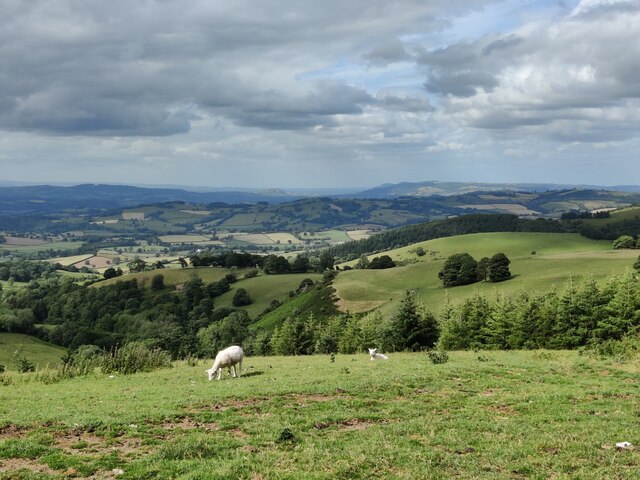
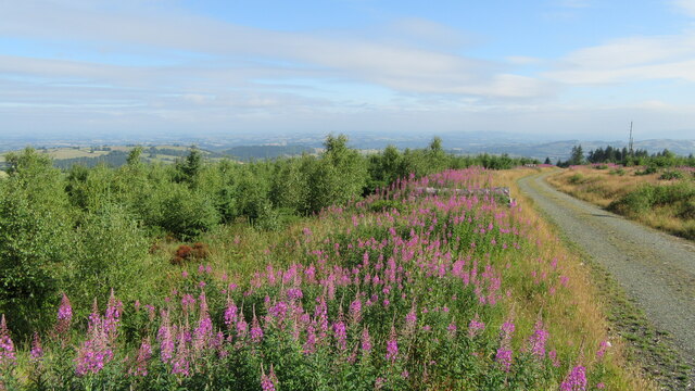
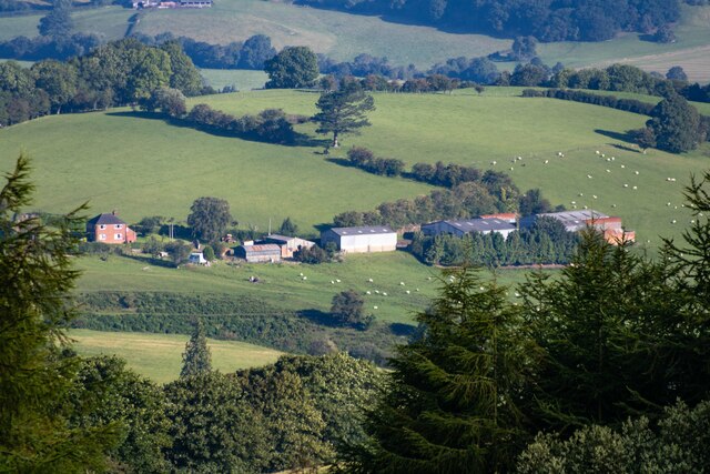
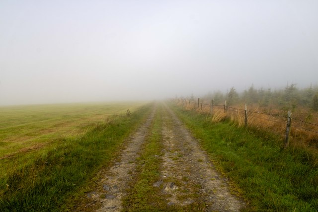
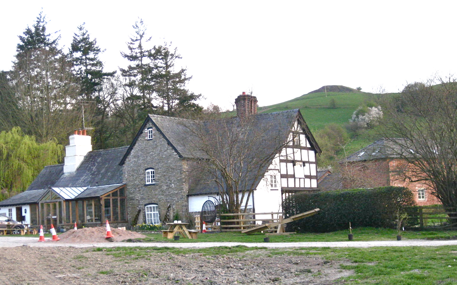
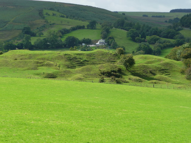
Coed Cefn-craig Images

Images are sourced within 2km of 52.473157/-3.2526169 or Grid Reference SO1586. Thanks to Geograph Open Source API. All images are credited.

View from the lane near Kerry Pole 440 metres (1443 feet) above sea level.
View from the lane near Kerry Pole
440 metres (1443 feet) above sea level.
Lane near Kerry Pole 440 metres (1443 feet) above sea level.
Lane near Kerry Pole
440 metres (1443 feet) above sea level.
Forest track in Block Wood Forest track dropping down through Block Wood on kerry Hill
Forest track in Block Wood
Forest track dropping down through Block Wood on kerry Hill
Block Wood Sunrise over Block Wood.
Block Wood
Sunrise over Block Wood.
B4368 The B4368 at Block Wood.
B4368
The B4368 at Block Wood.
Kerry Ridgeway From the <span class="nowrap"><a title="http://www.shropshiresgreatoutdoors.co.uk/" rel="nofollow ugc noopener" href="http://www.shropshiresgreatoutdoors.co.uk/">Link</a><img style="margin-left:2px;" alt="External link" title="External link - shift click to open in new window" src="https://s1.geograph.org.uk/img/external.png" width="10" height="10"/></span> website: This ancient path is 15 miles (24 km) long, journeying from Cider House Farm, near the village of Kerry, to Bishop's Castle. It holds a long tradition as a trade and drovers’ route from Wales to the lowland English markets.

The route follows a ridgetop overlooking Wales on the one side and England on the other. It never dips below 1000 ft (300 m)above sea level, resulting in remarkable views in all directions.  The ancient pathway forges a route through heather moors, woodlands and bilberry-rich heaths.  The Kerry Ridgeway is a mix of country road, trackway and bridleway across fields and is suitable for cycling and horse riding.

The Kerry Ridgeway is one of the oldest routes in Wales and was used by drovers to drive livestock out of Wales into England.  As the name suggests it maintains high ground for its duration offering wonderful views over the surrounding border countryside as it links Powys with Shropshire. Idyllic on a fine day however no doubt it was far from pleasant in wind and rain. On a clear day it is possible to see up to 70 miles.
Kerry Ridgeway
From the LinkExternal link website: This ancient path is 15 miles (24 km) long, journeying from Cider House Farm, near the village of Kerry, to Bishop's Castle. It holds a long tradition as a trade and drovers’ route from Wales to the lowland English markets. The route follows a ridgetop overlooking Wales on the one side and England on the other. It never dips below 1000 ft (300 m)above sea level, resulting in remarkable views in all directions. The ancient pathway forges a route through heather moors, woodlands and bilberry-rich heaths. The Kerry Ridgeway is a mix of country road, trackway and bridleway across fields and is suitable for cycling and horse riding. The Kerry Ridgeway is one of the oldest routes in Wales and was used by drovers to drive livestock out of Wales into England. As the name suggests it maintains high ground for its duration offering wonderful views over the surrounding border countryside as it links Powys with Shropshire. Idyllic on a fine day however no doubt it was far from pleasant in wind and rain. On a clear day it is possible to see up to 70 miles.
Kerry Pole Cottage
Kerry Pole Cottage
Cwm Forest above Cwm, seen from the Kerry Ridgeway.
Cwm
Forest above Cwm, seen from the Kerry Ridgeway.
Kerry Ridgeway The Kerry Ridgeway seen from Kerry Pole Cottage.
Kerry Ridgeway
The Kerry Ridgeway seen from Kerry Pole Cottage.
Block Wood Sunrise over Block Wood.
Block Wood
Sunrise over Block Wood.
Block Wood Early morning view from Block Wood.
Block Wood
Early morning view from Block Wood.
Llwyn-y-rhwd
Llwyn-y-rhwd
Kerry Ridgeway From the <span class="nowrap"><a title="http://www.shropshiresgreatoutdoors.co.uk/" rel="nofollow ugc noopener" href="http://www.shropshiresgreatoutdoors.co.uk/">Link</a><img style="margin-left:2px;" alt="External link" title="External link - shift click to open in new window" src="https://s1.geograph.org.uk/img/external.png" width="10" height="10"/></span> website: This ancient path is 15 miles (24 km) long, journeying from Cider House Farm, near the village of Kerry, to Bishop's Castle. It holds a long tradition as a trade and drovers’ route from Wales to the lowland English markets.

The route follows a ridgetop overlooking Wales on the one side and England on the other. It never dips below 1000 ft (300 m)above sea level, resulting in remarkable views in all directions.  The ancient pathway forges a route through heather moors, woodlands and bilberry-rich heaths.  The Kerry Ridgeway is a mix of country road, trackway and bridleway across fields and is suitable for cycling and horse riding.

The Kerry Ridgeway is one of the oldest routes in Wales and was used by drovers to drive livestock out of Wales into England.  As the name suggests it maintains high ground for its duration offering wonderful views over the surrounding border countryside as it links Powys with Shropshire. Idyllic on a fine day however no doubt it was far from pleasant in wind and rain. On a clear day it is possible to see up to 70 miles.
Kerry Ridgeway
From the LinkExternal link website: This ancient path is 15 miles (24 km) long, journeying from Cider House Farm, near the village of Kerry, to Bishop's Castle. It holds a long tradition as a trade and drovers’ route from Wales to the lowland English markets. The route follows a ridgetop overlooking Wales on the one side and England on the other. It never dips below 1000 ft (300 m)above sea level, resulting in remarkable views in all directions. The ancient pathway forges a route through heather moors, woodlands and bilberry-rich heaths. The Kerry Ridgeway is a mix of country road, trackway and bridleway across fields and is suitable for cycling and horse riding. The Kerry Ridgeway is one of the oldest routes in Wales and was used by drovers to drive livestock out of Wales into England. As the name suggests it maintains high ground for its duration offering wonderful views over the surrounding border countryside as it links Powys with Shropshire. Idyllic on a fine day however no doubt it was far from pleasant in wind and rain. On a clear day it is possible to see up to 70 miles.
Kerry Ridgeway Kerry Ridgeway, shrouded in the clouds!
Kerry Ridgeway
Kerry Ridgeway, shrouded in the clouds!
Old Milepost by the B4368, Cilthriew, Pentre, Kerry parish Turner Arrow Casting by the B4368, in parish of Kerry (Powys District), Pentre, 100m South of Cilthriew farm buildings, on verge, East side of road. Broken on top.

Inscription reads:-
: ANCHOR / 4 - M / KNIGHTON / 17 - M / {arrow->} : : KERRY / 1½ - M / NEWTOWN / 4½ - M / {<-arrow} : 

Grade II listed by Cadw.
Reference Number: 17309 <span class="nowrap"><a title="https://cadwpublic-api.azurewebsites.net/reports/listedbuilding/FullReport?lang=&id=17309" rel="nofollow ugc noopener" href="https://cadwpublic-api.azurewebsites.net/reports/listedbuilding/FullReport?lang=&id=17309">Link</a><img style="margin-left:2px;" alt="External link" title="External link - shift click to open in new window" src="https://s1.geograph.org.uk/img/external.png" width="10" height="10"/></span>

Surveyed

Milestone Society National ID: MOT_KNNT17
Old Milepost by the B4368, Cilthriew, Pentre, Kerry parish
Turner Arrow Casting by the B4368, in parish of Kerry (Powys District), Pentre, 100m South of Cilthriew farm buildings, on verge, East side of road. Broken on top. Inscription reads:- : ANCHOR / 4 - M / KNIGHTON / 17 - M / {arrow->} : : KERRY / 1½ - M / NEWTOWN / 4½ - M / {<-arrow} : Grade II listed by Cadw. Reference Number: 17309 LinkExternal link Surveyed Milestone Society National ID: MOT_KNNT17
On part of the Kerry Ridgeway / Ffordd Las Ceri The lane bends around a corner here.
On part of the Kerry Ridgeway / Ffordd Las Ceri
The lane bends around a corner here.
View from part of the Kerry Ridgeway / Ffordd Las Ceri near Kerry Pole Lovely views down this way, towards the Vale of Kerry and the Severn Valley.
View from part of the Kerry Ridgeway / Ffordd Las Ceri near Kerry Pole
Lovely views down this way, towards the Vale of Kerry and the Severn Valley.
Show me another place!

Coed Cefn-craig is located at Grid Ref: SO1586 (Lat: 52.473157, Lng: -3.2526169)

Unitary Authority: Powys

Police Authority: Dyfed Powys

What 3 Words

///glass.snuggled.powers. Near Newtown, Powys

Nearby Locations

Coed Cefn-craig Block Wood

Related Wikis

Garthmyl Hall, Berriew

Garthmyl Hall is a Grade II listed house in Berriew, in the historic county of Montgomeryshire, now Powys. The house stood close to the site of a large...

Cilthriew, Kerry (Montgomeryshire)

Cilthriew is a Grade II listed house and former farm in Kerry, Powys, in the historic county of Montgomeryshire, now Powys. Cilthriew was used by the...

Bryn Amlwg Castle

Bryn Amlwg Castle (Welsh: Castell Bryn Amlwg, lit. 'castle on a prominent hill') was an enclosure castle near Anchor, Shropshire, abutting the England...

Anchor, Shropshire

Anchor is a remote hamlet in southwest Shropshire, England. The hamlet is the most westerly place in Shropshire. == Geography == Anchor lies only 400 yards...

Have you been to Coed Cefn-craig?

Leave your review of Coed Cefn-craig below (or comments, questions and feedback).