Coed Allt-y-tywod

Wood, Forest in Flintshire

Wales

Coed Allt-y-tywod

Giat ar batrwm croes / A cross-barred gate
Giat ar batrwm croes / A cross-barred gate Credit: Ceri Thomas

The requested URL returned error: 429 Too Many Requests

If you have any feedback on the listing, please let us know in the comments section below.

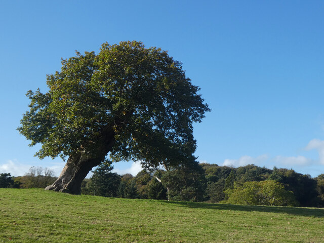
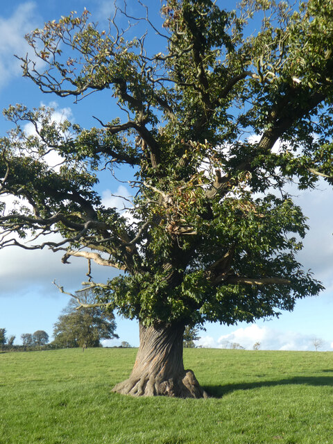
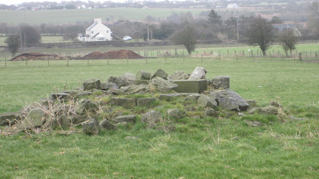
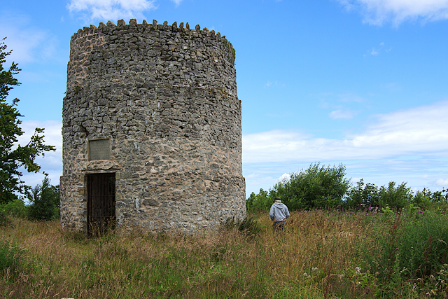
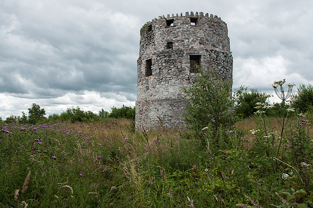
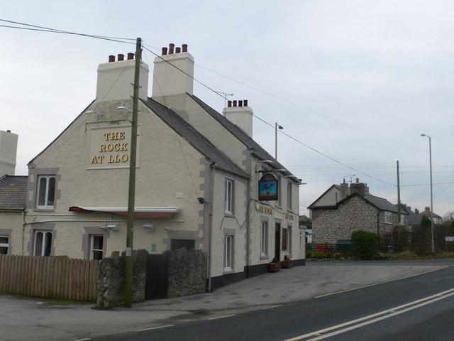
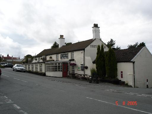
Coed Allt-y-tywod Images

Images are sourced within 2km of 53.284288/-3.2825482 or Grid Reference SJ1477. Thanks to Geograph Open Source API. All images are credited.

Giat ar batrwm croes / A cross-barred gate
Derwen ar ogwydd / A leaning oak
Rhisgl troellog castanwydden / A chestnut's twisted bark
Mynydd y Garreg Tower May have been a windmill and then converted to a Roman Pharos folly?
Mynydd y Garreg Tower
May have been a windmill and then converted to a Roman Pharos folly?
A55 eastbound near Gorsedd
Pant Y Wacco Welcome to Pant Y Wacco, just off the A5026 near Gorsedd.
Pant Y Wacco
Welcome to Pant Y Wacco, just off the A5026 near Gorsedd.
A55 westbound nears junction 31
Pasture land between Whitford and Holywell Typical scene for this area.  In the near distance to the left is Pennant Park Golf Club, to the right Highbrook,far centre - a view across the Dee Estuary to The Wirral
Pasture land between Whitford and Holywell
Typical scene for this area. In the near distance to the left is Pennant Park Golf Club, to the right Highbrook,far centre - a view across the Dee Estuary to The Wirral
Upper Downing Hall Once part of a country estate, recently a nursing home, now boarded up.  An abandoned wheelchair and walking frame on the forecourt were a poignant reminder of this building's last residents
Upper Downing Hall
Once part of a country estate, recently a nursing home, now boarded up. An abandoned wheelchair and walking frame on the forecourt were a poignant reminder of this building's last residents
Pond in grazing land North East of Whitford
Pond in grazing land
North East of Whitford
A5026 at Holywell Tyres
A5026 north of Gorsedd
A5026 looking to the Dee estuary and Liverpool beyond
10th Tee Pennant Park Golf Course A little gem of a course.
10th Tee Pennant Park Golf Course
A little gem of a course.
12th Tee Pennant Park Golf Course Mostyn Dock is just visible to the right.
12th Tee Pennant Park Golf Course
Mostyn Dock is just visible to the right.
The remains of the Holywell Racecourse Grandstand I believe that the wood and stone structure was evident until a few years ago but all that is left is a couple of piles of stones.
The remains of the Holywell Racecourse Grandstand
I believe that the wood and stone structure was evident until a few years ago but all that is left is a couple of piles of stones.
Tower on Garreg Hill, Whitford (1) This round tower on the summit of Garreg Hill overlooking the Dee estuary, is supposedly a Roman pharos (a lighthouse), but there is no evidence to support this. It probably dates from the early C17 when it may have been a windmill, and is labelled as such on a Mostyn estate map of 1732. It has since been described as an unlit maritime beacon, and as a watchtower serving as a look out for pirates. It was restored in 1897 by Baron Mostyn to commemorate the Diamond Jubilee of Queen Victoria.
Tower on Garreg Hill, Whitford (1)
This round tower on the summit of Garreg Hill overlooking the Dee estuary, is supposedly a Roman pharos (a lighthouse), but there is no evidence to support this. It probably dates from the early C17 when it may have been a windmill, and is labelled as such on a Mostyn estate map of 1732. It has since been described as an unlit maritime beacon, and as a watchtower serving as a look out for pirates. It was restored in 1897 by Baron Mostyn to commemorate the Diamond Jubilee of Queen Victoria.
Tower on Garreg Hill, Whitford (2) This round tower on the summit of Garreg Hill overlooking the Dee estuary, is supposedly a Roman pharos (a lighthouse), but there is no evidence to support this. It probably dates from the early C17 when it may have been a windmill, and is labelled as such on a Mostyn estate map of 1732. It has since been described as an unlit maritime beacon, and as a watchtower serving as a look out for pirates. It was restored in 1897 by Baron Mostyn to commemorate the Diamond Jubilee of Queen Victoria.
Tower on Garreg Hill, Whitford (2)
This round tower on the summit of Garreg Hill overlooking the Dee estuary, is supposedly a Roman pharos (a lighthouse), but there is no evidence to support this. It probably dates from the early C17 when it may have been a windmill, and is labelled as such on a Mostyn estate map of 1732. It has since been described as an unlit maritime beacon, and as a watchtower serving as a look out for pirates. It was restored in 1897 by Baron Mostyn to commemorate the Diamond Jubilee of Queen Victoria.
Show me another place!

Coed Allt-y-tywod is located at Grid Ref: SJ1477 (Lat: 53.284288, Lng: -3.2825482)

Unitary Authority: Flintshire

Police Authority: North Wales

What 3 Words

///butterfly.newlyweds.bulk. Near Whitford, Flintshire

Nearby Locations

Coed Allt-y-tywod

Related Wikis

Lloc

Lloc is a small village in Flintshire, north Wales. It is located within the community of Whitford. It lies north of the Clwydian Range, just east of the...

Gorsedd, Flintshire

Gorsedd is a village in Flintshire, Wales, in the community of Whitford, with a population of 391 in the 2011 census. == References ==

Church of St Beuno and St Mary

The Church of St Beuno and St Mary is a Grade I listed church in Whitford, overlooking the estuary of the river Dee. The church has a well preserved late...

Whitford, Flintshire

Whitford (Welsh: Chwitffordd) is a village, community and an electoral ward near Holywell in Flintshire, northeast Wales. The population of both the community...

Nearby Amenities

Located within 500m of 53.284288,-3.2825482
Tumulus
Archaeological Site: tumulus
Historic: archaeological_site
Lat/Long: 53.2807599/-3.2803653
Disused: yes
Man Made: mineshaft
Lat/Long: 53.2798255/-3.2831864
Disused: yes
Man Made: mineshaft
Lat/Long: 53.2798305/-3.2834476
Disused: yes
Man Made: mineshaft
Lat/Long: 53.2798744/-3.283028
Disused: yes
Man Made: mineshaft
Lat/Long: 53.2800232/-3.2830924
Disused: yes
Man Made: mineshaft
Lat/Long: 53.2800163/-3.2820885
Disused: yes
Man Made: mineshaft
Lat/Long: 53.2800726/-3.2822732
Disused: yes
Man Made: mineshaft
Lat/Long: 53.2800883/-3.2827147
Disused: yes
Man Made: mineshaft
Lat/Long: 53.2808456/-3.2833768
Tumulus
Archaeological Site: tumulus
Historic: archaeological_site
Historic Civilization: iron-age
Lat/Long: 53.2827024/-3.2847743
Man Made: mineshaft
Lat/Long: 53.279953/-3.28188
Man Made: mineshaft
Lat/Long: 53.2818002/-3.2818179
Man Made: mineshaft
Lat/Long: 53.2809377/-3.2809025
Man Made: mineshaft
Lat/Long: 53.2806084/-3.2797816
Man Made: mineshaft
Lat/Long: 53.2805446/-3.2796624
Man Made: mineshaft
Lat/Long: 53.281928/-3.2763578
Man Made: mineshaft
Lat/Long: 53.2824734/-3.2769975
Man Made: mineshaft
Lat/Long: 53.282173/-3.2797909
Man Made: mineshaft
Lat/Long: 53.2824447/-3.2795211
Man Made: mineshaft
Lat/Long: 53.2825882/-3.2793804
Man Made: mineshaft
Lat/Long: 53.2827329/-3.2792879
Man Made: mineshaft
Lat/Long: 53.2821299/-3.2790081
Man Made: mineshaft
Lat/Long: 53.2823141/-3.2796687
Man Made: mineshaft
Lat/Long: 53.2821688/-3.2801292
Man Made: mineshaft
Lat/Long: 53.2819414/-3.2801021
c
Archaeological Site: tumulus
Historic: archaeological_site
Lat/Long: 53.2815576/-3.2841237
Tumulus
Archaeological Site: tumulus
Historic: archaeological_site
Lat/Long: 53.2812484/-3.2851453
Tumulus
Archaeological Site: tumulus
Historic: archaeological_site
Lat/Long: 53.2812015/-3.2833652
Power: pole
Lat/Long: 53.2864437/-3.2887386
Power: pole
Lat/Long: 53.2865609/-3.2878953
Power: pole
Lat/Long: 53.2867724/-3.2863347
Power: pole
Lat/Long: 53.2872026/-3.2876588
Direction: SE
Generator Method: photovoltaic
Generator Output Electricity: yes
Generator Solar Modules: 8
Generator Source: solar
Generator Type: solar_photovoltaic_panel
Location: roof
Power: generator
Lat/Long: 53.2811483/-3.2825142
Direction: 195
Generator Method: photovoltaic
Generator Output Electricity: yes
Generator Solar Modules: 16
Generator Source: solar
Generator Type: solar_photovoltaic_panel
Location: roof
Power: generator
Lat/Long: 53.2816927/-3.2778686
The data included in this document is from www.openstreetmap.org. The data is made available under ODbL.

Have you been to Coed Allt-y-tywod?

Leave your review of Coed Allt-y-tywod below (or comments, questions and feedback).