Coed y Garreg

Wood, Forest in Flintshire

Wales

Coed y Garreg

St Michael's Church, Caerwys
St Michael's Church, Caerwys Credit: Chris Andrews

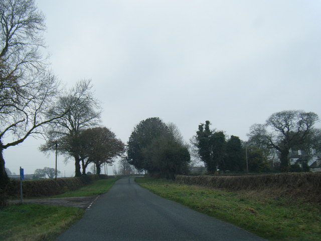
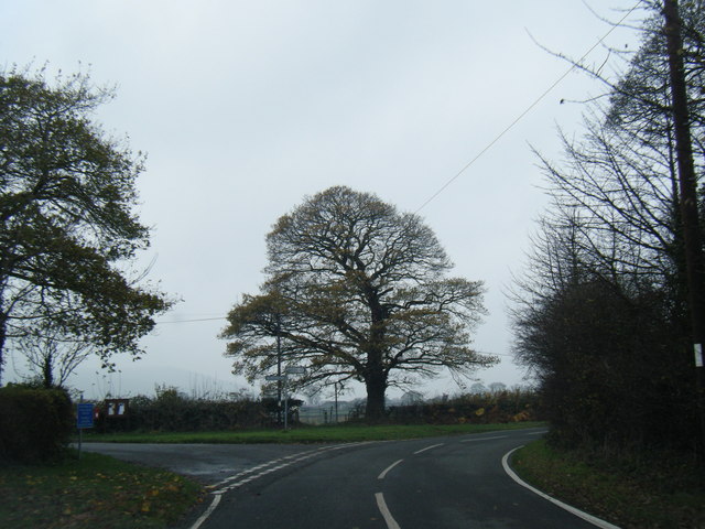
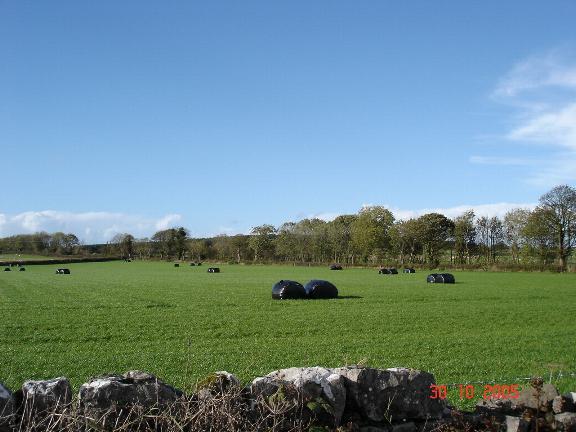
Coed y Garreg is a picturesque wood located in the county of Flintshire, Wales. It is situated near the village of Gwaenysgor and covers an area of approximately 20 hectares. The wood is nestled within the Clwydian Range and Dee Valley Area of Outstanding Natural Beauty, offering visitors stunning views of the surrounding countryside.

The woodland primarily consists of mature broadleaf trees, including oak, beech, and ash. These majestic trees create a dense canopy, providing a sheltered and tranquil environment for both wildlife and visitors alike. The forest floor is covered with a rich carpet of ferns, bluebells, and other wildflowers, adding to the natural beauty of the area.

Coed y Garreg is a popular destination for nature lovers, walkers, and birdwatchers. It offers a network of well-maintained footpaths that meander through the wood, allowing visitors to explore the diverse flora and fauna. The wood is home to a variety of bird species, including woodpeckers, nuthatches, and tawny owls, making it a haven for birdwatching enthusiasts.

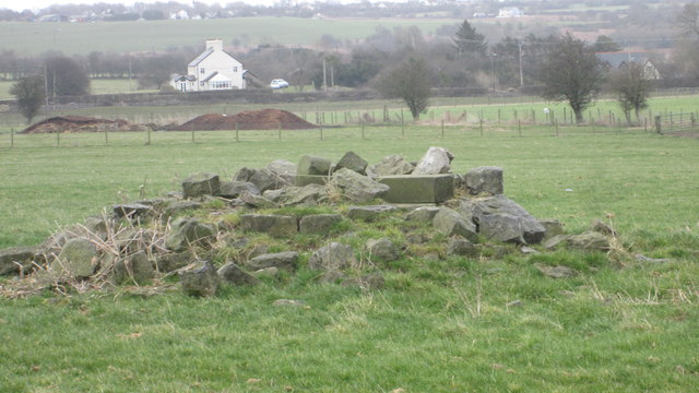
In addition to its natural beauty, Coed y Garreg also has historical significance. The wood was once part of the Gop Estate and contains remnants of ancient settlements, including a stone circle and burial mounds. These archaeological features provide a glimpse into the area's rich history and add an element of intrigue to any visit.

Overall, Coed y Garreg is a captivating woodland that offers a peaceful retreat from the hustle and bustle of everyday life. With its breathtaking scenery, diverse wildlife, and historical significance, it is a must-visit destination for nature enthusiasts and those seeking solace in the beauty of the natural world.

If you have any feedback on the listing, please let us know in the comments section below.

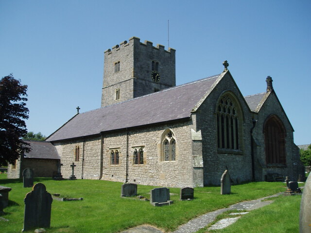
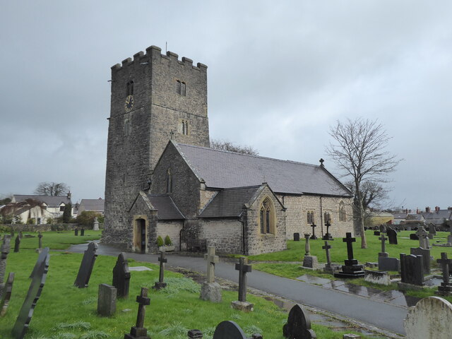
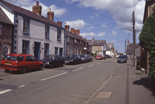
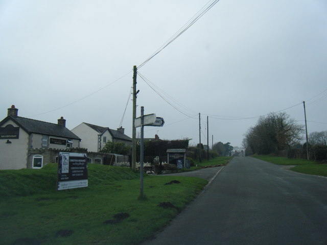
Coed y Garreg Images

Images are sourced within 2km of 53.25695/-3.2868568 or Grid Reference SJ1474. Thanks to Geograph Open Source API. All images are credited.

St Michael's Church, Caerwys
Caerwys, St Michael
Caerwys, St Michael
South Street, Caerwys Although only really a village, Caerwys proudly claims itself to be the smallest town in Great Britain with a royal charter - and indeed it does have a town council and its own mayor.
South Street, Caerwys
Although only really a village, Caerwys proudly claims itself to be the smallest town in Great Britain with a royal charter - and indeed it does have a town council and its own mayor.
Babell village and Black Lion Inn
Lane at Waen-isaf
Lane at Waen-isaf
Lane junction at Groes Faen Bach
The remains of the Holywell Racecourse Grandstand I believe that the wood and stone structure was evident until a few years ago but all that is left is a couple of piles of stones.
The remains of the Holywell Racecourse Grandstand
I believe that the wood and stone structure was evident until a few years ago but all that is left is a couple of piles of stones.
Fish Farm Buildings - Caerwys Old farm buildings now used as a fish farm
Fish Farm Buildings - Caerwys
Old farm buildings now used as a fish farm
Westbound A55 near to Gorsedd The A55, also known as the North Wales Expressway (Gwibffordd Gogledd Cymru), is the major road in North Wales running for 88 miles between Chester and Holyhead via Conwy and Bangor. 

The A55 is a very high quality road, much of it rebuilt since the 1970s in response to traffic problems in Colwyn Bay, Colwyn and Llandudno caused by traffic having to pass through town centres on totally unsuitable streets, (especially in Conwy where lorries often scraped their paintwork as they passed through 12th century arches in the town's walls), leading to the construction of an east-west expressway bypassing the urban centres. It is a dual carriageway primary route for its entire length with the exception of the point where it crosses the Britannia Bridge over the Menai Strait. All of its junctions are grade separated except for two roundabouts; one east of Penmaenmawr and one in Llanfairfechan. The road originally ran from Chester to Bangor but was extended parallel to the A5 across Anglesey right into Holyhead Docks in 2001.

<span class="nowrap"><a title="http://www.sabre-roads.org.uk/wiki/index.php?title=A55" rel="nofollow ugc noopener" href="http://www.sabre-roads.org.uk/wiki/index.php?title=A55">Link</a><img style="margin-left:2px;" alt="External link" title="External link - shift click to open in new window" src="https://s1.geograph.org.uk/img/external.png" width="10" height="10"/></span>  SABRE
Westbound A55 near to Gorsedd
The A55, also known as the North Wales Expressway (Gwibffordd Gogledd Cymru), is the major road in North Wales running for 88 miles between Chester and Holyhead via Conwy and Bangor. The A55 is a very high quality road, much of it rebuilt since the 1970s in response to traffic problems in Colwyn Bay, Colwyn and Llandudno caused by traffic having to pass through town centres on totally unsuitable streets, (especially in Conwy where lorries often scraped their paintwork as they passed through 12th century arches in the town's walls), leading to the construction of an east-west expressway bypassing the urban centres. It is a dual carriageway primary route for its entire length with the exception of the point where it crosses the Britannia Bridge over the Menai Strait. All of its junctions are grade separated except for two roundabouts; one east of Penmaenmawr and one in Llanfairfechan. The road originally ran from Chester to Bangor but was extended parallel to the A5 across Anglesey right into Holyhead Docks in 2001. LinkExternal link SABRE
North Wales Expressway near to Gorsedd The A55, also known as the North Wales Expressway (Gwibffordd Gogledd Cymru), is the major road in North Wales running for 88 miles between Chester and Holyhead via Conwy and Bangor. 

The A55 is a very high quality road, much of it rebuilt since the 1970s in response to traffic problems in Colwyn Bay, Colwyn and Llandudno caused by traffic having to pass through town centres on totally unsuitable streets, (especially in Conwy where lorries often scraped their paintwork as they passed through 12th century arches in the town's walls), leading to the construction of an east-west expressway bypassing the urban centres. It is a dual carriageway primary route for its entire length with the exception of the point where it crosses the Britannia Bridge over the Menai Strait. All of its junctions are grade separated except for two roundabouts; one east of Penmaenmawr and one in Llanfairfechan. The road originally ran from Chester to Bangor but was extended parallel to the A5 across Anglesey right into Holyhead Docks in 2001.

<span class="nowrap"><a title="http://www.sabre-roads.org.uk/wiki/index.php?title=A55" rel="nofollow ugc noopener" href="http://www.sabre-roads.org.uk/wiki/index.php?title=A55">Link</a><img style="margin-left:2px;" alt="External link" title="External link - shift click to open in new window" src="https://s1.geograph.org.uk/img/external.png" width="10" height="10"/></span>  SABRE
North Wales Expressway near to Gorsedd
The A55, also known as the North Wales Expressway (Gwibffordd Gogledd Cymru), is the major road in North Wales running for 88 miles between Chester and Holyhead via Conwy and Bangor. The A55 is a very high quality road, much of it rebuilt since the 1970s in response to traffic problems in Colwyn Bay, Colwyn and Llandudno caused by traffic having to pass through town centres on totally unsuitable streets, (especially in Conwy where lorries often scraped their paintwork as they passed through 12th century arches in the town's walls), leading to the construction of an east-west expressway bypassing the urban centres. It is a dual carriageway primary route for its entire length with the exception of the point where it crosses the Britannia Bridge over the Menai Strait. All of its junctions are grade separated except for two roundabouts; one east of Penmaenmawr and one in Llanfairfechan. The road originally ran from Chester to Bangor but was extended parallel to the A5 across Anglesey right into Holyhead Docks in 2001. LinkExternal link SABRE
Cottage Farm Rather large for a Cottage!
Cottage Farm
Rather large for a Cottage!
Arwyddion ffordd yn troi / Bend in road signs
Neuadd Dref Caersws / Caersws Town Hall
Capel Bethel Bethel is a bilingual Presbyterian chapel.
Capel Bethel
Bethel is a bilingual Presbyterian chapel.
The burial ground and church of St Michael at Caerwys Viewed from the east.
The burial ground and church of St Michael at Caerwys
Viewed from the east.
Drovers Lane in Caerwys Looking eastward.
Drovers Lane in Caerwys
Looking eastward.
Hollywell Road leaving Caerwys Looking north-eastward.
Hollywell Road leaving Caerwys
Looking north-eastward.
Water Street in Caerwys Looking north-westward.
Water Street in Caerwys
Looking north-westward.
Show me another place!

Coed y Garreg is located at Grid Ref: SJ1474 (Lat: 53.25695, Lng: -3.2868568)

Unitary Authority: Flintshire

Police Authority: North Wales

What 3 Words

///dinosaur.singing.sway. Near Whitford, Flintshire

Nearby Locations

Pant Coed y Garreg

Related Wikis

Caerwys

Caerwys is a town in Flintshire, Wales. It is just under two miles from the A55 North Wales Expressway and one mile from the A541 Mold-Denbigh road. At...

Babell

Babell is a hamlet in Flintshire, Wales. It is part of the community of Ysgeifiog. The hamlet takes its name from the Babell Methodist chapel, built in...

Caerwys Tufa

Caerwys Tufa is a Site of Special Scientific Interest in the preserved county of Clwyd, north Wales. Tufa, a very soft limestone that was once used to...

Pantasaph

Pantasaph is a small village in Flintshire, north-east Wales, two miles south of Holywell in the community of Whitford. Its name translates into English...

Nearby Amenities

Located within 500m of 53.25695,-3.2868568
Power: pole
Lat/Long: 53.2599675/-3.2840771
Power: pole
Lat/Long: 53.2590676/-3.2815926
Power: pole
Lat/Long: 53.258923/-3.2814801
Power: pole
Lat/Long: 53.258497/-3.2814387
Power: pole
Lat/Long: 53.2587145/-3.2814573
Power: pole
Lat/Long: 53.2570942/-3.2820006
Power: pole
Lat/Long: 53.2564731/-3.2828531
Power: pole
Lat/Long: 53.2560089/-3.2835307
Power: pole
Lat/Long: 53.2558748/-3.285629
Power: pole
Lat/Long: 53.2555022/-3.2873777
Power: pole
Lat/Long: 53.2551589/-3.289017
Power: pole
Lat/Long: 53.2548614/-3.2903996
Power: pole
Lat/Long: 53.2540866/-3.2917602
Power: pole
Lat/Long: 53.2537439/-3.2915131
Power: pole
Lat/Long: 53.2542027/-3.2902636
Power: pole
Lat/Long: 53.2547062/-3.2888345
Power: pole
Lat/Long: 53.2557895/-3.2851759
Power: pole
Lat/Long: 53.25523/-3.2871361
Power: pole
Lat/Long: 53.2550151/-3.2878507
Power: pole
Lat/Long: 53.2555557/-3.2859776
Power: pole
Lat/Long: 53.2586001/-3.2815736
Power: pole
Lat/Long: 53.2584392/-3.2836419
Power: pole
Lat/Long: 53.2587962/-3.2861622
Power: pole
Lat/Long: 53.2589563/-3.2873124
Power: pole
Lat/Long: 53.2591006/-3.2883156
Power: pole
Lat/Long: 53.2596039/-3.2895277
Power: pole
Lat/Long: 53.260109/-3.2907133
Power: pole
Lat/Long: 53.2610493/-3.2894748
Power: pole
Lat/Long: 53.2609805/-3.2887534
Power: pole
Lat/Long: 53.2608167/-3.2879171
Power: pole
Lat/Long: 53.2606207/-3.2869438
Power: pole
Lat/Long: 53.2604173/-3.2859167
Power: pole
Lat/Long: 53.260233/-3.2849141
Power: pole
Lat/Long: 53.2595177/-3.2828697
Power: pole
Lat/Long: 53.2591476/-3.2815967
Power: pole
Lat/Long: 53.2596274/-3.2827548
Power: pole
Lat/Long: 53.2600955/-3.2837378
Power: pole
Lat/Long: 53.2607801/-3.2852736
Power: pole
Lat/Long: 53.2611759/-3.2876252
Power: pole
Lat/Long: 53.2611151/-3.2887534
Power: pole
Lat/Long: 53.258923/-3.2814474
Power: pole
Lat/Long: 53.260443/-3.2829957
Power: pole
Lat/Long: 53.2597985/-3.2821416
Power: pole
Lat/Long: 53.2591781/-3.2813368
Power: pole
Lat/Long: 53.2590138/-3.2813268
Power: pole
Lat/Long: 53.2591952/-3.2812262
Power: pole
Lat/Long: 53.2590143/-3.2813036
Power: pole
Lat/Long: 53.2590228/-3.2810734
Power: pole
Lat/Long: 53.2591652/-3.2810805
Power: tower
Lat/Long: 53.2563329/-3.2827379
Power: tower
Lat/Long: 53.255871/-3.2878329
Power: tower
Lat/Long: 53.2554806/-3.2924762
Pant
Place: hamlet
Lat/Long: 53.2591203/-3.2867029
Power: pole
Lat/Long: 53.260207/-3.2864602
Power: pole
Lat/Long: 53.259754/-3.2846404
Power: pole
Lat/Long: 53.2589878/-3.2824601
Power: pole
Lat/Long: 53.2586585/-3.2815621
Power: pole
Lat/Long: 53.2593312/-3.2834443
Power: pole
Lat/Long: 53.260726/-3.2887412
Power: pole
Lat/Long: 53.2609045/-3.2894688
Power: pole
Lat/Long: 53.2605252/-3.2900315
Power: pole
Lat/Long: 53.2541114/-3.281671
Power: pole
Lat/Long: 53.2567623/-3.2795899
Power: pole
Lat/Long: 53.2577786/-3.2797421
Power: pole
Lat/Long: 53.2586147/-3.2798691
Power: pole
Lat/Long: 53.2551728/-3.2814281
Power: pole
Lat/Long: 53.2547466/-3.2819081
Power: pole
Lat/Long: 53.253474/-3.2824984
Power: pole
Lat/Long: 53.2555471/-3.2804898
Power: pole
Lat/Long: 53.2585822/-3.2826204
Power: pole
Lat/Long: 53.2605131/-3.2878475
Pant Field System and Earthworks
Historic: archaeological_site
Lat/Long: 53.2609212/-3.2875958
Power: pole
Lat/Long: 53.2612363/-3.2864027
Power: pole
Lat/Long: 53.2576487/-3.2817736
The data included in this document is from www.openstreetmap.org. The data is made available under ODbL.

Have you been to Coed y Garreg?

Leave your review of Coed y Garreg below (or comments, questions and feedback).